From Sunscreen to Umbrellas: Atlanta’s Dynamic Week Ahead
By
Amy Freeze
Explore the diverse weather patterns Atlanta is expected to experience this week, from blazing suns to impending storms.
This week, Atlanta sees a mix of partly cloudy skies and severe weather alerts. Check our detailed guide for daily forecasts and safety tips.
The Southeastern city of Atlanta is in for a week of notable climatic shifts. From scorching days touching 90 degrees to severe weather warnings indicating scattered storms and heavy rains, the unfolding days demand attention and preparedness. Alongside daily temperature details, our report also includes precautionary measures during extreme UV indexes and potential localized flooding. Dive into our comprehensive analysis to stay safe and informed.
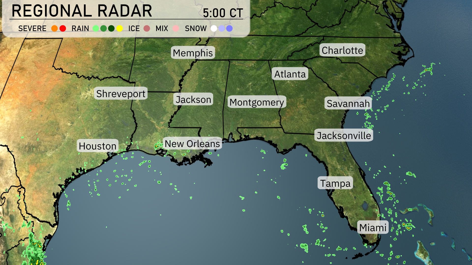
On the Regional Radar, much of the Southeast is experiencing clear conditions, but activity is picking up along the Gulf Coast. Scattered showers are evident near Houston and west of New Orleans, slowly making their way eastward. Key cities like Atlanta and Charlotte remain dry, while more isolated rain showers are beginning to approach Miami. Keep an eye on Jacksonville as some cloud cover is advancing from the Gulf, possibly bringing light rain later.
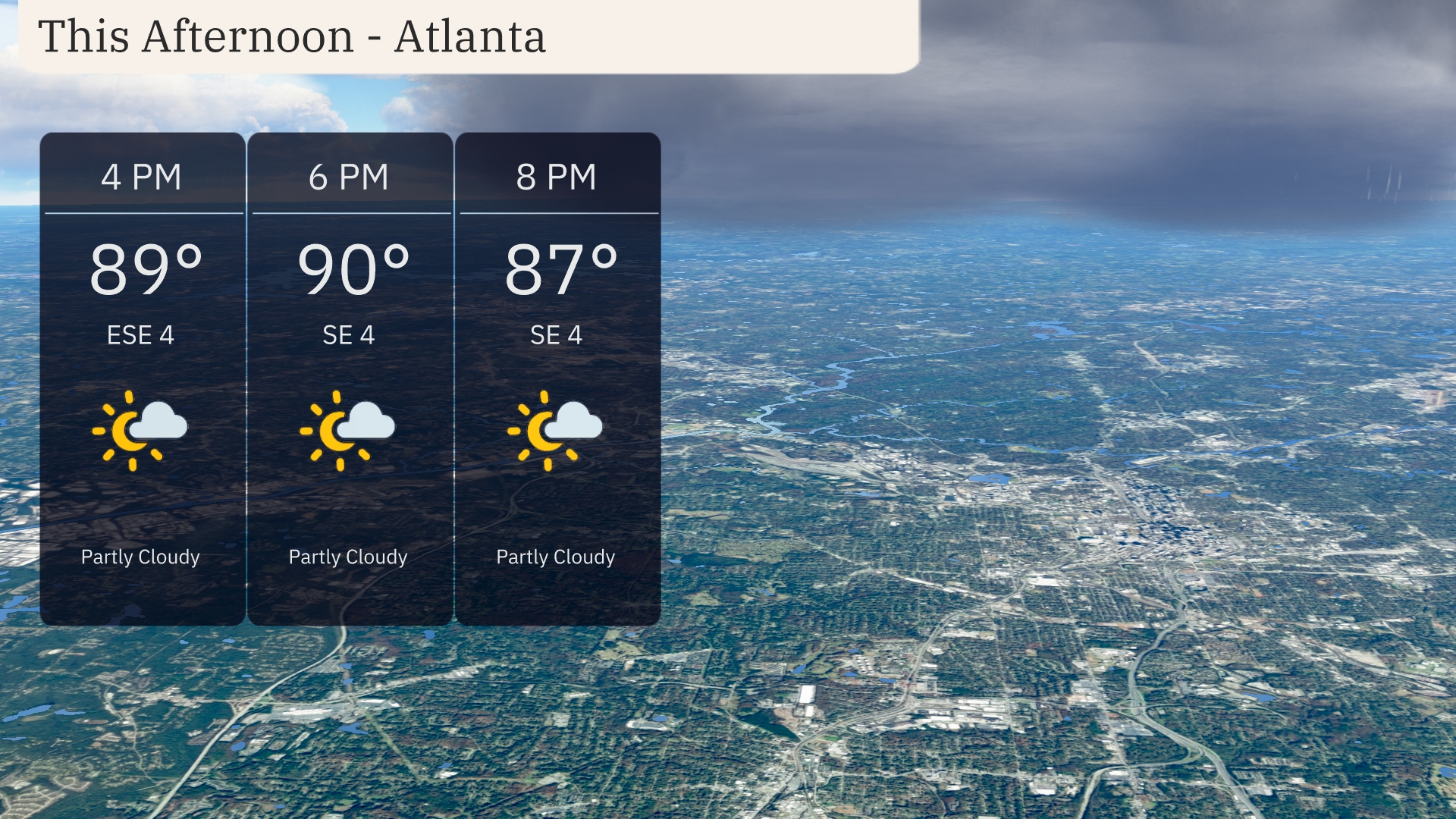
This afternoon in Atlanta, temperatures will peak around 90 degrees with partly cloudy skies and a calm southeast breeze at 4 to 6 miles per hour. The cloud cover will provide some relief from the heat, with temperatures slightly dropping to 87 degrees by 8 PM. ties with only light winds to contend with.
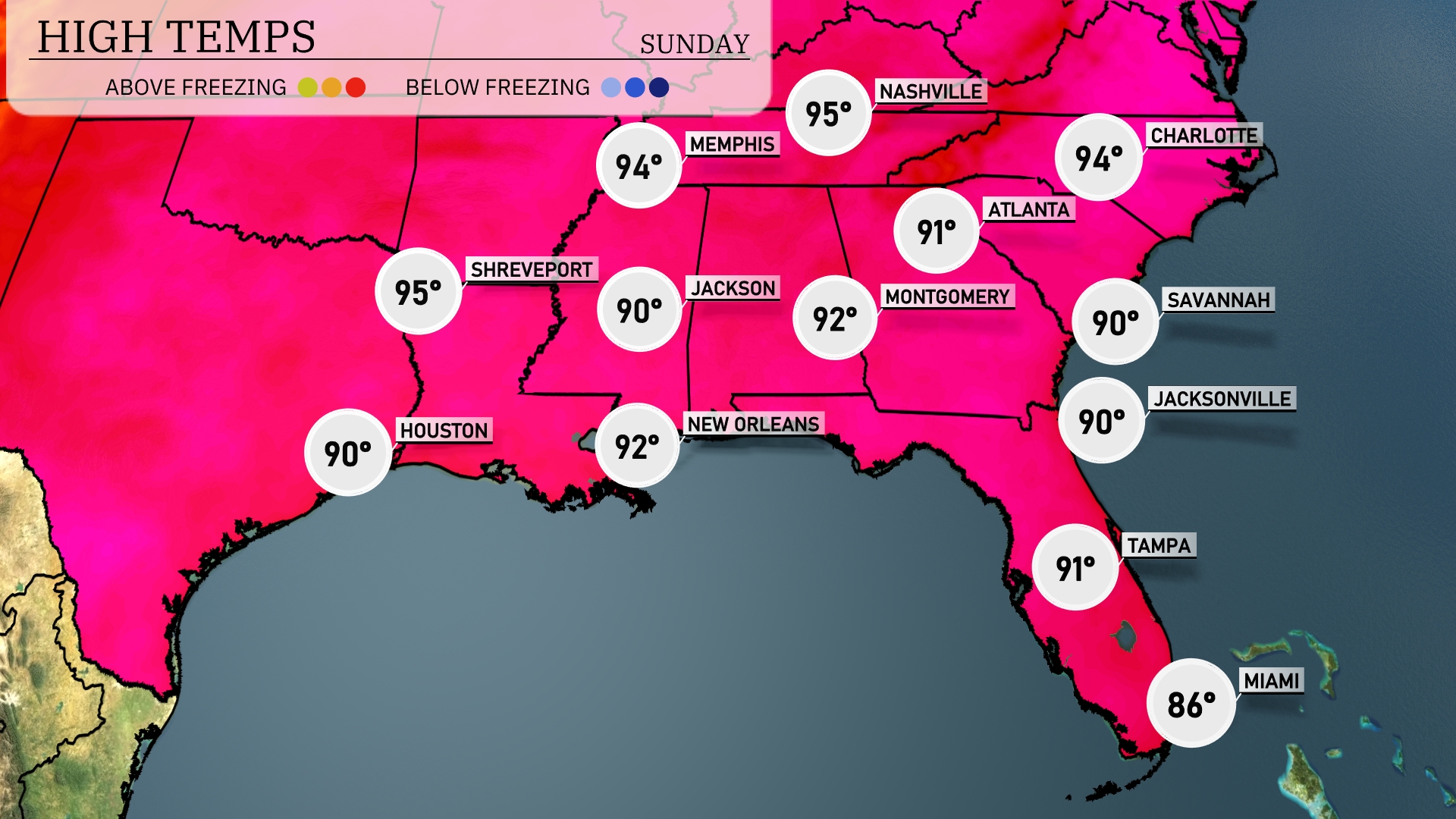
In the Southeast today, temperatures are heating up significantly. Shreveport sees a high of 95 degrees, while Houston is slightly cooler at 90. Jackson and New Orleans will both reach a comfortable 90 and 92 degrees, respectively. Across the coast, Tampa is enjoying a high of 91, but Miami stays much cooler at 86 due to an onshore breeze. Savannah and Jacksonville both hit 90, keeping consistent warmth throughout the region.
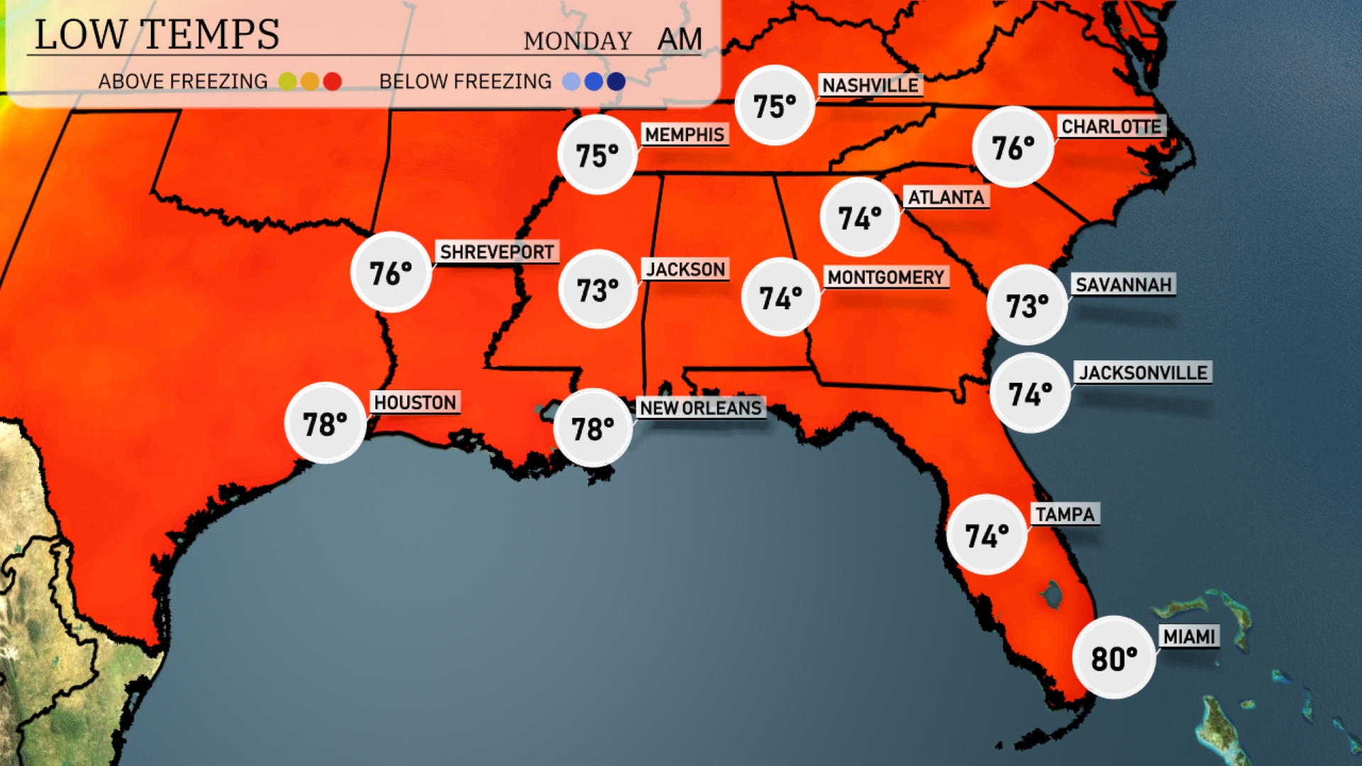
Tonight, Shreveport will cool down to 76 degrees, while Jackson dips to 73. Expect Montgomery to see a low of 74, and Atlanta will register 74 as well. Savannah and Jacksonville will both experience lows of 73 degrees.
Tomorrow in the Southeast, temperatures will soar as the region experiences a warm air mass. Atlanta is set to hit 94 degrees, while Charlotte anticipates a hot 99 degrees, well above average for this time of year. In the Gulf Coast, New Orleans and Houston will see highs around 90 degrees, with Jackson close behind at 93. Savannah is also in the mix with a high of 93 degrees, while Jacksonville will reach 91.
Expect a dynamic weather shift across the Southeast as a cold front makes its way from the west into the region by midday Monday. Scattered storms with the potential for heavy rain will impact areas from Houston to New Orleans, pushing eastward into Montgomery and Atlanta by nightfall. The line of storms is expected to bring localized flooding, particularly in areas with already high water tables. Following the storm passage, cooler and drier conditions arrive, settling across much of the area by Tuesday.
The UV index in Atlanta will be extreme on Sunday and Monday with a value of 10, signaling a burn time of just 12 minutes in direct sunlight.