Bracing for Breezes: Miami’s Weather Outlook for the Coming Week
By
Amy Freeze
Explore Miami's weekly weather forecast featuring temperature trends, regional updates, and UV insights. Stay prepared with our comprehensive guide!
Stay updated with this week’s weather narrative in Miami, highlighting partly cloudy conditions with potentials for local showers.
As Miami navigates through temperatures in the high 80s, get the scoop on regional patterns affecting the Southeast. We delve into a dynamic weather front, expecting thunderstorms from Houston to New Orleans, and clear insights into the extreme UV index readings prepping you for the week.
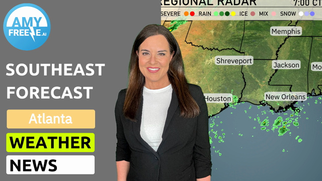
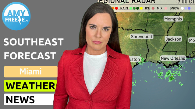
On the Regional Radar, scattered rain showers are evident over the Gulf of Mexico, near New Orleans, and coastal areas of Louisiana, slowly drifting eastward. Houston is getting light rain, while areas around Jacksonville and Miami in Florida are staying clear under partly cloudy skies. Across the rest of the Southeast, including cities like Jackson and Atlanta, the weather remains mostly dry with increasing cloud cover moving in from the west, signaling a potential for showers later in the day.
In Miami this afternoon, temperatures will hover in the high 80s, reaching 87 degrees by 4 PM. Winds will be coming from the east-northeast at around 14 miles per hour, gradually decreasing into the evening. Expect mostly cloudy skies as the day progresses.
Today’s temperatures in the Southeast are heating up! Atlanta leads the charge with a high of 99 degrees, while Savannah isn’t far behind at 97. In contrast, Jacksonville will see a cooler high of 93. Over in Montgomery, the forecast calls for 96, while New Orleans will stay mild at 89 degrees. Expect a mix of sunshine and humidity across the region, particularly in Florida, where Tampa hits 92 degrees and Miami remains a bit cooler at 88.
Tonight, temperatures will remain mild in the Southeast. Expect lows of 75 degrees in Shreveport, 73 in Jackson, and 76 in Houston. Nashville will see a low of 75, while Montgomery will drop to 72. Atlanta and Charlotte will both register at 71 degrees.
Tomorrow in Atlanta, look for a high of 95 degrees, while temperatures in Montgomery soar to 97. Memphis will see a warm high of 96 degrees, and Jackson will also reach 95. The heat continues in Charlotte, peaking at 97 degrees, and Jacksonville will hit 95.
A dynamic weather pattern is expected across the Southeast as a cold front pushes through the region tomorrow. Thunderstorms will impact areas from Houston to New Orleans, with the potential for isolated severe storms, especially in southern Louisiana and Mississippi. Heavy downpours could lead to localized flooding as the line of storms moves eastward into Alabama and Georgia by midday. Temperatures will follow a cooling trend post-front, with drier conditions expected to set in by the early morning. Stay vigilant for severe weather alerts, particularly during peak commuting hours.
The UV index in Miami will reach an extreme level of 11 on Tuesday, meaning a burn time of about 11 minutes in direct sunlight. On Wednesday, the UV index remains at 11, necessitating quick protection as the burn time is still around 11 minutes.