The Summer Buzz: NYC’s Weather Forecast for June 27, 2025
By
Amy Freeze
Discover what the skies hold over New York City and the Northeast on June 27, 2025, from morning clouds to evening storms.
New York City wakes up to a partly cloudy June 27 with a dynamic weather situation across the Northeast. Expect temperature variations and prepare for potential evening thunderstorms.
https://www.youtube.com/watch?v=0k6QQ1IpUa8
On June 27, 2025, NYC starts the day under cloudy skies with a mild 69°F. As the day progresses, temperatures rise and so does the chance of rain. Evening forecasts predict a cold front inducing scattered showers and possible flooding. Essential tips: brace for the weather and protect against a high UV index. Detailed analysis in your full 7-day NYC forecast found on our blog: https://amyfreeze.ai/nyc-weather-june-2025
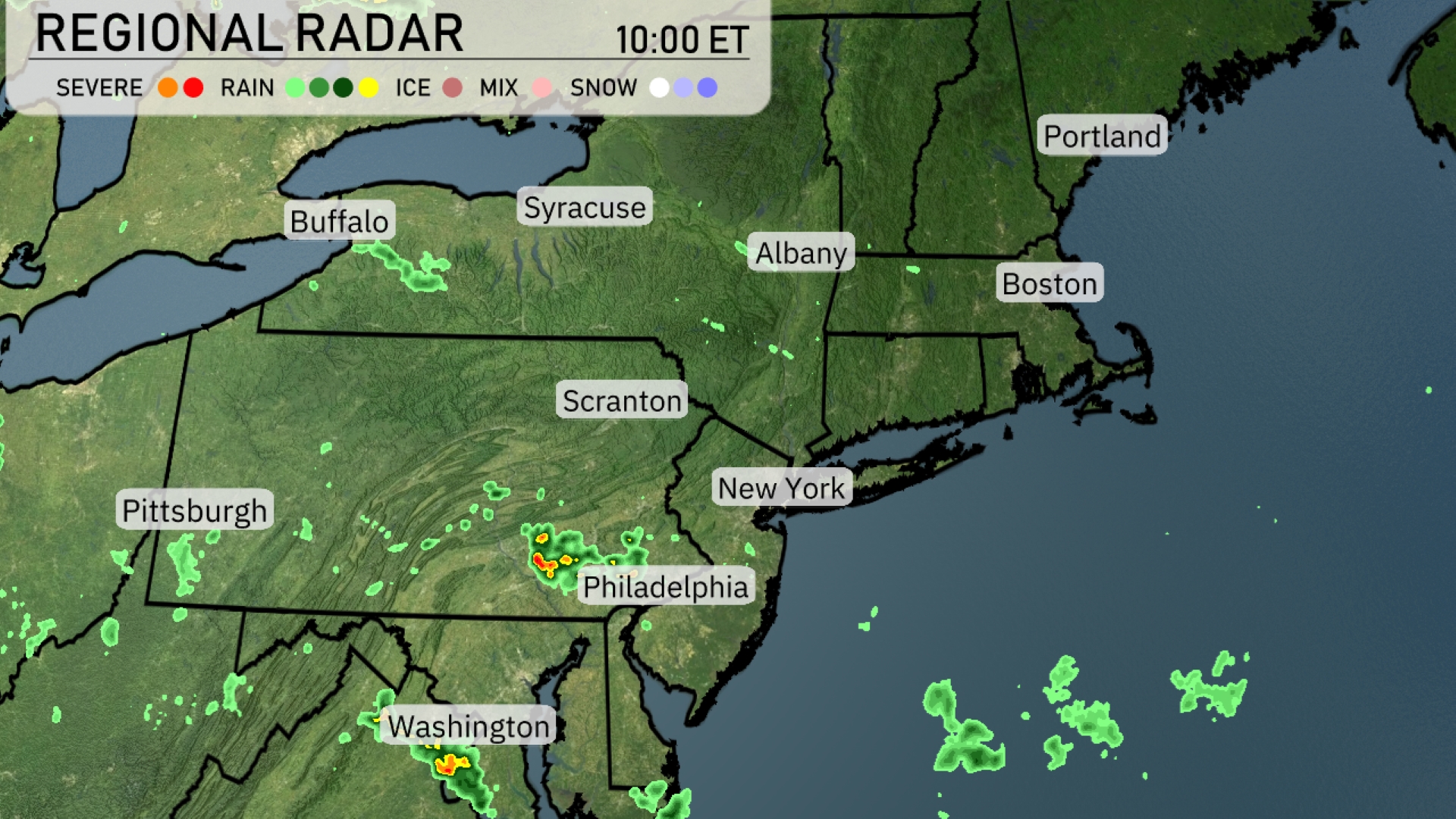
The Northeast region is experiencing scattered showers, with some developing storms around Philadelphia moving toward the north. Washington, D.C. is also seeing a pocket of thunderstorms, adding to the humid summer weather. Light rain showers are speckled from Scranton to Albany, bringing a bit of dampness to the morning. Buffalo and Syracuse can enjoy clear skies, with no precipitation currently detected in those areas.
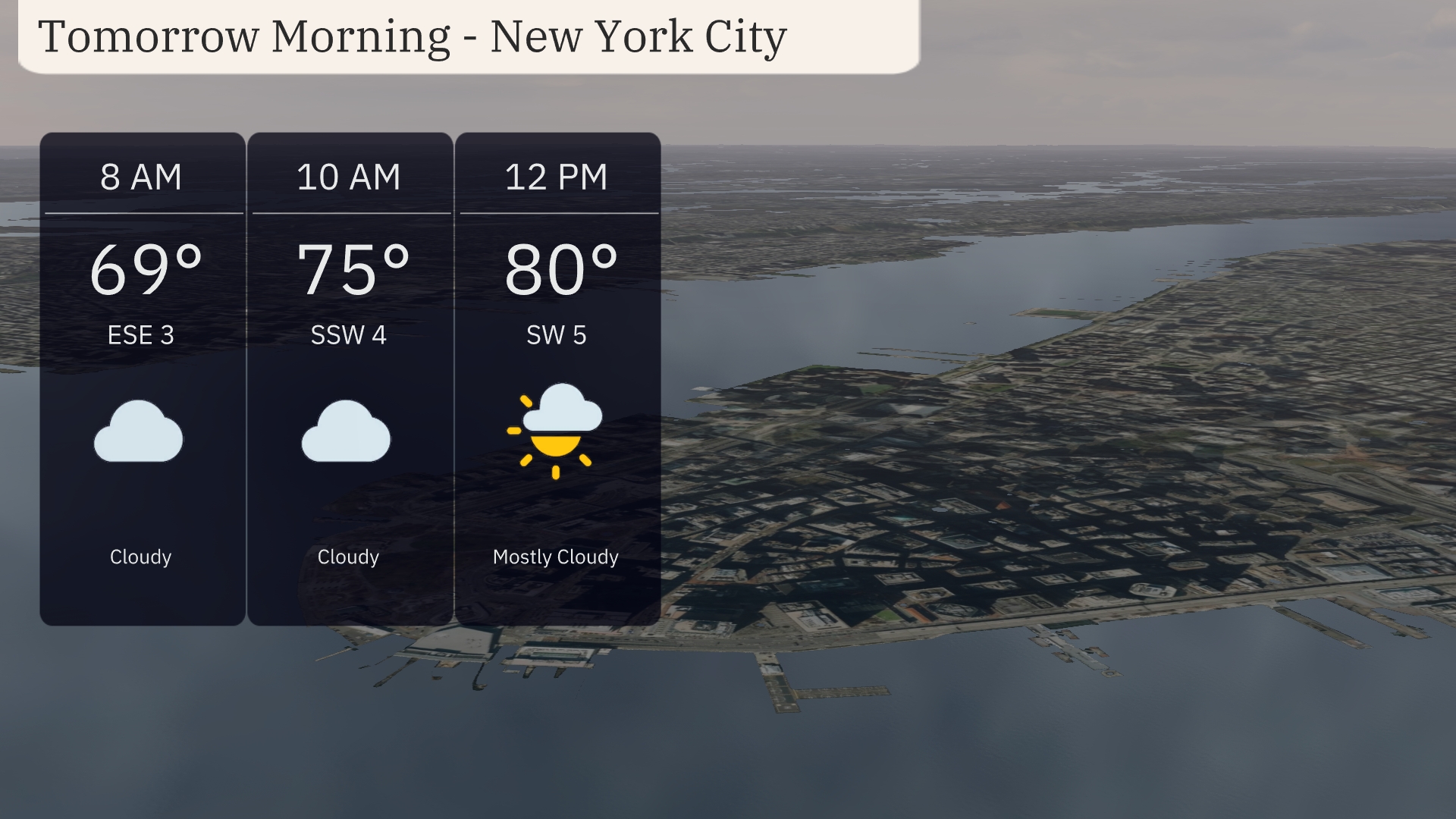
Tomorrow morning in New York City begins with cloudy skies and a mild temperature of 69 degrees at 8 AM. The wind will be coming from the east-southeast at 3 miles per hour. By 10 AM, expect the temperature to rise to 75 degrees with a shift in winds to the south-southwest at 4 miles per hour. Clouds start to clear as noon approaches, leading to mostly cloudy conditions with the temperature reaching 80 degrees and winds at 5 miles per hour from the southwest.
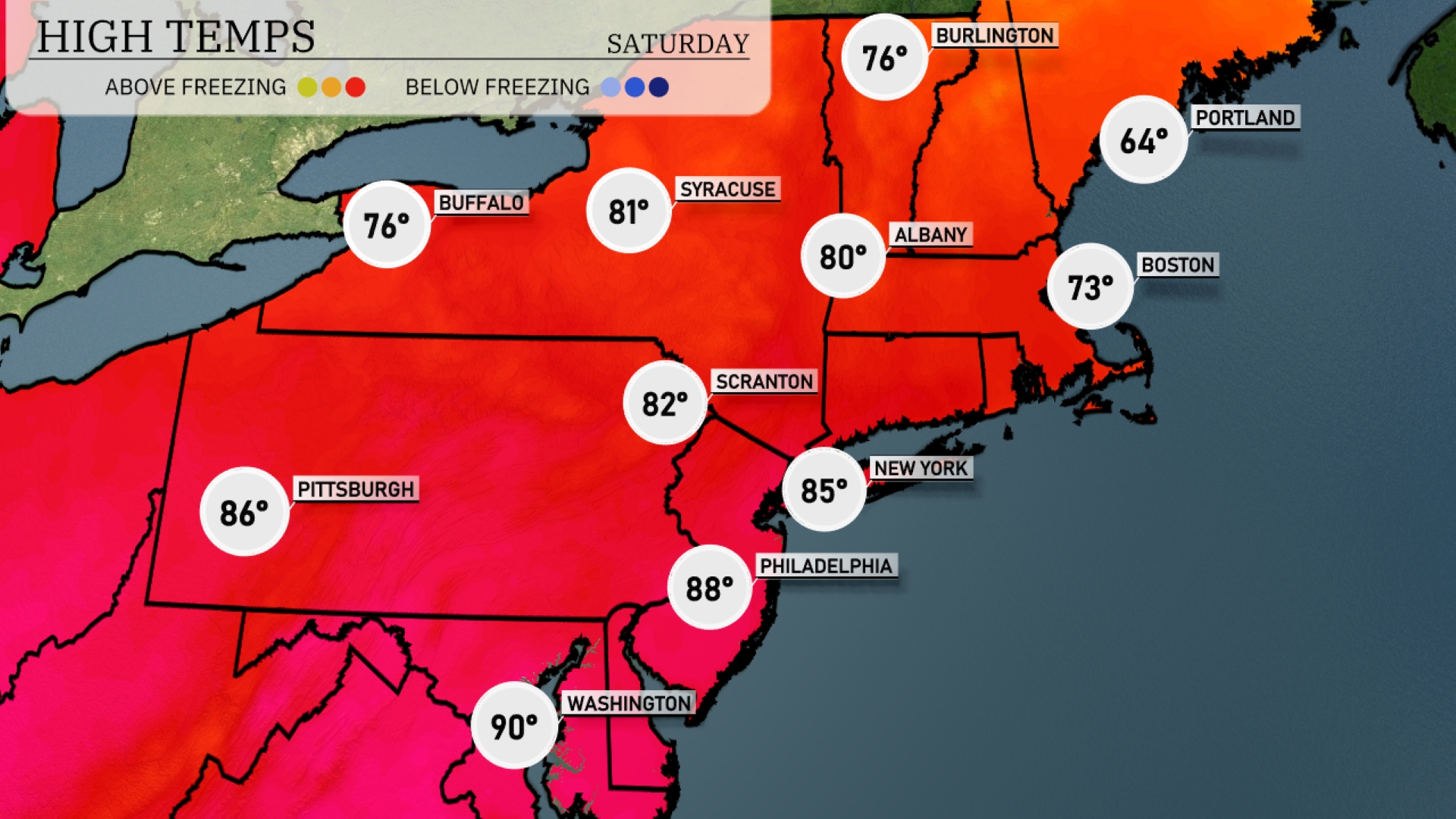
Tomorrow in the Northeast, temperatures will soar into the mid to upper 80s. Philadelphia can expect a high of 88 degrees, while New York City is set to reach 85. Scranton will warm up to 82 degrees, with Syracuse not far behind at 81. Boston will be cooler at 73 degrees, and farther north in Burlington, highs will only reach 76.
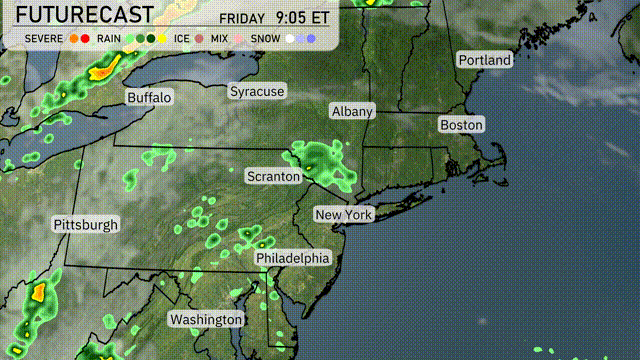
A cold front is set to sweep through the Northeast by early evening tomorrow, bringing with it scattered showers and thunderstorms. Areas from Pittsburgh to New York City should prepare for heavy rainfall, with localized flooding potential in urban settings. Thunderstorms may produce gusty winds, especially over central New York and Pennsylvania. On the temperature front, expect a noticeable drop to more comfortable levels post-front passage.
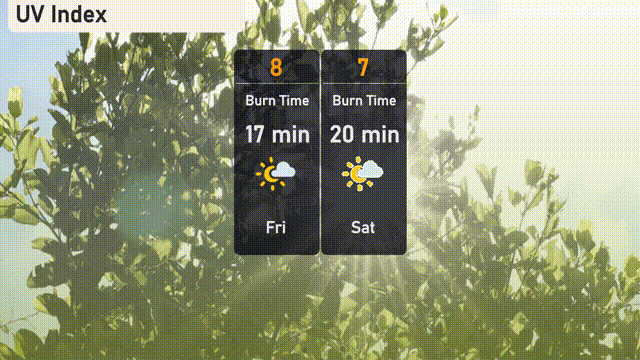
The UV index in New York City on Friday is high at 8, so take precautions as burn times can occur in as little as 17 minutes. By Saturday, expect slightly reduced sun strength with a UV index of 7, allowing for a burn time of approximately 20 minutes.
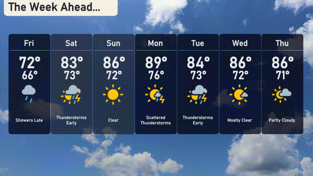
For the 7-day forecast in New York City:
Friday: Showers will arrive late with a high of 72 degrees and a low of 66 degrees.
Saturday: Early thunderstorms to start the weekend, reaching a warm 83 degrees, dipping to 73 degrees overnight.
Sunday: Clear skies will grace the city, with temperatures peaking at 86 degrees and dropping to 72 degrees.
Monday: Scattered thunderstorms are in the picture with a high of 89 degrees and a low of 76 degrees.
Tuesday: Thunderstorms continue with temperatures reaching 84 degrees and a nighttime low of 73 degrees.
Wednesday: Mostly clear skies as temperatures stay around 86 degrees, cooling slightly to 72 degrees at night.
Thursday: Partly cloudy conditions expected with a high of 86 degrees and a low of 71 degrees.