Chicago’s Dynamic Skies: Sunlit Days and Stormy Horizons
By
Amy Freeze
Explore the shifts from clear skies to storm fronts in Chicago’s latest weather forecast, capturing a city dancing between sunny highs and rainy evenings.
Today in Chicago, revel in the sun as temperatures peak, but don’t stash away your umbrella just yet—the Midwest could see some lively storms rolling in. Click to know more!
The Midwest is showing off its volatile weather patterns, with Chicago enjoying sunny skies amid a backdrop of advancing storms. With a detailed 7-day forecast, find out what this means for your week ahead. For full insights, click the link!
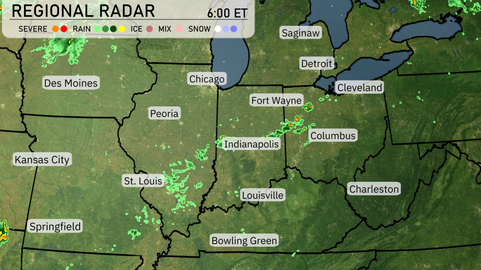
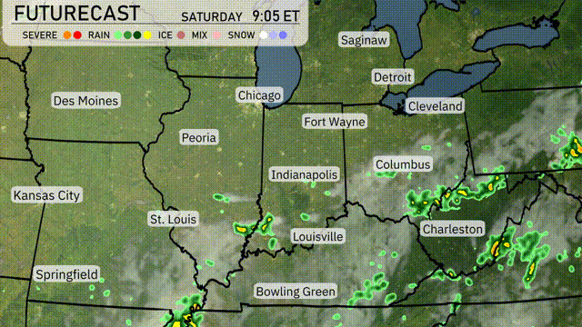
A line of storms is advancing across the Midwest, with intense activity observed from Indianapolis moving northeast toward Fort Wayne and Columbus. Showers are developing around Springfield and St. Louis, with additional precipitation brushing past Peoria. Clouds are thickening near Detroit, suggesting incoming rain. Farther north, light precipitation is reaching areas around Chicago, while Cleveland and Saginaw remain largely dry under increasing cloud cover.
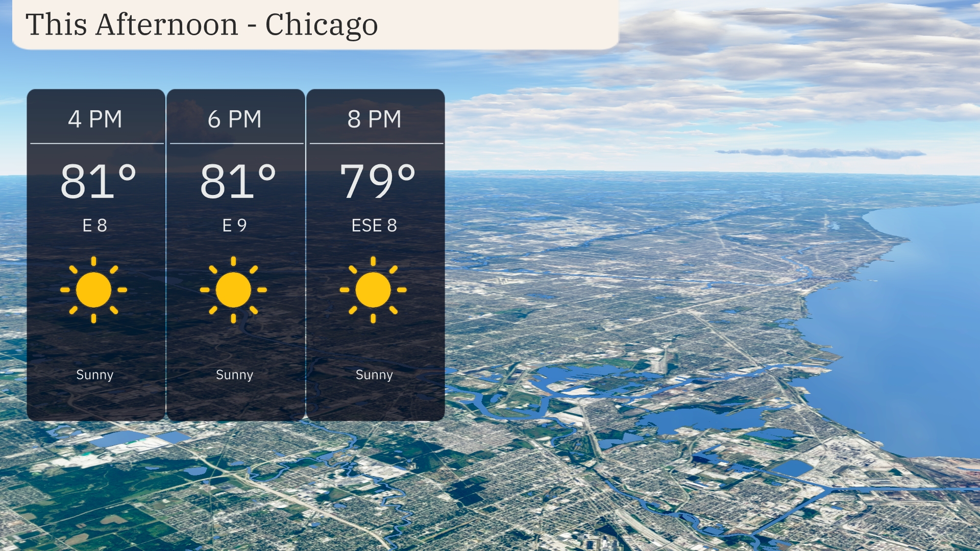
Afternoon temperatures in Chicago are holding steady at 81 degrees with an easterly wind around 8 to 9 mph. Sunny skies dominate the afternoon, offering a bright and pleasant day. As we approach the evening, expect a slight dip to 79 degrees with the breeze shifting to an east-southeast direction.
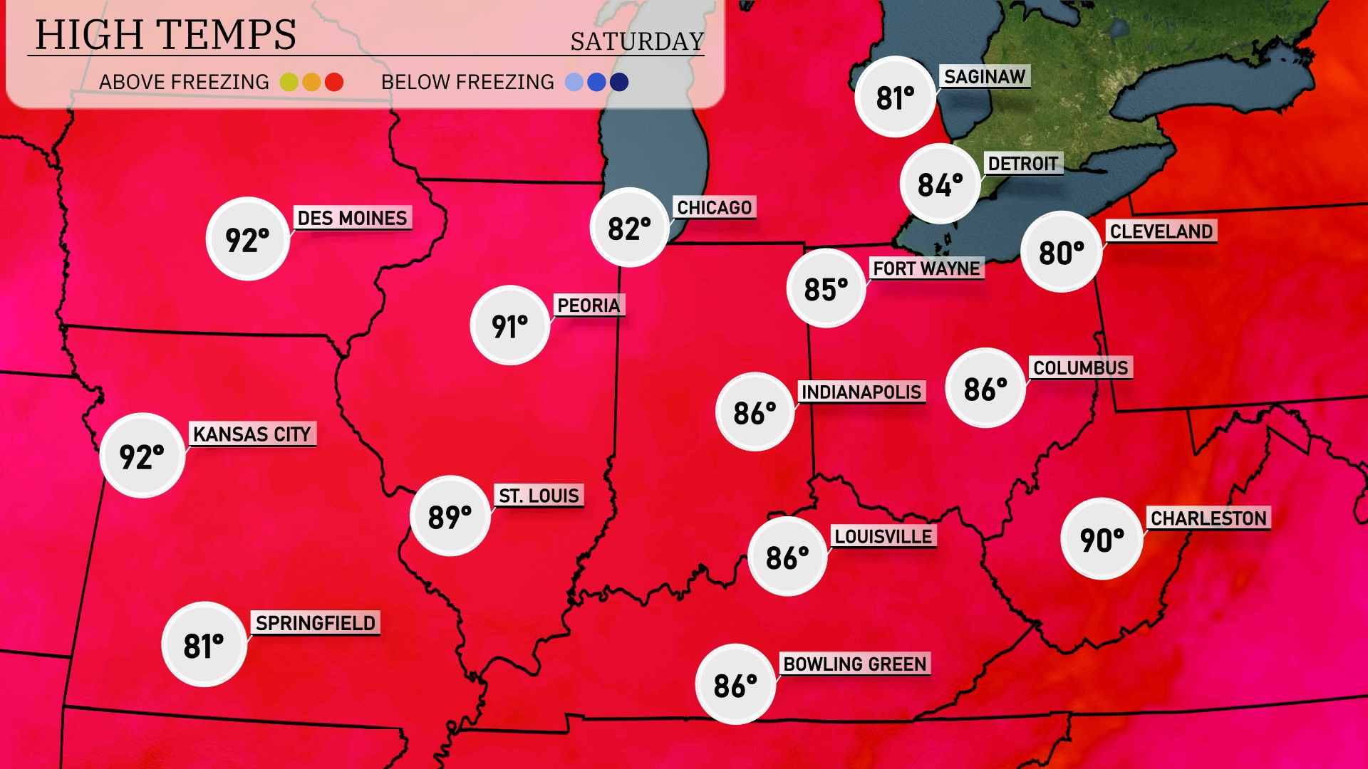
Today, the Midwest is experiencing a mix of temperatures, with some areas heating up significantly. In Chicago, expect a high of 82 degrees, while Peoria will be warmer at 91. Kansas City is on the hotter side at 92 degrees. St. Louis is slightly cooler at 89 degrees, but still on the warm side. Indianapolis registers a comfortable 86 degrees, creating notable temperature contrasts across the region.
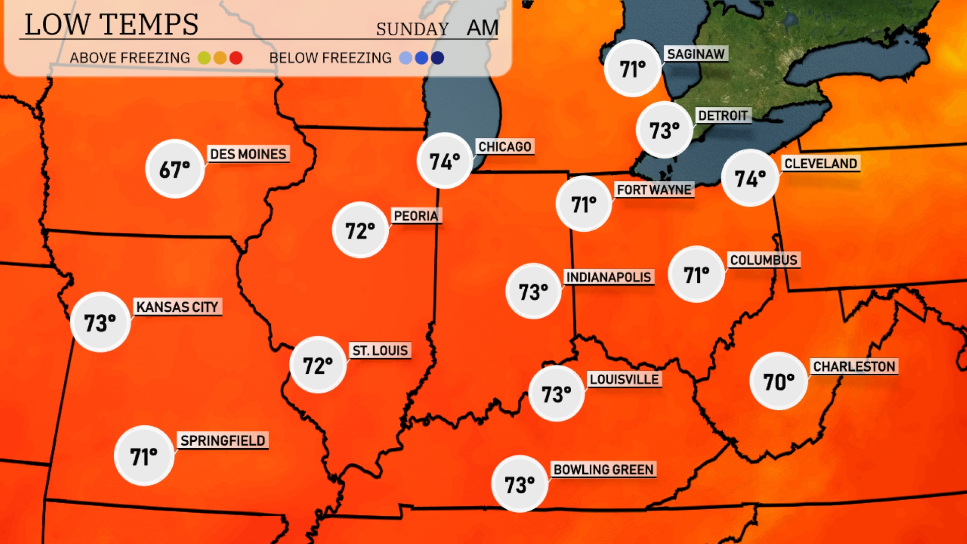
Tonight, Chicago will see a low of 74 degrees. Expect 71 in Indianapolis and 70 in Columbus. St. Louis is forecast to drop to 72, while Kansas City will be a bit warmer at 73.
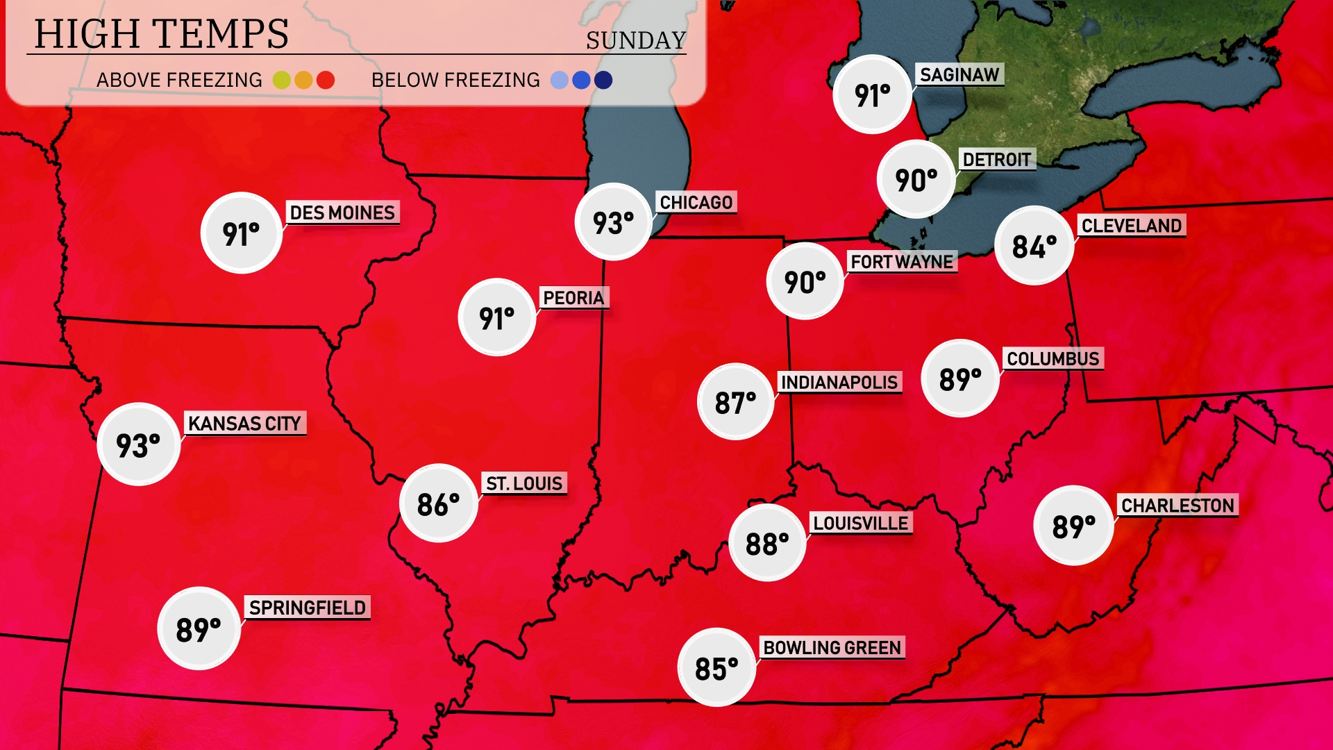
Tomorrow in the Midwest, Kansas City will reach a sizzling 93 degrees, making it one of the hottest spots in the region. Chicago and Peoria are also warming up significantly, both expected to hit 93 degrees as well. Indianapolis will see temperatures around 87 degrees, while St. Louis will be slightly cooler at 86 degrees.
A warm front is moving through the Midwest tomorrow, bringing isolated thunderstorms, particularly around St. Louis and Springfield. Expect periods of heavy rain in Columbus and Indianapolis, while Bowling Green and Louisville may see scattered showers. Temperatures rise across the region, reaching highs in the mid-80s. Some storms could produce gusty winds and lightning, so remain alert for any severe weather alerts. Post-frontal passage, clearer skies are expected as we head into the next week.
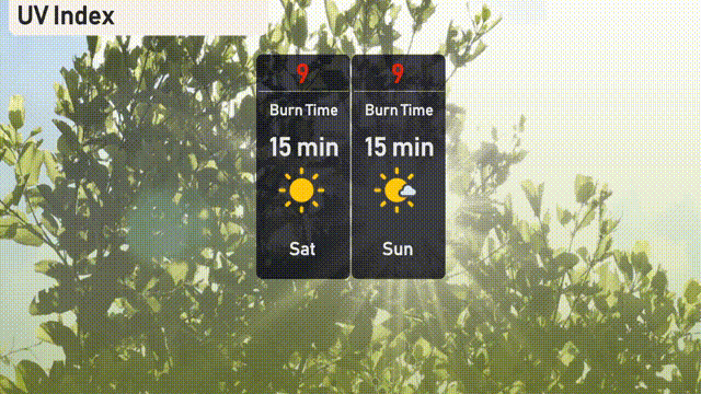
The UV index in Chicago is very high at 9 on Saturday with a burn time of just 15 minutes in direct sunlight.