Southeast Skies: Weather Whirl from Miami to Memphis
By
Amy Freeze
Navigating the Southeast's summer solstice, this forecast covers Miami's cloudy prospects to New Orleans’ rainy retreats, and a UV alert that you can't afford to miss!
Delving into this week’s shifting skies, Miami oscillates between cloudy calm and stormy surges. Explore the nuances of Southeast weather, from Jacksonville’s jumps to Shreveport’s summer sizzle.
As the Southeast braces for another week of weather whims, Miami’s forecast promises cloudy days with brief respites of sun. A looming low-pressure trough threatens to spice things up with potential thunderstorms, especially impacting areas from Houston to Savannah. Don’t miss out on our UV safety tips for Miami’s extreme exposure this weekend!
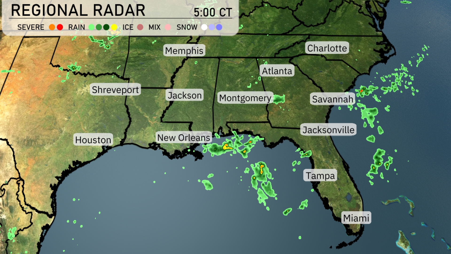
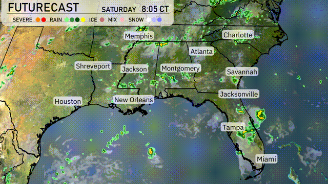
On the Regional Radar, scattered showers are mainly affecting the Gulf Coast, with notable rain near New Orleans pushing eastward. A few showers are also visible around Jacksonville, Florida, and are expected to continue moving inland. Atlanta is clear, but increasing clouds are approaching from the southwest, signaling potential rain later. Memphis and Charlotte remain calm under clear skies, providing a break from any precipitation.
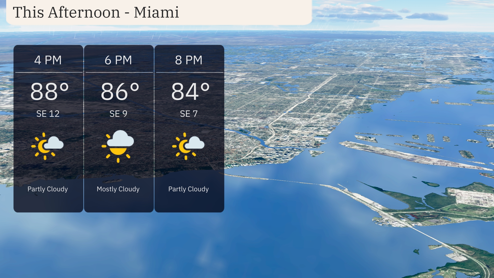
Afternoon hours in Miami bring temperatures starting at 88 degrees, gradually cooling to 84 degrees by 8 PM. Expect partly to mostly cloudy skies throughout, with winds from the southeast ranging from 12 miles per hour at 4 PM to 7 miles per hour by 8 PM.
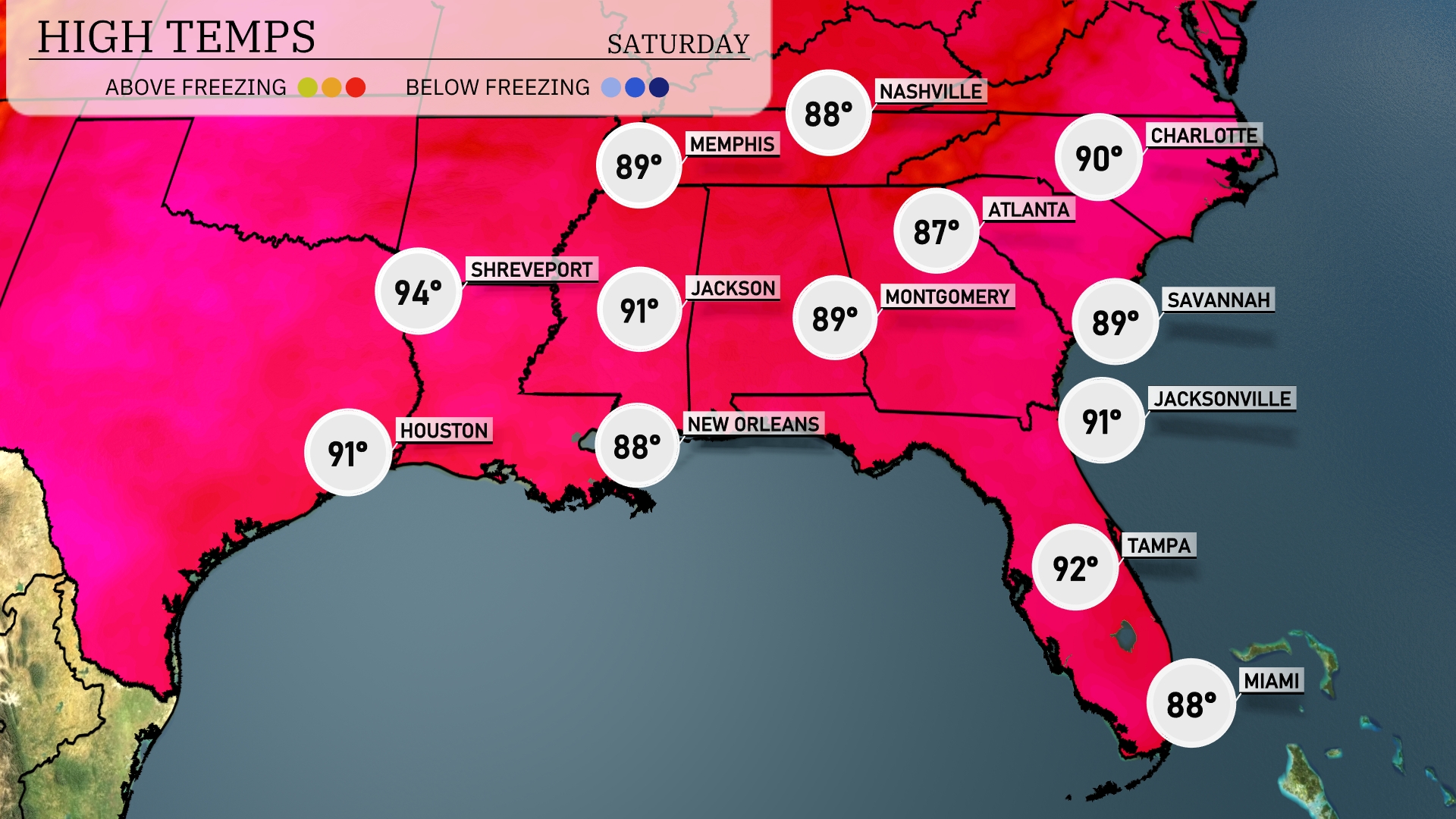
Temperatures are climbing across the Southeast today. In Jackson, expect a high of 91 degrees, while New Orleans will be slightly cooler at 88. Shreveport is heating up with a warm 94 degrees, and Houston follows closely at 91. Jacksonville and Atlanta are both seeing highs around 91 and 87 degrees respectively.
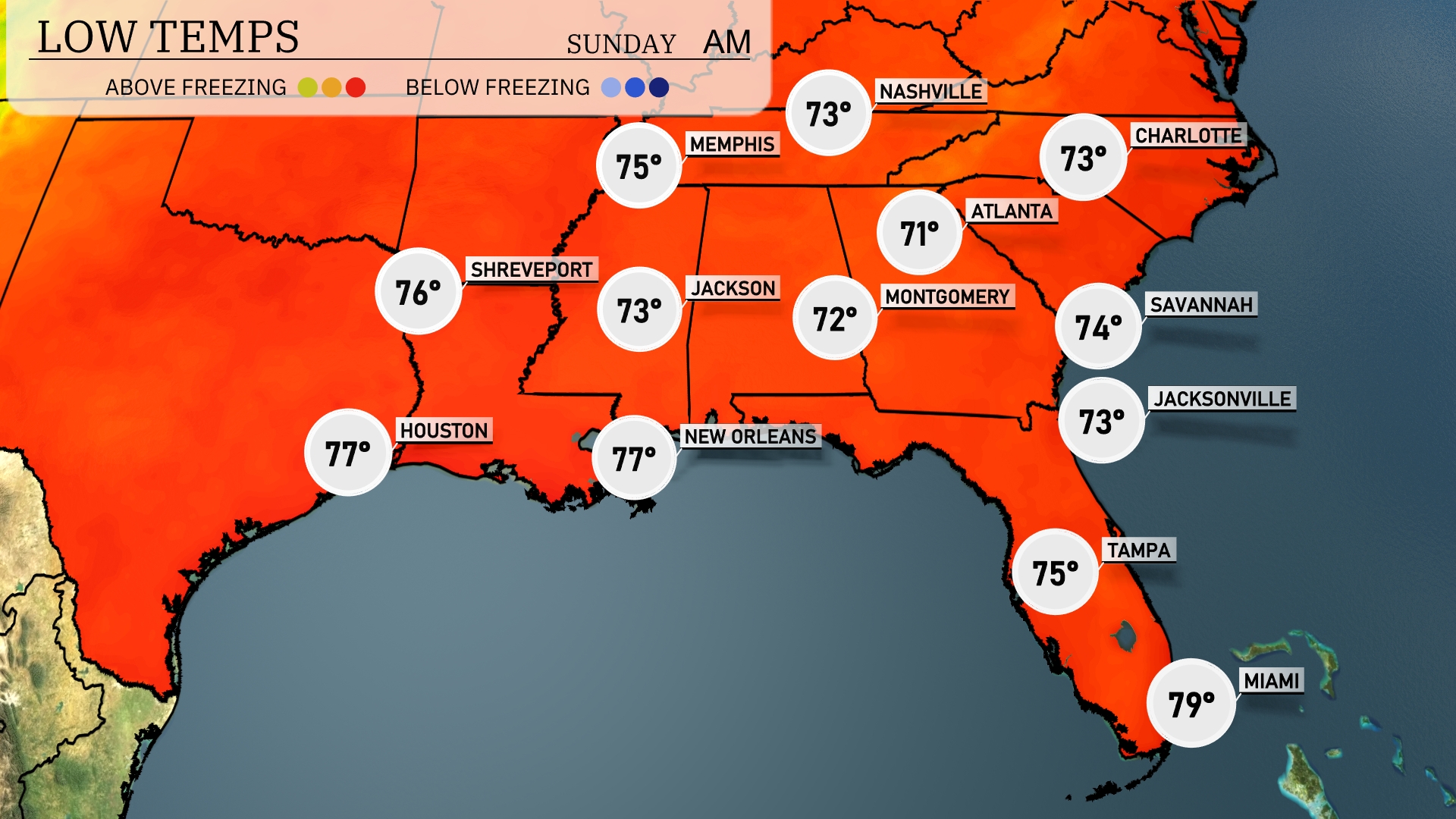
Tonight, Nashville will see a low of 73 degrees, while Memphis cools down to 75. Jackson is expected to drop to 73, and Montgomery will hit 72. Farther south, New Orleans will remain warmer at 77, but temperatures will dip to 74 in Savannah and 73 in Jacksonville.
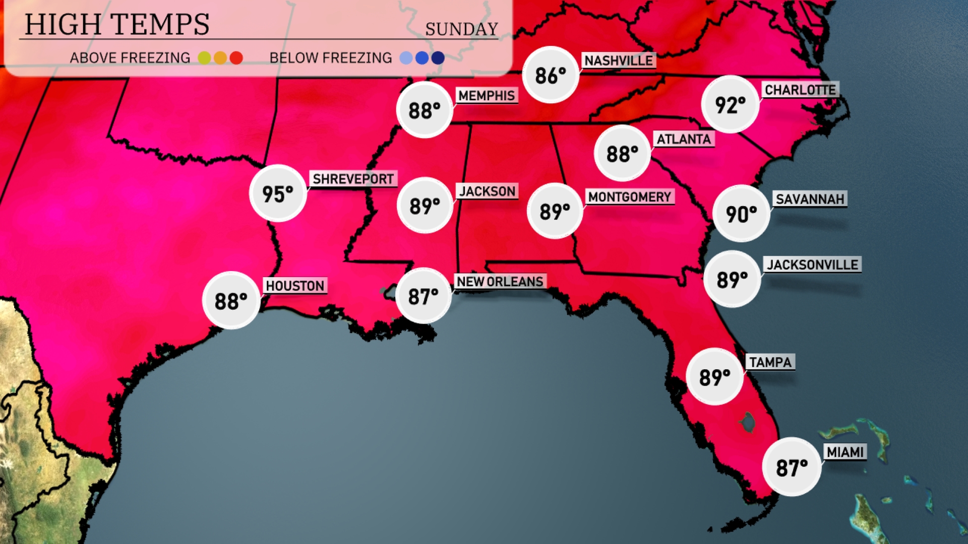
Tomorrow, temperatures in the Southeast will soar, with Montgomery and Jackson both hitting 89 degrees. Atlanta is not far behind, reaching a high of 88. The coastal cities are also warming up, with Jacksonville and Tampa at 89 and 87 degrees, respectively. Notably, Shreveport could see highs climb to a sweltering 95, indicating above-average heat for this time of year.
A trough of low pressure is shaping up to bring impactful weather across the Southeast on Sunday. Expect scattered thunderstorms to bubble up from Houston to New Orleans, with stronger storms possibly reaching into Montgomery by midday. Rainfall totals could exceed an inch, with localized flooding possible in low-lying areas. By Sunday night, a secondary wave of storms may sweep through Savannah, keeping a close eye on severe thunderstorm risks. With this system exiting Monday morning, drier and seasonably warm conditions are expected to follow.
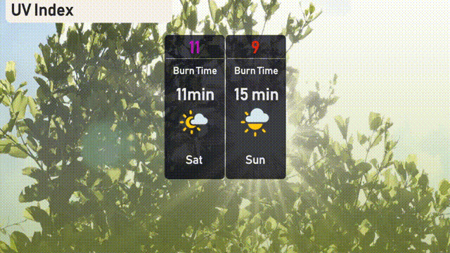
The UV index in Miami is extreme on Saturday with a value of 11, indicating a burn time of just 11 minutes in direct sunlight. For Sunday, expect the UV index to remain very high at 9, with a burn time of 15 minutes.