NYC Morning Weather Forecast: A Glimpse into Tomorrow | June 28, 2025
By
Amy Freeze
Get ready for a sunny start with a preview of New York City's weather. From crisp mornings to warm afternoons, see what tomorrow holds for NYC locals and visitors.
Plan your day in NYC with our detailed morning weather forecast for tomorrow, June 28. Expect a sunny start with surprise showers later!
NYC starts yet another day under the spell of an evolving sky! Tune into tomorrow’s prognosis as we predict mild beginnings turning into a scorching noon. With the weather moving swiftly across the Northeast, from clear blues to rapid showers aiming towards Philly, stay tuned as we update you with every hour’s narrative. Dive deeper into our forecasts and how they compare with last week’s weather conditions at our blog.
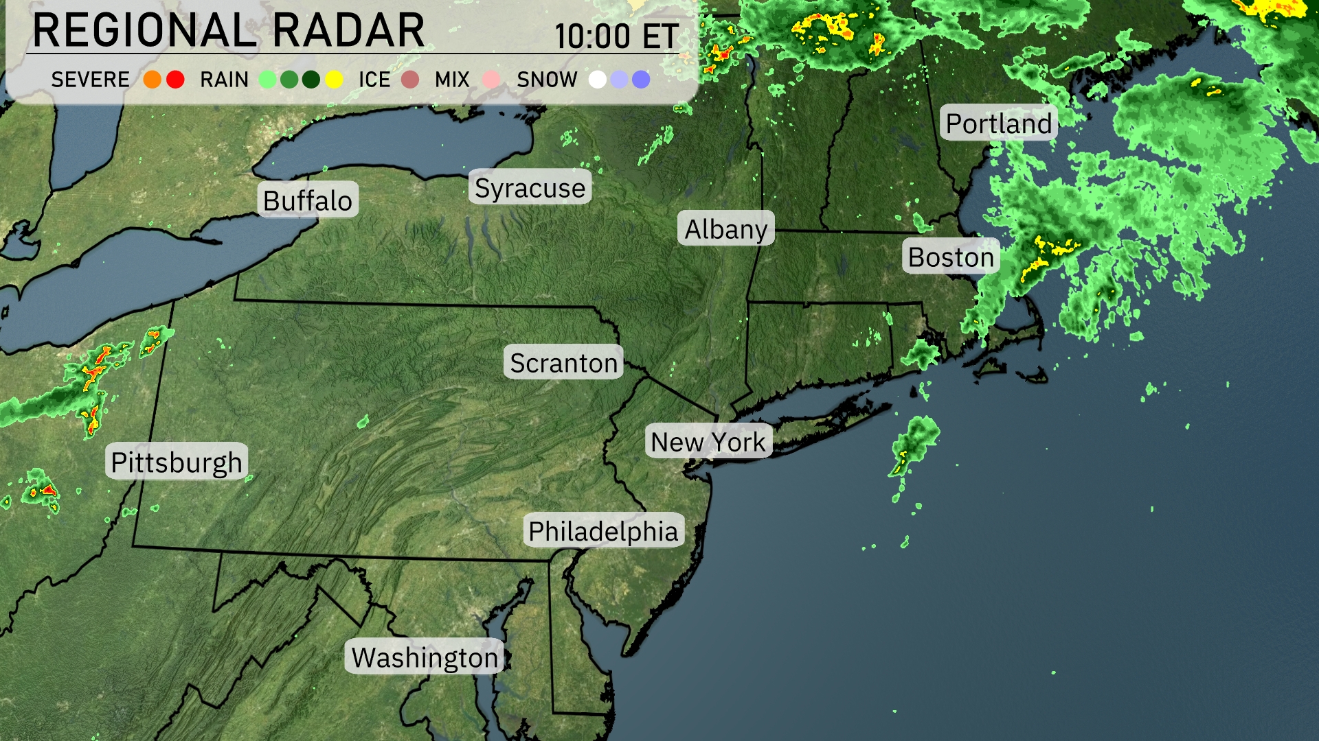
A swath of rain is sweeping across the northeast, from Boston up to Portland, bringing wet conditions to these areas. Light sprinkles extend westward towards Albany, while Scranton and New York remain under clear skies for now. Showers are also beginning to form over western Pennsylvania, with Pittsburgh on the edge of potential precipitation. The rest of the region, including Philadelphia and Syracuse, is enjoying calm and dry weather.
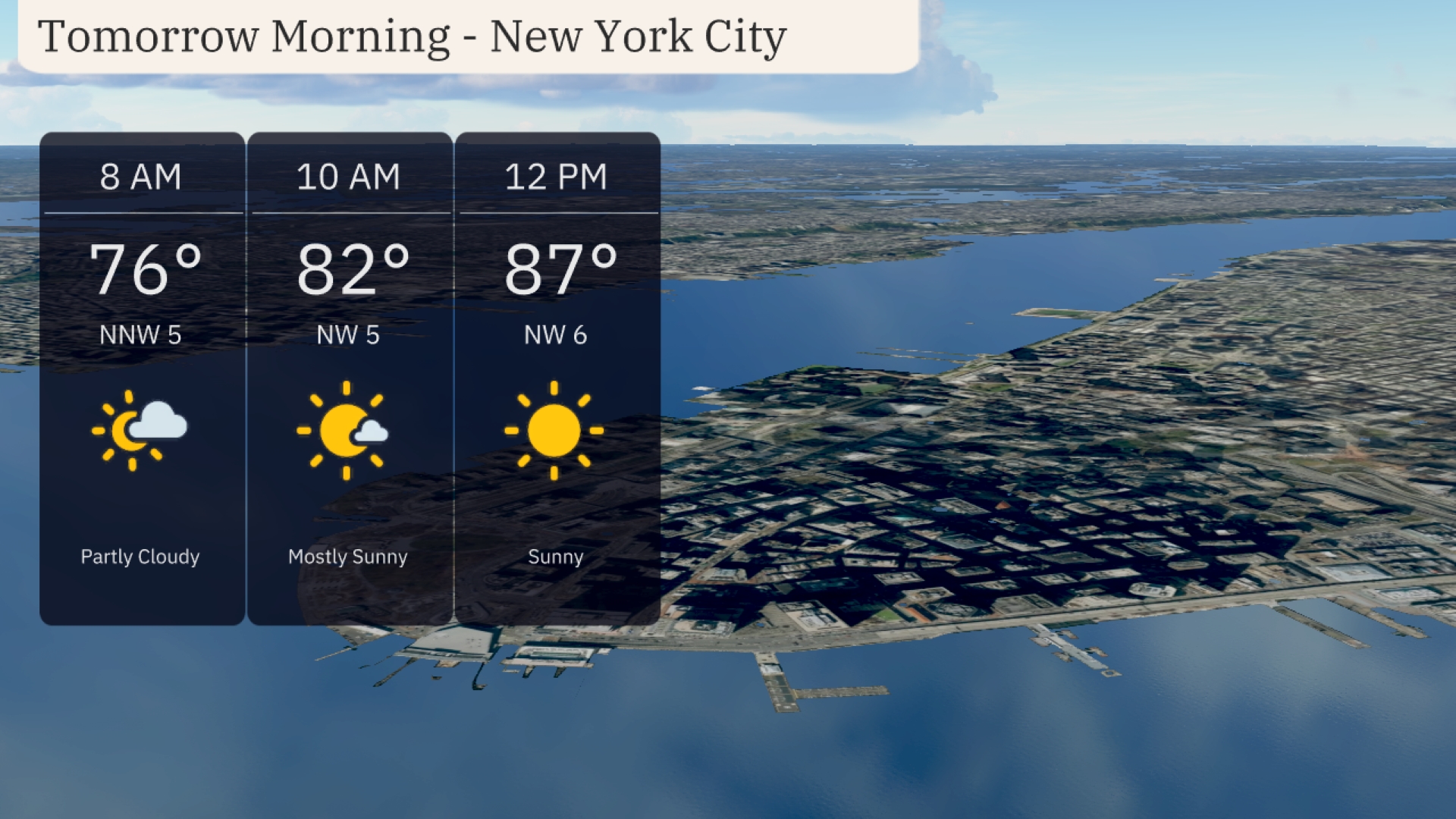
For tomorrow morning in New York City, temperatures will start at 76 degrees at 8 AM under partly cloudy skies. By 10 AM, the temperature will rise to 82 degrees with mostly sunny conditions. A light northwest wind at 5 miles per hour continues through the morning. By noon, expect a sunny sky with temperatures reaching 87 degrees and winds slightly picking up to 6 miles per hour.
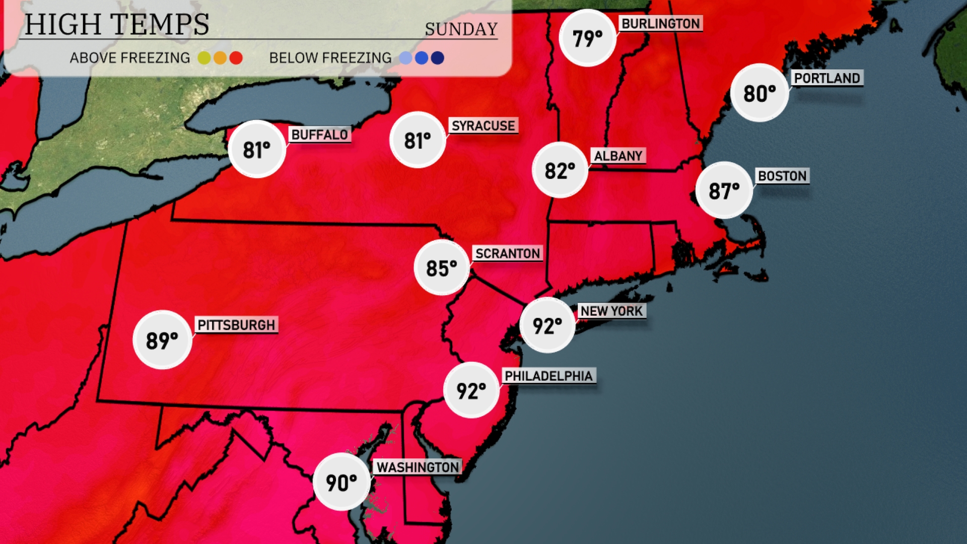
Tomorrow in the Northeast, New York City experiences a hot day with a high of 92 degrees, while Philadelphia also hits 92, reflecting above-average temperatures due to a strong ridge of high pressure. Boston will see a warm afternoon at 87 degrees, with Albany reaching 82. Slightly cooler, Pittsburgh anticipates a high of 89, and Scranton will settle at 85.
A wave of showers and thunderstorms moves through the Northeast, impacting areas from Pittsburgh to New York tomorrow. Expect showers to begin early in the morning, with heavier downpours likely around midday, especially near Philadelphia. As the front passes, skies will clear overnight into Saturday, bringing cooler and drier conditions. Temperatures will range from the mid-60s in the morning, peaking in the mid-70s by afternoon.
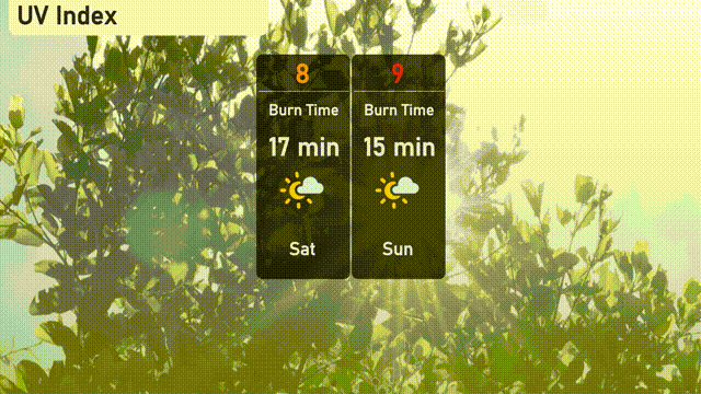
The UV index in NYC will be very high on Saturday, coming in at 8, with a burn time of just 17 minutes in direct sunlight. On Sunday, the sun’s intensity increases with the UV index at 9, reducing the burn time to 15 minutes.
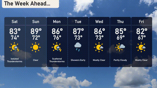
Saturday: Isolated thunderstorms with a high of 83 degrees and a low of 74 degrees.
Sunday: Clear skies with temperatures reaching a high of 89 degrees and cooling to 72 degrees at night.
Monday: Expect scattered thunderstorms with a high of 86 degrees and an overnight low of 76 degrees.
Tuesday: Showers early in the day with the high peaking at 87 degrees and a low of 73 degrees.
Wednesday: Mostly clear conditions with highs around 86 degrees and a low reaching 73 degrees.
Thursday: Partly cloudy skies with temperatures hitting a high of 85 degrees and a low of 69 degrees.
Friday: Mostly clear, concluding the week with a high of 82 degrees and a low of 67 degrees.