Chicago and Midwest Weather Outlook for June 28, 2025
By
Amy Freeze
Explore the detailed weather forecast for Chicago and the broader Midwest for June 28, 2025, featuring sunny mornings, potential thunderstorms, and more.
Dive into the weather changes impacting Chicago and the Midwest on June 28, 2025. Find out what to expect from the skies!
Get ready for a rollercoaster of weather conditions across Chicago and the Midwest on June 28, 2025. The day begins with a warm morning in Chicago, with temperatures swiftly climbing. However, as a cold front approaches, expect scattered thunderstorms by the afternoon, potentially leading to severe weather in several areas. Keep yourself prepared and check out our full forecast for actionable insights and safety tips.
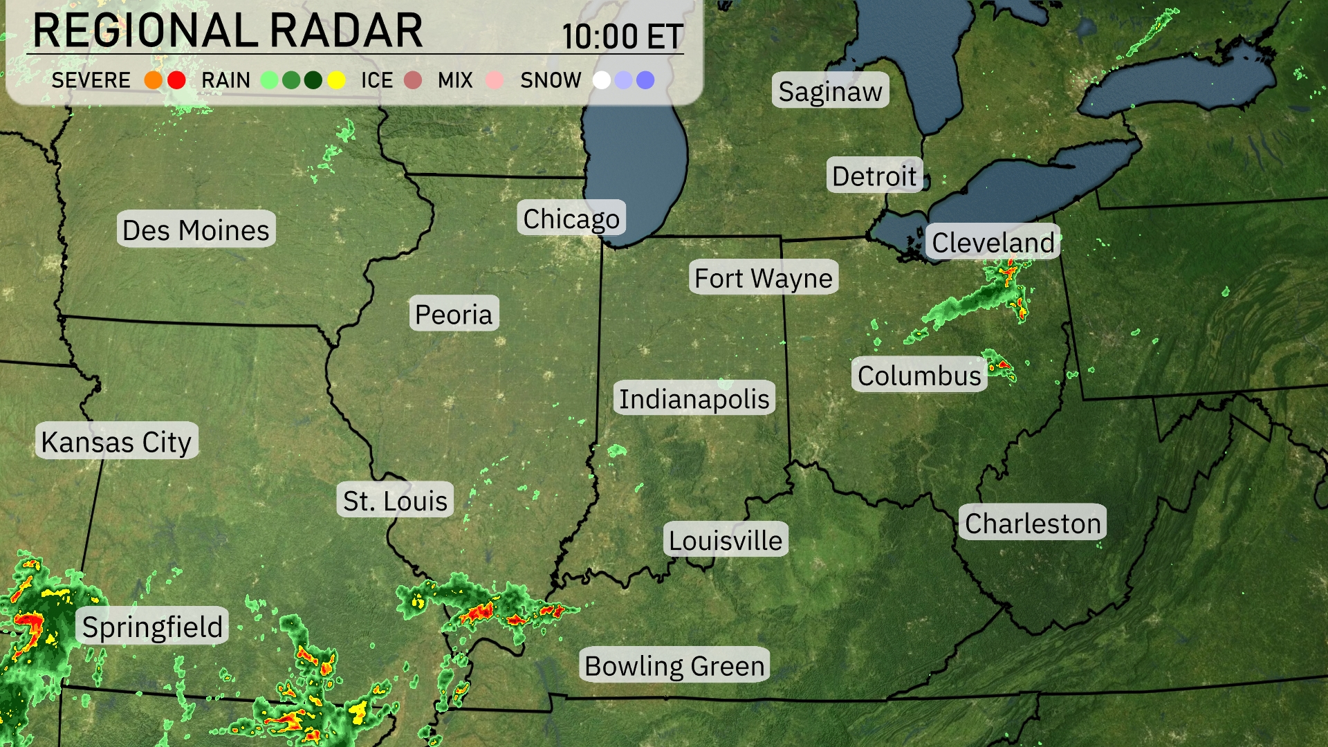
The Midwest is experiencing a mix of weather conditions today. In the southern areas, Springfield sees significant storm activity, with severe weather stretching towards St. Louis. Des Moines and Kansas City remain clear at the moment, while Fort Wayne and Cleveland encounter scattered showers. Detroit and Chicago enjoy clear skies, although clouds are beginning to increase over Bowling Green and Indianapolis as weather systems advance.
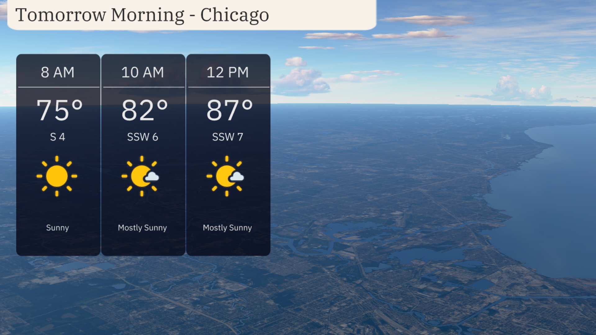
Tomorrow morning in Chicago starts sunny with temperatures rising from 75 degrees at 8 AM to 82 degrees by 10 AM. Winds will be from the south-southwest at 6 to 7 mph throughout the morning. The skies transition to mostly sunny as temperatures reach 87 degrees by noon.
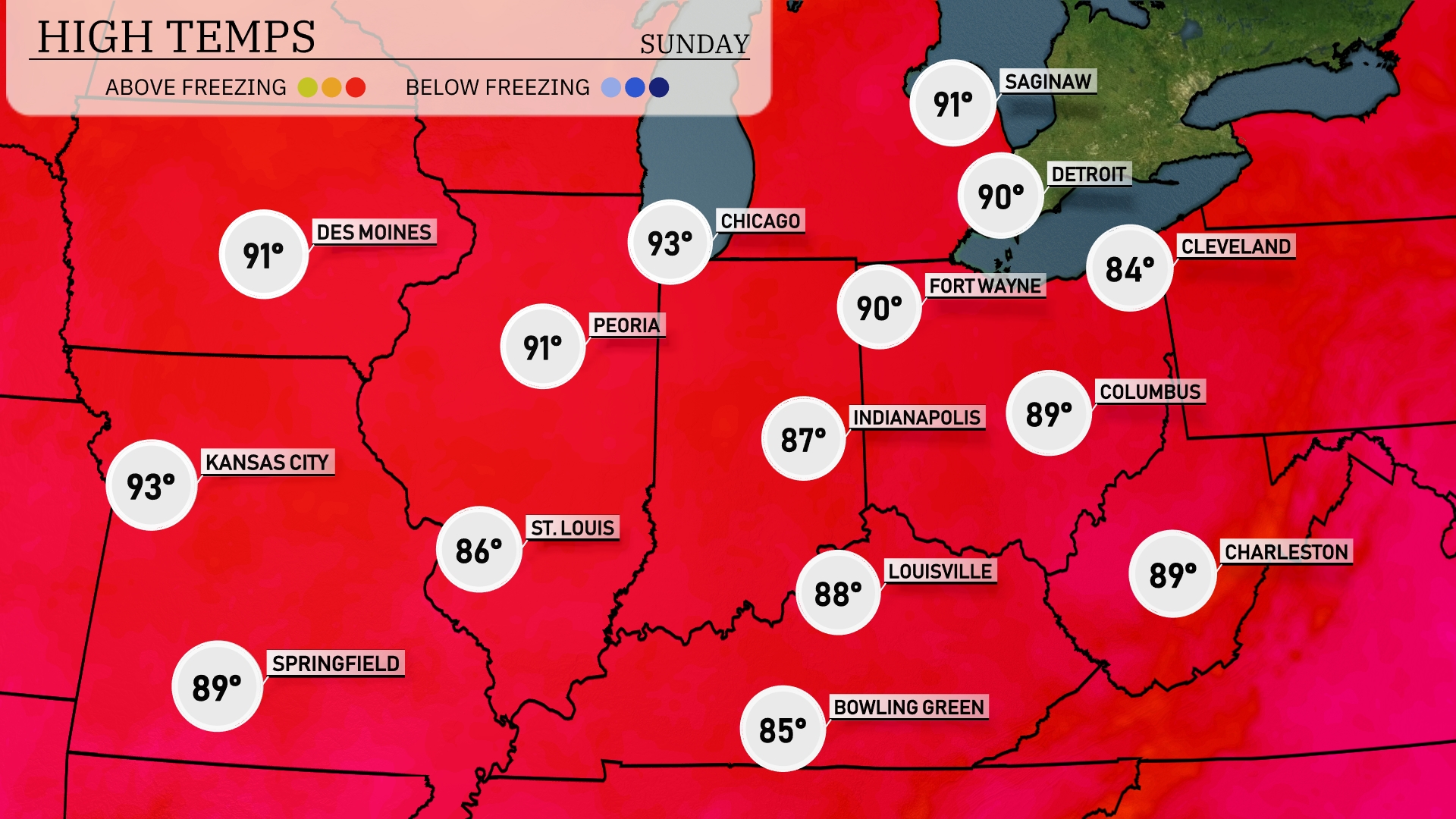
Tomorrow in the Midwest, expect a sweltering day with highs peaking at 93 degrees in Kansas City and Peoria. Chicago will also feel the heat, reaching 93 degrees, while Indianapolis sees a high of 87 degrees. Fort Wayne can anticipate a warm 90 degrees, and St. Louis will be slightly cooler at 86 degrees. Interestingly, Cleveland will be below average with a high of only 84 degrees amidst this heat wave.
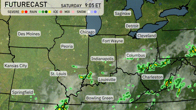
A cold front approaches the Midwest from the west, triggering scattered thunderstorms across parts of Missouri, Illinois, and Indiana tomorrow. Expect heavier rainfall and potential flooding near Springfield and St. Louis by late afternoon. Temperatures will drop into the 60s behind the front, bringing relief from the heat. Stronger storms could develop around Indianapolis and Louisville, with damaging winds being the primary concern. By evening, the front progresses eastward, leaving cooler and drier conditions in its wake for Sunday.
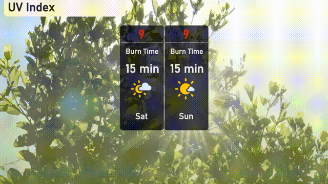
The UV index in Chicago will reach a very high level of 9 on both Saturday and Sunday, with a potential burn time of just 15 minutes in direct sunlight.
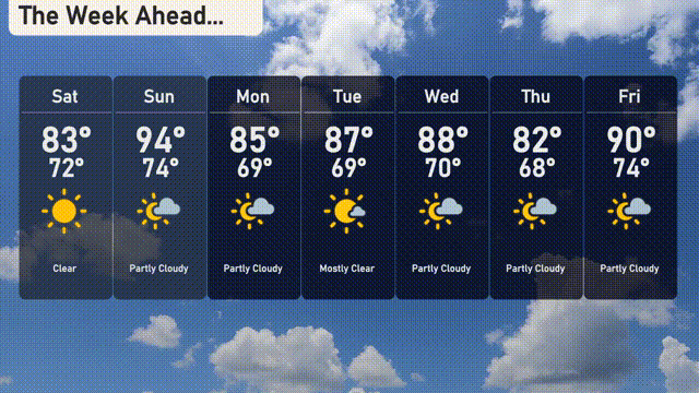
Saturday: Clear skies with a high of 83 degrees, cooling down overnight to 72 degrees.
Sunday: Partly cloudy, reaching a warm 94 degrees during the day and a low of 74 degrees.
Monday: Mostly sunny and warm, with highs around 85 degrees and a comfortable low of 69 degrees.
Tuesday: Mostly clear conditions continue, as temperatures climb to 87 degrees, with a low of 69 degrees.
Wednesday: Partly cloudy skies, expect a high of 88 degrees and a nighttime low of 70 degrees.
Thursday: Temperatures dip slightly with a high of 82 degrees under partly cloudy skies and a low of 68 degrees.
Friday: Partly cloudy, warming up again to a high of 90 degrees, with a mild low of 74 degrees.