Miami’s Weekly Weather Outlook: From Sunscreen to Umbrellas
By
Amy Freeze
Unpack the full week of Miami's weather—from balmy sunny mornings to potential stormy disruptions. Your ultimate guide is here!
From sunny skies to storm alerts, get ready for a week of weather whiplash in Miami. Check out our full forecast for all the details!
Welcome to your detailed forecast for Miami! This week, experience a mix of mostly sunny mornings with potential stormy interruptions, particularly towards midweek. Be sure to prepare for varying temperatures and stay updated on the thunderstorm warnings, especially if you’re planning any outings. Safety tips, UV index details, and more in our comprehensive guide. Read more here: https://amyfreeze.ai/
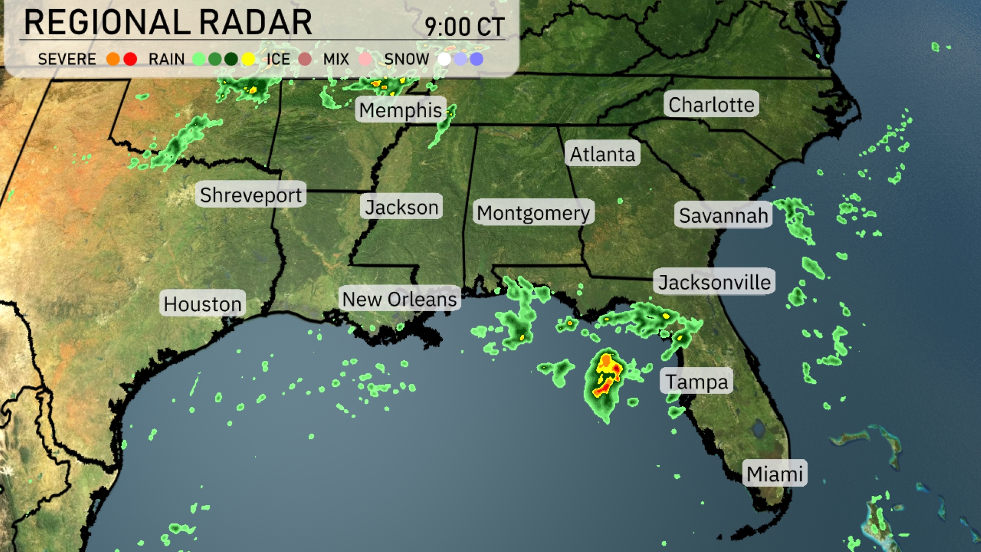
A cluster of storms is intensifying just off the coast near Tampa, Florida, moving northward into the Gulf. Atlanta is under overcast skies, while scattered showers drift eastward over Jackson. Charlotte and Savannah are currently experiencing clear skies, but clouds are building to the west. Memphis and Shreveport are witnessing isolated thunderstorms with the potential for heavy rain in localized areas.
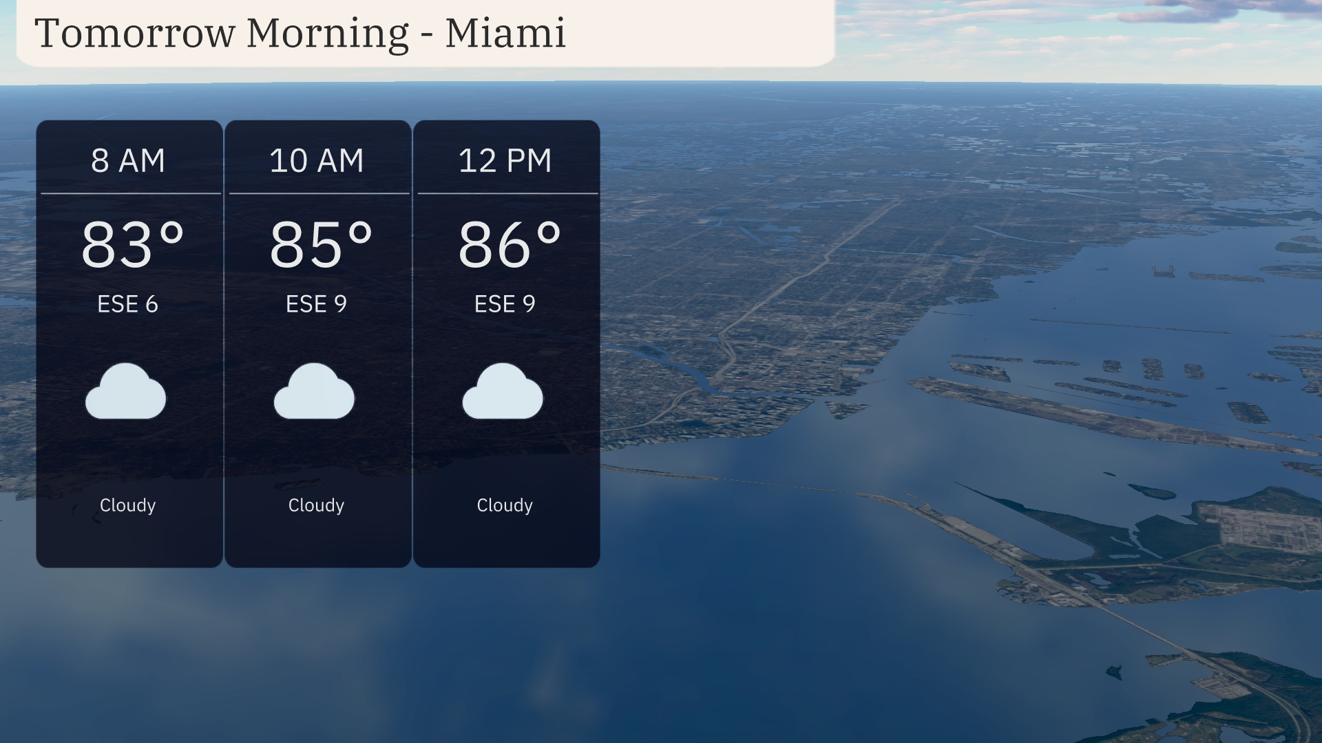
Tomorrow morning in Miami, temperatures will start at 83 degrees by 8 AM, rising to 85 degrees by 10 AM, and reaching 86 degrees by noon. Expect cloudy skies with an east-southeast wind around 6 to 9 miles per hour. A cloudy and humid morning is in store with a gentle breeze from the ESE.
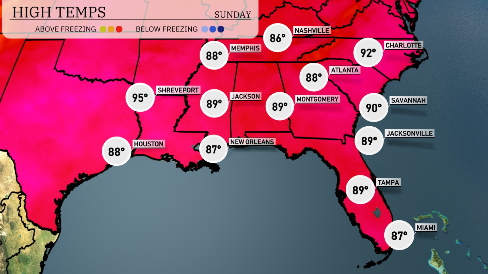
Tomorrow, Memphis can expect a high of 88 degrees. In Jackson and Montgomery, temperatures will both reach 89 degrees, while New Orleans slightly cools to 87 degrees. Atlanta will be warmer, climbing to 90 degrees, and further south, Savannah matches that with a high of 90. Over in Houston, temperatures will be a bit cooler at 88 degrees, lending to a warm but manageable day across the Southeast.
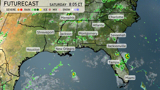
A cold front is set to push through the Southeast tomorrow, bringing thunderstorms from Houston to Jacksonville. Early morning storms may impact the commute in Atlanta and Montgomery. Watch for heavy downpours especially in Louisiana and Mississippi, with potential for isolated flash flooding. The front will pass by Wednesday afternoon, ushering in cooler and drier air across the region, calming conditions as the week progresses. Be prepared for rapidly changing weather over the next 24 to 48 hours with some severe weather risks.
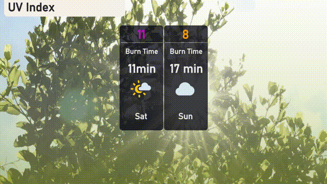
The UV index in Miami today is a high of 11, meaning sun exposure can lead to skin damage in as little as 11 minutes. On Sunday, the UV index will be 8, so plan for a burn time of around 17 minutes.
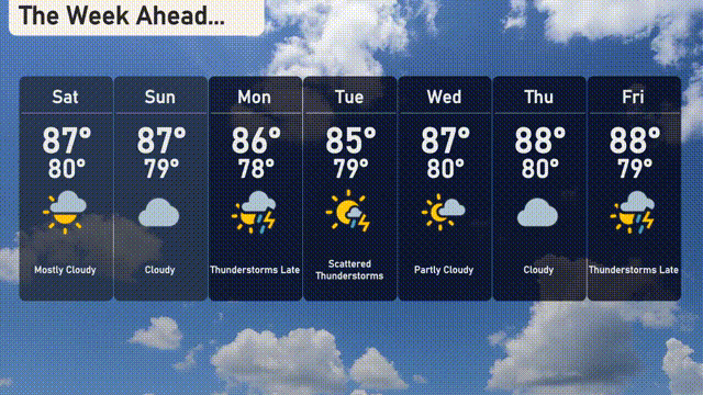
Saturday: Warm and mostly sunny with a high of 87 degrees and a low of 80 degrees.
Sunday: Cloud cover moves in with temperatures holding steady at 87 degrees for the high and 79 degrees for the low.
Monday: Thunderstorms expected in the afternoon, with a high of 86 degrees and a low of 79 degrees.
Tuesday: Scattered thunderstorms roll through with a high of 85 degrees and a low of 79 degrees.
Wednesday: Enjoy partly cloudy skies with the temperature reaching up to 87 degrees, and a low of 80 degrees.
Thursday: It heats up slightly with highs around 88 degrees, under partly cloudy skies, cooling down to 80 degrees at night.
Friday: Another round of thunderstorm activity late in the day, with a high of 88 degrees and a low of 79 degrees.