Navigating Through Nimbus: Atlanta’s Comprehensive Weekly Weather Forecast
By
Amy Freeze
Explore the elements as we delve into Atlanta's weather for the week ahead—from serene skies to looming storms. Get all the details right here!
Get ready for a week of weather twists in Atlanta! From a pleasant 88°F to potential thunderstorms—here’s everything you need to keep you prepared!
This week in Atlanta, expect a mix of skies and surprises. Beginning with partly cloudy conditions and gentle breezes, our temperatures will gradually rise across the week. However, a looming cold front promises a shift, bringing thunderstorms that could lead to significant rainfall and possible flooding. Stay with us for daily updates and take a glance at our 7-day detailed forecast to plan your days effectively.
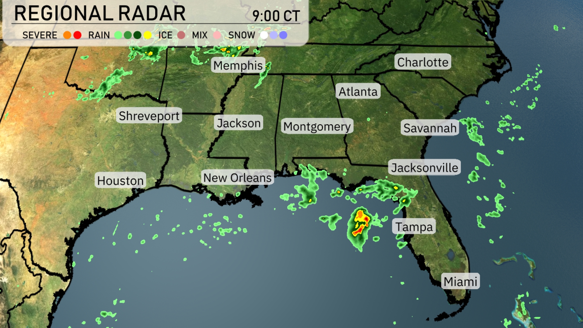
On the Regional Radar for the Southeast, we’re tracking a line of showers approaching from the Gulf of Mexico toward the Florida Peninsula, especially impacting areas around Tampa with heavier rain. Coastal regions of Louisiana to the Panhandle of Florida, including New Orleans, are experiencing scattered showers. Over Mississippi and Alabama, light showers are present with increasing cloud cover, while Memphis is showing some thunderstorm activity with areas of intense rainfall. The Carolinas and Georgia are enjoying a break from precipitation, with mostly clear to partly cloudy skies currently.
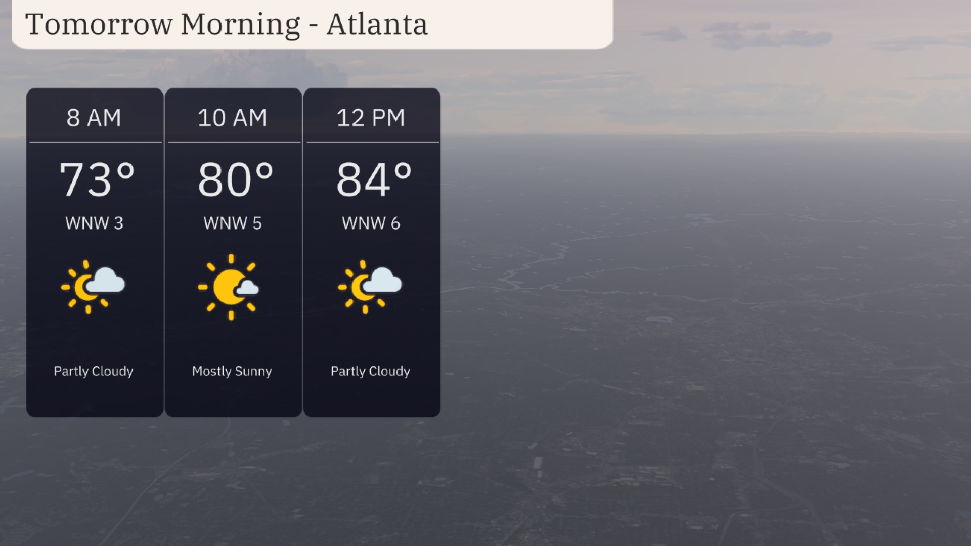
Tomorrow morning in Atlanta, enjoy partly cloudy skies with temperatures starting at 73 degrees by 8 AM. By mid-morning, conditions shift to mostly sunny, with temperatures rising to 80 degrees at 10 AM. Expect a gentle west-northwest breeze between 3 to 5 miles per hour. Shortly before noon, anticipate a temperature of 84 degrees with intermittent clouds returning.
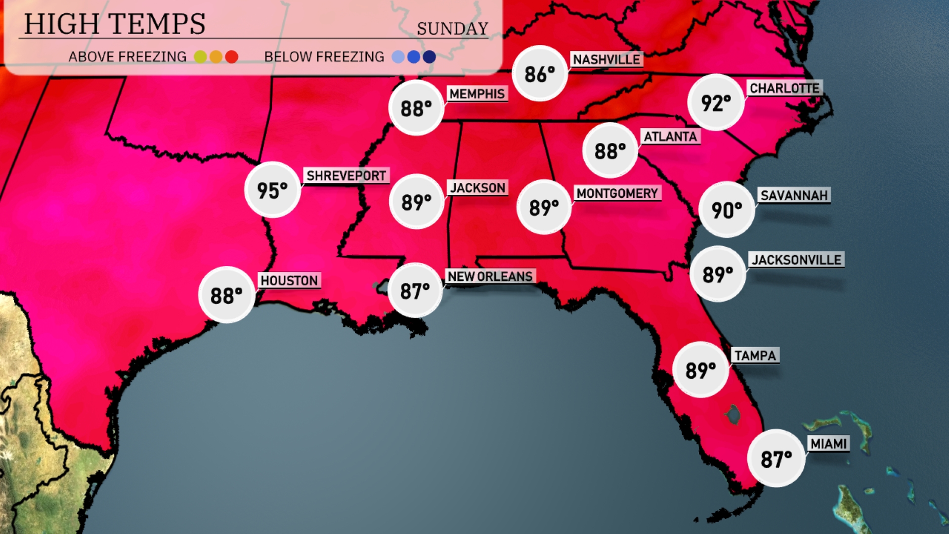
Tomorrow, high temperatures across the Southeast will be warm, with Atlanta reaching 88 degrees. In the Carolinas, Charlotte is poised for a high of 92 degrees, while Savannah will hit 90. Mississippi sees highs around 89 in both Jackson and Montgomery, with New Orleans slightly cooler at 87 degrees. Houston will experience a warm day with a high of 88 degrees, signaling slightly above-average temperatures influenced by ongoing warm air masses in the region.
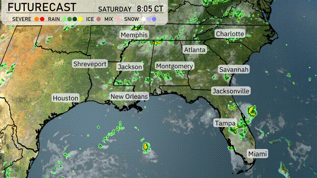
A cold front sweeping through the Southeast will trigger a mix of thunderstorms and showers, especially from Shreveport to Jacksonville over the next 24 to 48 hours. Expect a significant line of storms to develop, with heavy rain and gusty winds likely, particularly impacting areas from New Orleans to Savannah. Storms are set to travel eastward, bringing wet conditions to the region tomorrow with temperatures remaining steady. Pay attention to potential flooding, as some regions could see substantial rainfall amidst the convection.
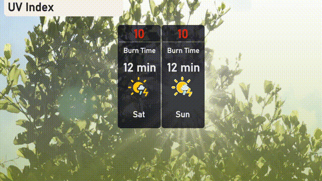
Atlanta will experience a very high UV index of 10 on both Saturday and Sunday, with a burn time of just 12 minutes in direct sunlight.
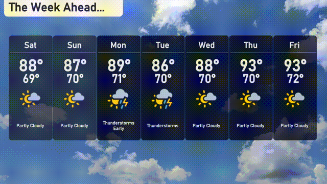
For the 7-day forecast in Atlanta:
Saturday: Partly cloudy with a high of 88 degrees and a low of 69 degrees.
Sunday: Partly cloudy, reaching up to 87 degrees and cooling to 70 degrees overnight.
Monday: Thunderstorms expected early, with a high of 89 degrees and a low of 70 degrees.
Tuesday: Thunderstorms continue, as temperatures reach 89 degrees for a high and an overnight low of 70 degrees.
Wednesday: Partly cloudy with a daytime high of 88 degrees and a low of 70 degrees.
Thursday: Warming up to 93 degrees with a nighttime low of 70 degrees, under partly cloudy skies.
Friday: Partly cloudy conditions persist with a high of 93 degrees and a low of 72 degrees.