The Balmy and the Bold: Weather Warnings & Updates Across Miami
By
Amy Freeze
Partly cloudy skylines and impending thunderstorms paint this week's weather canvas in Miami. Check out the full forecast and how to prepare for the turbulent conditions ahead.
This week in Miami: oscillating between storms and clear skies! Get the rundown on temperatures, storm dangers, and safety tips.
Welcome to your comprehensive guide on Miami’s weather this week! We’re seeing a mix of partly cloudy skies and active storm fronts moving through. With temperatures peaking at 87 degrees and storm warnings in effect, it’s crucial to stay informed. From UV protection tips to nightly forecast rundowns, ensure you’re ready to tackle whatever the weather throws your way.
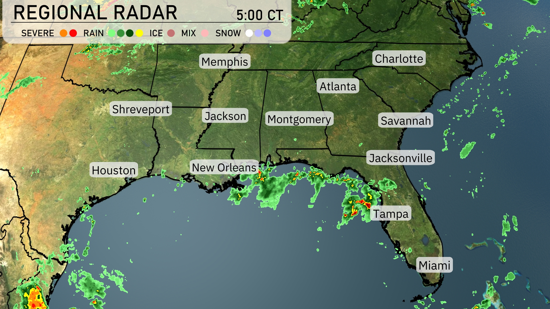
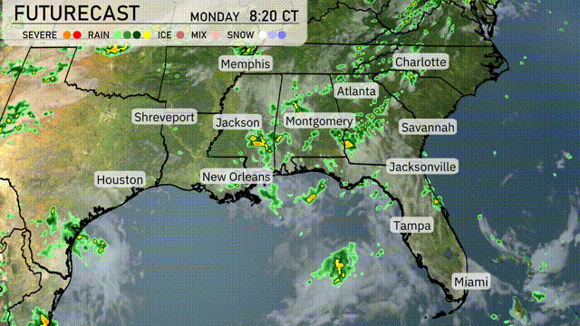
A broad area of showers and thunderstorms extends across the Gulf Coast, with significant storm activity just west of Tampa, moving eastward. Scattered rain showers are reaching New Orleans, spilling over toward the Mississippi Delta. In the interior Southeast, cities like Atlanta and Montgomery are seeing increasing cloud cover as the system advances. Skies over Memphis and Jackson remain mostly clear, holding onto dry conditions.
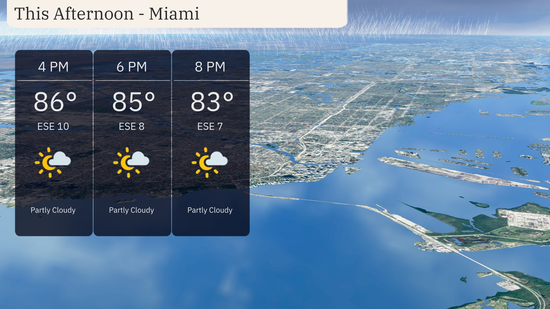
In Miami this afternoon, temperatures will hover around 86 degrees by 4 PM, cooling slightly to 83 degrees by 8 PM. Expect partly cloudy skies throughout, accompanied by a gentle east-southeast breeze at 10 miles per hour, decreasing slightly into the evening.
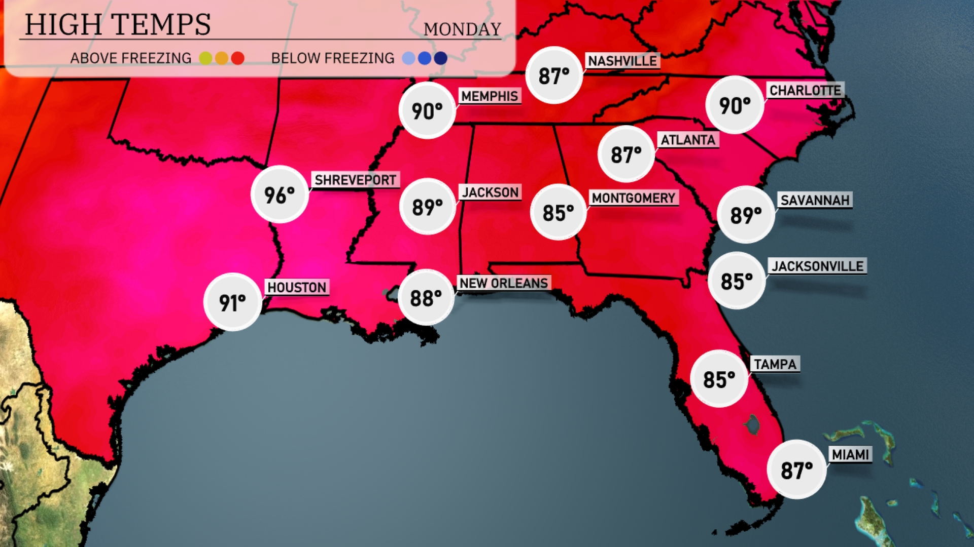
Today in the Southeast, we’re seeing some warm temperatures across the board. Houston is hitting a high of 91 degrees, while Shreveport is even warmer at 96. In the Mississippi area, Jackson will reach 89 degrees, and New Orleans isn’t far behind with a high of 88. Moving over to the Florida coast, both Tampa and Jacksonville are cooler at 85 degrees, and Miami will see a high of 87. Atlanta is also shaping up with a high of 90 degrees, making for a steamy afternoon overall.
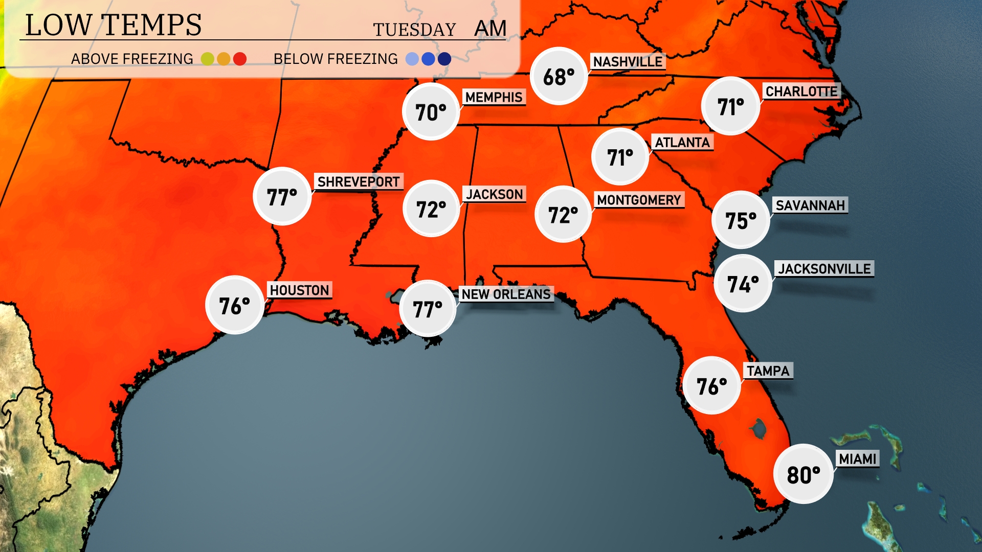
Tonight, Memphis will see a low of 68 degrees, while Nashville cools to 68 as well. Expect temperatures around 71 in Atlanta and Charlotte. Shreveport will sit at a warm 77 degrees, with both Montgomery and Jackson at 72. The coastal cities of Jacksonville and Tampa will experience lows of 74 and 76, respectively, while Miami remains the warmest at 80 degrees.
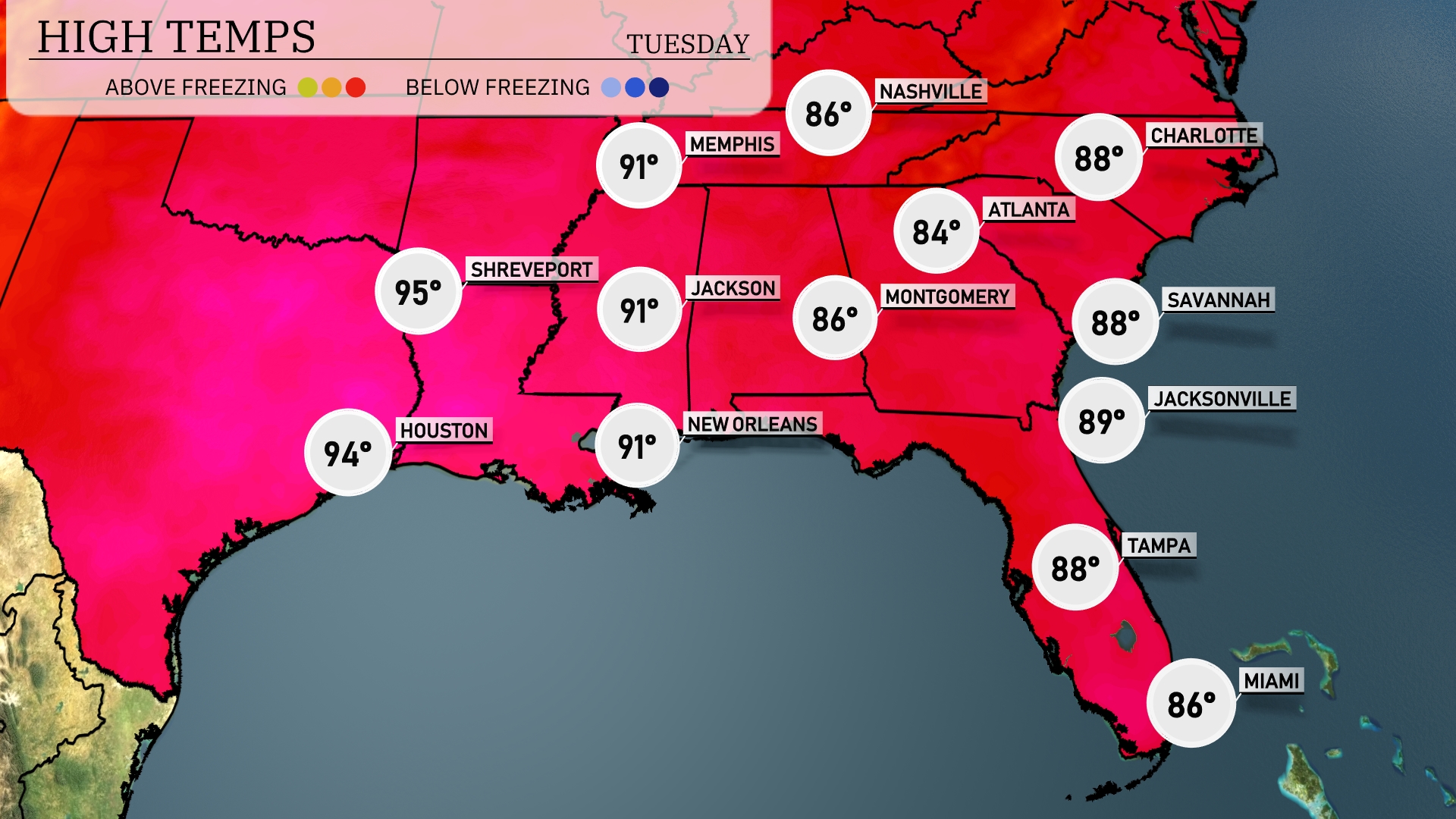
Tomorrow, Shreveport will reach a sizzling 95 degrees, with Houston not far behind at 94. Both Jackson and New Orleans are set to warm up to 91, reflecting higher-than-average temperatures across the region. Nashville will see a pleasant high of 86 degrees, while Atlanta expects a cooler 84. Temperatures will remain warm in Florida, with Jacksonville and Tampa both hitting 89 and 88 degrees, respectively.
A developing weather system brings scattered thunderstorms and showers across the Southeast on Tuesday, especially impacting the areas from New Orleans to Jacksonville. Expect heavy rainfall and possible localized flooding as these storms move through. A significant line of storms is projected to move into Atlanta during the morning commute, with strong winds and lightning expected. Cooler temperatures and clearing skies will follow the passage of this frontal system, leading into a calmer Wednesday across the region.
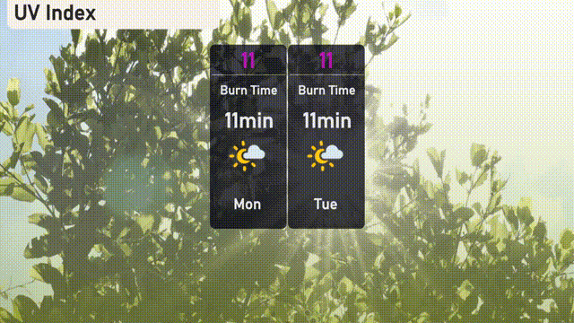
The UV index in Miami today and Tuesday is extremely high at 11, with a burn time of just 11 minutes in direct sunlight. Take extra precautions, including using sunscreen, wearing wide-brimmed hats, and seeking shade, especially between 10 a.m. and 4 p.m.