Weather Whirlwind: Austin’s Weekly Forecast and Storm Predictions
By
Amy Freeze
Explore a week of weather in Austin—from scorching highs to chilling thunderstorms. Stay ahead with our comprehensive guide.
This week, Austin sees a whirl of weather patterns, from thunderstorms to sunlit days. Discover what the Southern Plains forecast has in store for you!
In this week’s weather overview for Austin and the Southern Plains, we dive into a comprehensive day-by-day forecast that covers everything from rising temperatures to impending storm systems. With fluctuating conditions expected, our detailed guide provides strategic insights to help locals and visitors alike plan their week around the weather, ensuring safety and convenience despite nature’s unpredictability.
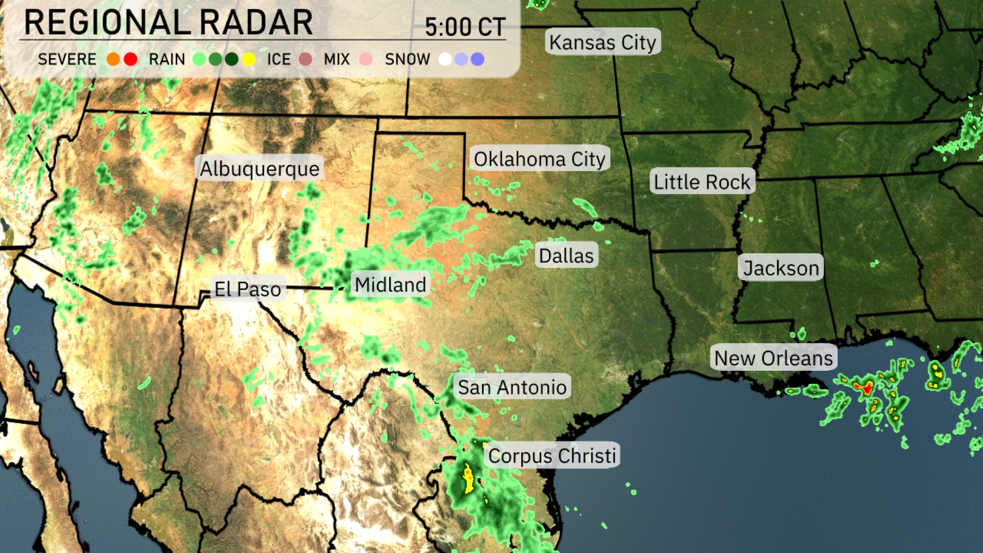
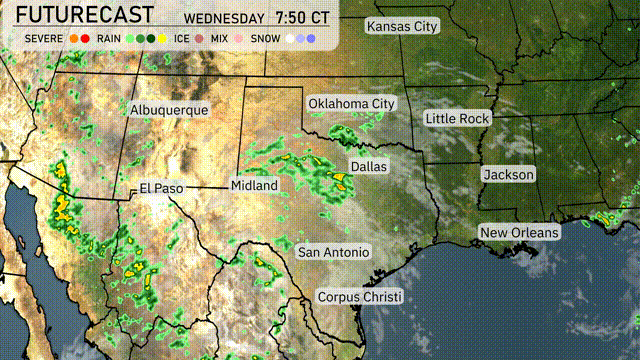
A line of showers is extending from Albuquerque northeast through northern Texas, impacting areas like Oklahoma City and providing cloudy skies. Dallas is experiencing lighter rain showers, which are part of a broader system stretching towards Midland. Farther south, heavier rain coupled with thunderstorms is affecting Corpus Christi, moving northeast towards San Antonio, so be prepared for potential heavy downpours. In the southeast, the Gulf Coast, particularly near New Orleans, is currently dry and clear, with some isolated showers in the western Gulf visible moving inland.
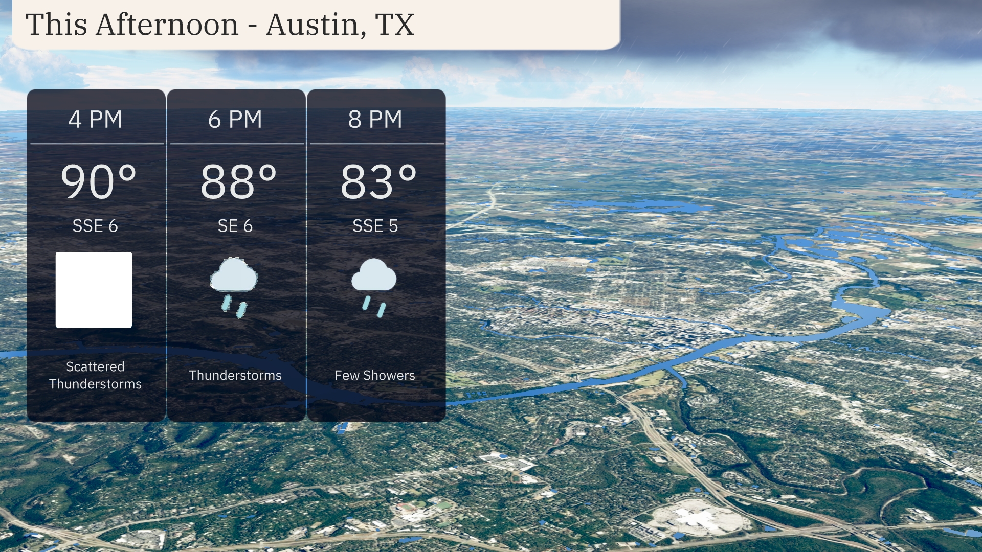
Austin weather this afternoon will see temperatures starting at 90 degrees with winds from the south-southeast at 6 mph. Expect scattered thunderstorms to develop, providing some relief. By 6 PM, temperatures will dip slightly to 88 degrees as thunderstorms continue. The evening will bring temperatures down to 83 degrees with a few lingering showers under continued SSE winds at 6 mph.
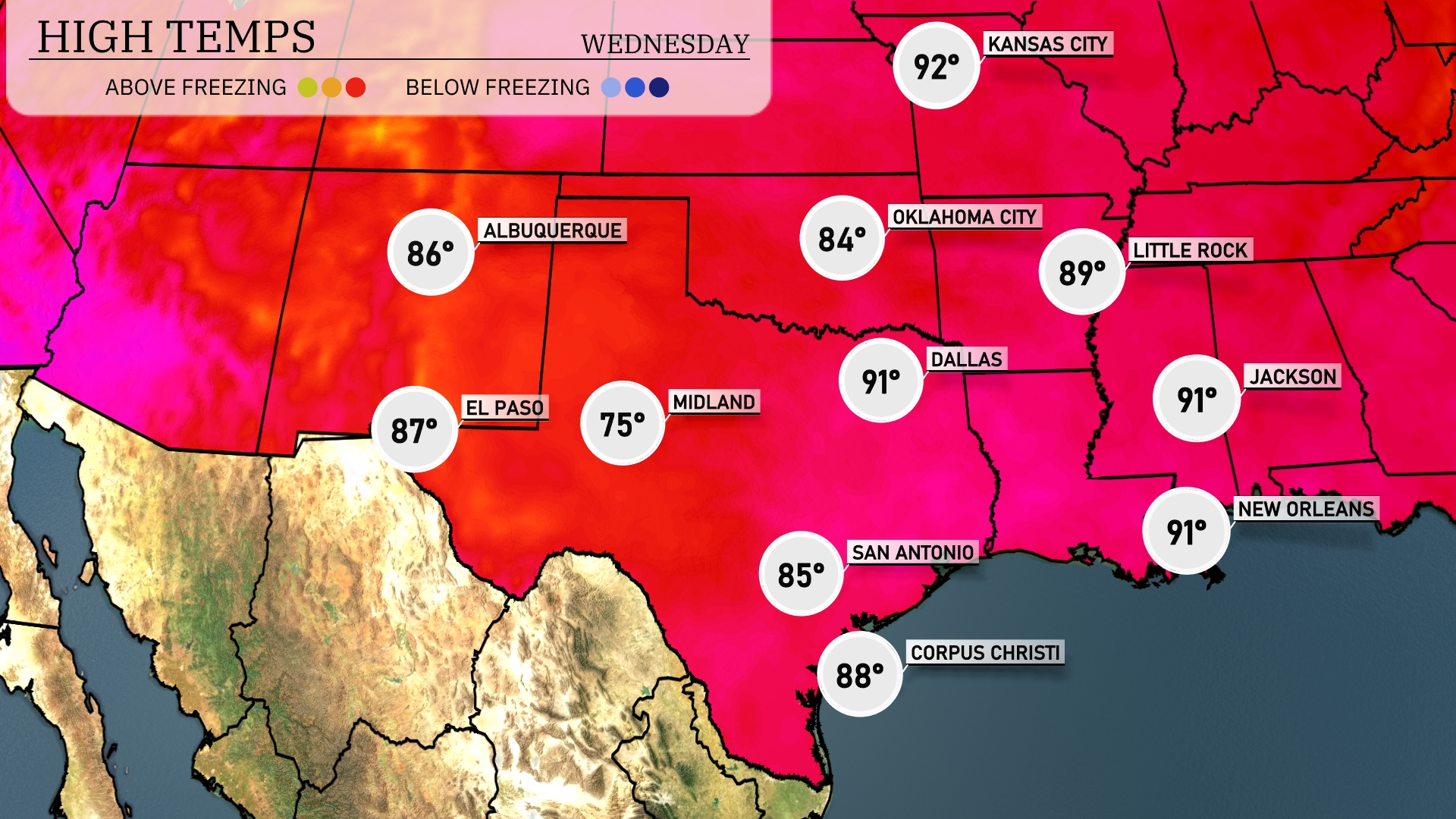
In the Southern Plains today, temperatures are heating up. Dallas expects a high of 91 degrees, while slightly cooler conditions are found in Midland at 75 degrees. San Antonio will see a high of 85 degrees, with Corpus Christi not far behind at 88. El Paso is enjoying a warm 87 degrees, and Jackson is at a balmy 91 degrees.
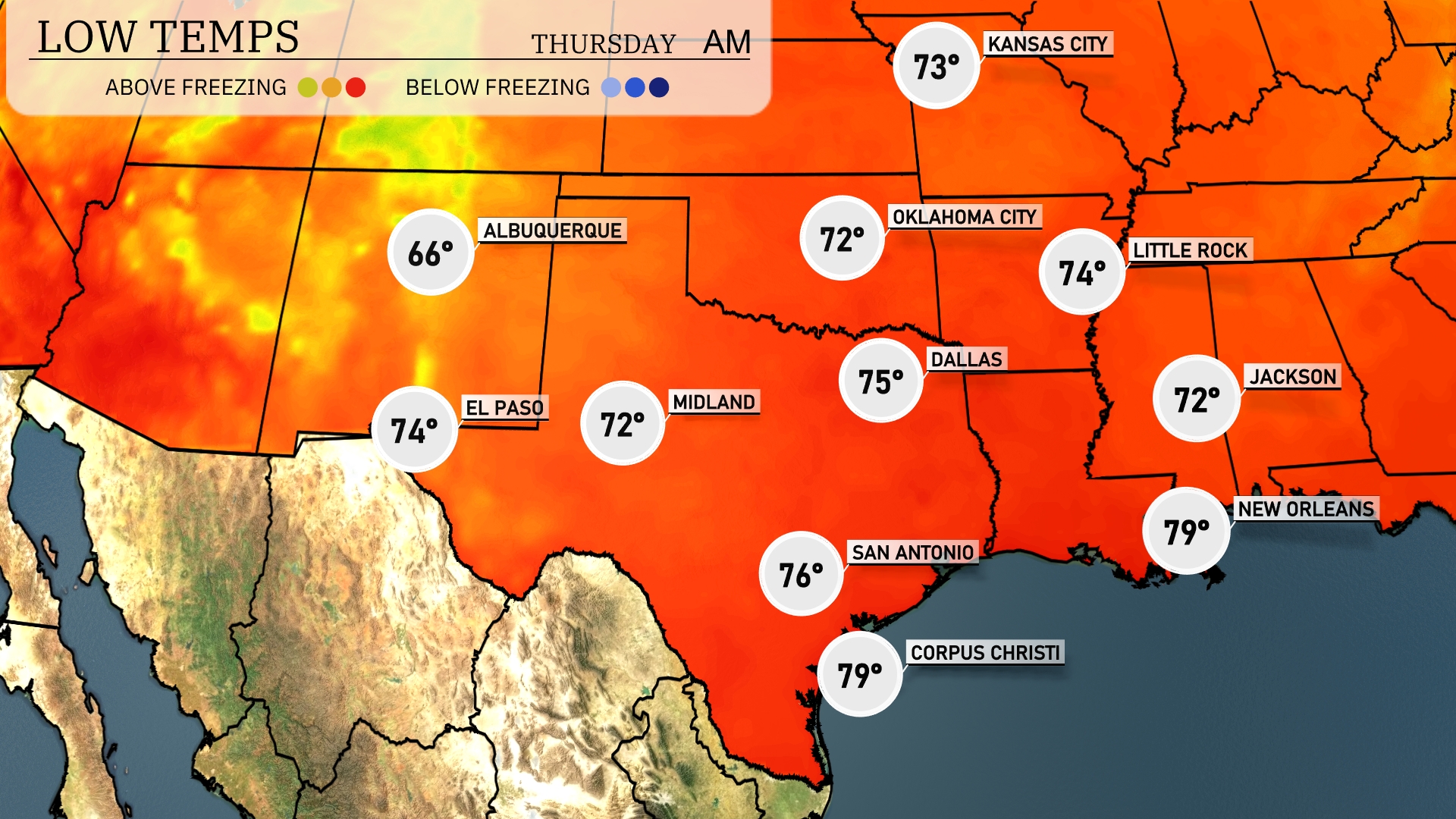
Tonight, Dallas is expected to cool down to 75 degrees. In Oklahoma City, look for a low of 72 degrees. Midland will drop to 72, while San Antonio remains slightly warmer at 76 degrees. Expect a mild night for New Orleans with a low of 79 degrees.
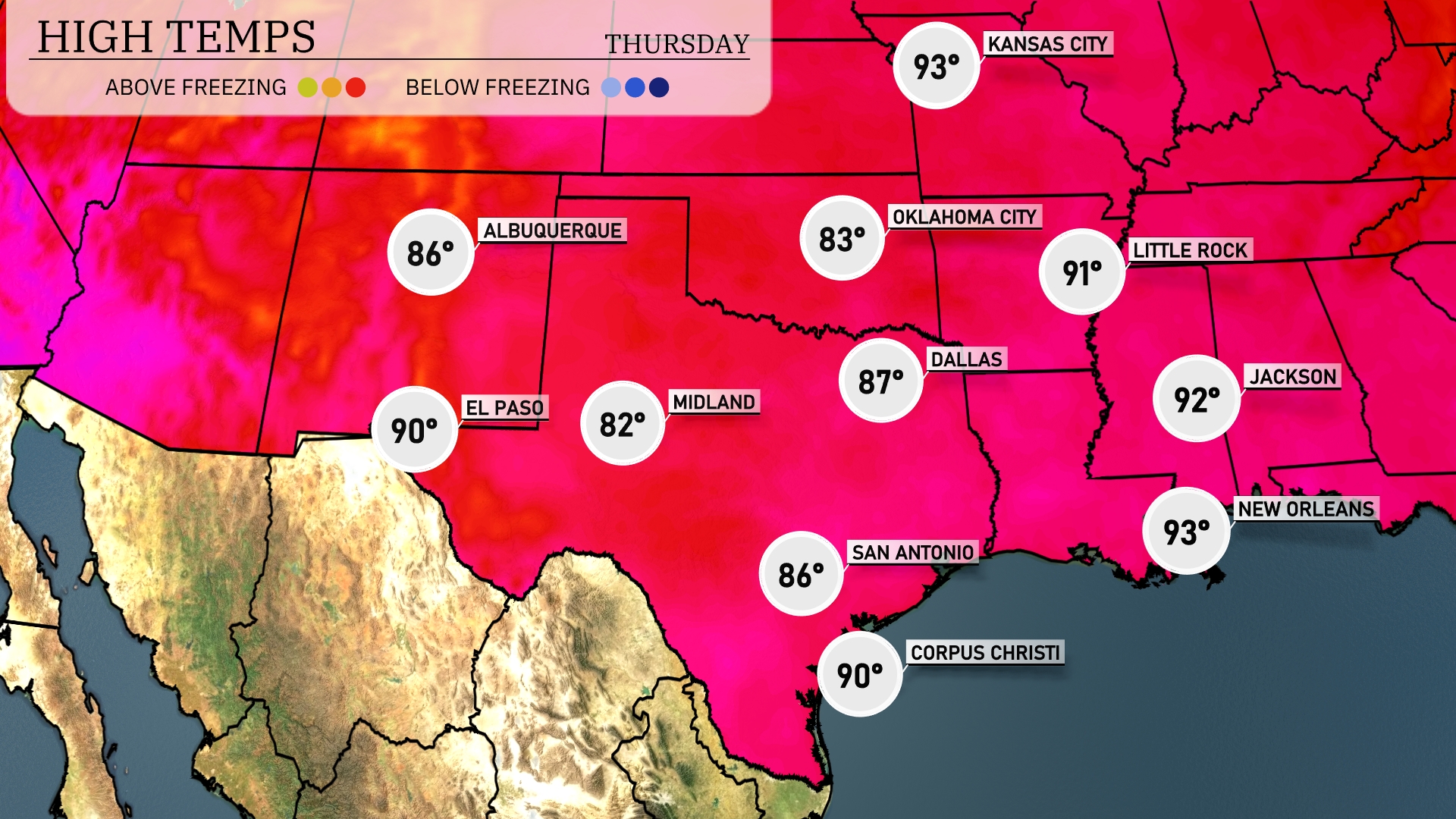
Tomorrow in the Southern Plains, we’ll see some warm temperatures with notable peaks. El Paso will reach a high of 90 degrees, while Midland enjoys a comfortable 82. San Antonio will warm up to 86, and Corpus Christi should also hit 90. Dallas is expected to be slightly cooler at 87, whereas Little Rock sees a high of 91.
A dynamic weather shift is expected for the Southern Plains tomorrow. Rain showers begin early from Dallas to Corpus Christi, delivering much-needed moisture. Oklahoma City braces for stronger storm systems due to an unstable air mass, with potential for severe weather warnings. The cold front pushes into the southeast by Wednesday night, heightening alertness for severe weather threats. This active weather pattern could impact travel and outdoor plans, so stay weather aware.
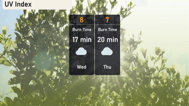
Today, Austin experiences a very high UV index of 8, with a burn time of just 17 minutes—so sunscreen is a must! Thursday’s index remains high at 7, with a slight increase in burn time to 20 minutes.