Miami’s Mixed Bag: A Week of Sun, Showers, and Surprises
By
Amy Freeze
Explore the dynamic weather patterns over Miami this week from sultry afternoons to refreshing evening showers. Learn how to navigate Miami's ever-changing weather with style and ease.
Catch up on Miami’s weekly weather forecast: mixed skies with chances of showers and refreshing breezes. Stay ahead with our daily weather tips and insights.
In-depth look at Miami’s weather for the upcoming week. We dissect the fluctuations – from steamy mid-80 temperatures to cooler breezy evenings and unexpected showers. Understand the nuances of city’s climate and how it impacts your daily activities.
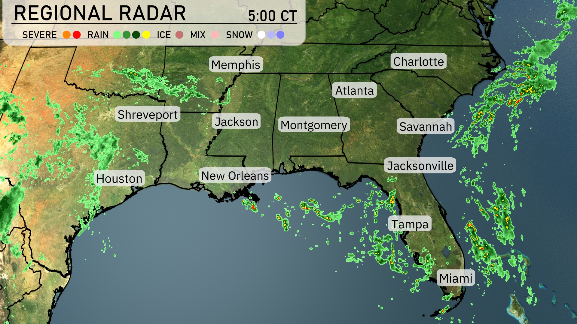
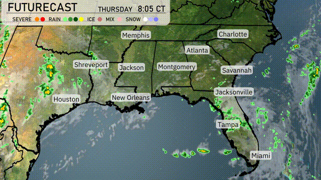
The Southeast is seeing a mix of weather conditions today. Rain is spreading over eastern Louisiana, with showers reaching into the Shreveport area. As we move eastward, scattered rain can be spotted approaching the Florida coast near cities like Jacksonville and Miami. The Atlanta area remains calm with clear skies ahead of any incoming weather systems.
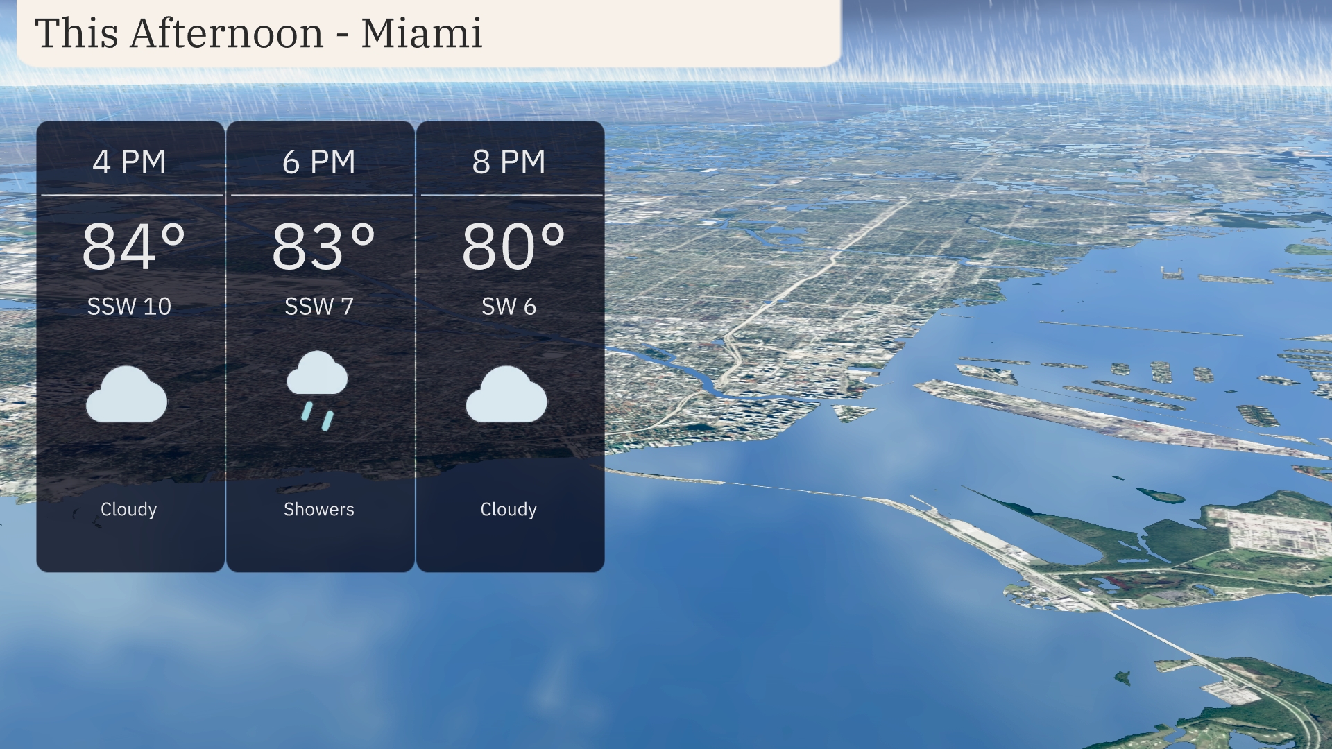
Expect a warm, humid afternoon in Miami with temperatures steady in the mid-80s, peaking around 84 degrees by 4 PM. Winds will be gentle from the south-southwest at speeds around 10 miles per hour. Showers are anticipated around 6 PM, offering some relief before the evening brings a drop to 80 degrees by 8 PM. Cloudy skies will dominate the afternoon, so keep the umbrella handy!
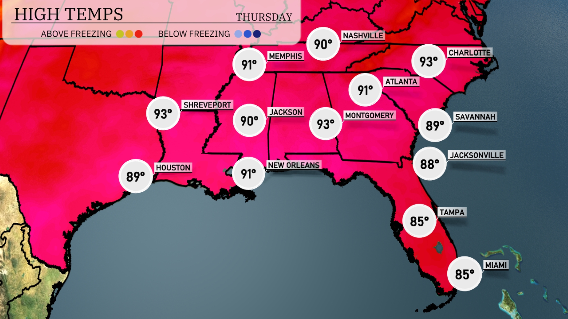
This afternoon, high temperatures in the Southeast are soaring. New Orleans is hitting a warm 91 degrees, while Jackson follows closely with 90. As we move east, Atlanta will see a high of 91, and Montgomery is warming up to 93 degrees. In contrast, coastal cities like Jacksonville and Savannah are a bit cooler, reaching 88 and 89 degrees, respectively. Tampa and Miami are staying comfortable at 85 degrees.
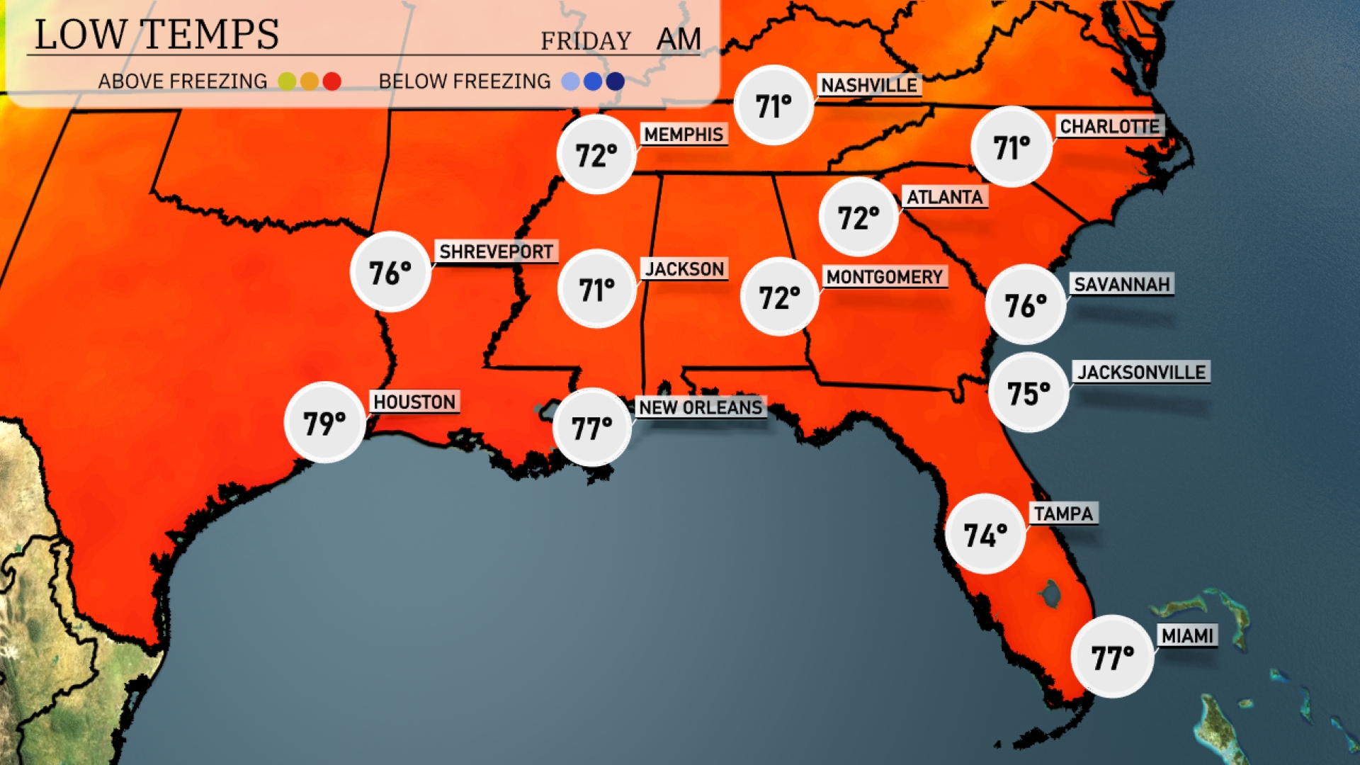
Tonight, temperatures will cool down to 71 degrees in Nashville and Memphis. Jackson is expected to dip to 71, with Montgomery closely following at 72. Atlanta will see a low of 72, while the coastal cities remain warmer, with Savannah at 76 and Jacksonville at 75. Expect milder conditions overnight, but some areas will experience notable cooling compared to previous nights.
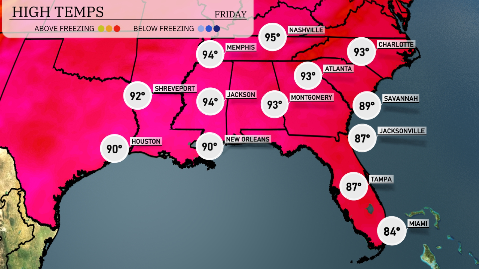
Tomorrow in Memphis, expect a high of 95 degrees, while Nashville will see similar warmth at 93. Jackson will reach 94 degrees, just a degree shy of New Orleans’ anticipated high of 90. Over in Atlanta, temperatures will climb to 93, contributing to the above-average heat impacting the region. Coastal cities like Jacksonville will be slightly cooler with a high of 87 degrees, while Miami stays mild at 84.
The Southeast is in for an increasingly active weather scenario as a frontal system advances. Expect storms from Shreveport to New Orleans, with some storms potentially severe, delivering heavy rains. By tomorrow morning, this system will stretch stormy conditions from Jackson through to Atlanta, possibly affecting the morning commute. Temperatures will remain warm ahead of the front, but cooler, drier air should filter in by Friday. Be alert for heavy rainfall, which could lead to localized flooding in vulnerable areas.
The UV index in Miami on Thursday is moderate at level 5, allowing a burn time of around 27 minutes in direct sunlight. By Friday, the UV index increases to 8, meaning sun exposure can lead to burns in approximately 17 minutes.