Dive into our detailed analysis of Chicago's weather trends from sizzling highs to upcoming thunderstorms. Stay prepared with our daily weather insights!
Stay updated with the latest weather in Chicago! From thunderstorms to clear skies, we outline what to expect over the next seven days in our full article.
Welcome to your detailed weather forecast across Chicago and the Midwest. This week, we’re seeing a range of conditions from thunderstorms to clear skies. Discover how this will affect your week with our complete day-by-day breakdown, safety tips for stormy weather, and how to make the most of sunny days. Learn more in our extensive guide to Chicago’s dynamic weather week.
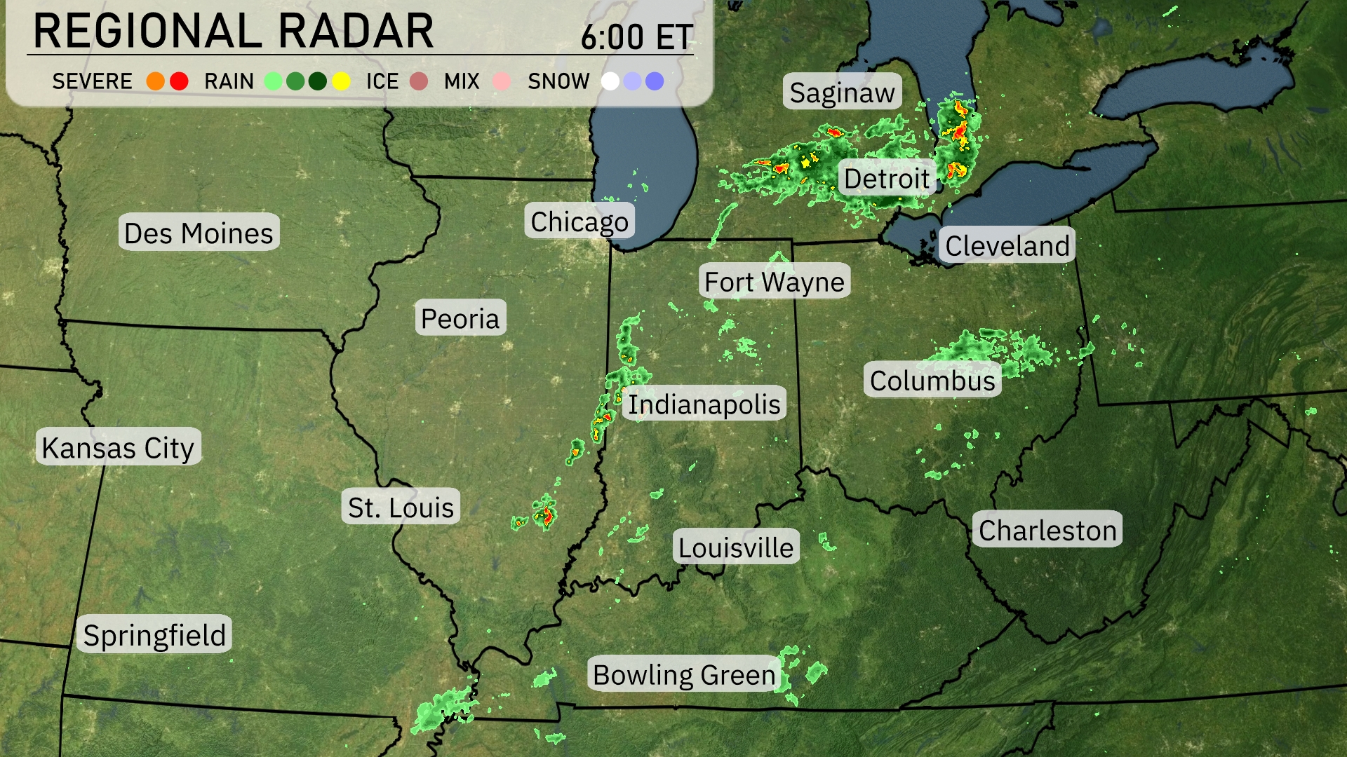
A line of storms is stretching across parts of the Midwest, with significant activity from Indianapolis heading up towards Detroit. Saginaw is experiencing scattered thunderstorms peppered with heavy rain. Chicago appears clear for now, but keep an eye on approaching showers. Areas like Bowling Green and Fort Wayne should also anticipate rain, as precipitation is noted moving through these locations.
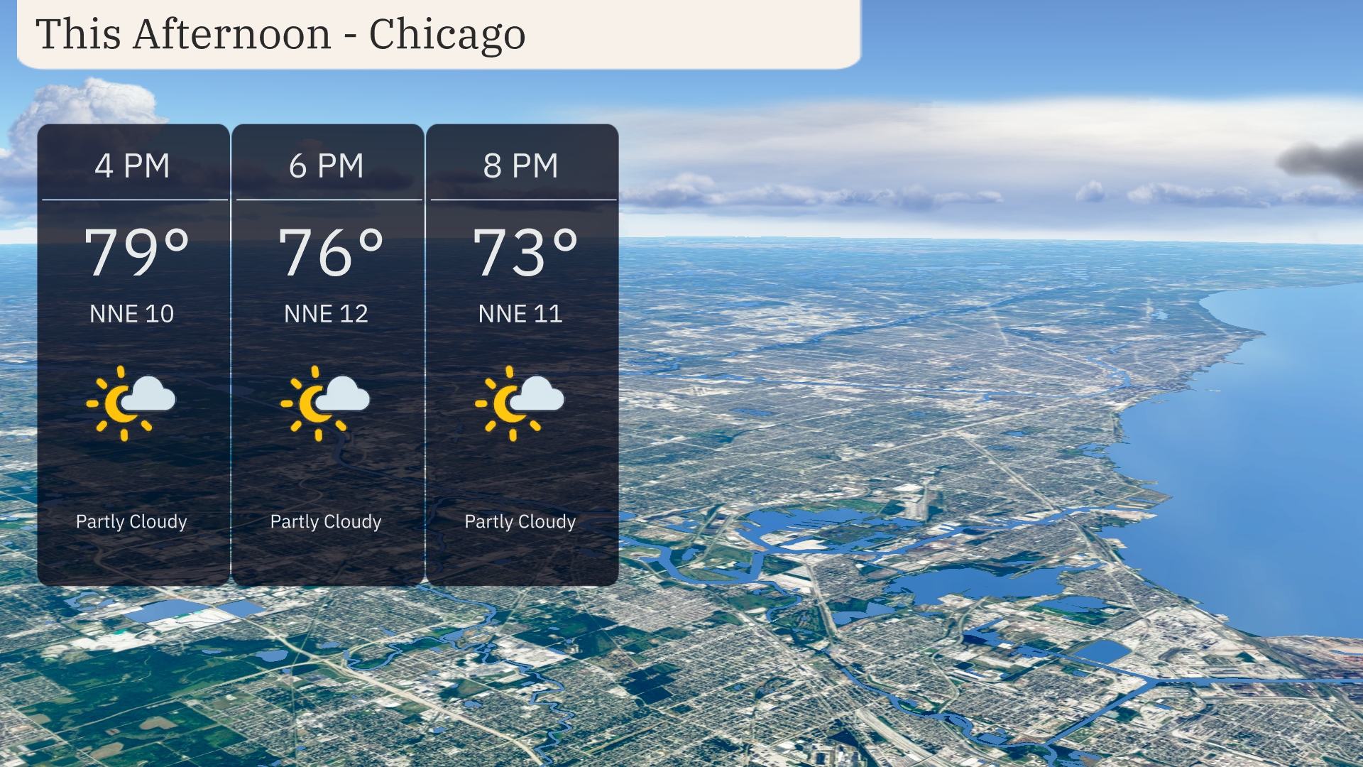
The afternoon in Chicago will see temperatures gradually dropping from 79 degrees at 4 PM to 76 degrees by 6 PM, continuing to 73 degrees at 8 PM. Partly cloudy skies will dominate the scene throughout the afternoon. Winds from the north-northeast will be light, ranging from 10 to 12 miles per hour.
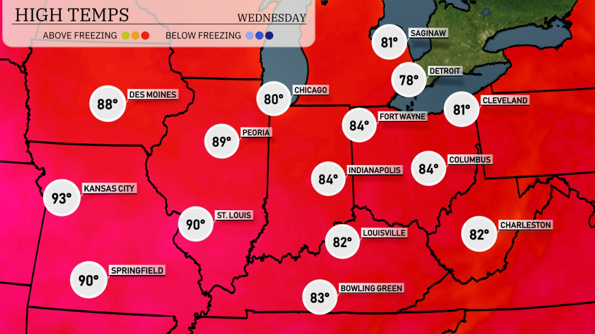
In the Midwest today, high temperatures are soaring. Kansas City is heating up to a sizzling 93 degrees, while St. Louis isn’t far behind at a warm 90. Further north, Chicago will reach around 80 degrees, offering some relief. Indianapolis also sees a pleasant high of 84 degrees, contrasting with cooler temps in Fort Wayne at 78. Peoria will be hot at 89, providing a warm backdrop to this regional heat wave.
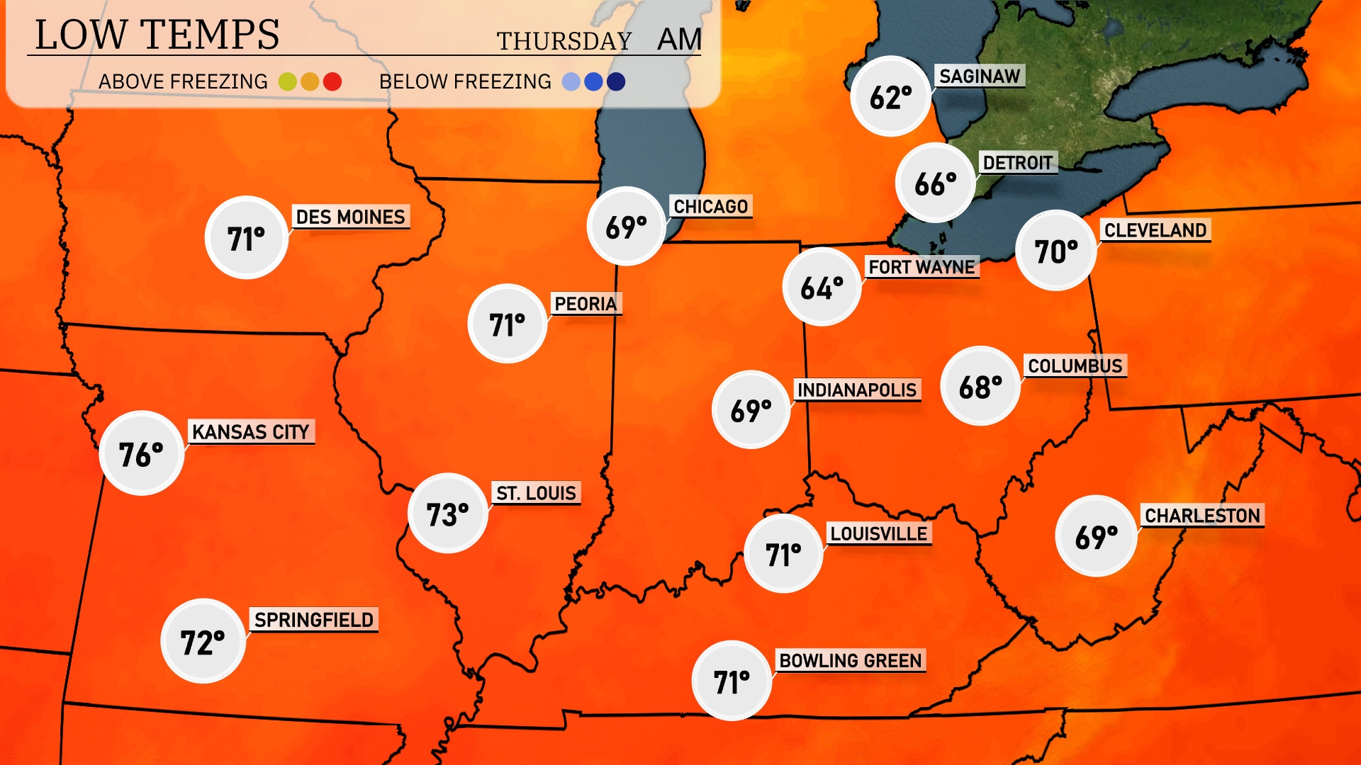
Tonight, Chicago is expected to cool down to 69 degrees, while Milwaukee will see a low of 62. Indianapolis will drop to 69, with Fort Wayne hitting 64. Cleveland can anticipate a temperature of 70 degrees, providing a relatively mild evening for the region.
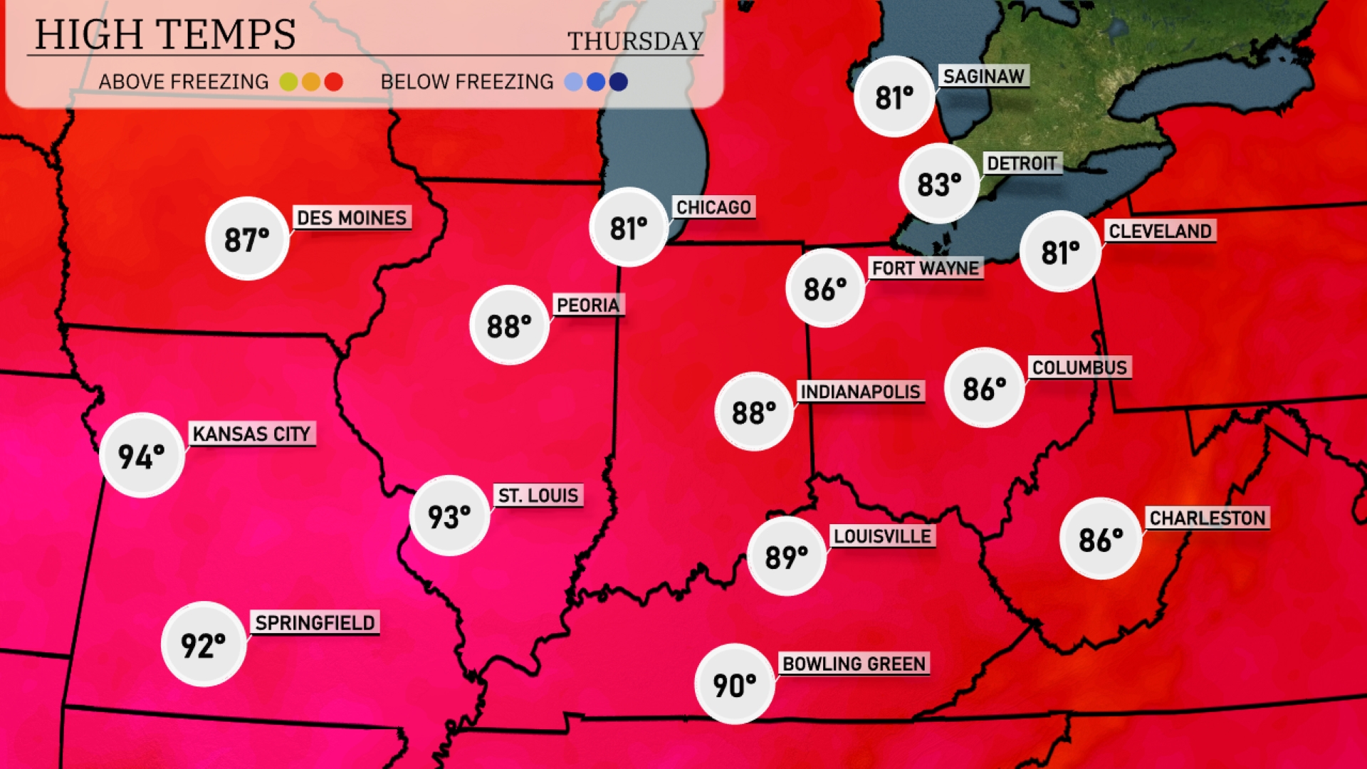
Tomorrow in the Midwest, expect sizzling highs as Kansas City reaches a scorching 94 degrees. St. Louis is also hot at 93 degrees, while Peoria can anticipate a high of 88. Indianapolis will see temperatures hitting 88 as well, and Louisville warms up to 89. This warm trend is influenced by a high-pressure system settling in, contributing to above-average readings across the region.
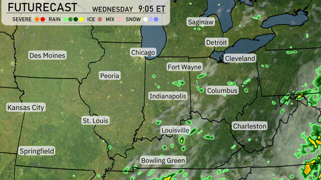
A slow-moving system will usher in scattered showers and storms from St. Louis to Indianapolis and into Columbus early Wednesday. Northern areas like Detroit and Cleveland will see isolated storm activity with potential heavy rain in localized areas. Temperatures across the Midwest are expected to remain seasonably warm, ranging from the mid-70s to low 80s. Although severe weather is not anticipated, be aware of lightning and gusty winds around any stronger thunderstorms. By Wednesday night, expect conditions to clear, leading to drier weather as the front moves eastward.
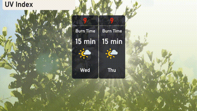
The UV index in Chicago on Wednesday is very high at 9, with a burn time of just 15 minutes in direct sunlight.