Navigating Austin’s Weather: From Clear Skies to Storm Alerts
By
Amy Freeze
Your comprehensive guide to this week's weather in Austin and the Southern Plains. Stay updated with daily forecasts, weather trends, and safety tips.
Explore the shifting weather patterns over Austin and the Southern Plains. From sunny mornings to stormy evenings, learn what the week has in store for us!
As Austin wakes to partly cloudy skies, a busy weather day lies ahead. Expect a warm 85°F by noon and keep an eye on emerging storms. This detailed guide offers a glimpse into daily fluctuations and prepares you for the intense UV levels hitting 11! We’ll cover areas from Corpus Christi rain to El Paso’s scorching 103°F heat. Concluding with safety tips for navigating the extreme sun and incoming cooler wave, this post is your go-to for all Southern Plains weather updates!
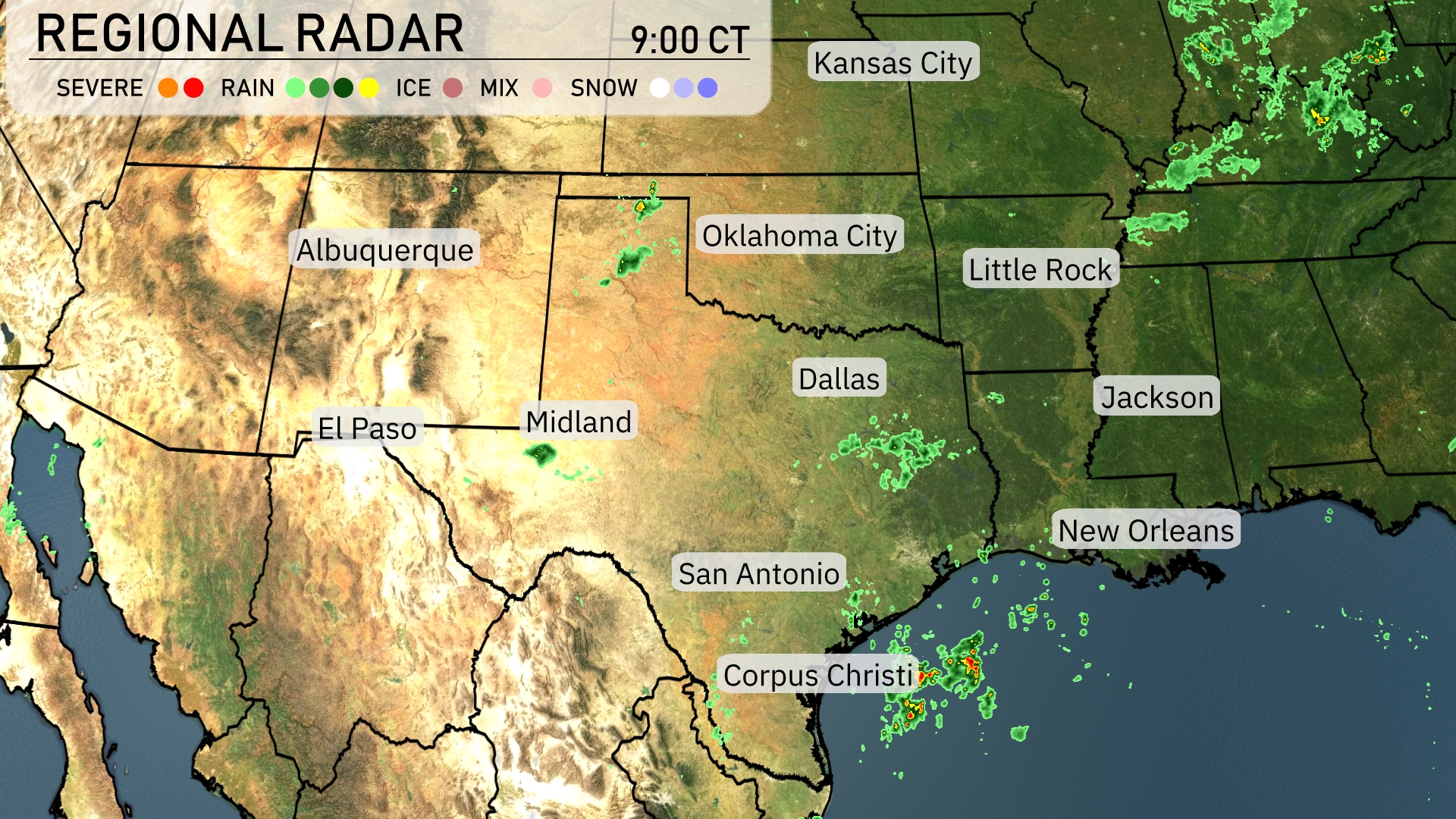
A cluster of storms is developing near Corpus Christi, with heavy rain pushing southeast towards the Gulf of Mexico. Dallas and areas southwest of San Antonio are currently experiencing some scattered showers, although they are light and patchy. Clear conditions dominate Albuquerque and El Paso, providing a dry start to the day. Oklahoma City remains free of precipitation, with only some cloud cover anticipated as the day progresses.
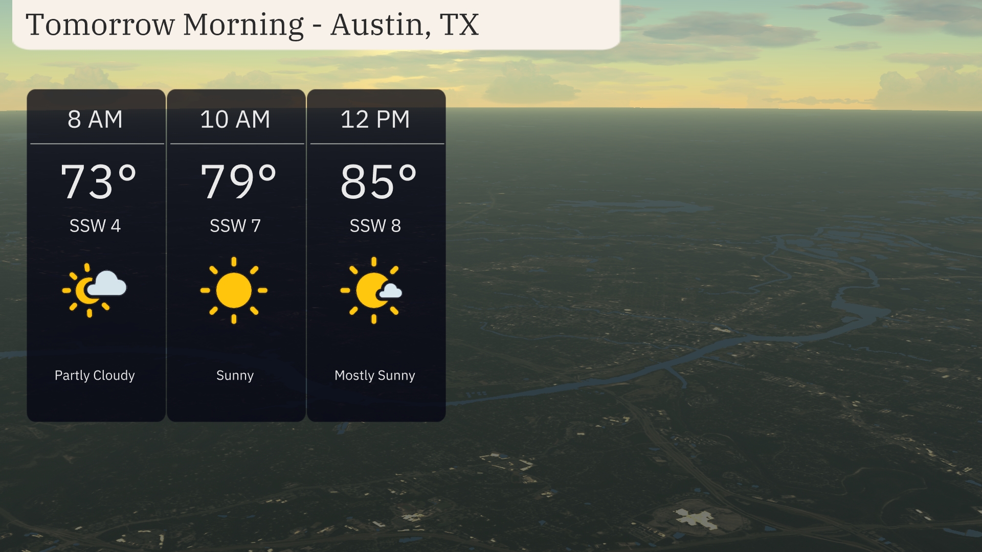
Tomorrow morning in Austin, expect a partly cloudy start with temperatures at 73 degrees by 8 AM. As the morning progresses, the sun will shine through, and temperatures will rise to 79 degrees by 10 AM and 85 degrees by noon. Winds will remain steady from the south-southwest, ranging from 4 to 8 miles per hour, offering a gentle breeze throughout the morning.
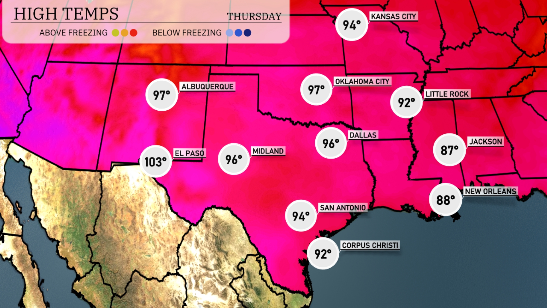
Tomorrow in El Paso, expect a sizzling high of 103 degrees, well above average for this time of year. Midland will reach a warm 96 degrees, while San Antonio is forecasted to hit a pleasant 94 degrees. Dallas will experience highs around 96 degrees, alongside Oklahoma City, which also sees similar temperatures. Central and southern areas will bask in the warmth, with Little Rock expecting a high of 92 degrees, while New Orleans will see temperatures climb to 88 degrees.
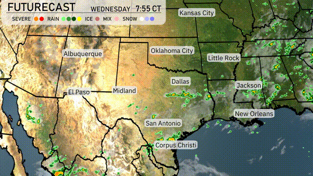
A cold front will sweep through the Southern Plains tomorrow, creating active weather conditions. Starting in the morning, expect rain stretching from Dallas to Corpus Christi, which will help alleviate dry conditions. Watch for stronger storms around Oklahoma City, as the unstable air mass combines with the approaching front. Prepare for potential severe weather alerts, especially in eastern Texas and southern Oklahoma, through Wednesday evening. By Thursday, cooler and more stable conditions should follow the front.
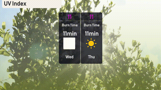
The UV index in Austin will soar to an extreme level of 11 on both Wednesday and Thursday. In such intense sun, burn time can occur in as little as 11 minutes. It’s essential to take precautions—apply a high-SPF sunscreen frequently and seek shade when possible!
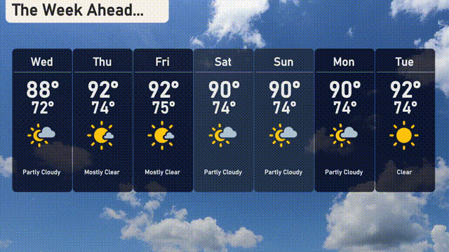
For the 7-day forecast in Austin:
Wednesday: Partly cloudy skies with a warm high of 88 degrees and a low of 72 degrees.
Thursday: Mostly clear and heating up to 92 degrees during the day with a mild night at 74 degrees.
Friday: Again, mostly clear with a similar high of 92 degrees and a pleasant low of 74 degrees.
Saturday: Expect partly cloudy conditions, reaching 90 degrees for the high and 74 degrees for the low.
Sunday: Continued partly cloudy skies, with temperatures peaking at 90 degrees and a low of 74 degrees.
Monday: Partly cloudy is the trend, with a repeat of Sunday’s high of 90 degrees and a low of 74 degrees.
Tuesday: The clear skies return, as the temperature climbs to 92 degrees with a low of 74 degrees.
Stay cool and enjoy the week ahead!