Atlanta’s Weekly Weather Rollercoaster: From Thunderstorms to Clear Skies
By
Amy Freeze
Get a grip on Atlanta's fluctuating weather patterns with our comprehensive weekly forecast. From thunderstorms to scorching sunny days, stay prepared!
This week in Atlanta brings a mix of thunderstorms and sunshine. Stay tuned as we guide you through the daily shifts in weather from storms to clear skies!
Welcome to your definitive source for Atlanta’s weather updates! This week features a dynamic mix of weather conditions, from stormy afternoons to bright, sunny mornings. With thunderstorms expected along with high temperatures soaring above the seasonal average, our guide will help you plan your week effectively. Dive into our day-by-day breakdown with tips on how to stay safe and enjoy the weather, regardless of the forecast.
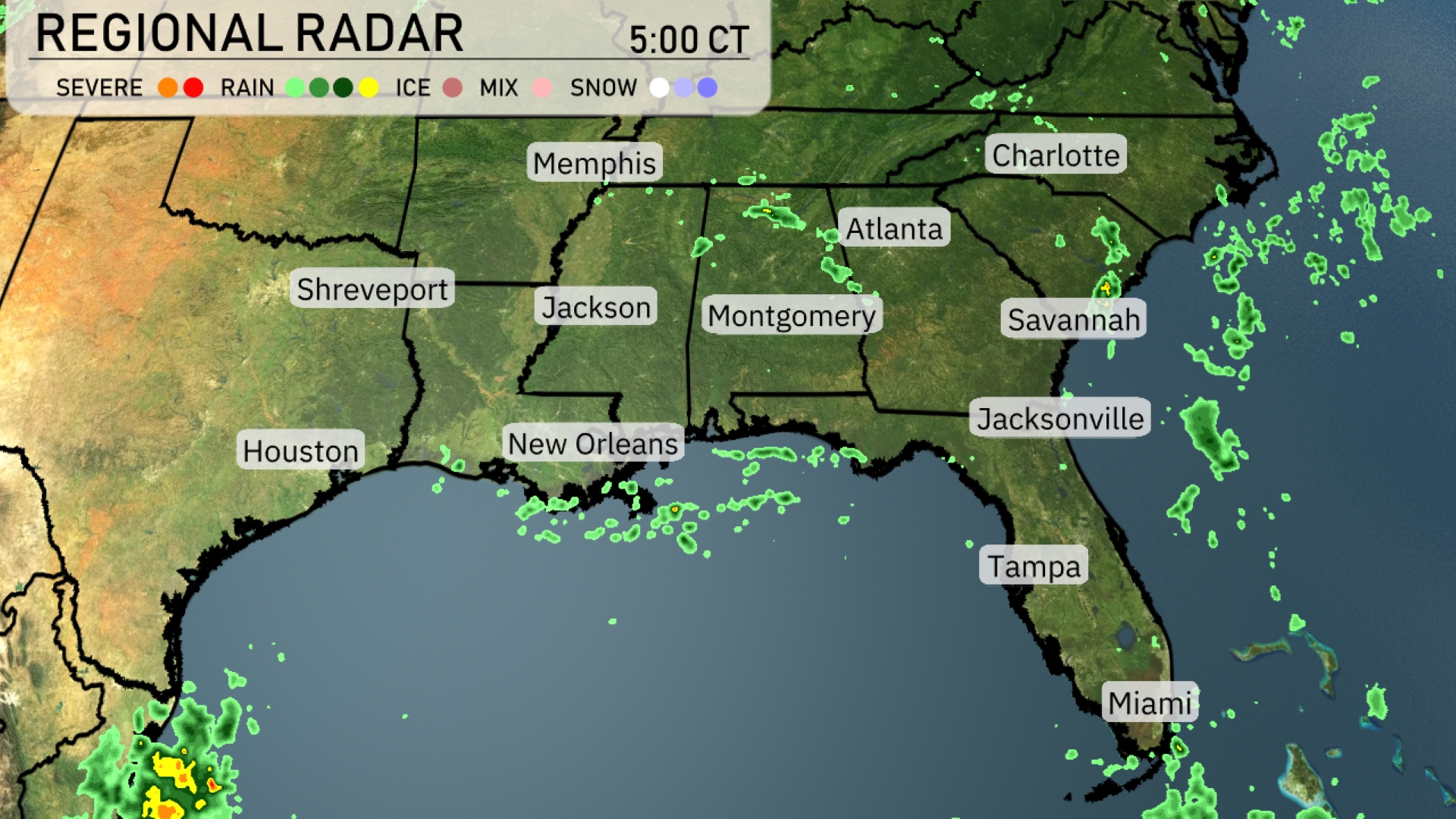
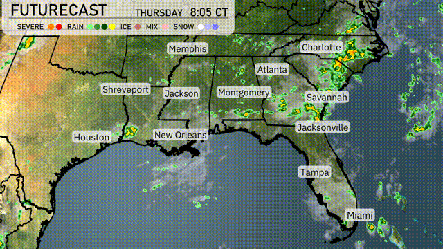
On the Regional Radar, the Southeast is experiencing areas of scattered rain showers. New Orleans is observing some precipitation, and the showers are slowly moving northeast across southern Mississippi and Alabama. Rain bands are also approaching the Gulf Coast, with clear skies dominating further inland. As rain continues to develop, keep an eye on coastal areas around the Florida Panhandle for possible wet conditions.
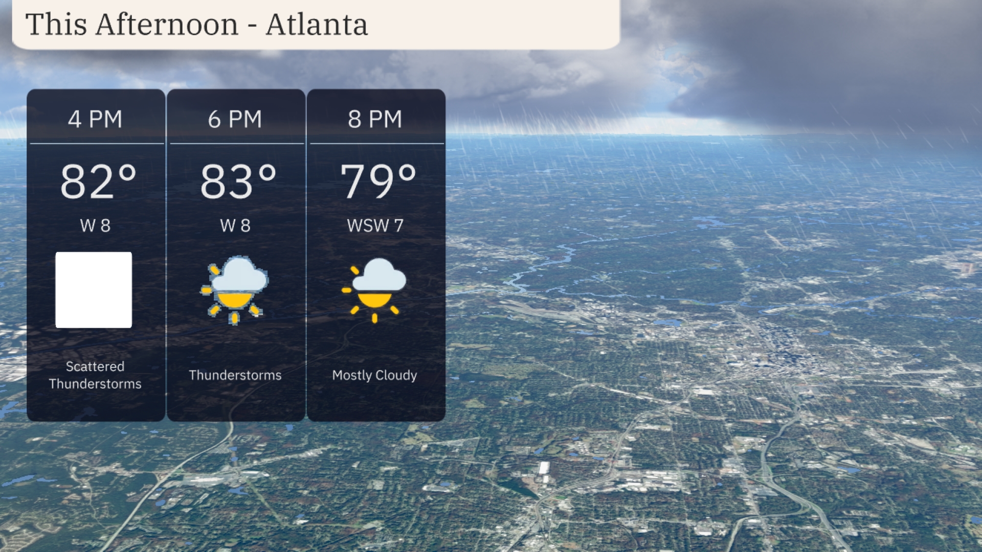
This afternoon in Atlanta, temperatures climb to 83 degrees with thunderstorm activity expected to develop. Winds from the west at 8 miles per hour will accompany the storms. By 8 PM, conditions become mostly cloudy as temperatures begin to drop to 79 degrees. Keep an eye on the sky and be prepared for rain showers moving through.
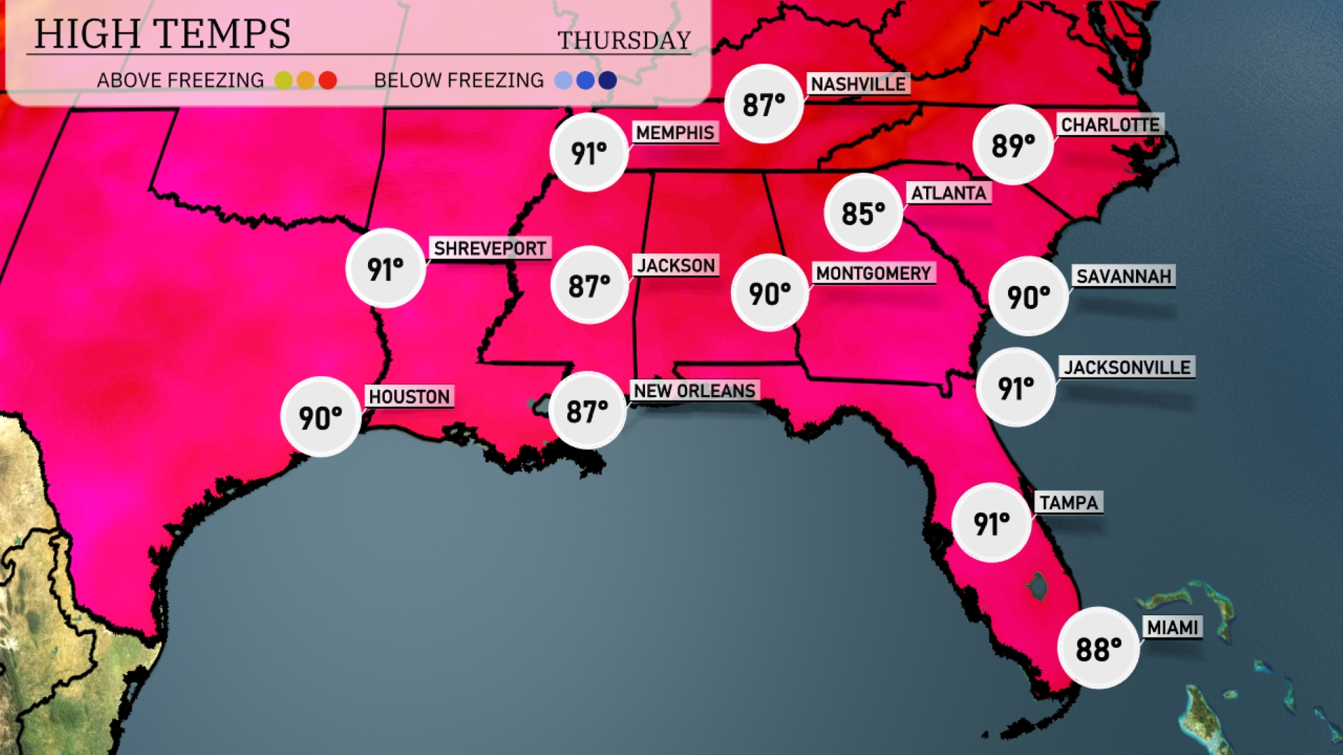
This afternoon’s high temperatures reveal a warm day across the Southeast. In Jackson, we’re looking at a high of 87 degrees, while New Orleans will reach 87 as well. Over in Montgomery, temperatures will peak at 90 degrees. Cities like Jacksonville and Tampa are even warmer, both expecting a high of 91 degrees. Atlanta lags slightly behind with a high of 85 degrees, highlighting some temperature contrasts within the region.
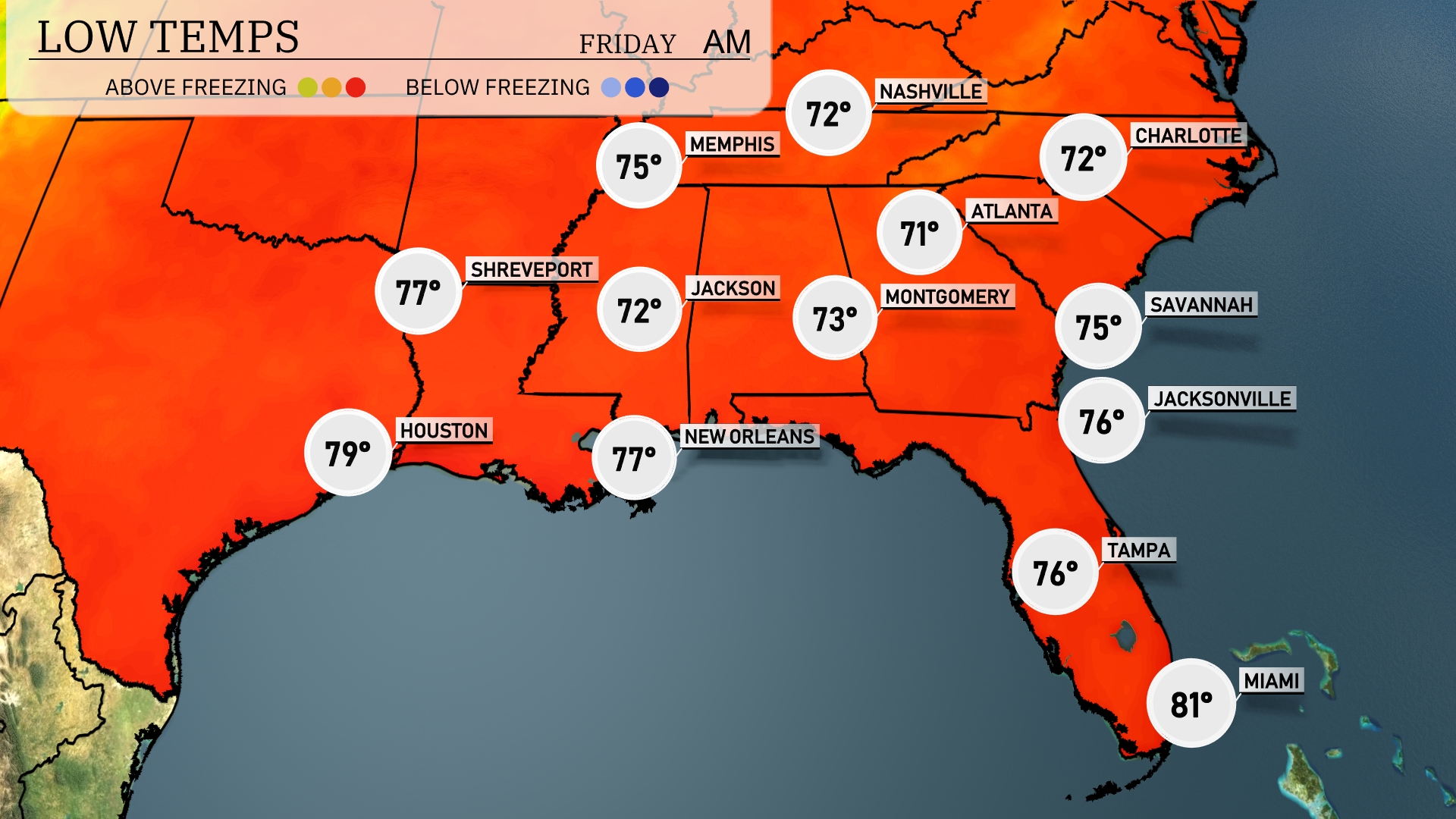
Tonight in Memphis, expect a low of 72 degrees. Nashville will see cooler temperatures at 71 degrees. In Atlanta, the low is forecasted to drop to 71 degrees as well. Further south, New Orleans will remain mild with a low of 77, while Miami will stay warm at 81 degrees.
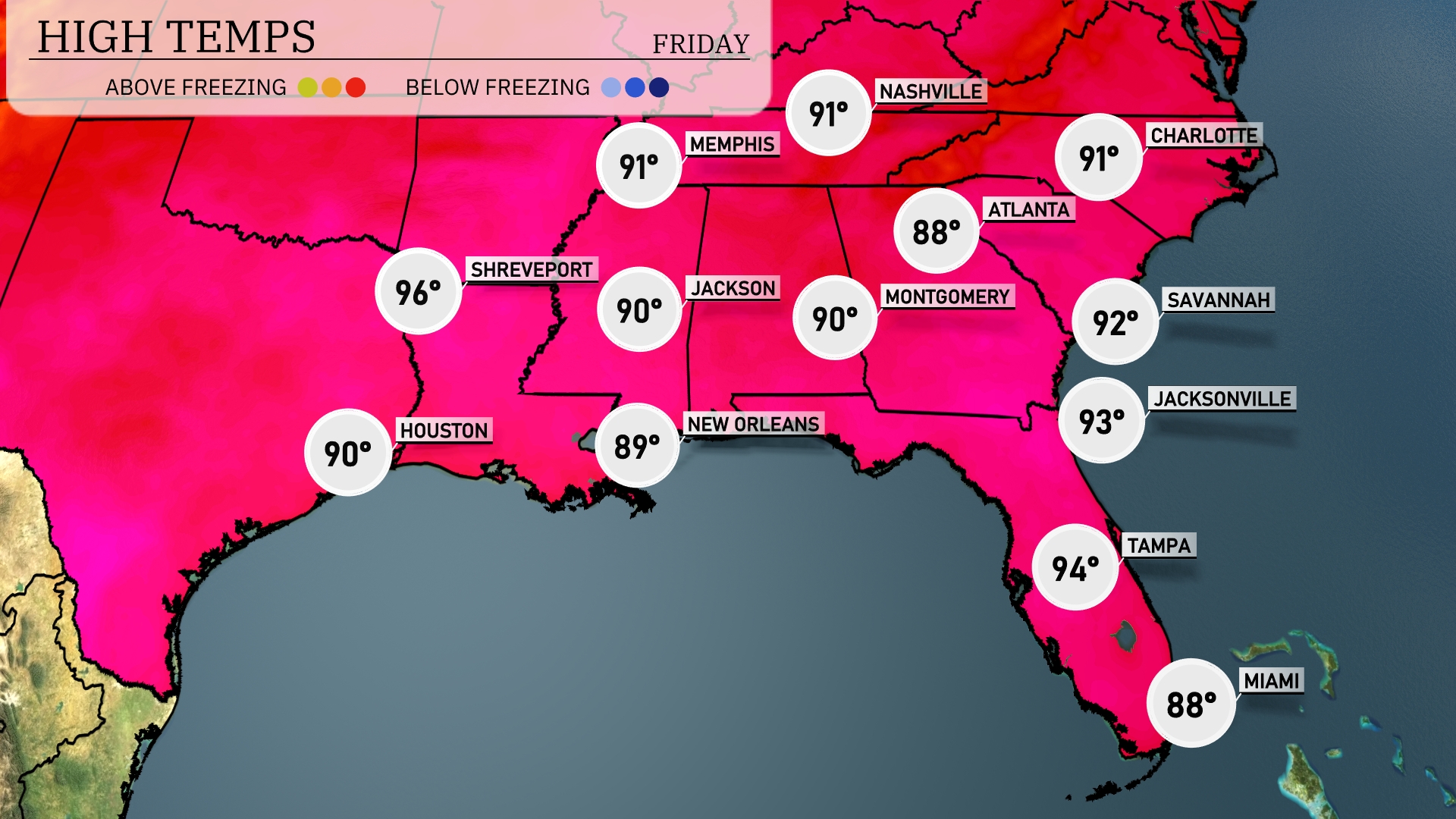
Tomorrow, high temperatures across the Southeast are set to soar. Shreveport will reach a sizzling 96 degrees, while Houston peeks at 90 degrees. In New Orleans, expect a warm 89 degrees, closely matched by Jackson at 90. Farther east, Atlanta will see a high of 91, with Jacksonville rising to 93 degrees. These temperatures reflect a trend well above average for the time of year, influenced by a high pressure system dominating the region.
A cold front is set to sweep across the Southeast tomorrow, triggering scattered thunderstorms, particularly from Jackson to Atlanta by late morning. Expect heavier downpours and potential flooding along the Gulf Coast, impacting areas like New Orleans. The frontal passage will usher in cooler and drier conditions into Friday, with a noticeable drop in temperatures across the region. Winds could reach advisory levels in exposed areas from Shreveport to Charlotte.
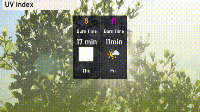
The UV index in Atlanta will reach a high of 8 on Thursday, with a burn time of just 17 minutes in direct sunlight, so be cautious outdoors. By Friday, expect a UV index of 11, which is very high, and sunburn can occur in as little as 11 minutes. It’s important to use sunscreen, wear protective clothing, and seek shade when possible!