NYC’s Weather Rollercoaster: From Sultry Afternoons to Stormy Nights
By
Amy Freeze
Unpack the dynamic weather patterns affecting NYC and the Northeast this week, from soaring temperatures to cooling showers.
Today, NYC will see a blend of partly cloudy skies and rising temperatures, while a low-pressure system promises cooler nights and possible thunderstorms. Dive deeper into what this means for your week ahead!
This week in New York City promises a whirlwind of weather activity. Starting with mild afternoons boasting temperatures up to 84 degrees, the city will see a significant shift as a low-pressure system introduces scattered showers and the potential for thunderstorms leading into the weekend. With the UV index peaking, New Yorkers are also advised to manage their sun exposure. For a detailed daily forecast and expert tips on weather preparedness, check out the complete feature at our blog.
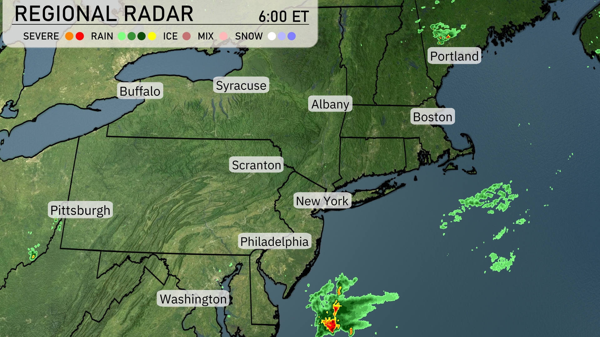
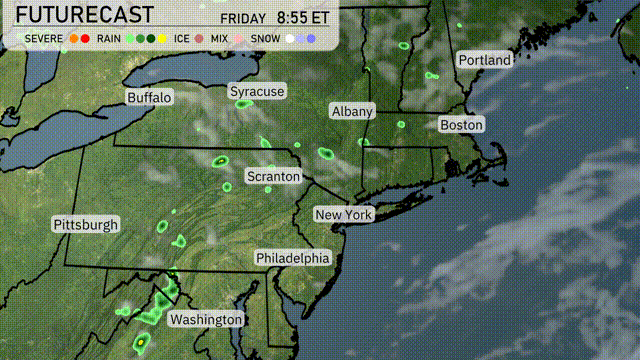
The Regional Radar shows a clear and calm weather pattern across most of the Northeast. Areas off the coast of New Jersey are experiencing some isolated rain showers, pushing northeast toward Long Island. A patch of severe weather is lurking just off the Atlantic coast south of New Jersey, indicating potentially heavy rain and wind for nearby maritime regions. Cities like New York, Philadelphia, and Albany currently enjoy dry conditions with no significant weather disruptions.
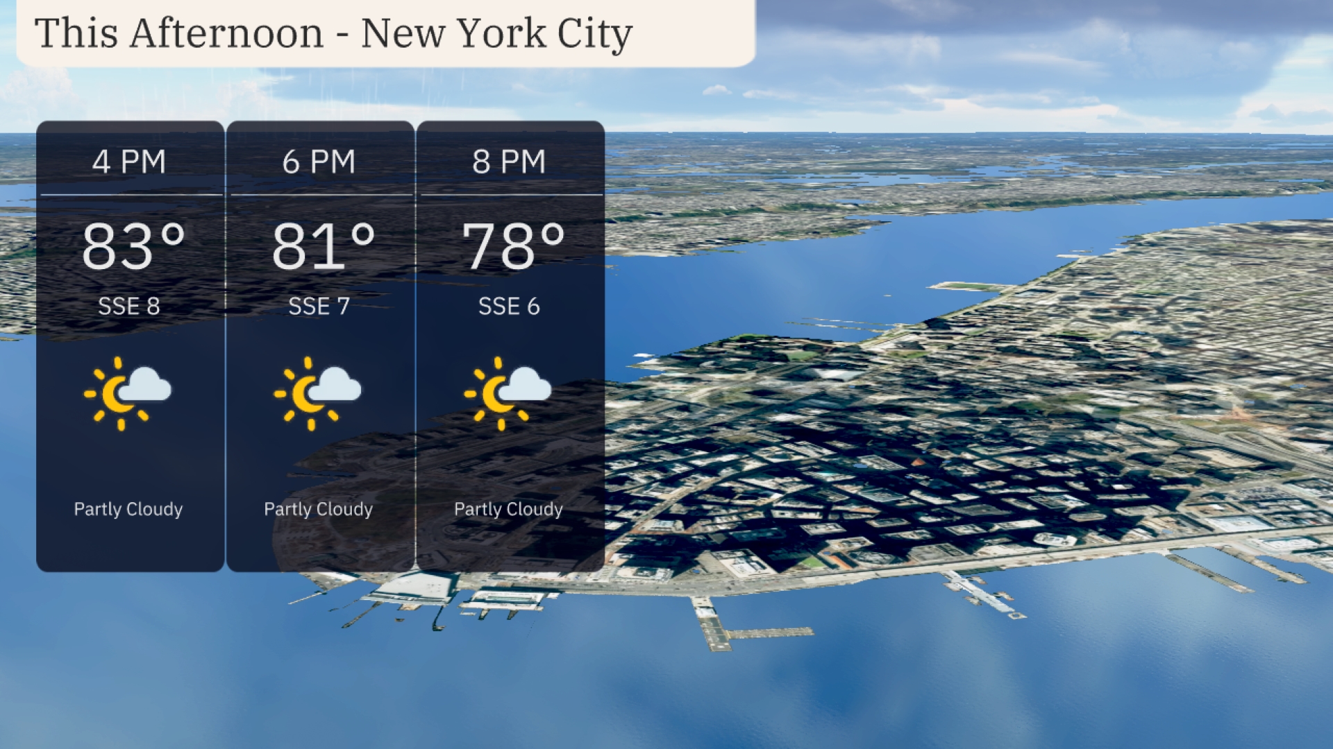
Expect partly cloudy skies in New York City with temperatures starting at 83 degrees at 4 PM, gradually cooling to 81 degrees by 6 PM, and reaching 78 degrees by 8 PM. A light breeze from the south-southeast at 8 miles per hour will ease to 6 miles per hour by the evening.
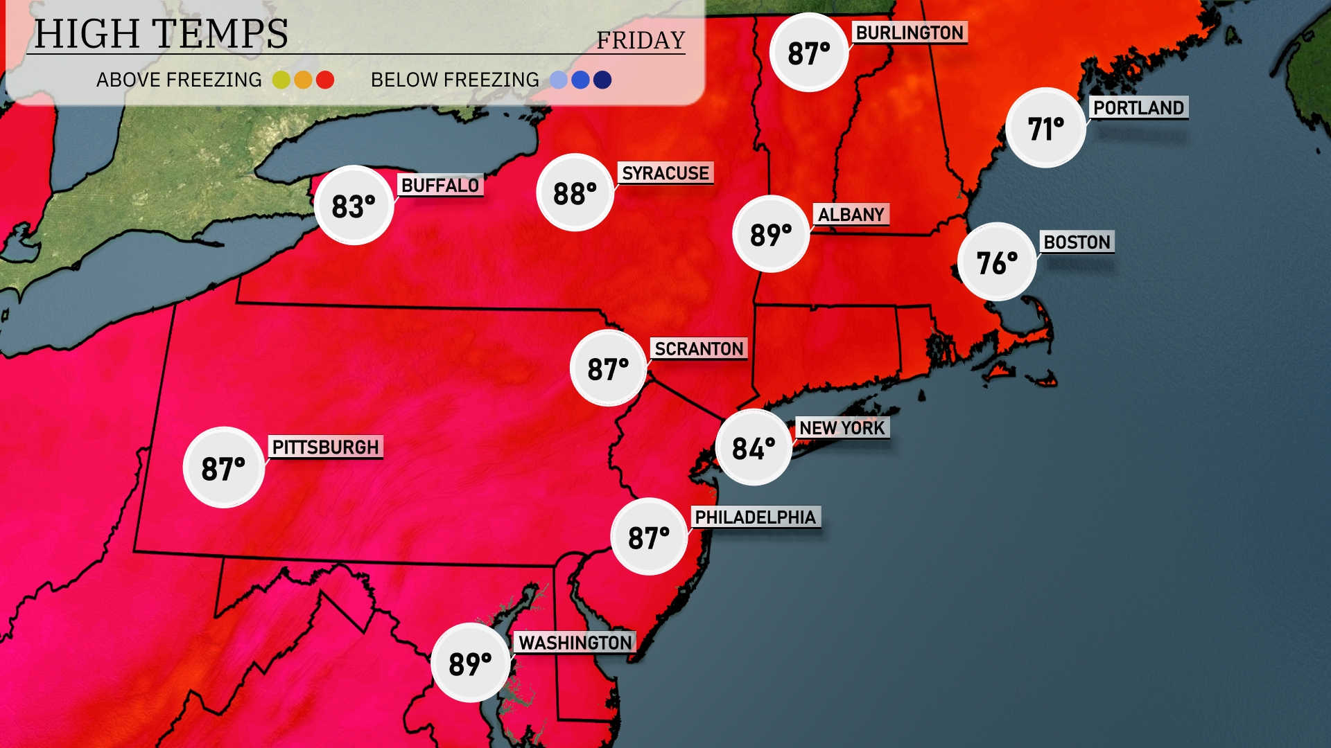
This afternoon, temperatures are heating up across the Northeast. New York City hits a high of 84 degrees, while Philadelphia warms up to 87. Scranton and Pittsburgh both match that 87-degree mark, signaling a warm day in Pennsylvania. Up north, Albany sees 89 degrees, making it one of the hottest spots today, while Burlington stays a bit cooler at 87. On the coastline, Boston will experience a high of just 76 degrees, reflecting a noticeable temperature contrast to the inland areas.
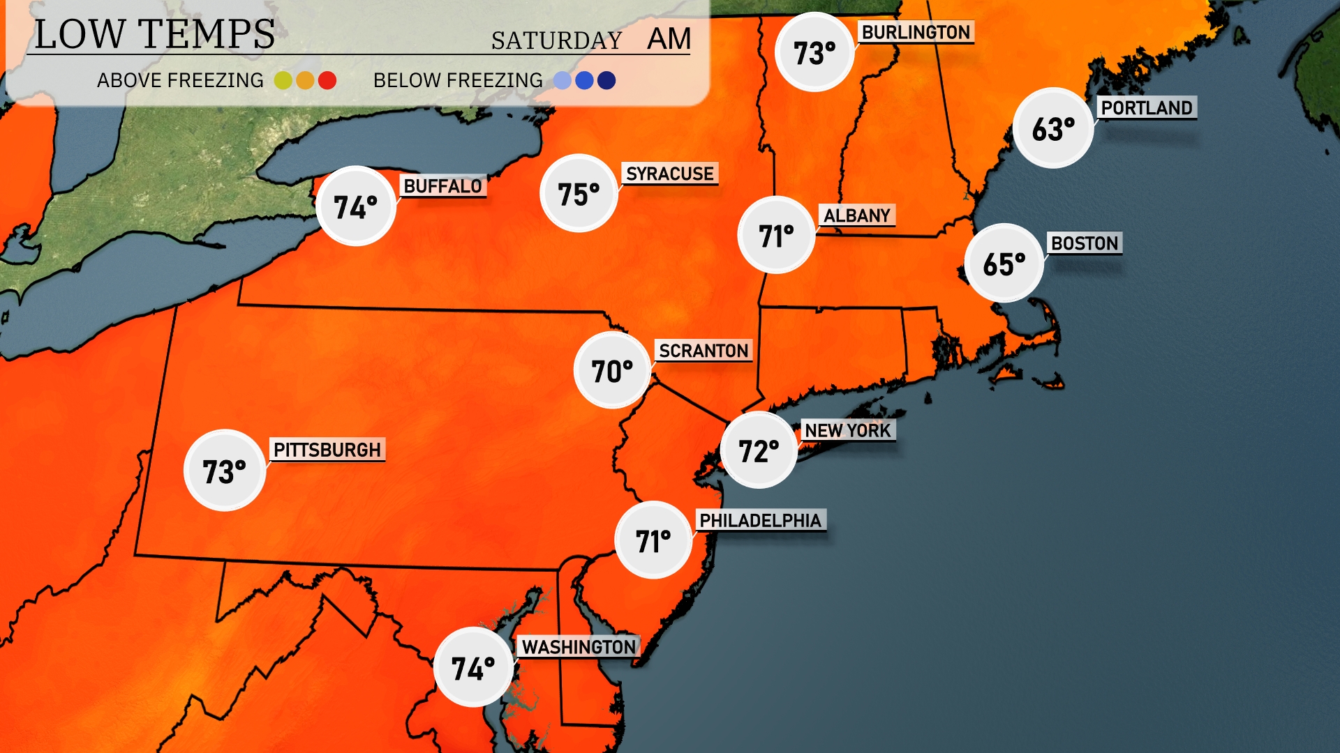
Tonight, Boston will see a low of 65 degrees, while New York is expected to cool down to 72. Philadelphia will drop to 71 degrees, and Scranton is forecasting a low of 70. Albany will experience a slight chill, falling to 71 degrees, indicating a shift in temperatures across the Northeast.
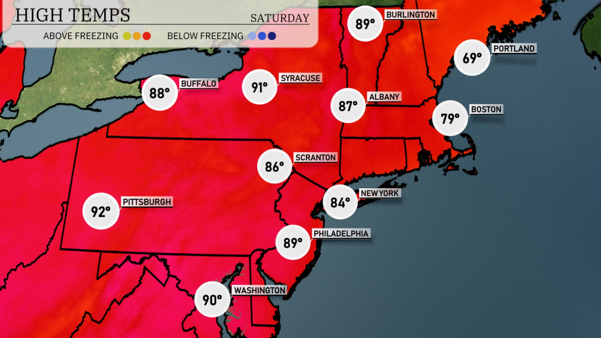
Tomorrow in the Northeast, expect some sizzling highs, with Pittsburgh leading the way at 92 degrees. Philadelphia will also see warm temperatures, reaching 89 degrees, while New York City is expected to hit 84 degrees. Buffalo and Syracuse will not be far behind, with highs of 88 and 91 degrees, respectively. Noticeably, many areas are experiencing above-average temperatures due to a persistent high-pressure system influencing the region. Boston will be slightly cooler at 79 degrees, still above seasonal norms.
A low-pressure system is moving into the Northeast, bringing scattered showers and thunderstorms from Scranton to Boston on Friday. Temperatures will remain mild during the day but expect cooler conditions by evening as the front passes through. Syracuse and Albany could experience brief periods of heavy rainfall. Watch out for localized flooding in urban areas due to potential heavy downpours. By Saturday, conditions improve with clearing skies and slightly cooler temperatures across the region.
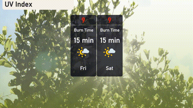
The UV index in New York City on Friday is high with a level of 9, leading to a burn time of just 15 minutes in direct sunlight. For Saturday, the UV index remains at 9, sustaining the brief burn time of 15 minutes.