Southeast Showdown: Atlanta’s Combat with Clouds and Cloudbursts
By
Amy Freeze
Explore how Atlanta's weather is shaping up this week with sporadic thunderstorms and varying temperatures. From a very high UV index to tips on handling the thunderstorm odds, get all the insights.
This week, Atlanta encounters scattered thunderstorms and fluctuating temperatures, along with a severe UV index warning. Make sure to stay weather-wise!
The weather in Atlanta and the Southeast is on a rollercoaster this week, with conditions ranging from partly cloudy skies to thunderstorms ready to rumble. Atlanta sees temperatures climbing to the high 80s while nights promise cooler breezes. Moreover, a special alert for a very high UV index requires precaution. Read on for our detailed 7-day forecast, weather tips, and how to navigate through stormy bouts, all at https://amyfreeze.ai/
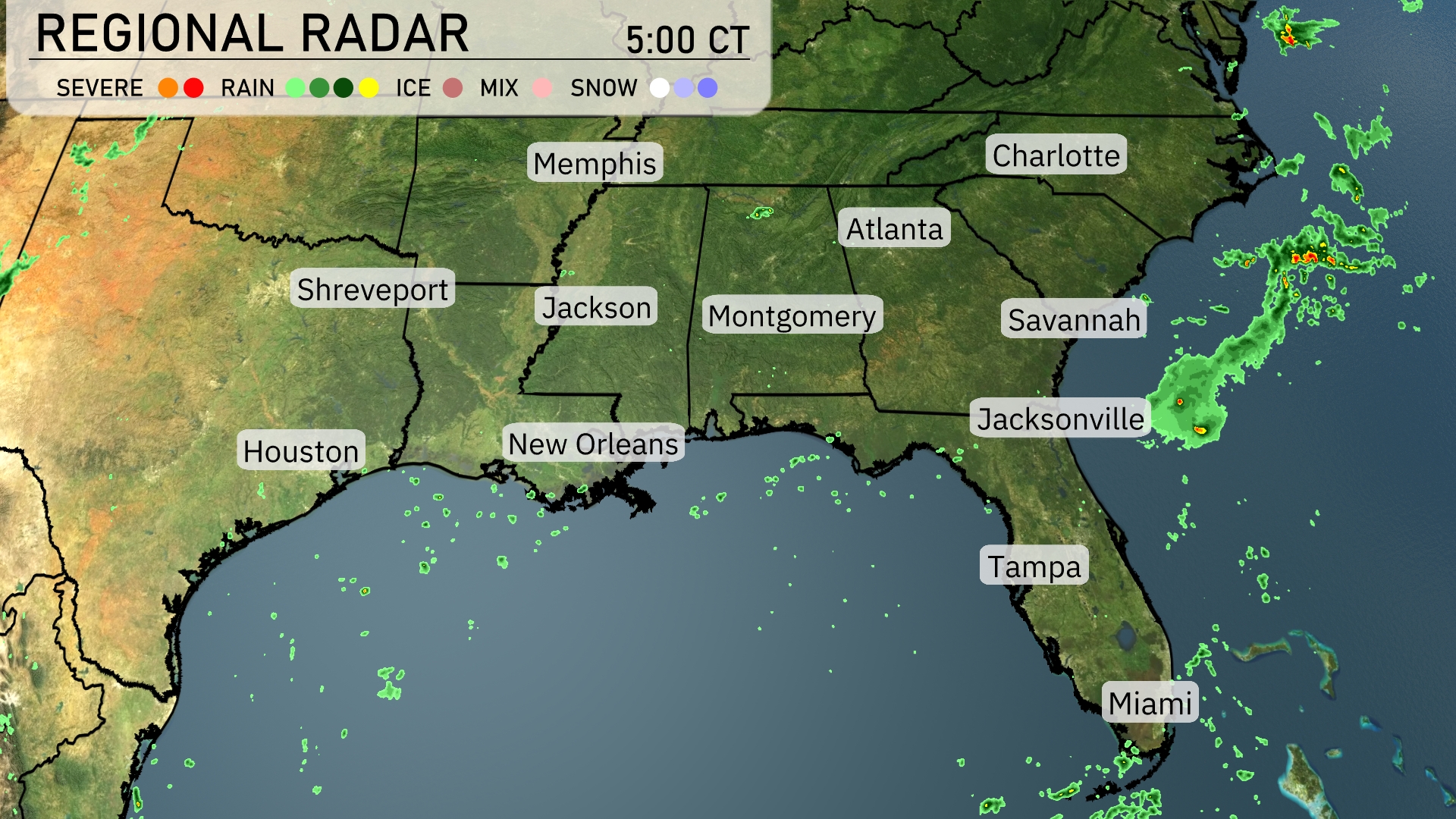
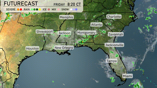
A significant cluster of storms is moving eastward off the coast of Jacksonville, bringing heavy rain and possible severe weather just offshore. Cloud cover is increasing over Savannah as the showers approach from the west. Light rain is noted over the Gulf of Mexico, moving slowly towards New Orleans, which remains dry for the moment. Clear conditions persist from Tampa to Charlotte, with no precipitation reported.
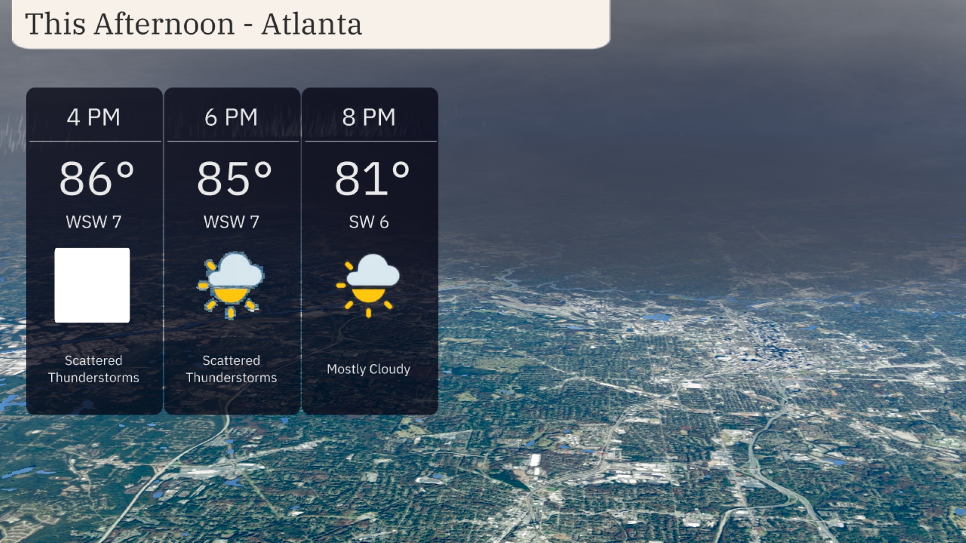
Afternoon temperatures in Atlanta are reaching 86 degrees with scattered thunderstorms likely. The wind will be coming from the west-southwest at 7 miles per hour. By 6 PM, expect a slight drop to 85 degrees with continued thunderstorm chances. Cloud cover will increase as the afternoon progresses, transitioning to mostly cloudy skies by 8 PM when temperatures fall to 81 degrees.
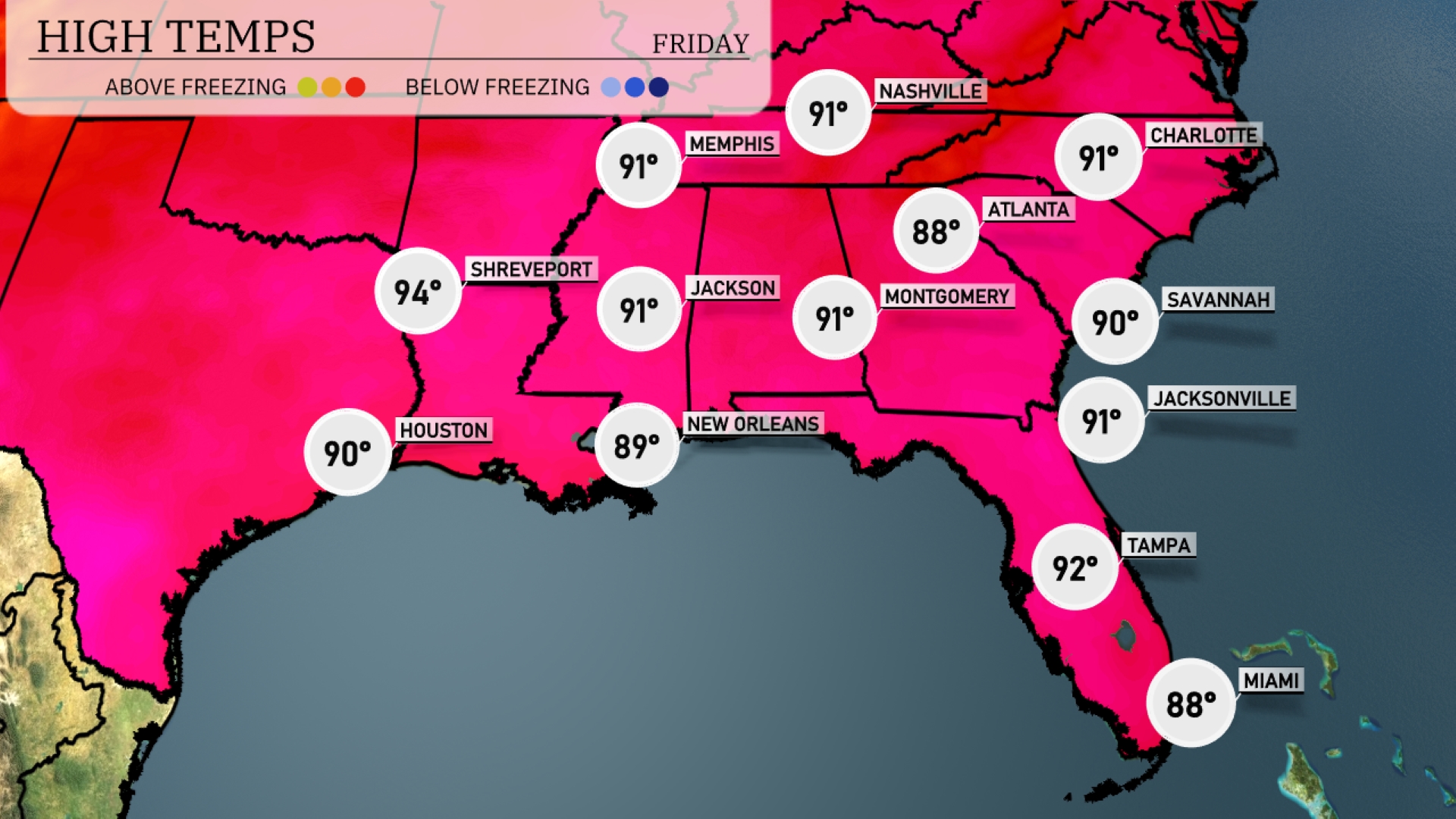
Afternoon high temperatures across the Southeast are looking warm today. In Shreveport, the high reaches 94 degrees, while Houston is slightly cooler at 90. New Orleans will see a high of 89, contrasting with Jackson, which will hit 91 degrees. Atlanta is expected to warm up to 91, while in Florida, Tampa will be hotter at 92 degrees, with Miami staying a bit cooler at 88.
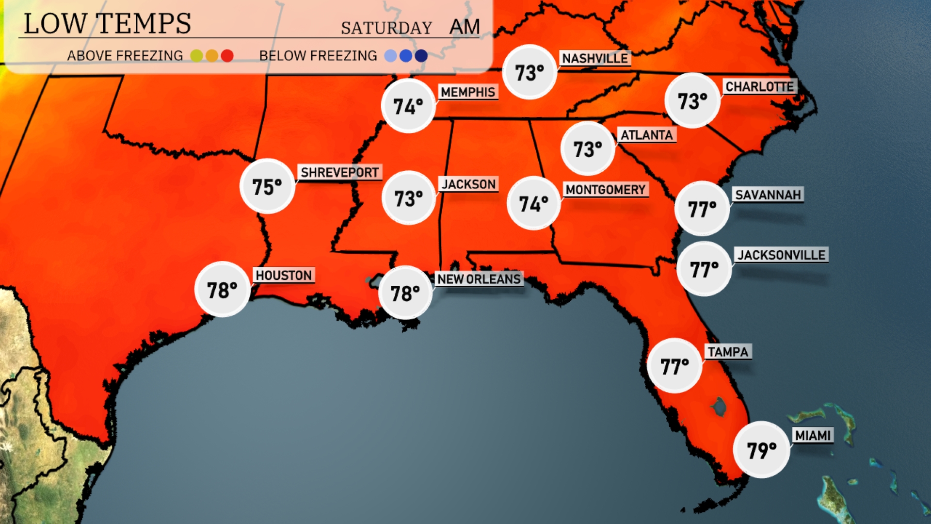
Tonight, expect temperatures to drop to 73 degrees in Atlanta. Memphis is forecasted to cool down to 74 degrees, while Nashville will see a low of 73. Montgomery will also stay mild at 74 degrees. In contrast, Jackson is projected to experience a cooler night with a low of 73 degrees.
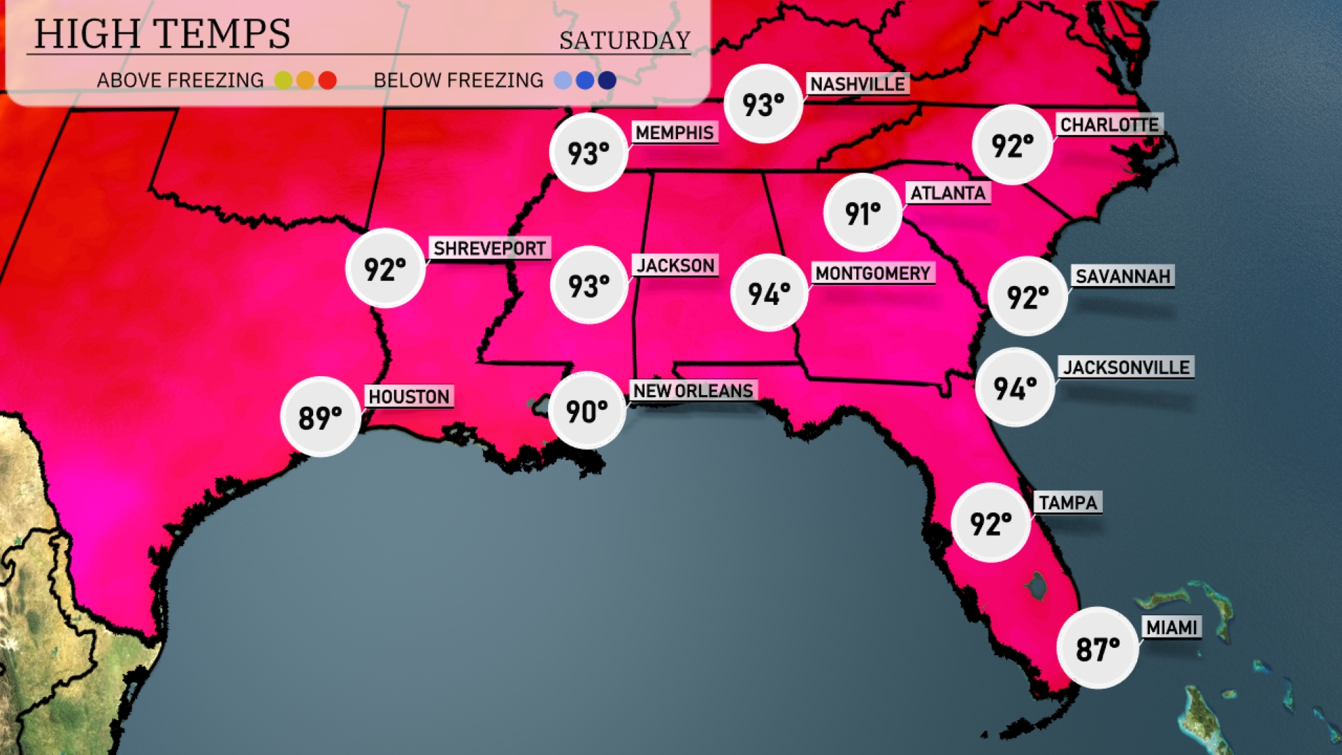
Tomorrow, high temperatures in the Southeast are soaring, with Memphis hitting 93 degrees and Nashville reaching 93 as well. Jackson and Montgomery are slightly warmer at 93 and 94 degrees, respectively. Atlanta will be warm but a bit cooler, with a high of 91. Coastal cities like Jacksonville and Savannah will also see highs of 94 and 92.
Expect thunderstorms to develop across the Southeast tomorrow, particularly from New Orleans to Jacksonville. These storms will bring the potential for heavy rain and strong winds due to an advancing cold front. Temperatures will hover in the mid-80s, slightly cooling post-storms by late afternoon. The heaviest rain is expected from Shreveport to Atlanta, with localized flooding possible in urban areas. By tomorrow night, conditions should begin to clear from west to east, leading to a drier and slightly cooler Saturday.
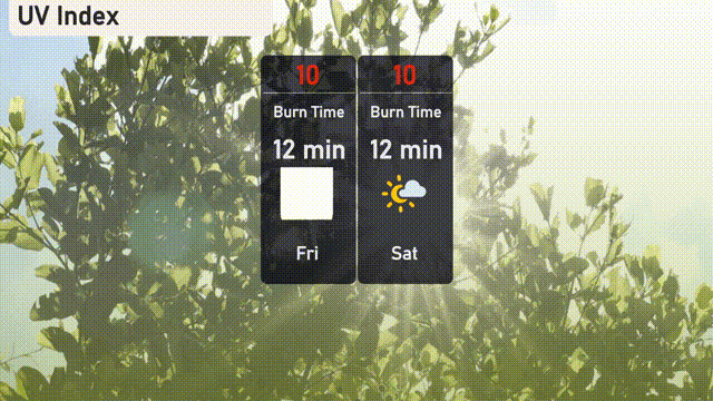
The UV index in Atlanta will be very high today at 10, with a burn time of just 12 minutes under direct sunlight. It remains at this level through Saturday, so take extra precautions by wearing sunscreen and seeking shade.