Atlanta’s Weather Forecast: A Rollercoaster of Temps and Tempests
By
Amy Freeze
Explore the intricacies of Atlanta's weather this week, from balmy highs to stormy lows. Get ready for a mix of sun, storms, and everything in between!
From sunny mornings to stormy afternoons, Atlanta’s weather has it all this week! Learn more about what to expect and how to prepare.
Atlanta’s weather is as dynamic as ever this week, with conditions ranging from clear skies and rising temperatures to severe storm warnings. Our latest blog dives deep into the daily forecast, provides tips on managing high UV indexes, and offers insights into the expected storm impacts across the Southeast. Keep up with the changes and stay prepared with our detailed daily breakdown. Visit our blog for all details: https://amyfreeze.ai/
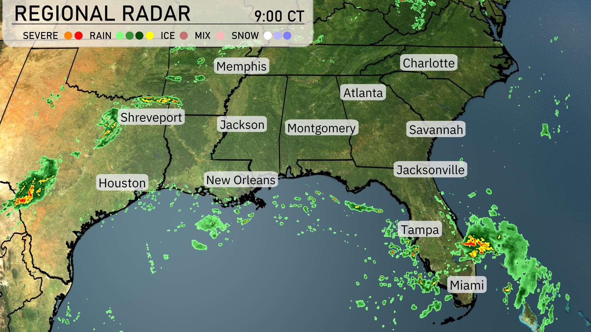
A line of severe storms is sweeping through western Louisiana, particularly intense near Shreveport, pushing towards Jackson, Mississippi. Meanwhile, scattered showers are hovering over the Gulf Coast from New Orleans to Houston. The southeastern coast of Florida, especially around Miami, is experiencing heavy rainfall that is moving northeast toward Tampa. Elsewhere, skies remain mostly clear with a few isolated showers developing in southern Mississippi.
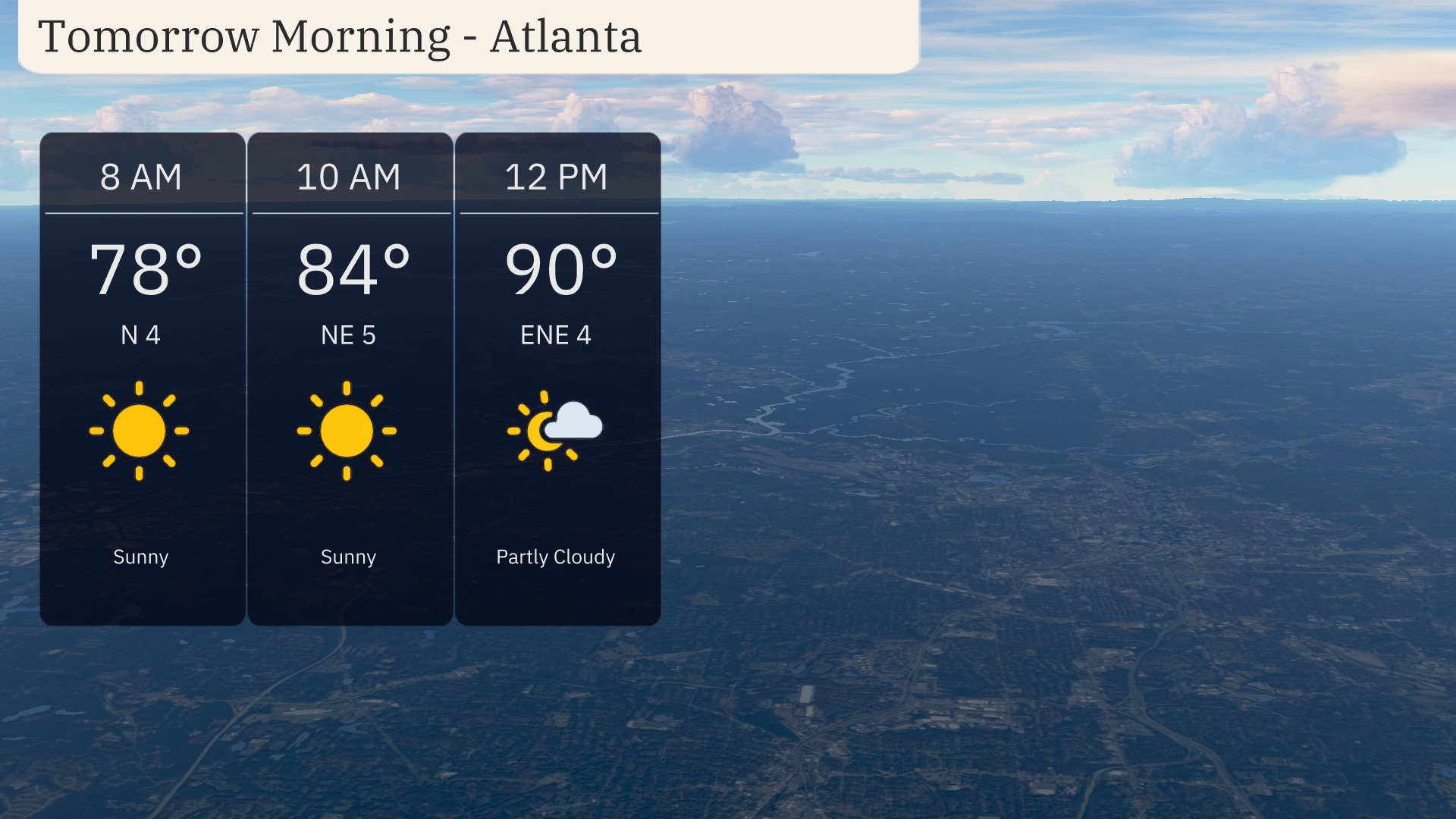
Tomorrow morning in Atlanta, expect clear skies with a steady rise in temperatures from 78 degrees at 8 AM to 84 degrees by 10 AM. Winds will be gentle, coming from the north at 4 miles per hour initially, shifting to the northeast at 5 miles per hour. By noon, temperatures will reach 90 degrees with a slight increase in cloud cover and an east-northeast wind at 4 miles per hour.
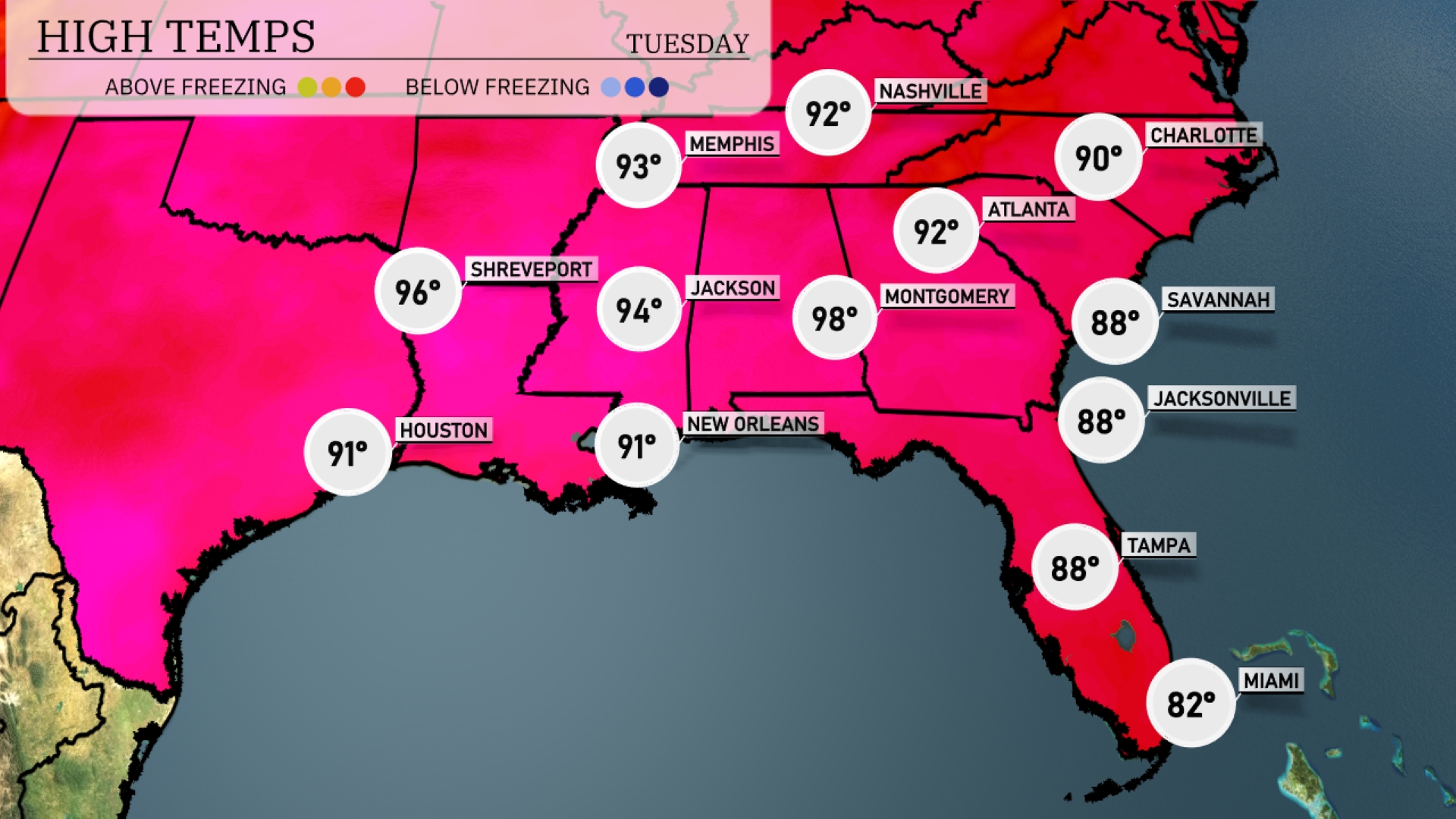
Tomorrow, Montgomery will be the hottest spot in the Southeast, reaching a sizzling 98 degrees, significantly above the average for this time of year. New Orleans isn’t far behind with a high of 91 degrees. Shreveport will also see warm conditions with temperatures hitting 96 degrees. In contrast, cities like Atlanta and Jacksonville will experience milder highs of 92 and 88 degrees, respectively. Overall, high pressure is driving these warmer temperatures across the region, leading to a summer-like day ahead.
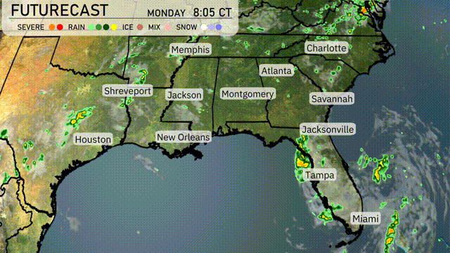
Get ready for a stormy day in the Southeast tomorrow! A line of thunderstorms approaches from the west, impacting cities from New Orleans to Montgomery. Expect heavy rain, lightning, and gusty winds, especially in the afternoon. Houston and Shreveport will see the wet weather early, with potential for flash flooding in low-lying areas. By late evening, the front pushes eastward, reaching Atlanta and into the Carolinas overnight.
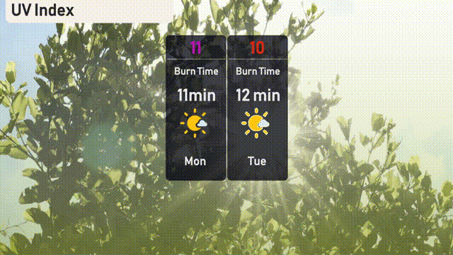
The UV index in Atlanta will be extremely high on Monday with a reading of 11, resulting in a burn time of just 11 minutes in direct sunlight. By Tuesday, the index slightly lowers to 10, but the sun remains intense with a burn time of 12 minutes. Make sure to apply broad-spectrum sunscreen and seek shade during peak sun hours to protect your skin!
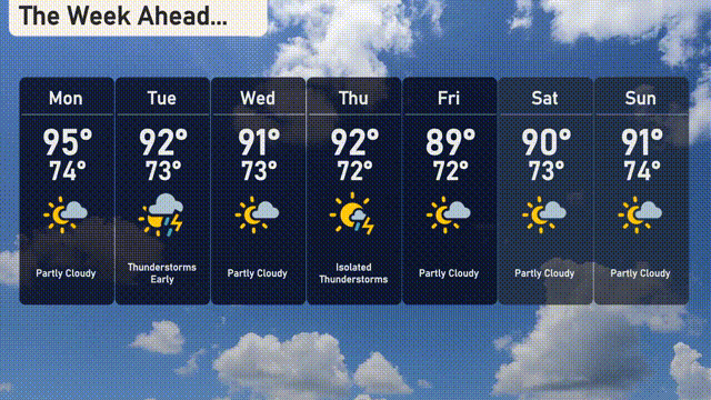
For the 7-day forecast in Atlanta:
Monday: Partly cloudy skies with a high of 95 degrees and a low of 74 degrees.
Tuesday: Thunderstorms early, expect temperatures to reach a high of 92 degrees with a low of 73 degrees.
Wednesday: Partly cloudy with the temperature rising to 91 degrees and dipping to 73 degrees at night.
Thursday: Isolated thunderstorms with a high of 92 degrees and a low of 72 degrees.
Friday: Partly cloudy conditions, the high is expected to be 89 degrees and the low 72 degrees.
Saturday: Another partly cloudy day with a high of 90 degrees and a low of 73 degrees.
Sunday: Wrapping up the week with partly cloudy skies, a high of 91 degrees, and a low of 74 degrees.
Hope that helps!