Morning Brew: Chicago’s Weather Outlook – From Clear Skies to Storm Alerts
By
Amy Freeze
Dive into our detailed forecast for Chicago and the Midwest, from serene mornings to stormy evenings. Get the insights you need to plan your day with confidence.
Begin your day informed with a snapshot of tomorrow’s weather in Chicago—partly cloudy morning escalates to stormy conditions by evening. Stay prepared with our detailed insights!
This detailed post delves into the nuances of the evolving weather patterns in Chicago and the broader Midwest region. From the gentle breezes of a partly cloudy morning to the robust thunderstorms rolling in by evening, we explore the dynamics causing these shifts and what they mean for your daily plans. Temperature trends, storm timings, and safety tips are all included, providing a comprehensive guide to navigating the Midwestern climate. Follow our updates and stay weather-aware!
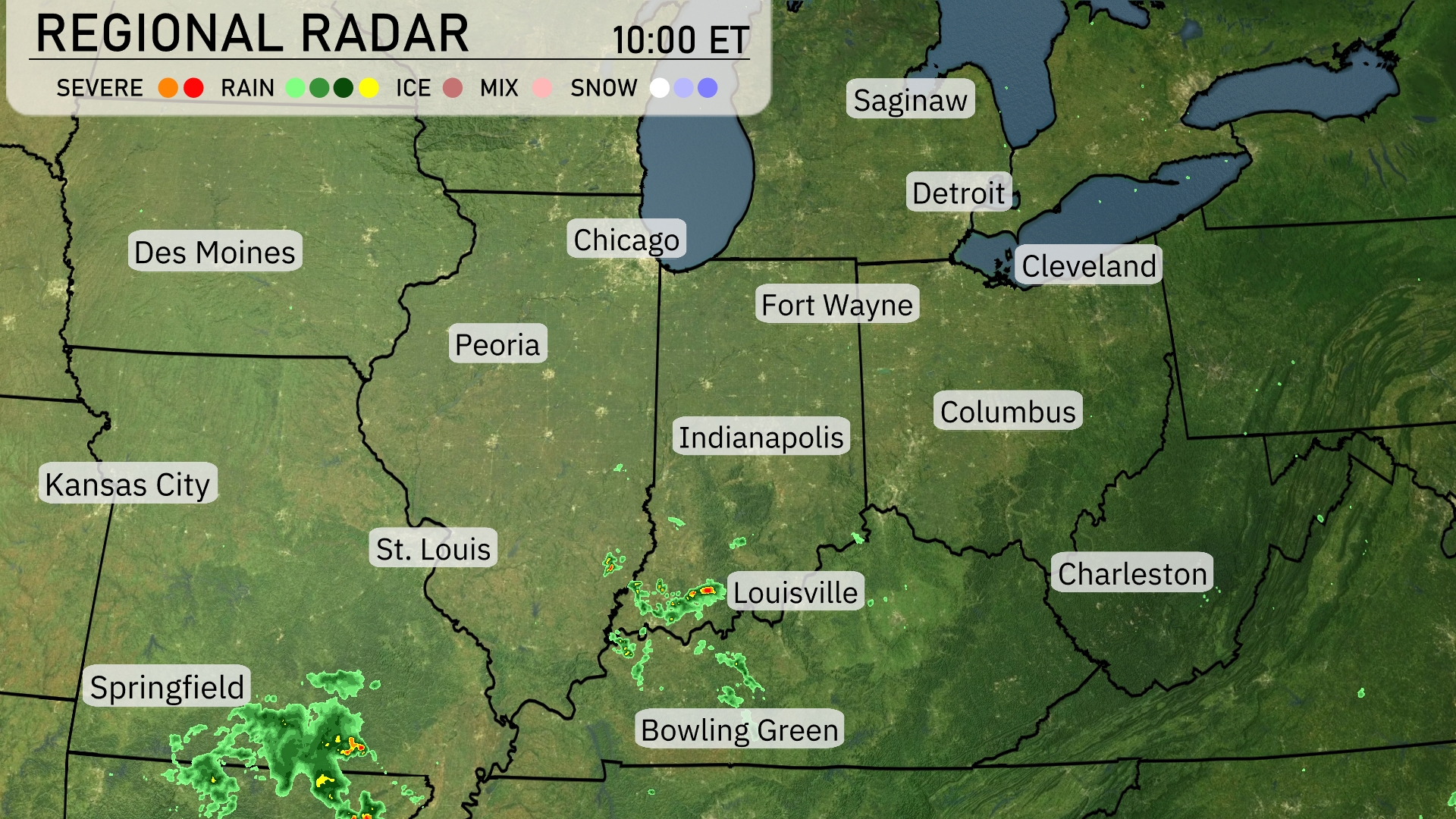
Across the Midwest, a patch of thunderstorms is developing near Springfield, moving northeast. Louisville is currently experiencing scattered showers, which are moving toward Bowling Green. Chicago, Detroit, and Cleveland are in the clear, with no significant cloud cover or precipitation at this time. Meanwhile, St. Louis appears mostly dry, with potential for showers southeast of the city.
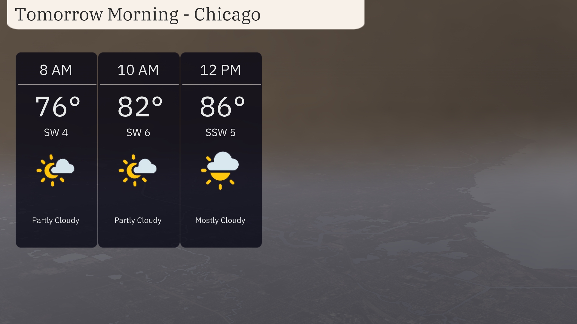
For tomorrow morning in Chicago, expect partly cloudy skies with temperatures rising from 76 degrees at 8 AM to 82 degrees by 10 AM. Winds will be coming from the southwest at 4 to 6 miles per hour, providing a slight breeze. By noon, temperatures will climb to 86 degrees as clouds increase, leading to mostly cloudy conditions.
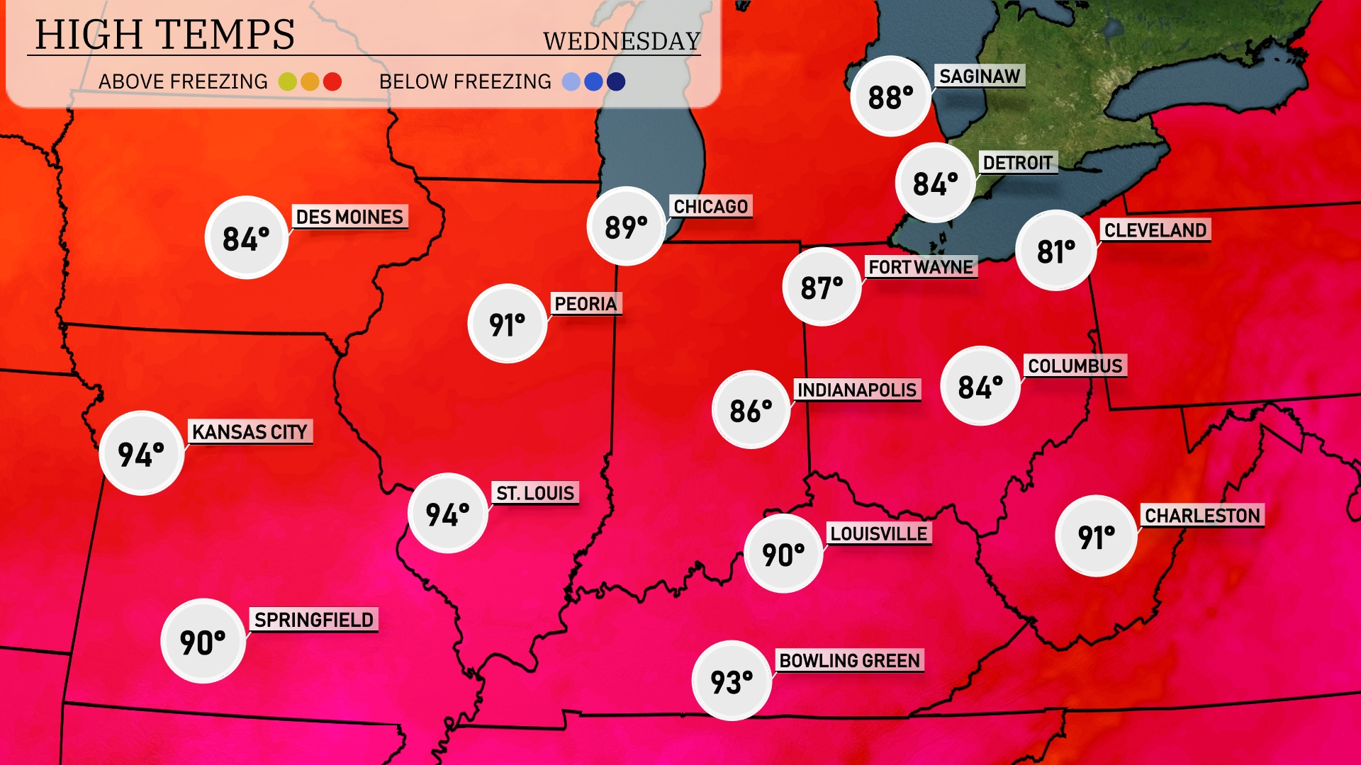
Tomorrow in the Midwest, Kansas City will sizzle with a high of 94 degrees, matching Springfield’s temperatures. Peoria will be slightly warmer at 91 degrees, while St. Louis also hits a steamy 94. Indianapolis reaches 86 degrees, with Chicago not far behind at 89.
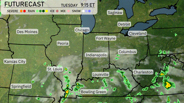
Expect an active weather day across the Midwest tomorrow as a cold front pushes through, bringing scattered thunderstorms from St. Louis to Indianapolis. Watch for potential heavy downpours and gusty winds, particularly in the late afternoon and evening hours. Temperatures will cool slightly following the front, with highs in the mid-70s to low 80s. Areas from Chicago to Fort Wayne should prepare for spotty showers that could lead to locally heavy rain and possible flooding.
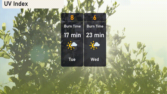
The UV index in Chicago on Tuesday will be high at 8, with sun exposure posing a risk. Expect a burn time of about 17 minutes, so take precautions if outdoors. On Wednesday, the UV index decreases to a moderate level of 6 with a burn time of around 23 minutes, suggesting some care is still needed when spending time in the sun.
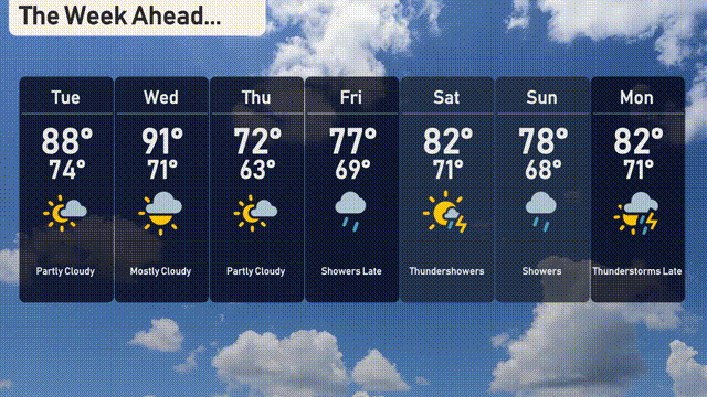
Tuesday: Partly cloudy with a high of 88 degrees and a low of 74 degrees.
Wednesday: Mostly cloudy and warmer with temperatures reaching 91 degrees, cooling to 71 degrees overnight.
Thursday: Expect partly cloudy conditions, a high of 72 degrees, and a comfortable low of 63 degrees.
Friday: Showers are likely with a high of 77 degrees and an evening low of 69 degrees.
Saturday: Thunderstorms are possible, with a high of 82 degrees and a low of 71 degrees.
Sunday: Continuing with some storms, expect a high of 78 degrees and a low of 68 degrees.
Monday: Thunderstorms develop later with a high of 82 degrees and a low of 71 degrees.