NYC Sizzles and Storms: Your Comprehensive Guide to This Week’s Weather
By
Amy Freeze
From thunderstorms tearing through to a surprising cooling weekend, here's everything you need to know about NYC's current weather conditions and what's to come.
This week, NYC grapples with highs of 95ºF and sudden thunderstorms. Learn what each day will bring with our detailed weather breakdown.
New York City’s weather is full of surprises this week. Experience sunny skies and unexpected showers. From the high of 95ºF to pleasant evenings, we’ve got the full scoop. Plus, tips on staying safe under a high UV index. Dive into our expanded analysis for a seven-day outlook, and make the most out of the weather forecasting technology at your fingertips.
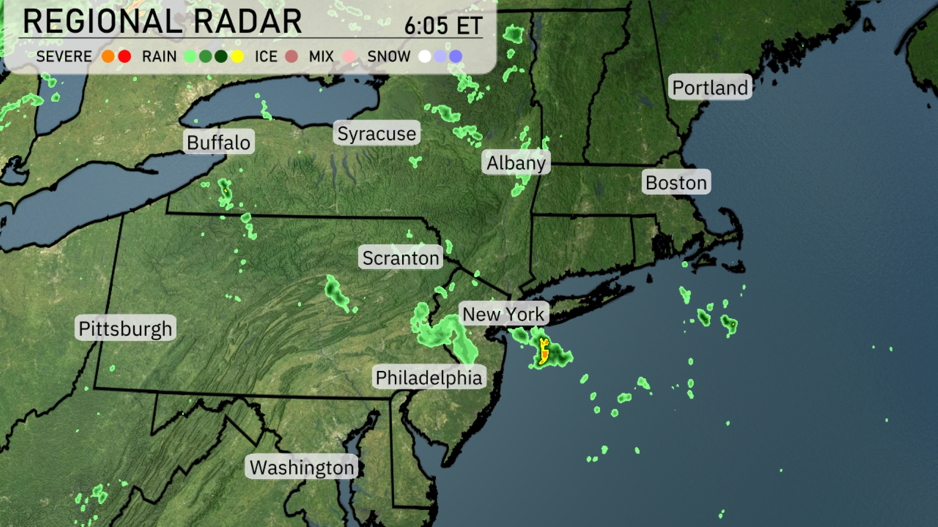
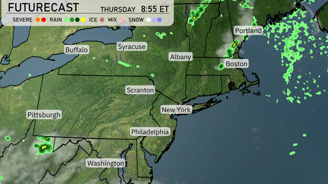
A line of showers is sweeping through Central New York, with Syracuse experiencing periods of rain, heading towards Albany. Another cluster of rain is moving through northeastern Pennsylvania affecting areas like Scranton, while Philadelphia remains mostly clear. In the coastal regions, rain showers are shifting eastward over New York City. Buffalo and Portland are enjoying clearer skies with no immediate precipitation.
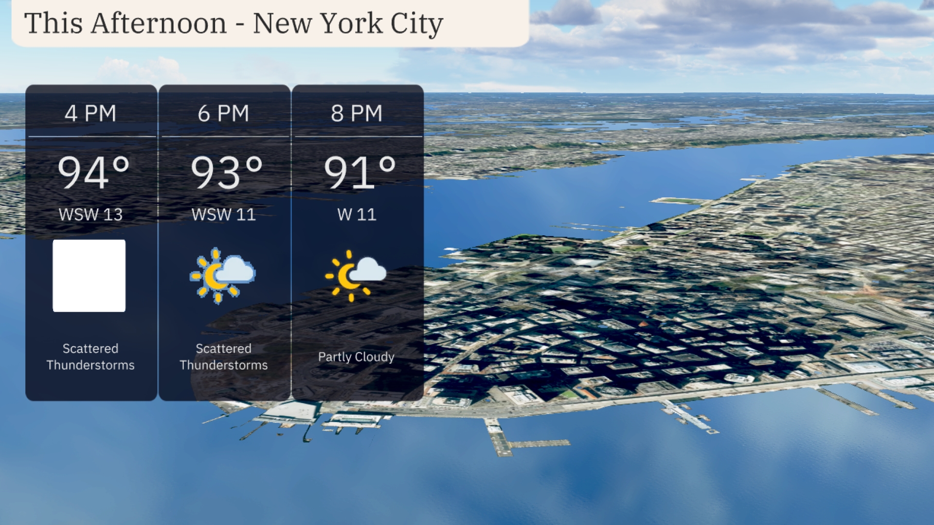
This afternoon in New York City, expect scattered thunderstorms with temperatures reaching 94 degrees. Winds will be from the west-southwest at 13 miles per hour. By 6 PM, thunderstorms will persist as temperatures decrease slightly to 93 degrees with winds tapering to 11 miles per hour. By 8 PM, conditions will become partly cloudy and the temperature will settle at 91 degrees with a light west wind at 11 miles per hour.
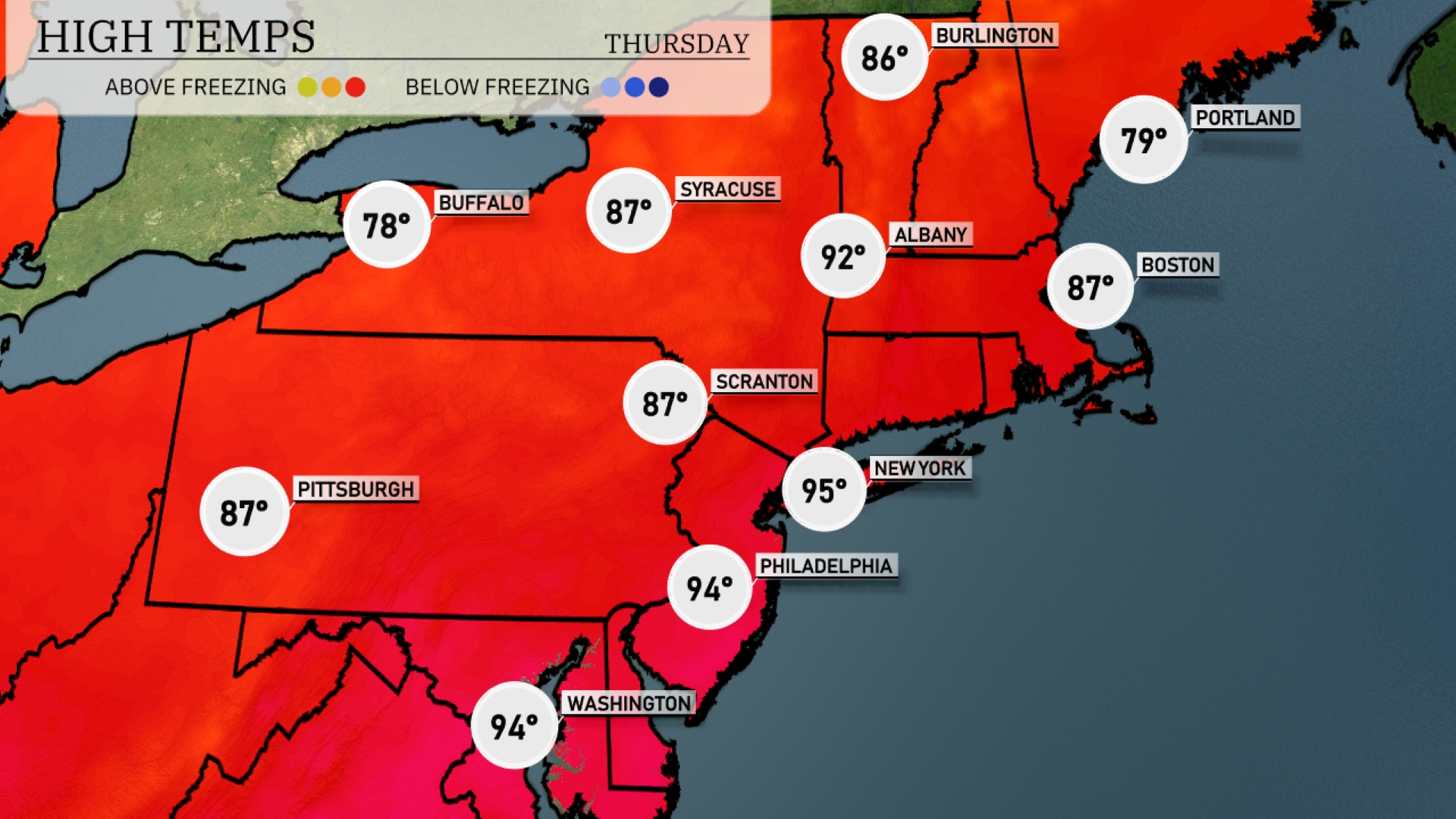
Today’s high temperatures across the Northeast show significant warmth. New York City leads the way with a scorching high of 95 degrees, while Philadelphia is close behind at 94 degrees. Up north, Albany reaches a high of 92 degrees, indicating some summer heat lingering in the Capital Region. Farther west in Scranton and Pittsburgh, temperatures remain mildly warm, each hitting 87 degrees. To the north, Buffalo is relatively cooler at 78 degrees, providing a noticeable contrast to the heat further south.
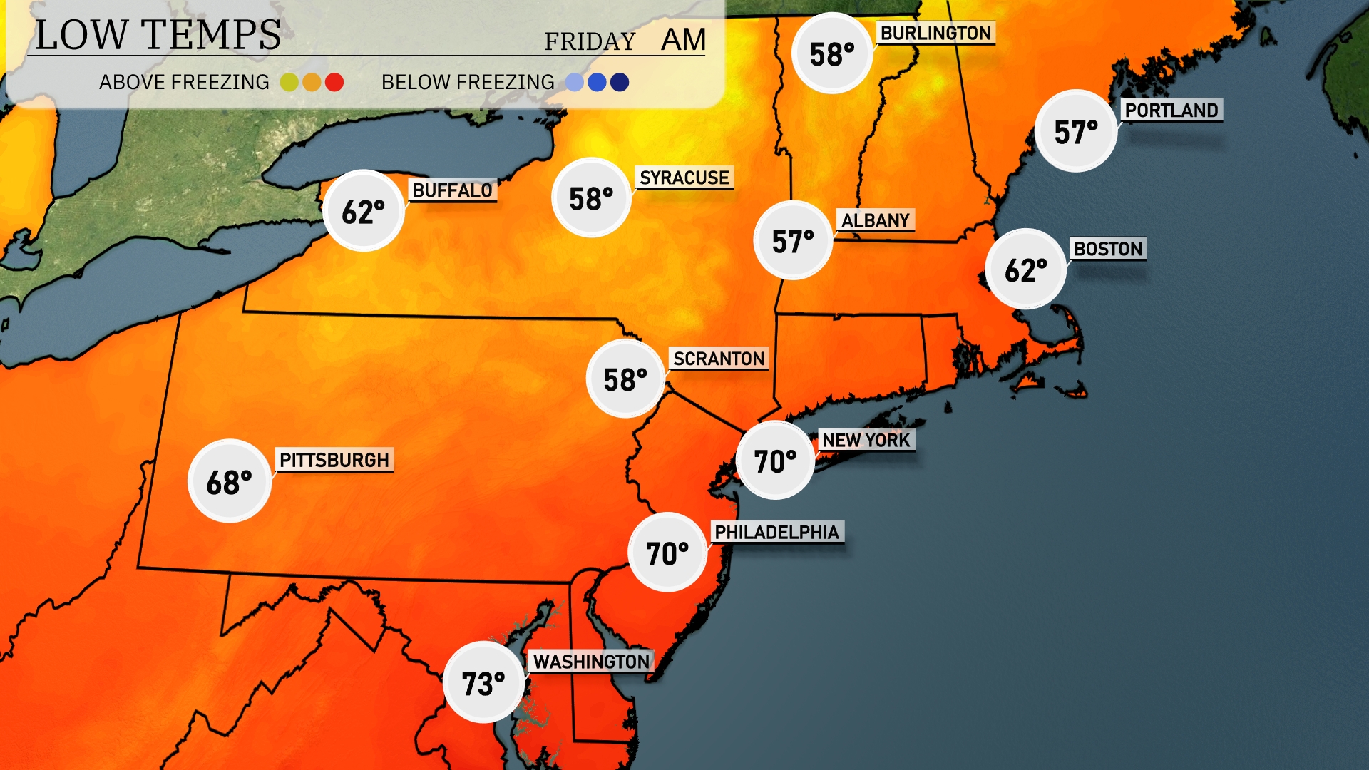
Tonight, expect lows to dip to 57 in Albany and 58 in Scranton, with Syracuse also dropping to 58 degrees. New York City will stay a bit warmer at 70 degrees, while Boston cools down to 62. Portland will see a low of 57 degrees, setting the stage for a noticeably cooler night across the Northeast.
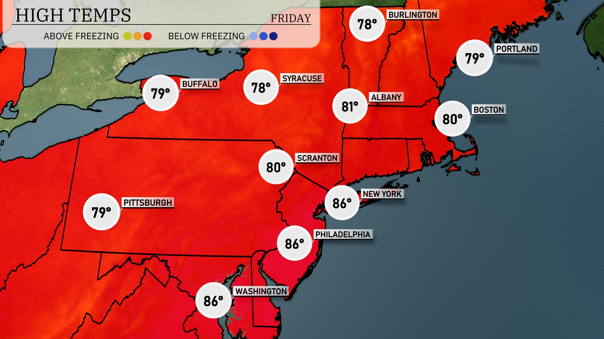
Tomorrow in New York City, expect a high of 86 degrees, well above the seasonal average. Philadelphia will also be warm, reaching 86 degrees, alongside Washington, D.C., which can expect similar highs. In contrast, areas like Scranton and Albany will see more moderate temperatures at 80 and 81 degrees, respectively. Buffalo and Pittsburgh are forecasted to be slightly cooler with highs around 79 degrees.
A quick-moving cold front will bring scattered showers across the Northeast by tomorrow evening, impacting areas from Buffalo to Boston. Expect temperatures to drop slightly post-front, providing slightly cooler conditions into Friday. While storms may form, severe weather risk remains low, but keep an eye out for brief heavy downpours, especially near coastal regions. As the front clears by Friday morning, dry air will bring clearer skies and comfortable temperatures into the weekend.
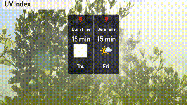
The UV index in New York City reaches a high of 9 both on Thursday and Friday, indicating a burn time of just 15 minutes in direct sunlight. With such strong sun, it’s crucial to apply sunscreen generously and wear protective clothing. Stay vigilant and protect your skin during outdoor activities!