The Heat is On: Atlanta’s Sizzling Summer Forecast and Weather Safety Guide
By
Amy Freeze
From balmy nights to near-record temperatures, discover how to navigate Atlanta’s summer weather with our comprehensive guide and forecast.
This week in Atlanta brings a mix of highs, lows, and storms. Stay prepared with our detailed daily forecasts and valuable weather safety tips!
Welcome to your go-to guide for Atlanta’s weather this July. Experience everything from steamy days to cool evenings and prep for potential storms with our expert tips. Explore daily breakdowns of temperatures, storm forecasts, and safety strategies to make the most of your summer days safely and comfortably.
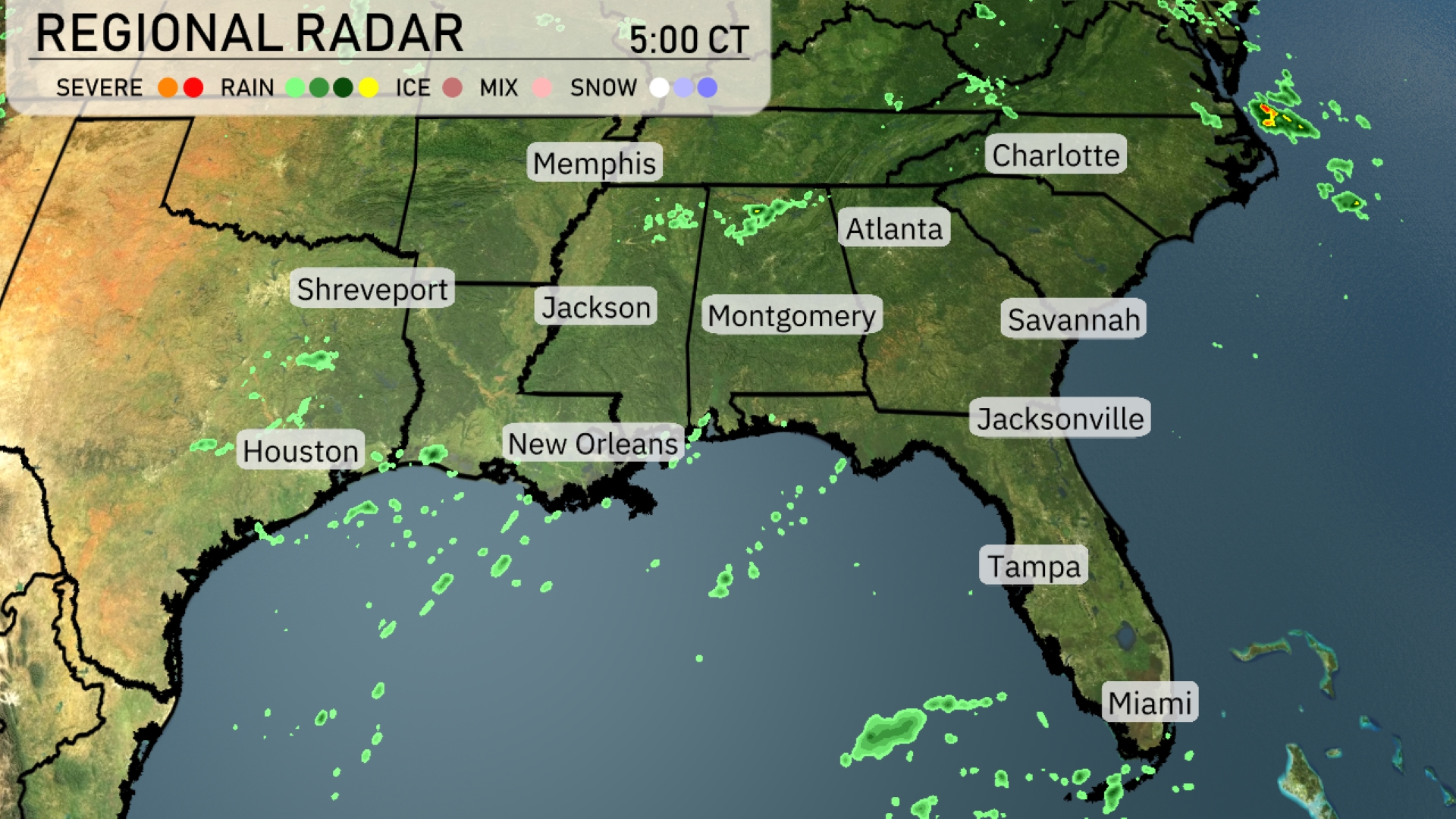
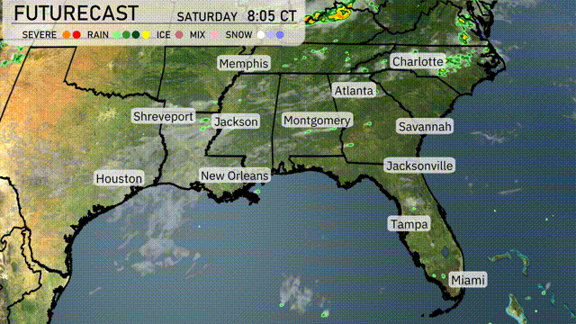
The Southeast radar indicates scattered light rain showers along the Gulf Coast, especially impacting areas like New Orleans and Houston. Toward the East, Jacksonville and Tampa are seeing a few light rain showers as well. From Montgomery to Atlanta, mostly clear skies prevail, creating a break between the Gulf showers and any approaching systems from the west. Memphis and Charlotte remain dry and calm.
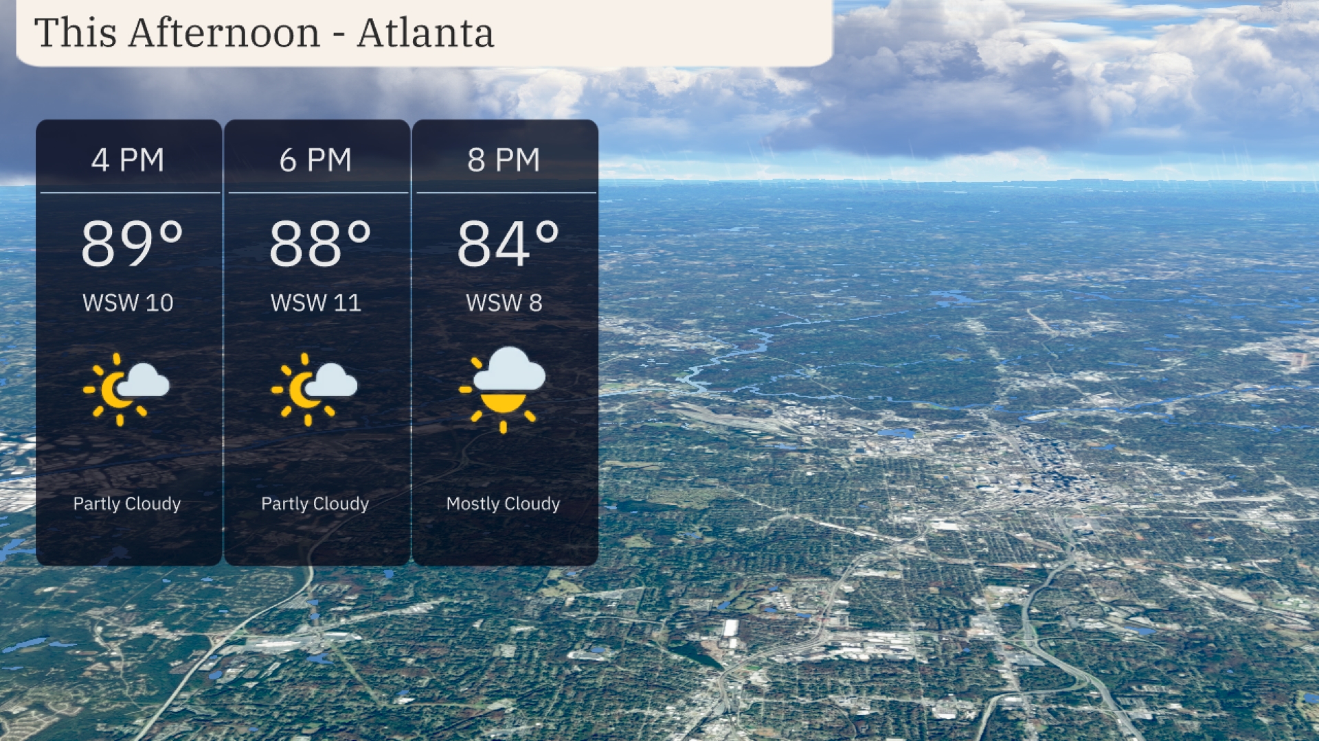
This afternoon in Atlanta, temperatures hover around 89 degrees, with winds from the west-southwest at 10 miles per hour. Clouds will begin to roll in, transitioning to mostly cloudy conditions by 8 PM. Temperatures gradually drop to 84 degrees, making for a warm and slightly breezy afternoon.
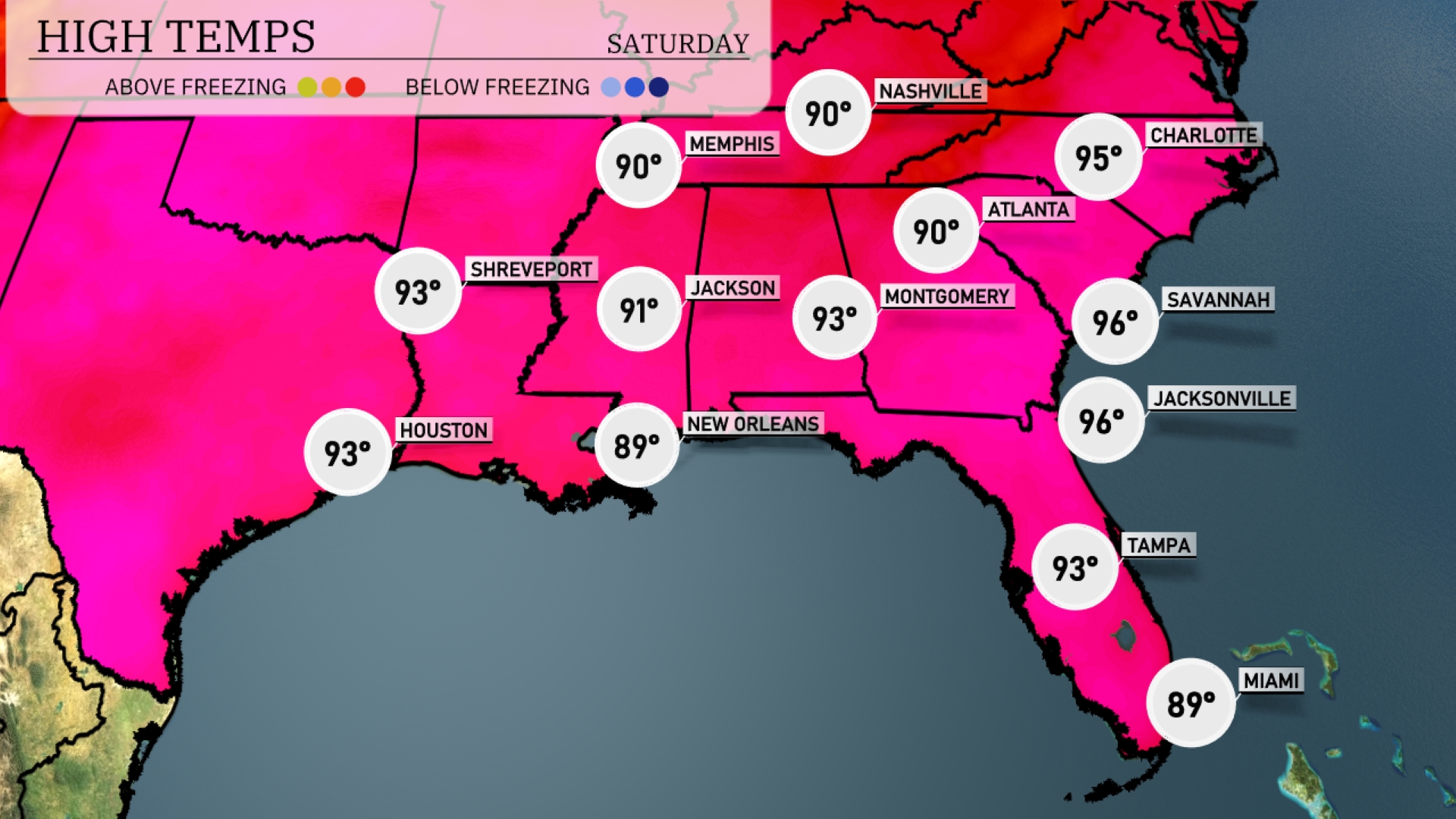
Today in the Southeast, we’re seeing some steamy highs across the region. Memphis and Montgomery both reach 90 degrees, while Jackson is just a notch warmer at 91. New Orleans will see a high of 89, a bit cooler compared to its neighbors. Over in Florida, Tampa is expected to hit 93 degrees, while Jacksonville and Savannah soar to 96, feeling the heat of summer. Expect a mix of sun and clouds as these warm temperatures settle in for the day.
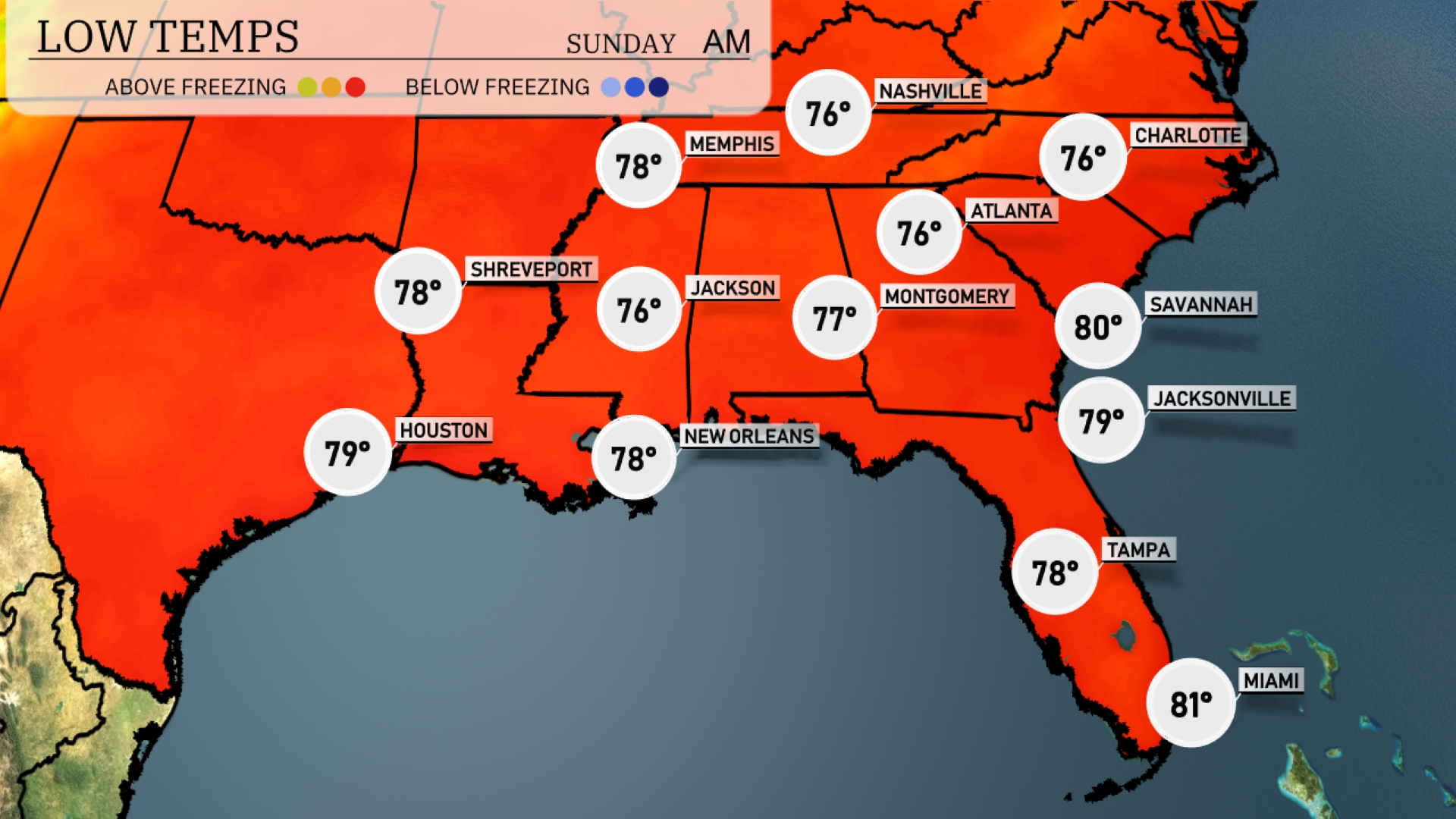
Tonight in the Southeast, temperatures will remain notably warm for July. Nashville will drop to a cool 76 degrees, while Memphis stays slightly warmer at 78. Jackson and Montgomery will see lows of 76 and 77 respectively, with New Orleans at 78. Expect a balmy night in Atlanta at 76 and Tampa around 78, while Miami wraps up with a warm 81 degrees.
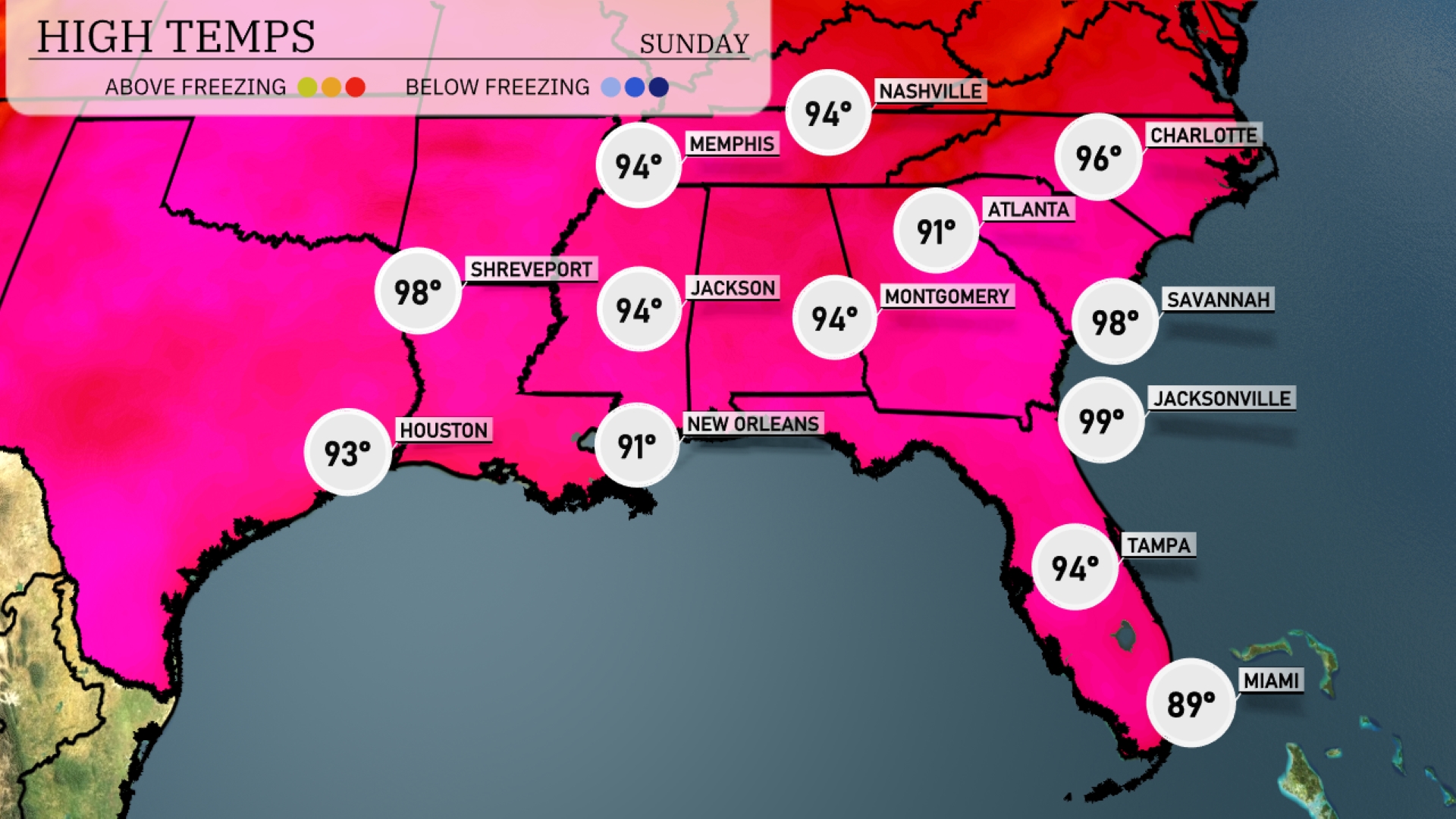
Tomorrow, Jacksonville sizzles with a high of 99 degrees. Savannah is expected to reach a near-record temperature of 98 degrees. Atlanta’s high will be 94, slightly above average for this time of year. Houston will see a warm 93 degrees, while New Orleans settles at a comfortable 91.
A cold front is approaching the Southeast, set to arrive by midday tomorrow, bringing scattered thunderstorms across Alabama, Georgia, and into the Carolinas. Expect heavy rain and localized flooding, particularly around Montgomery and Atlanta. Temperatures will dip by about 5 to 10 degrees post-front, settling in the low 80s across most of the region. The storm risk continues into the evening for areas like Tallahassee and Savannah. High moisture and instability increase the chance for severe weather warnings, including possible damaging winds and hail, especially near Jackson and Shreveport.
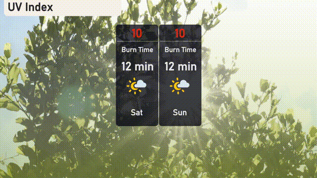
The UV index in Atlanta this Saturday and Sunday will be a very high 10, with potential burn times as short as 12 minutes in direct sunlight. This intense level of UV exposure calls for extra caution—make sure to apply broad-spectrum sunscreen, wear a hat and sunglasses, and seek shade during peak hours. Stay safe and protect yourself from the sun’s harsh rays!