From Storms to Sunlight: Navigating NYC’s Summer Weather Spectrum
By
Amy Freeze
Explore how NYC transitions from severe thunderstorms to clear skies with our comprehensive forecast. Be prepared for the sunny days and stormy nights ahead!
This week’s NYC weather whirlwind brings severe storms followed by sunny skies. Stay updated with our detailed forecasts.
Stay prepared as we navigate through a range of weather conditions from severe storms in Central New York to calming sunny days. Learn more about what to expect this week in New York City, from thunderstorms and localized flooding risks to enjoyable weather ideal for outdoor activities. For continuous weather updates, check our blog post here: https://amyfreeze.ai/
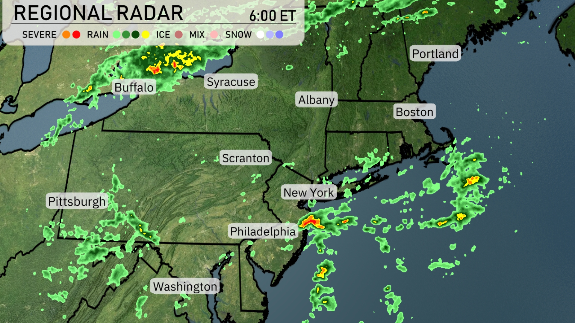
A cluster of severe storms is moving through central New York, particularly affecting areas near Syracuse with heavy rain and potential severe weather. Showers are entering the greater Boston area from the southwest while moving northeast, and parts of eastern New York, including Albany, are seeing light rain. Philadelphia is experiencing intermittent rain showers, and the broader New York City area has scattered rain activity. Washington is staying mostly dry, but Pittsburgh is under a mix of light showers.
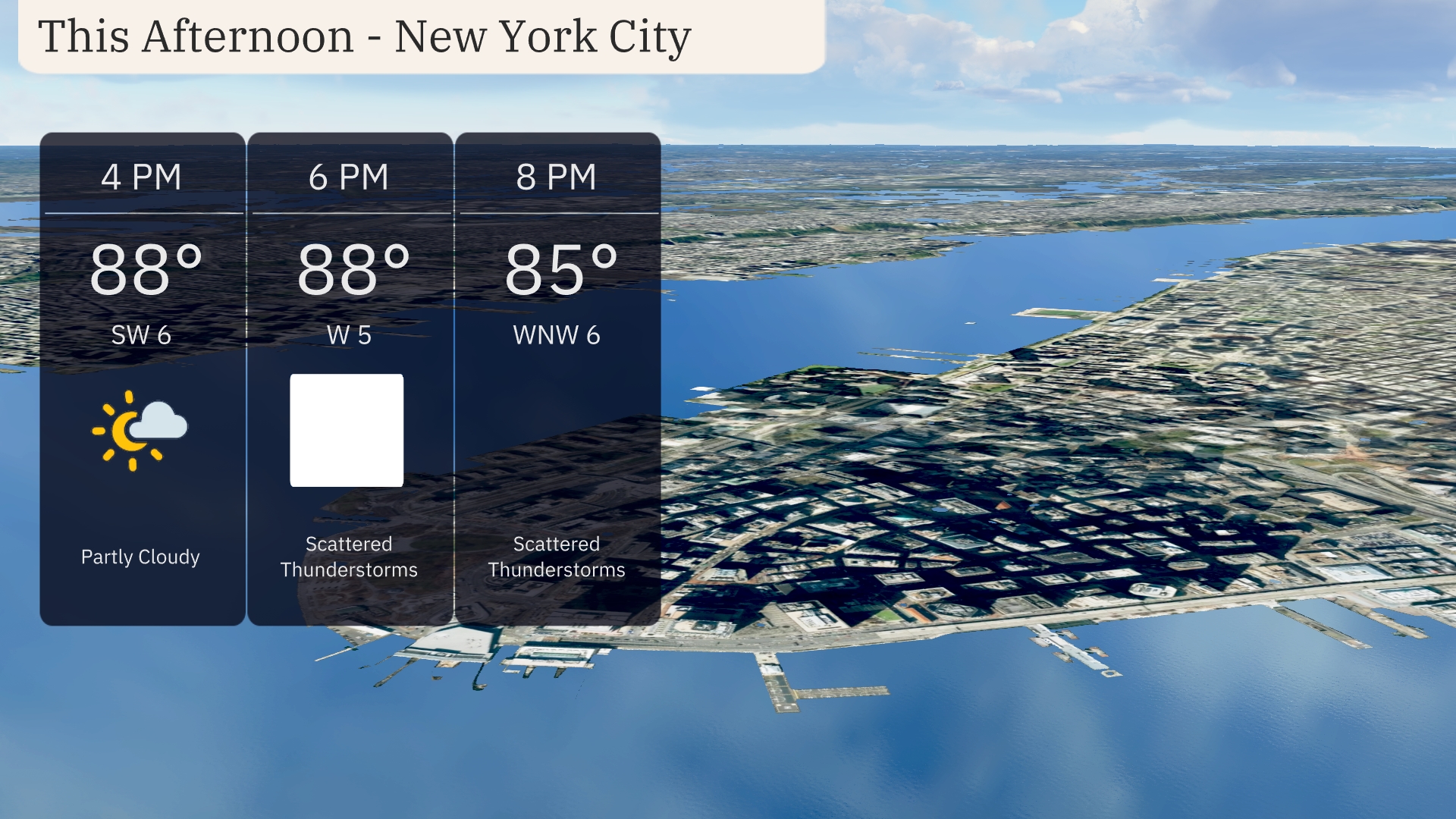
Afternoon temperatures in New York City will reach 88 degrees with partly cloudy skies initially. By 6 PM, scattered thunderstorms are anticipated as the wind shifts from southwest at 6 miles per hour to west at 5 miles per hour. Thunderstorms will persist into the evening, with temperatures slightly cooling to 85 degrees and winds coming from the west-northwest at 6 miles per hour.
This afternoon, the Northeast is warming up. Buffalo will see a high of 79 degrees, while Syracuse matches that temperature. New York City reaches a toasty 89 degrees, and nearby Philadelphia will also haasimilar warmth at 89. Further south, Washington, D.C. is heating up even more with a high of 90 degrees. Boston experiences a humid feel at 87 degrees, while Portland comes in at a mild 78.
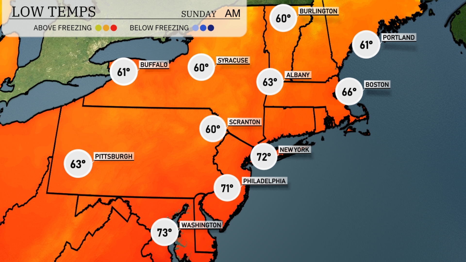
Tonight in the Northeast, expect some mild temperatures with lows around 60 degrees in Buffalo and Syracuse. Areas like Scranton and Albany will also see lows at 60 and 63 degrees, respectively. Philadelphia will drop to 71, while New York City remains warmer at 72. Boston is forecasted to cool down to 66 degrees, maintaining a pleasant evening for the region.
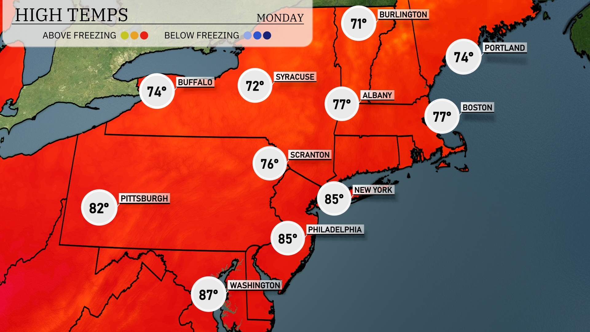
Tomorrow in the Northeast, New York City will see a high of 85 degrees, while Philadelphia matches that warm mark. Scranton is expected to hit 76 degrees, with Buffalo slightly cooler at 74. Across the region, temperatures will generally remain above average, driven by a warm front bringing in increased warmth. Washington, D.C. will be the hottest, reaching 87 degrees.
The Northeast is set for a mix of clouds and sunshine tomorrow, with scattered showers popping up, especially over coastal areas. Temperatures will hover around mid-70s to low 80s. A frontal boundary is enhancing the chance for afternoon thunderstorms, particularly from Boston down to New York City. Be on alert for periods of heavy rainfall that could lead to localized flooding. By evening, coastal showers will begin to taper off as drier air moves in from the west.
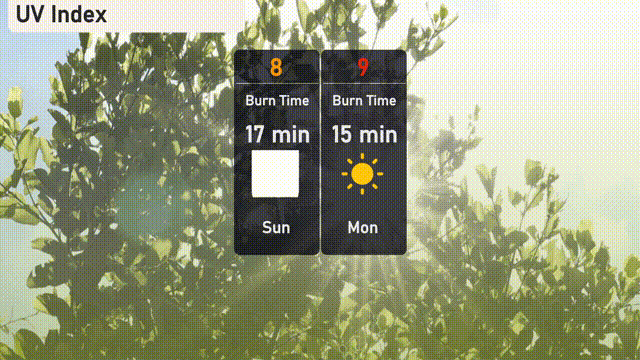
The UV index in New York City will reach 8 on Sunday, leading to a burn time of about 1 @ 7 minutes under direct sunlight. On Monday, it rises to 9, shortening the burn time to approximately 15 minutes. Make sure to protect your skin with sunscreen and protective clothing during these peak times!