Tomorrow’s Midwest Weather Snapshot: Chicago and Beyond
By
Amy Freeze
Get ready for a scenic morning in Chicago with partly cloudy skies, and stay updated on the developing storm patterns across the Midwest. Detailed temperatures and conditions inside.
Tomorrow in Chicago, enjoy partly cloudy skies and rising temperatures in the morning, with a careful eye on storm developments across the Midwest.
In this detailed post, we explore the weather patterns affecting Chicago and the broader Midwest region. Tomorrow morning promises a mix of clouds and sun in Chicago with temperatures warming to a pleasant 81 degrees by noon. Additionally, significant rainfall and storm activity are impacting areas like Kansas City and Indianapolis. Stay informed on temperature variations, storm progress, and safety tips with our comprehensive 7-day outlook.
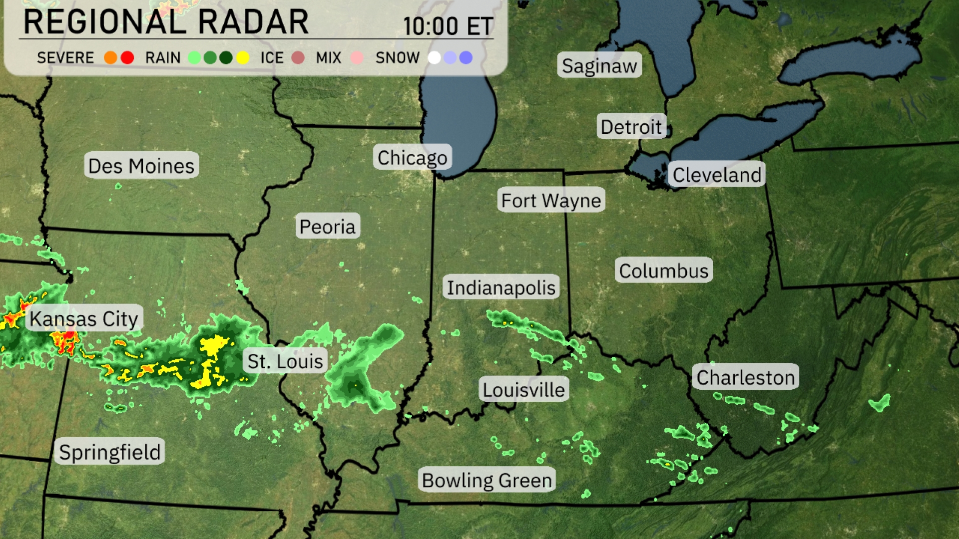
Storms are currently impacting areas just west of Kansas City, with intense rainfall moving across eastern parts towards St. Louis. Showers are scattered from Peoria down through Indianapolis, laying a damp trail across Indiana. Columbus and Charleston are under overcast skies with light drizzles expected to enhance as the day progresses. The north, including Detroit and Chicago, remains dry for now, fostering clear skies.
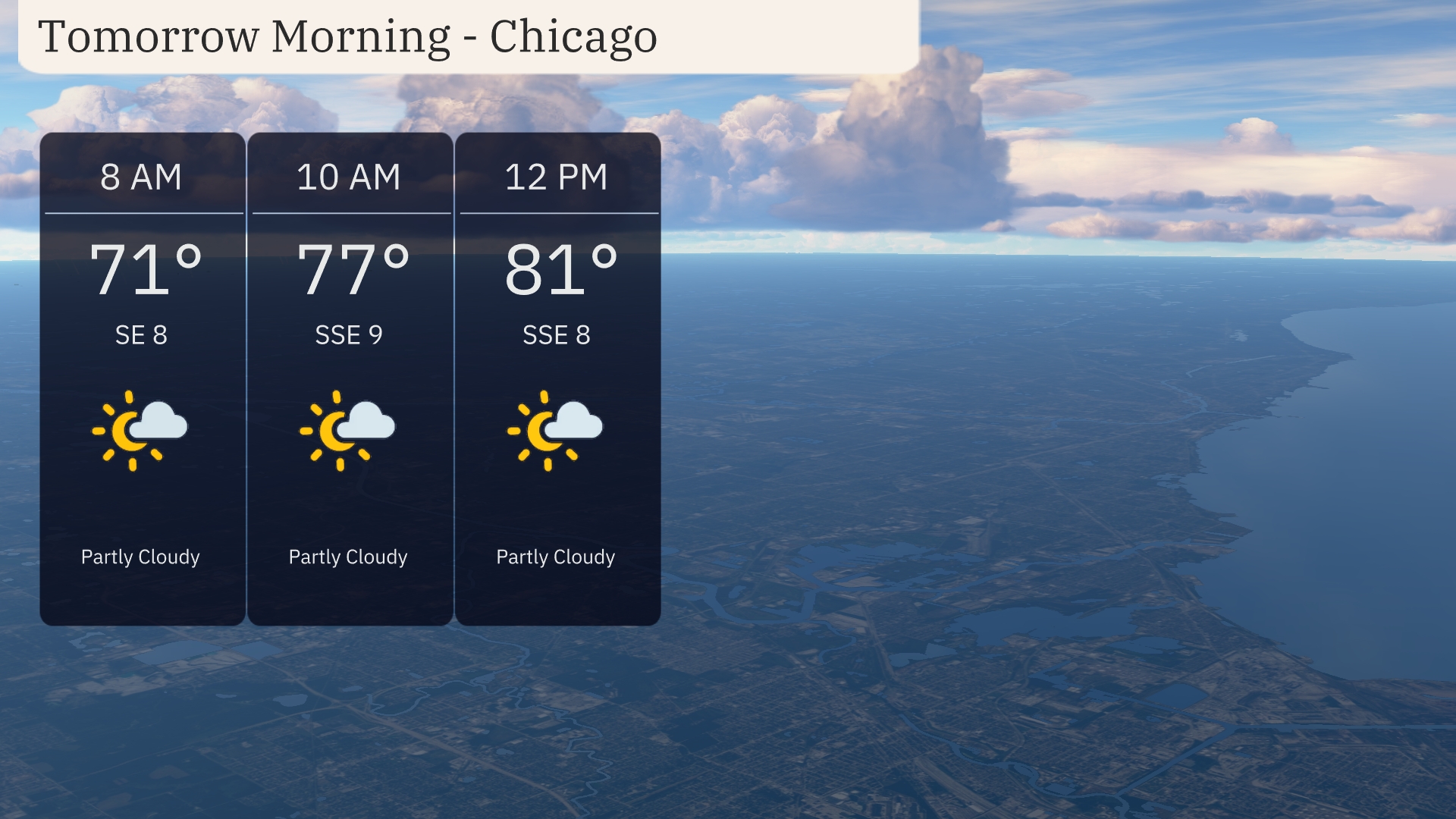
Expect a pleasant start to the morning in Chicago with partly cloudy skies. Temperatures will rise from 71 degrees at 8 AM to 77 degrees by 10 AM, climbing further to 81 degrees by noon. Winds will be light, coming from the south-southeast at around 8 to 9 miles per hour, contributing to a calm start to the day.
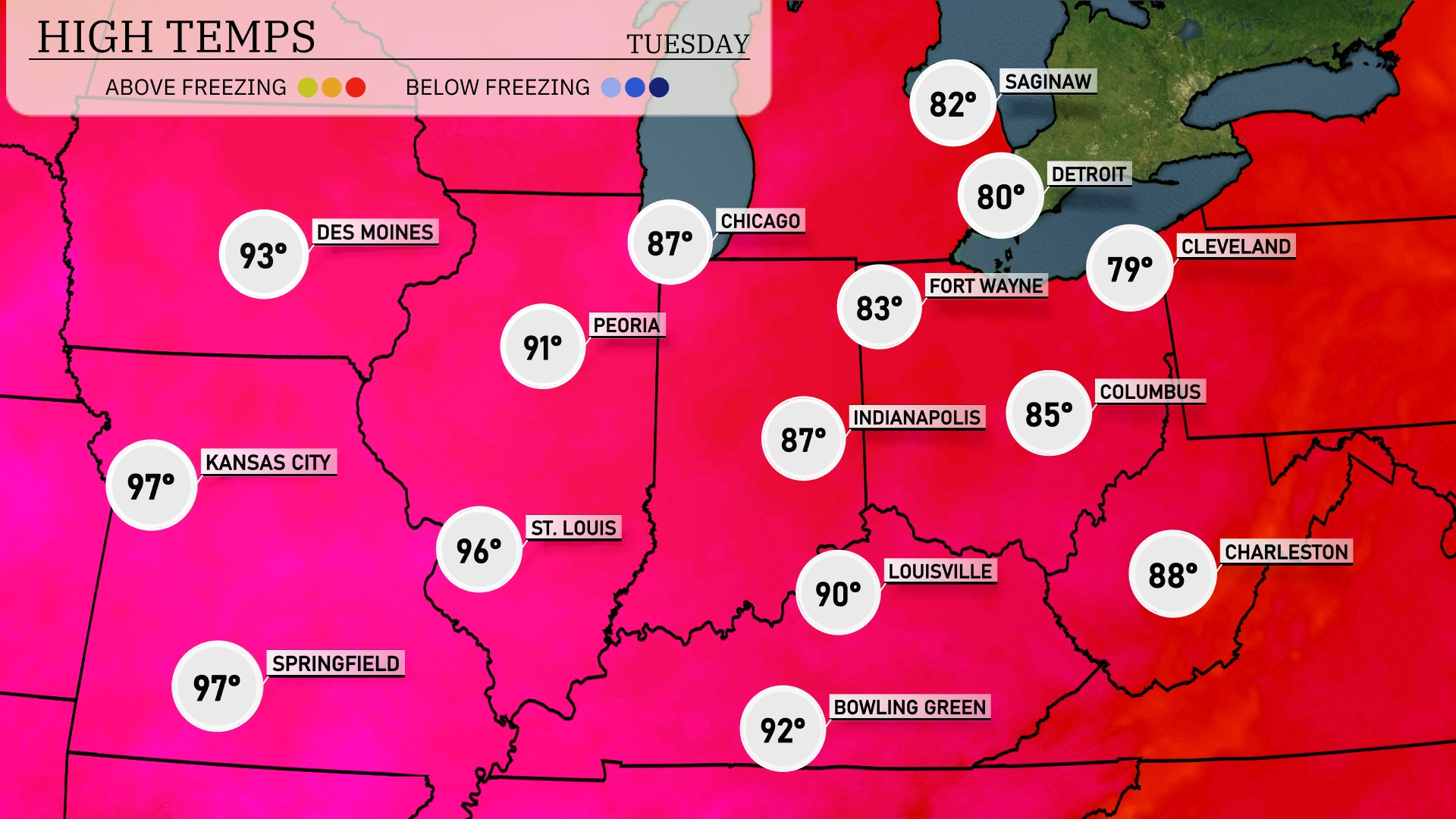
Tomorrow in the Midwest, high temperatures soar with Kansas City and Springfield both reaching 97 degrees. St. Louis is expected to hit 96, while Peoria will see a high of 91. Indianapolis warms up to 87 degrees, and Chicago is forecasted for 87 as well.
A cold front moves through the Midwest late Monday into Tuesday, bringing a round of showers and thunderstorms from Louisville to Indianapolis. Areas from Chicago to Fort Wayne remain mostly dry with mild conditions. Expect localized heavy rainfall and possible strong winds, especially in southern parts near Bowling Green. Temperatures will drop slightly behind the front, offering cooler and clearer conditions by Wednesday. Keep an eye on potential for scattered severe weather in southern Indiana and western Kentucky into Tuesday afternoon.
In Chicago, expect a high UV index of 9 today with a burn time of just 15 minutes, so ensure sunscreen and protective clothing are part of your afternoon plans. Tomorrow, the UV index will moderate to 7, with a burn time of 20 minutes, still requiring precautionary measures for any sun-filled activities. Stay sun-safe out there!
For the 7-day outlook in Chicago:
Monday: Mostly clear skies with a high of 80 degrees and a low of 69 degrees.
Tuesday: Partly cloudy conditions with temperatures reaching 88 degrees for a high and 74 degrees for a low.
Wednesday: Expect partly cloudy skies again with a warm high of 96 degrees and a low of 78 degrees.
Thursday: Scattered thunderstorms on the horizon, with a high of 95 degrees and a low around 76 degrees.
Friday: Thunderstorms continue, bringing the high down to 85 degrees and a low of 73 degrees.
Saturday: Scattered thunderstorms persist with a high temperature of 86 degrees and a nighttime low of 73 degrees.
Sunday: Isolated thunderstorms to end the week, with a high of 91 degrees and a low of 75 degrees.