Atlanta Greets the Day with Sunshine Amidst Southeast’s Sizzling Summer
By
Amy Freeze
Discover how Atlanta's sunny morning unravels into a hot day across the Southeast, with an impending cold front bringing late thunderstorms.
Morning sunshine in Atlanta leads a quiet day across the Southeast, but keep your umbrellas ready as showers from the Gulf are set to deliver a stormy punch by late afternoon!
This Tuesday, Atlanta wakes up to a glowing sun and temperatures around 77°F. As the morning progresses, temperatures will soar across the Southeast, reaching near triple digits in places like Shreveport and Houston. By late afternoon, a cold front from the Gulf will puncture this heat with thunderstorms, threatening heavy rains and potential flooding. Stay tuned and stay prepared for rapid weather changes that could affect your plans.
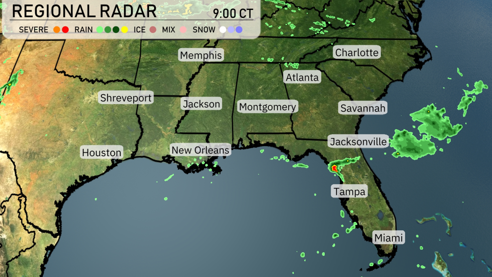
A quiet weather pattern dominates much of the Southeast, but that’s not the case everywhere. Showers are progressing east from the Gulf of Mexico towards Jacksonville, Florida, suggesting potential rain later in the day. Northeast Florida is seeing heavier showers as a line of rain moves inland. Elsewhere, clear skies persist from Atlanta to Houston, making for a bright and sunny day.
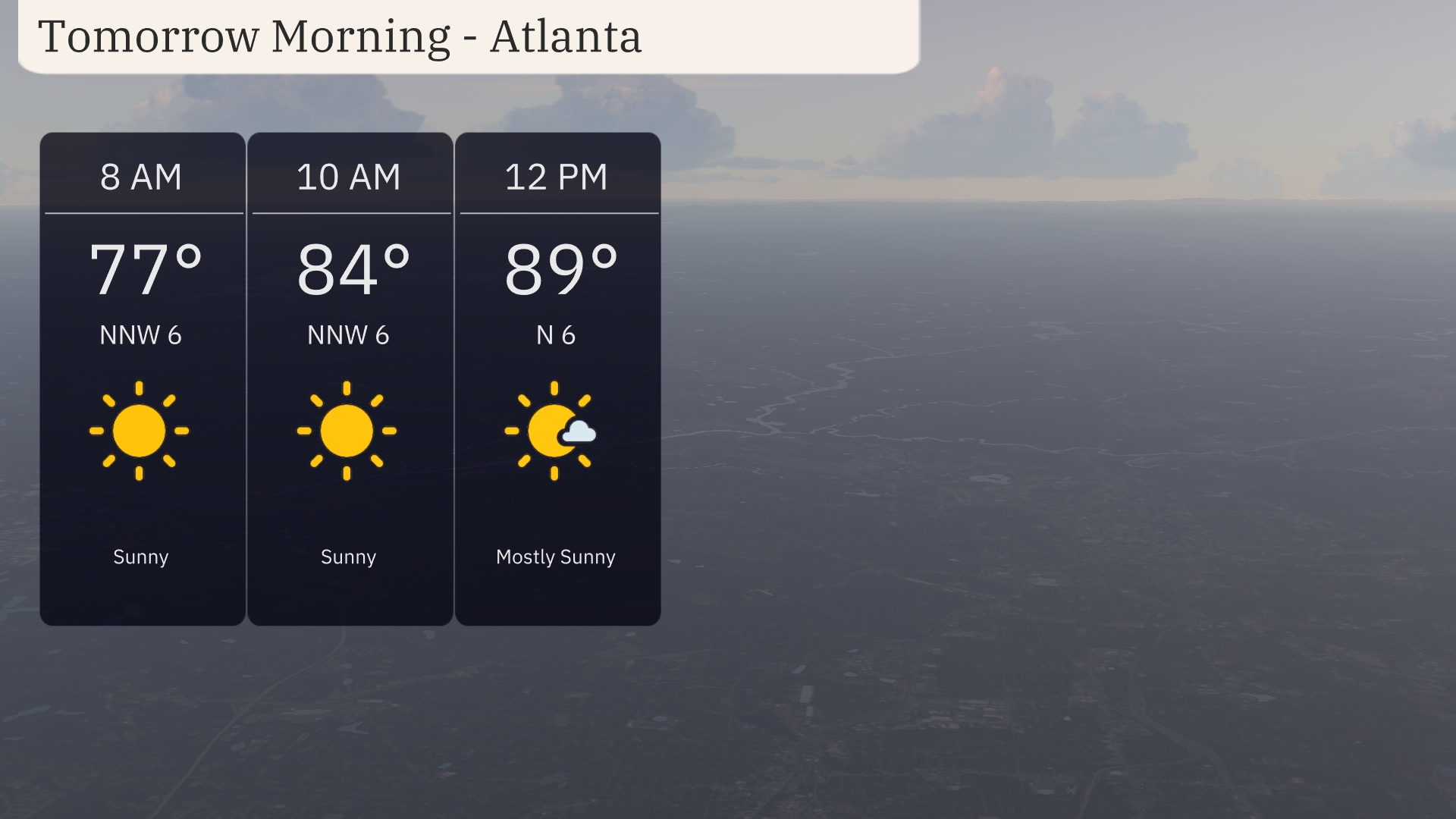
Tomorrow morning in Atlanta will start with sunny skies and temperatures at 77 degrees by 8 AM. A light north-northwest wind at 6 miles per hour will prevail through the morning, offering a refreshing breeze. By 10 AM, temperatures will rise to 84 degrees, maintaining clear and sunny conditions. Expect mostly sunny skies as temperatures climb to 89 degrees by noon, with winds shifting slightly to the north at 6 miles per hour.
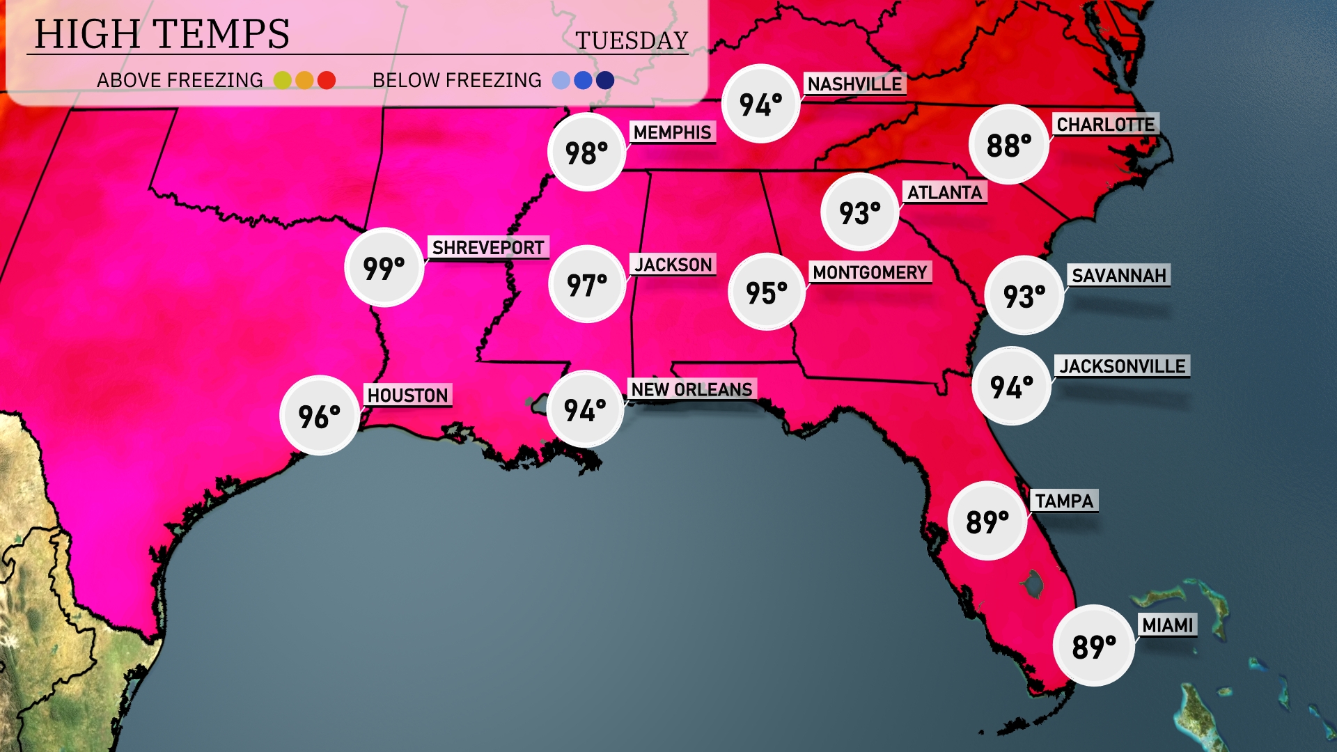
Tomorrow, Memphis is set for a sizzling high of 98 degrees. Shreveport will also see intense heat, with temperatures peaking at 99. In Jackson, the high reaches 97, while New Orleans warms to 94. Montgomery anticipates a notable high of 95 degrees, and Atlanta isn’t far behind at 93. Areas across the Southeast are experiencing above-average temperatures, largely influenced by a dominant ridge of high pressure.
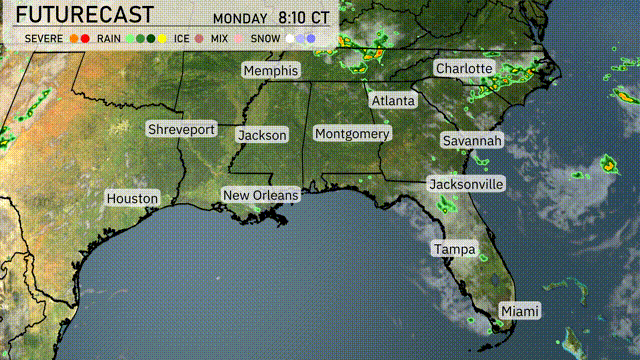
A cold front is set to sweep through the Southeast, bringing thunderstorms from the western Gulf Coast to the Carolinas. Expect heavy downpours and gusty winds starting late afternoon tomorrow, with the potential for localized flooding, especially from New Orleans to Atlanta. Jacksonville and Savannah will see rain and scattered storms by late Tuesday evening. Temperatures will fall behind the front, cooling by 10-15 degrees across most areas into Wednesday. Stay alert for severe weather alerts, particularly in Mississippi and Alabama, as conditions could escalate.
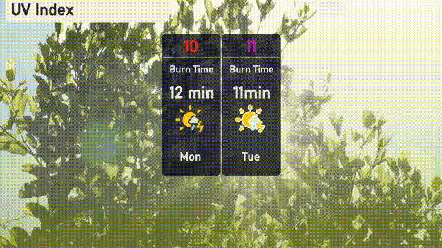
The UV index in Atlanta will be very high on Monday, reaching 10, with a burn time of just 12 minutes in direct sunlight. On Tuesday, an extreme UV index of 11 is forecasted, making sun protection crucial with a rapid burn time of 11 minutes.
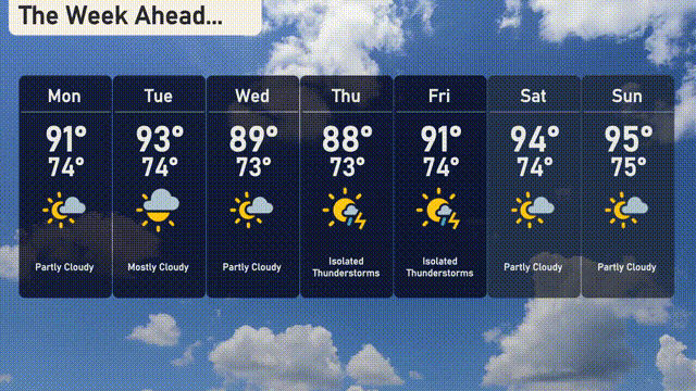
For the 7-day forecast in Atlanta:
Monday: Partly cloudy skies with a high of 91 degrees and a low of 74 degrees.
Tuesday: Expect mostly cloudy conditions with a high of 93 degrees, cooling to 74 overnight.
Wednesday: The day will be partly cloudy, reaching a high of 89 degrees, with the low around 73 degrees.
Thursday: Look out for isolated thunderstorms with temperatures peaking at 88 degrees and dropping to 73 at night.
Friday: More isolated thunderstorms, with the day warming up to 91 degrees and the night cooling to 74 degrees.
Saturday: Partly cloudy again and warming further to a high of 94 degrees, with a low of 74 degrees.
Sunday: Expect more partly cloudy skies, with the temperature hitting a high of 95 degrees and a low of 75 degrees.