Weather Whirlwind: Thunderstorms and Sweltering Heat Hit Atlanta
By
Amy Freeze
A comprehensive look at the volatile weather conditions in Atlanta and across the Southeast, with insights into temperature trends and storm forecasts.
With temperatures soaring and thunderstorms approaching, Atlanta is facing a mix of heat and humidity. Get the latest forecast and safety tips on our blog!
This week in Atlanta and the Southeast, weather patterns are making headlines! With temperatures reaching the mid-90s and a cold front ushering in severe thunderstorms, we’re on a rollercoaster of climatic extremes. From a UV index hitting a high of 10 to expected drops in temperature after the storms, residents should prepare for fluctuating weather. Learn more about what these changes mean for your week and how to stay safe during extreme weather!
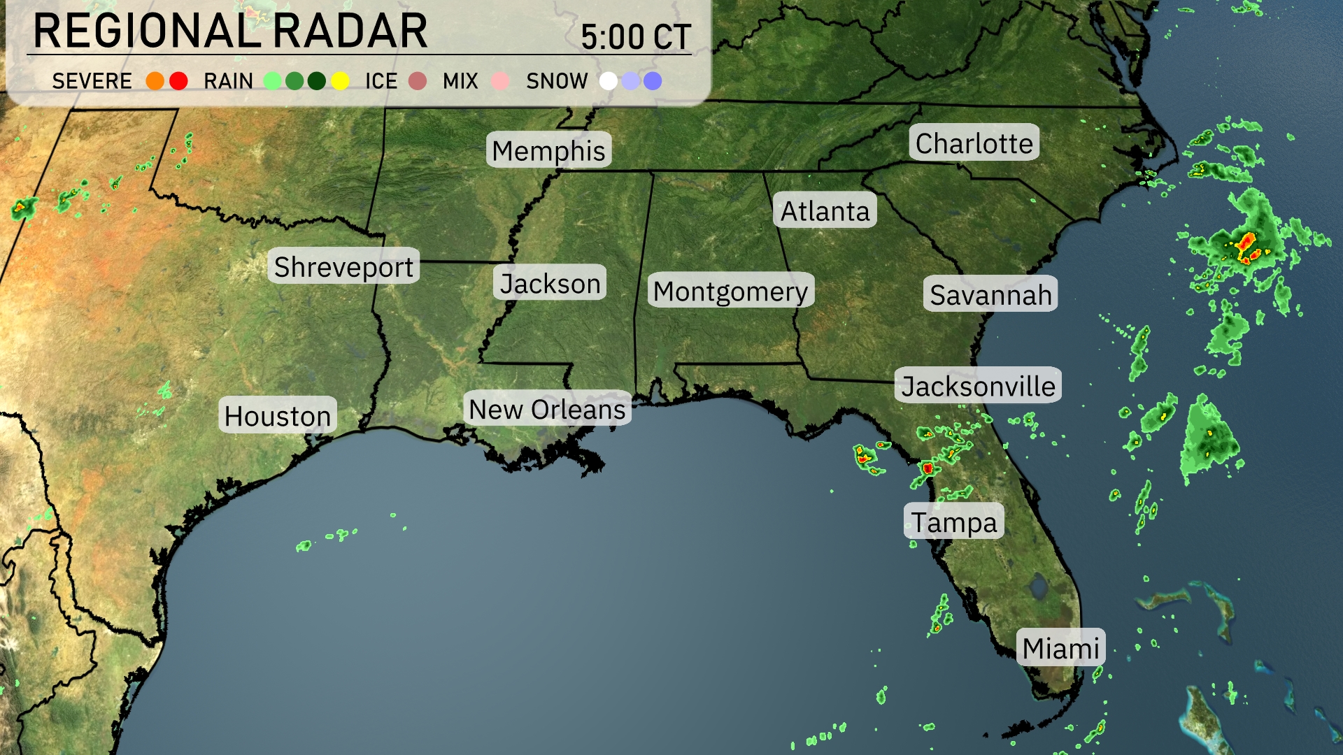
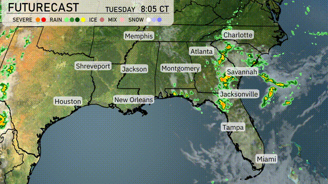
A line of thunderstorms is approaching the coast of northern Florida, with Jacksonville and surrounding areas seeing increased rainfall. Scattered showers are dotting the Gulf Coast near New Orleans, but much of Louisiana remains dry. Memphis to Atlanta enjoys clear skies, offering a break from recent precipitation. However, clouds are building along the coastlines, indicating changes on the horizon for places like Miami and Savannah.
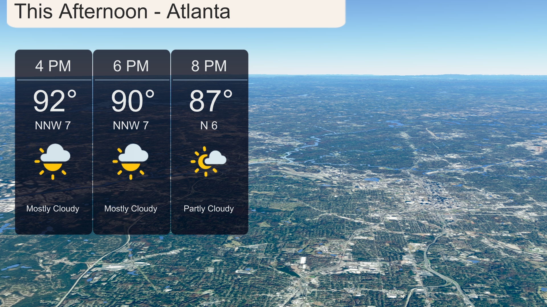
Expect a warm afternoon in Atlanta with temperatures starting at 92 degrees around 4 PM, dipping slightly to 90 degrees by 6 PM. Winds will be coming from the north-northwest at 7 miles per hour, bringing some relief from the heat with mostly cloudy skies. By 8 PM, temperatures will drop to a more comfortable 87 degrees with winds shifting to the north at 6 miles per hour and partly cloudy conditions.
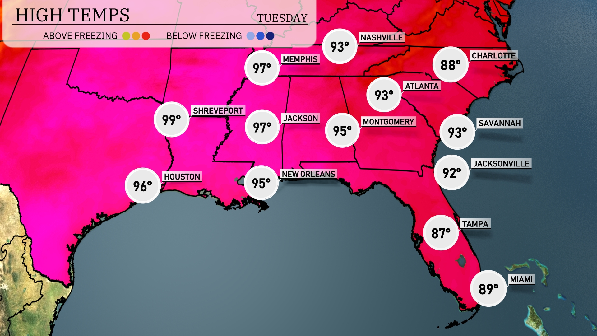
This afternoon, temperatures across the Southeast are soaring. In Shreveport, we’re looking at a high of 99 degrees, while Houston reaches a steamy 96. Jackson won’t be far behind with a high of 97, and New Orleans also warms up to 95 degrees. Montgomery sees a high of 95, contrasting with cooler conditions in Tampa at 87 degrees and Miami at 89. Jacksonville and Savannah both enjoy warm afternoons as they hit 92 and 93 degrees, respectively.
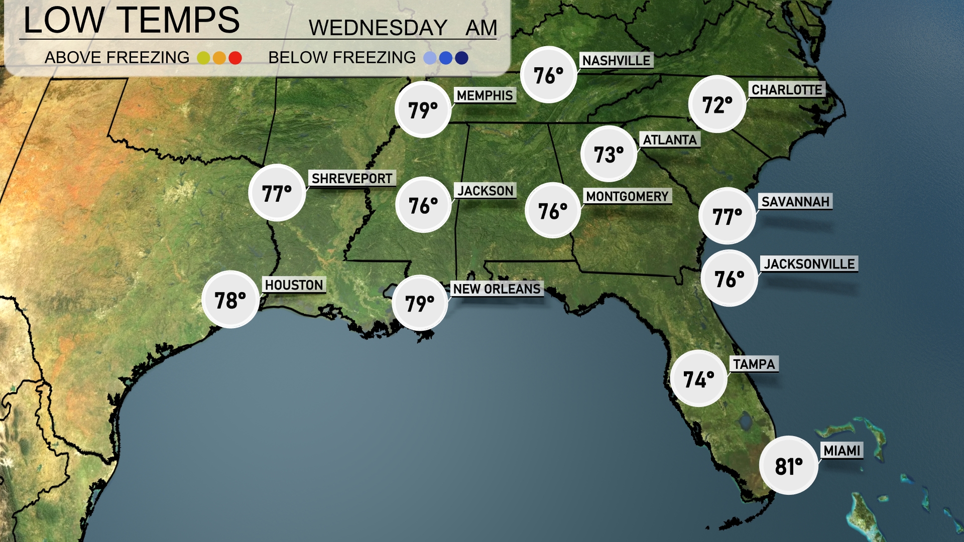
Tonight, Memphis will see a low of 79 degrees. New Orleans will remain warm at 79, while Jackson drops slightly to 76. Expect a cooler night in Atlanta with a low of 73 degrees, and Charlotte will see a comfortable low of 72. Miami stays warm at 81, maintaining the higher temperatures across the Southeast.
Tomorrow, Shreveport will soar to a blistering 101 degrees, while Houston reaches 97. In Jackson, expect a high of 97, and New Orleans will see a warm 93 degrees. Montgomery checks in at 93, while Atlanta warms up to 92 degrees.
A cold front is making its way across the Southeast, impacting areas from Shreveport to Jacksonville. Expect thunderstorms and heavy rain midday on Wednesday, particularly affecting Atlanta and Savannah, where localized flooding is possible due to over an inch of rain. High temperatures will hover in the 70s and low 80s but will drop post-front into the mid-60s. The heaviest storms with potential winds are likely near Montgomery, progressing eastward. As the front clears by Thursday, drier and cooler conditions await the region.
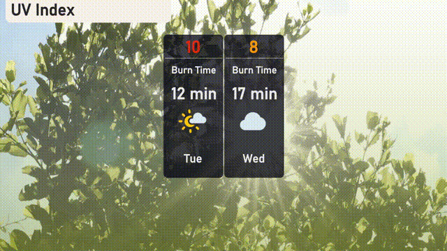
The UV index in Atlanta is very high at 10 today, meaning a burn time of just 12 minutes with direct sun exposure—sunscreen and protective clothing are essential! For Wednesday, the index decreases to 8, shortening the burn time to 17 minutes.