Week of Wonders: Sizzling Temperatures and Stormy Surprises in the Southwest
By
Amy Freeze
Explore the dynamic weather patterns shaping up this week across Salt Lake City and the Southwest, from heat waves to cooling thunderstorms.
This week in Salt Lake City and across the Southwest, temperatures are heating up with a mix of cloud cover and clear skies. Expect varying temperatures with a spike in heat and potential thunderstorms. Get the full weekly forecast here!
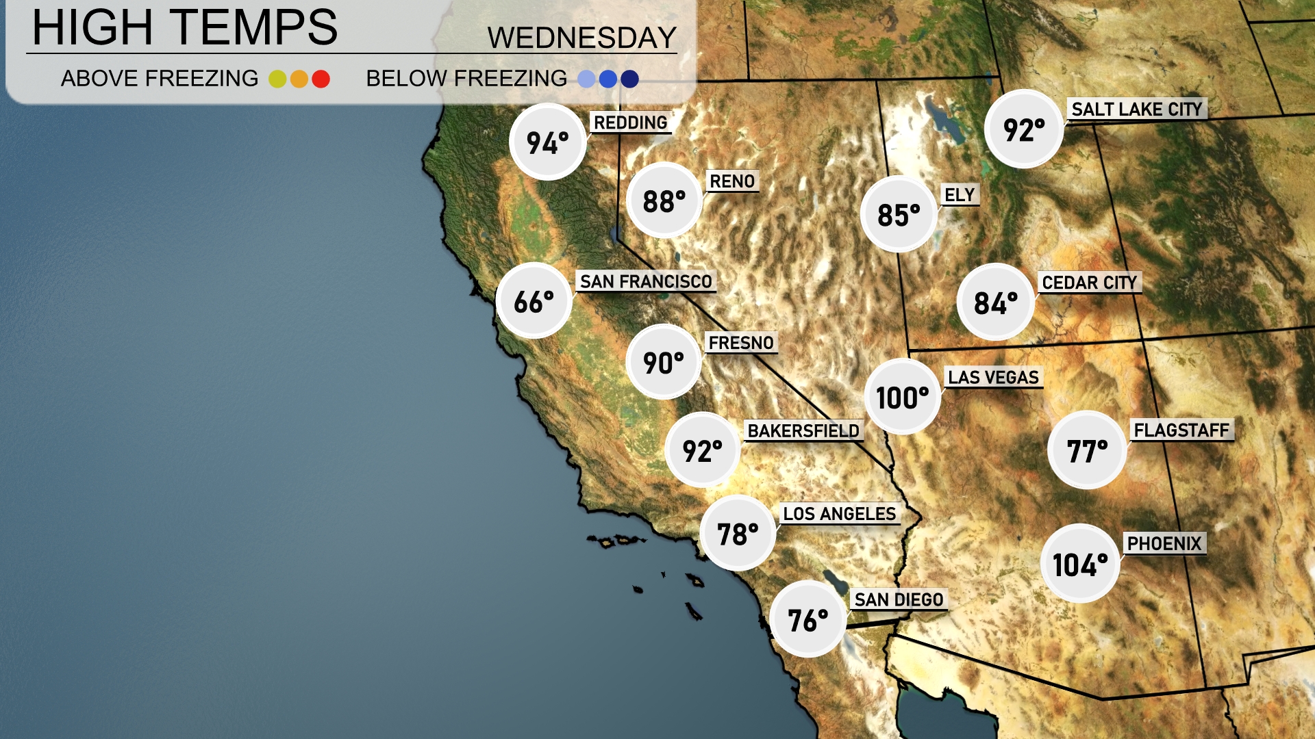
Salt Lake City is set for a week filled with mostly clear skies and rising temperatures up to 100 degrees, while the rest of the Southwest experiences similar warmth with occasional cloudy intervals. The region anticipates a development of scattered thunderstorms starting tomorrow – from the intense sun with a UV index of 9 to gusty winds carrying dust across areas west of El Paso. Dive in for a detailed day-by-day forecast, safety tips amid high temperatures, and what these weather patterns mean for your week ahead.
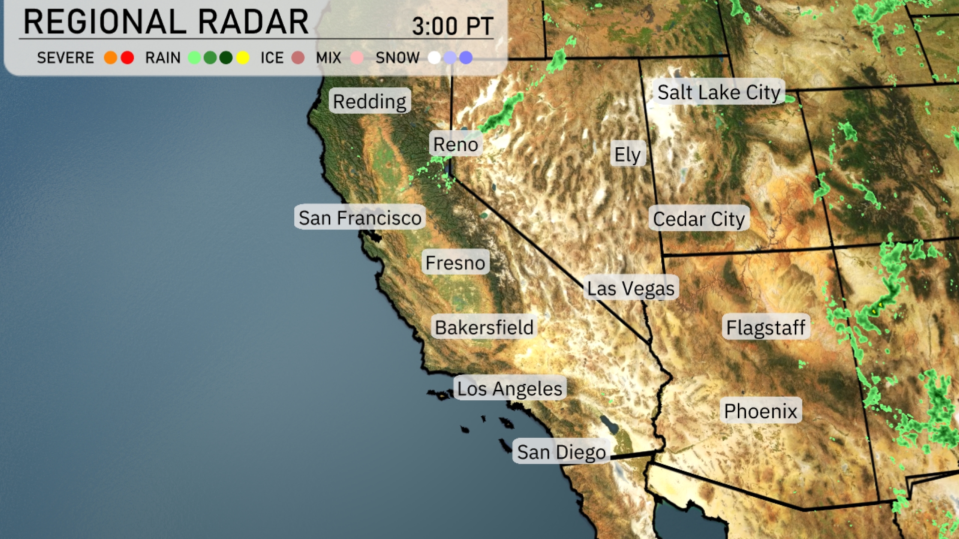
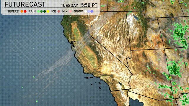
Currently on the Regional Radar, a band of storms is making its way through Nevada, affecting areas like Ely. Reno is experiencing light showers, while parts of southern Utah around Cedar City see isolated rain pockets. The coastal areas of California, including San Francisco and Los Angeles, remain clear with no significant precipitation. In Arizona, Phoenix and Flagstaff are staying mostly dry, contributing to a warm day ahead.
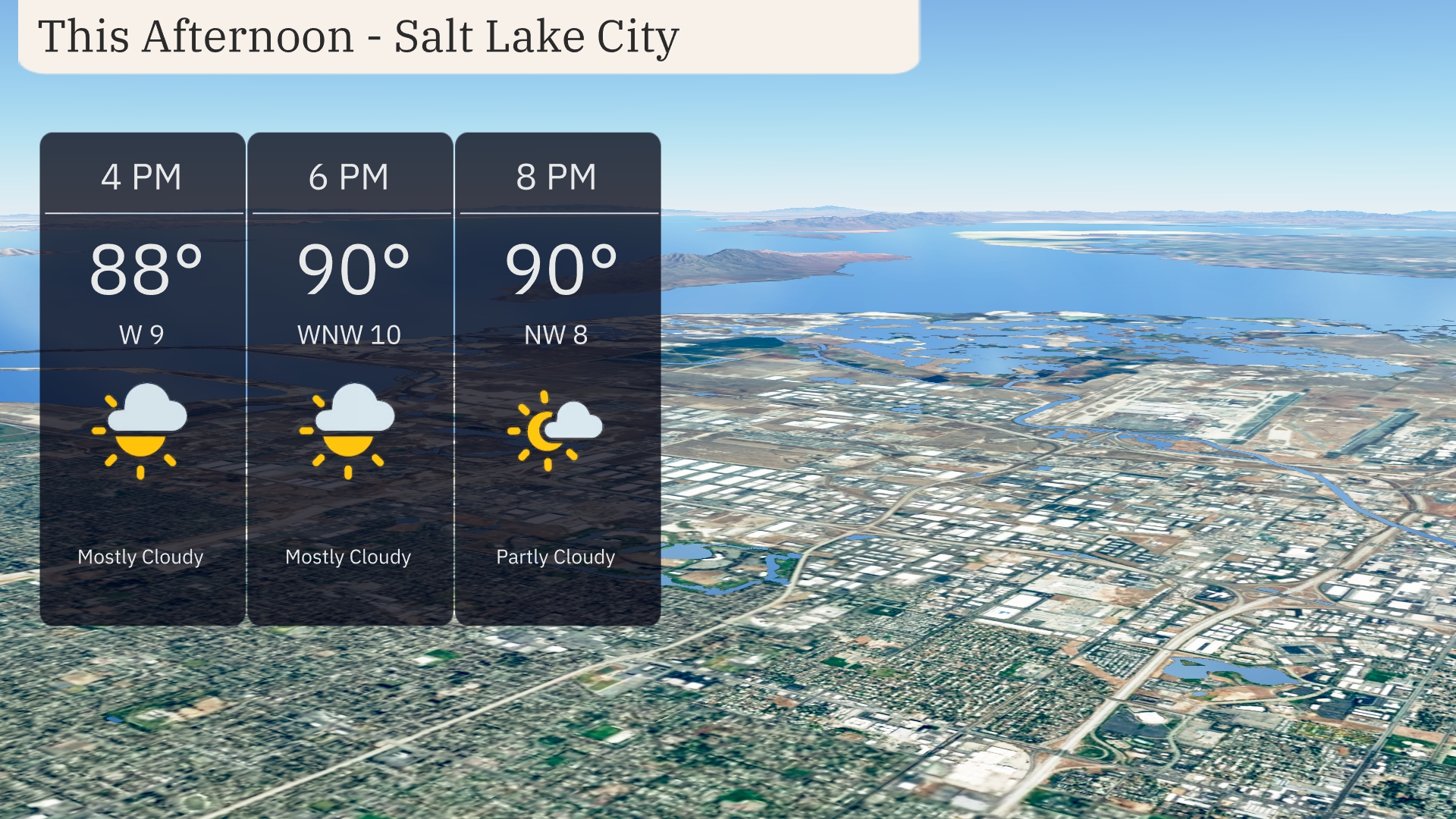
Expect a warm afternoon in Salt Lake City with temperatures reaching up to 90 degrees by 6 PM. Winds will be coming from the west-northwest at 10 mph, providing a subtle breeze. The sky will remain mostly cloudy throughout the afternoon, with a slight clearing toward the evening as clouds start to part.
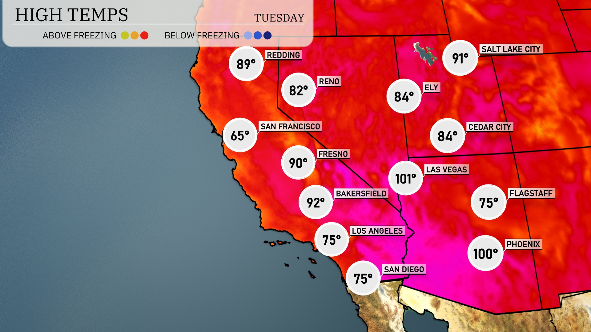
Today’s high temperatures in the Southwest show a mix of contrasts. Las Vegas is heating up with a sizzling high of 101 degrees, while Phoenix isn’t far behind at 100 degrees. In contrast, Flagstaff will remain much cooler with a high of just 75 degrees. Los Angeles experiences a mild afternoon at 75 degrees, while Bakersfield warms up to 92 degrees. Over in Fresno, expect a high of 90 degrees, providing another warm day across the region.
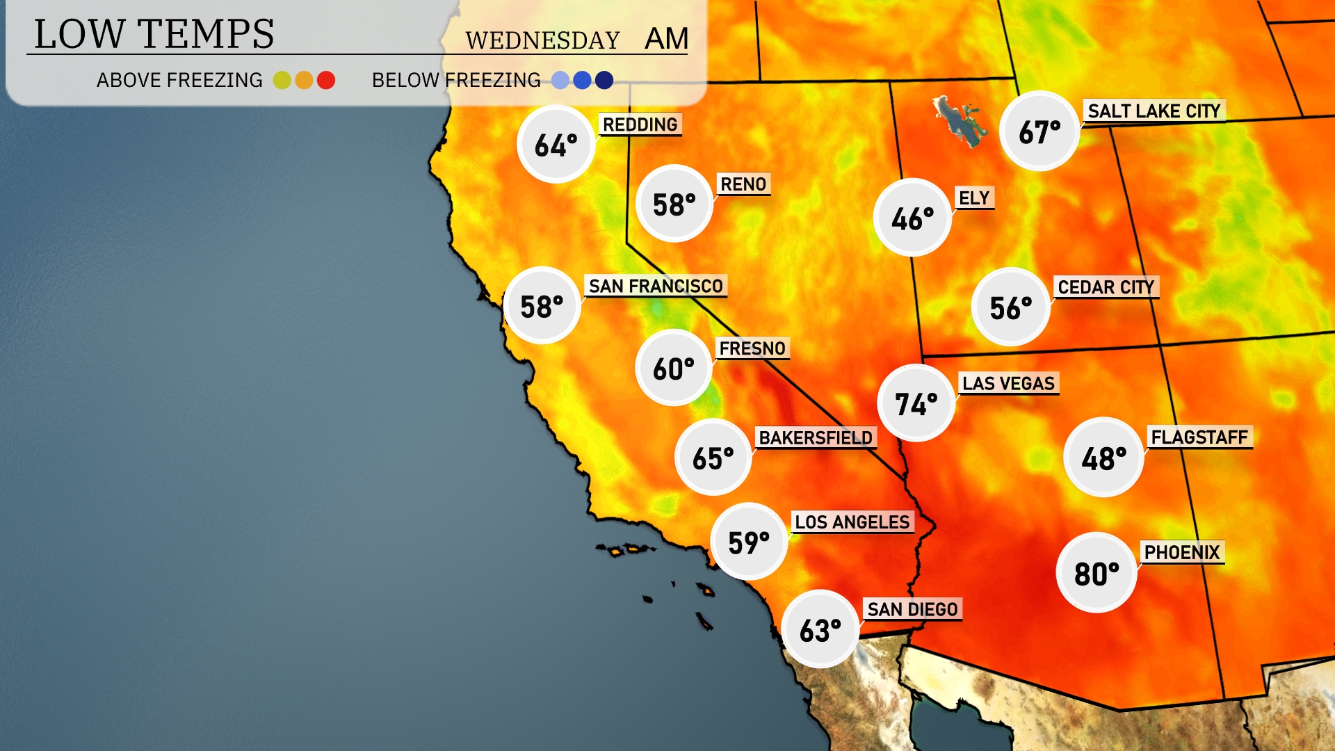
Tonight, temperatures in the Southwest region will drop significantly. Flagstaff can expect a chilly low of 48 degrees, while Las Vegas won’t be far behind at 56. San Francisco will see a low of 58, with Los Angeles even cooler at 59 degrees. Bakersfield will have a low of 65, making for a crisp evening across the region.
Tomorrow in the Southwest, Phoenix is heating up to a scorching 104 degrees. Las Vegas will also feel the heat, reaching 100 degrees, marking a notable spike above average for this time of year. In Bakersfield, temperatures are expected to hit 92 degrees, while Fresno warms up to 90. San Diego will enjoy a milder day at 76 degrees, remaining relatively cooler along the coastal areas.
A developing weather pattern over the Southwest will bring scattered thunderstorms with a risk of localized heavy showers tomorrow. Areas from Phoenix to Tucson should anticipate late afternoon and evening downpours, possibly leading to brief street flooding. Temperatures will hold steady in the mid-90s but expect a slight cooling effect following rainfall events. The region west of El Paso could see increased dust carried by gusty winds accompanying these storms. By Thursday, expect conditions to stabilize with a return to warm, dry weather throughout the area.
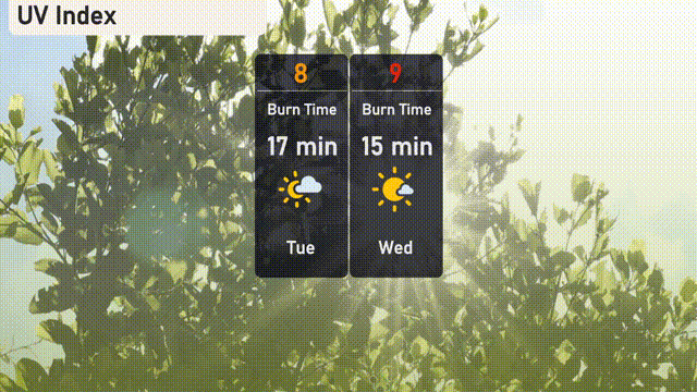
The UV index in Salt Lake City will be very high on Tuesday, reaching an 8, with a burn time of 17 minutes in direct sunlight. Prepare for an even stronger sun on Wednesday, as the index climbs to 9, reducing burn time to just 15 minutes!