Chicago’s Summer Symphony: Sun, Showers, and Storms
By
Amy Freeze
Explore the eclectic weather patterns sweeping through Chicago and the Midwest on July 22, 2025, from soothing sun to spellbinding storms.
Today’s weather in Chicago and the wider Midwest ranges from warm sunny moments to anticipated storms. Stay updated with our full forecast.
On this day, Chicago experiences a complex blend of weather conditions. Starting with partly cloudy skies, temperatures rise pleasantly, setting the stage for a mixed weather scenario across the Midwest. With storm alerts and high UV levels, here’s how to stay safe and enjoy the day despite the dramatic weather shifts. Ensure you’re prepared for outdoor activities with appropriate sun protection. For a detailed 7-day outlook, head to our blog.
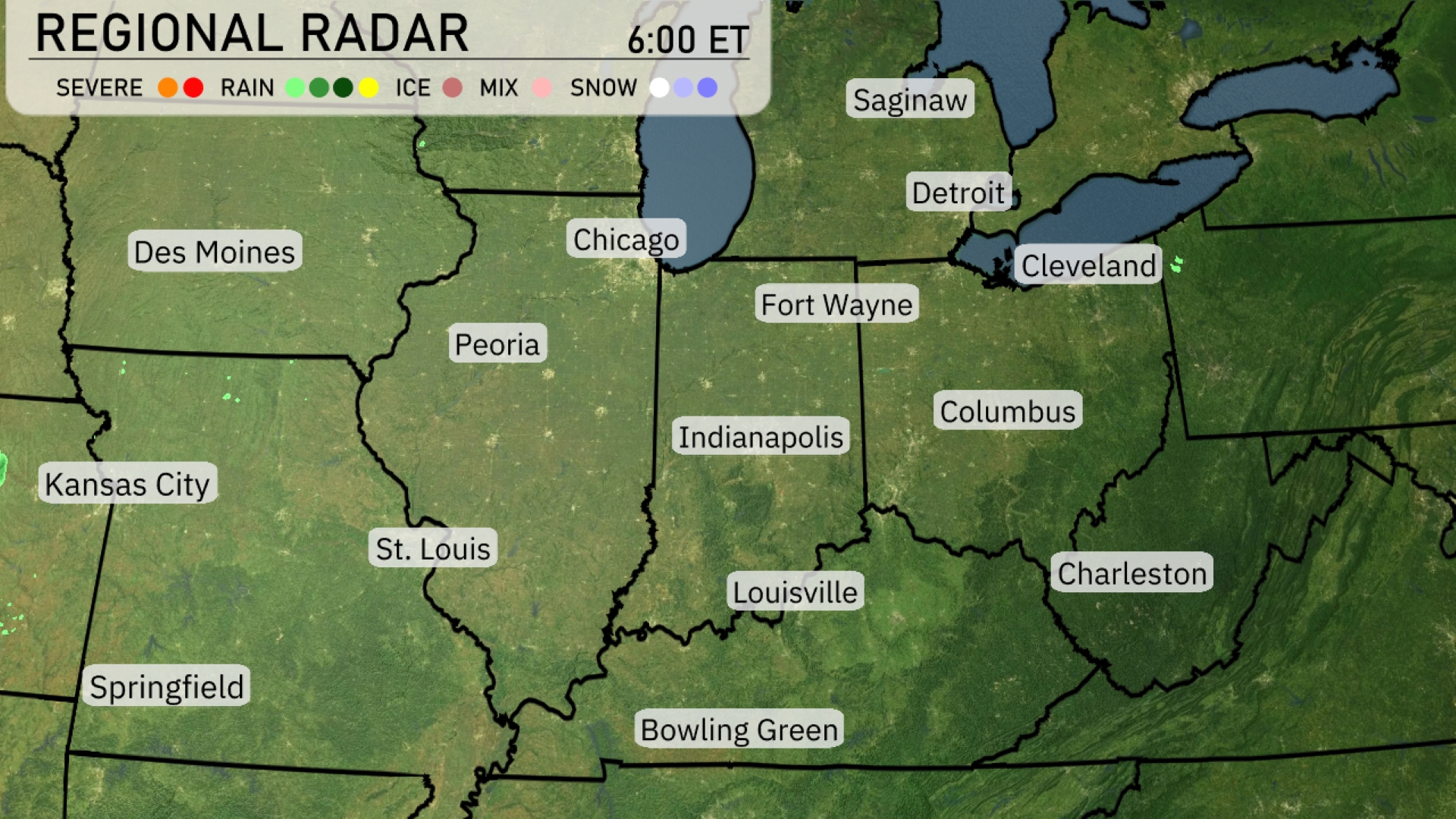
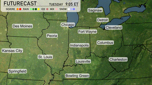
A band of rain is sweeping across the lower Midwest, with showers moving through Springfield and heading towards St. Louis. Peoria is experiencing scattered showers, while areas like Des Moines remain dry under partly cloudy skies. Fort Wayne and Indianapolis are in the path of incoming rain, which could bring brief downpours. Meanwhile, clear conditions are observed around Cleveland and Detroit.
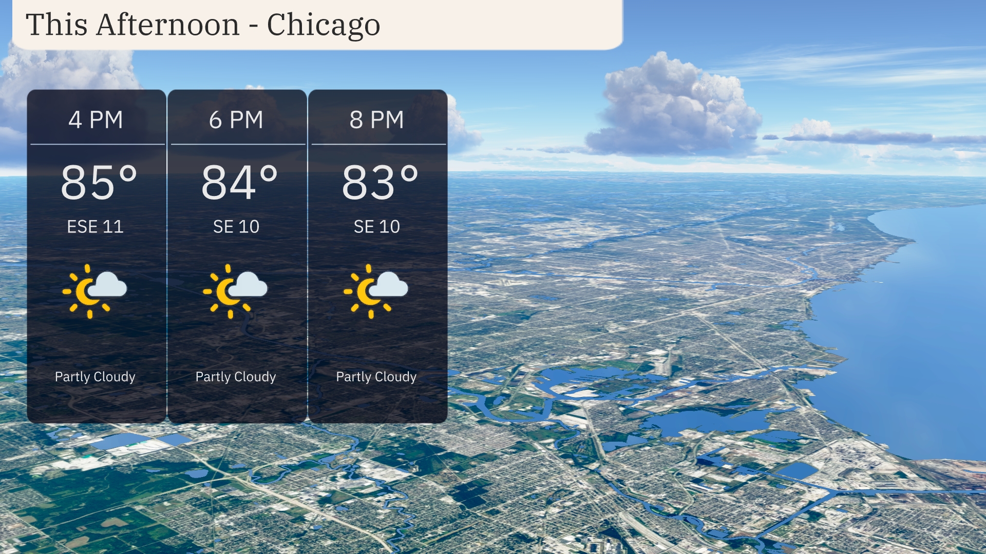
This afternoon in Chicago, temperatures will be warming up to 85 degrees by 4 PM, with a slight decrease to 84 degrees by 6 PM, and further cooling to 83 degrees by 8 PM. Expect partly cloudy skies with a consistent southeast wind blowing at 11 miles per hour initially, reducing slightly to 10 miles per hour later on. A pleasant afternoon for outdoor activities, with the sun peeking through the clouds at times.
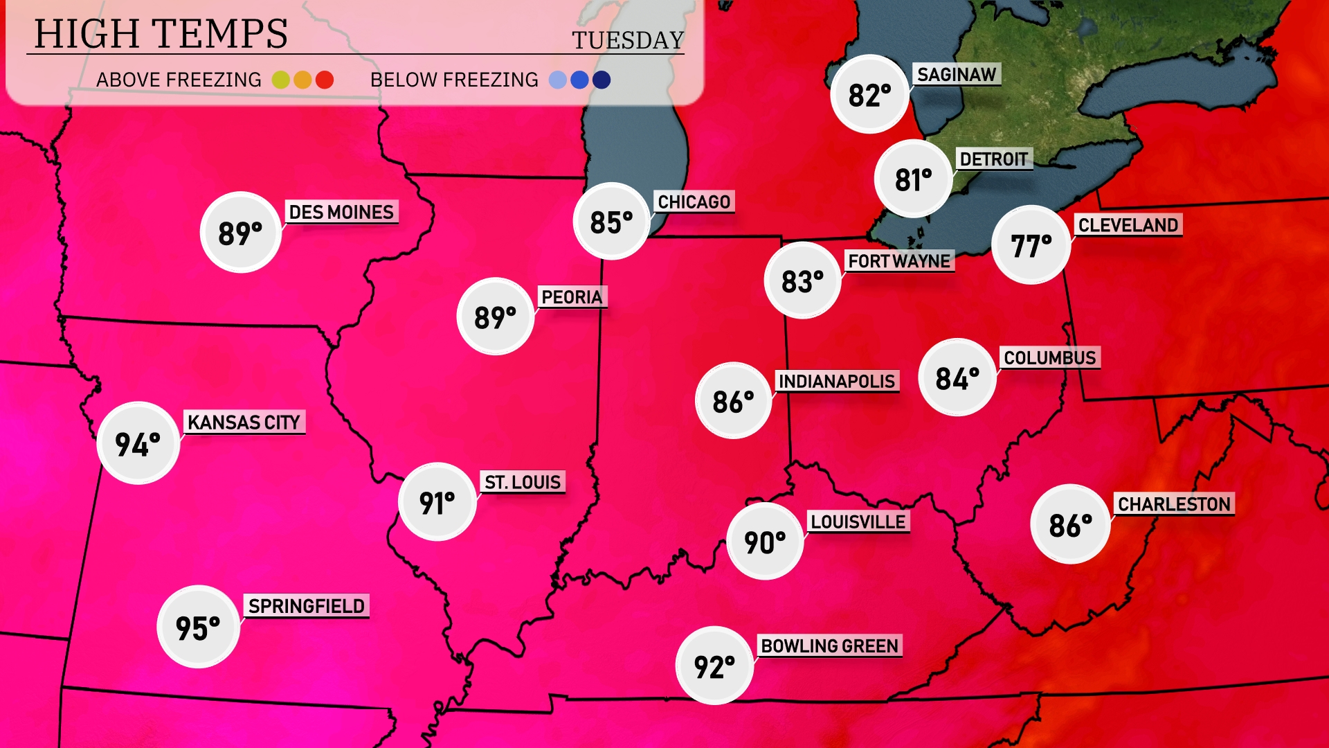
Today, the Midwest is experiencing a range of warm temperatures. Kansas City is reaching a sizzling 94 degrees, while Springfield isn’t far behind at 95. In the north, Peoria will see a high of 89, and just a bit warmer, St. Louis is forecasted to hit 91. The Great Lakes are cooler, with Chicago expecting a high of 85 and Fort Wayne at 83, showcasing that classic regional temperature contrast. In the Ohio Valley, Louisville warms up to 90 degrees, and Indianapolis settles at 86.
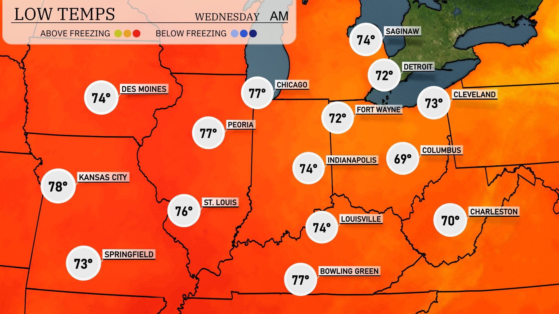
Tonight, temperatures in the Midwest are expected to remain warm, with Kansas City at 78 degrees and St. Louis close behind at 76. Chicago will see a low of 77 degrees, while Indianapolis is projected to drop slightly to 74. Columbus is looking at a cooler 69 degrees, making it the chillier spot among major cities this evening.
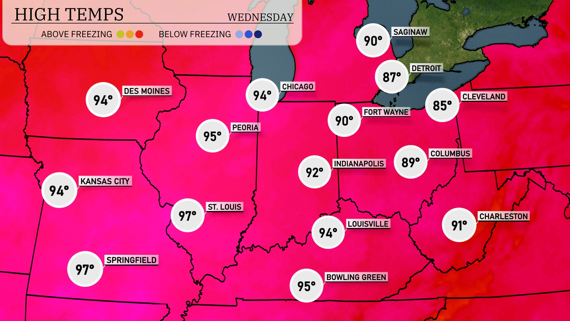
Tomorrow, high temperatures in the Midwest will reach impressive levels, with St. Louis topping out at 97 degrees, closely followed by Springfield at 97 and Peoria at 95. Kansas City and Chicago will both see highs around 94 degrees, while Indianapolis will hit 92. Notably, temperatures are well above average for this time of year due to a warm front sweeping through the region. Expect a mix of sunshine and scattered clouds, contributing to this summer heatwave.
A strong cold front is pushing across the Midwest with an active weather pattern. Expect showers and scattered thunderstorms to develop from Kansas City through St. Louis, with the potential for heavy rainfall and wind gusts. The system will continue its journey toward Fort Wayne, influencing weather with a mix of rain and thunderstorms. Watch for severe weather risks, particularly in the afternoon and evening hours across Indianapolis and Louisville. Behind the front, cooler and drier air will settle in, offering a brief reprieve before the next system approaches.
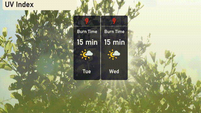
The UV index in Chicago is expected to be very high at 9 both today and tomorrow, with a burn time of just 15 minutes in direct sunlight. Make sure to apply sunscreen frequently and wear a hat and sunglasses if you’re spending time outdoors! Stay sun safe!