Weather Watch: Miami’s Weekly Forecast from Sunny Spells to Storm Warnings
By
Amy Freeze
Explore a comprehensive update on Miami's weather for the upcoming week - from hot highs to stormy skies. Keep ahead with our daily insights.
Catch up on what’s coming this week in Miami – from temperatures pushing the 90s to thunderstorms that may require you to alter your daily plans. Stay safe and informed with our latest weather insights!
This week in Miami presents a mixed bag of weather conditions, from hot sunny days to looming thunderstorms. As we examine day-to-day scenarios, one thing remains constant – the need to stay prepared. With a UV index hitting extreme levels and temperatures fluctuating, it’s crucial for Miamians and visitors alike to plan accordingly. Whether you’re scheduling outdoor activities or plotting your commute, our detailed weather report has you covered from today’s sun to tomorrow’s storms.
A line of storms is currently draped across northern Florida, extending from Jacksonville down to Tampa, where heavy rain and potential severe weather conditions are developing. Meanwhile, the Gulf Coast from Houston to New Orleans is seeing scattered showers moving eastward, potentially reaching Montgomery and Atlanta later in the day. Clearer skies persist over areas like Memphis, but as clouds build, the Carolinas should brace for possible incoming precipitation.
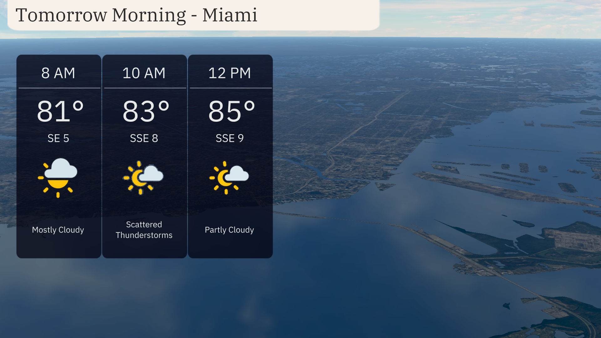
Tomorrow morning in Miami starts mostly cloudy with temperatures around 81 degrees at 8 AM and a southeast wind at 5 mph. By 10 AM, temperatures reach 83 degrees with scattered thunderstorms and a south-southeast wind at 8 mph. The morning wraps up with partly cloudy skies at noon, temperatures rising to 85 degrees, and winds from the south-southeast at 9 mph.
Tomorrow, Shreveport will hit a sizzling 101 degrees, making it one of the hottest spots in the Southeast. Memphis follows closely with a high of 99 degrees, while Jackson can expect a warm 97 degrees. Atlanta is forecasted to reach 92 degrees, with Montgomery at a comfortable 93. Coastal areas like Jacksonville and Miami will see highs around 88 and 86 degrees, respectively, as humidity starts to build in the region. Expect below-average temperatures in Savannah, with a high of only 86 degrees.
For tomorrow in the Southeast, a cold front brings an active weather pattern starting early, with thunderstorms from New Orleans to Montgomery. Heavy rain and scattered storms are likely throughout Georgia, with impacts peaking during the morning commute around Atlanta and further into Jacksonville. Expect rainfall amounts potentially exceeding an inch, raising flooding concerns especially in urban areas. As the system progresses, cooler and drier air will filter in, marking a noticeable temperature drop by Wednesday night. Severe weather risk is moderate; stay alert for possible alerts from the N-W-S.
In Miami, today’s UV index is extreme at 10, with a burn time of approximately 12 minutes under direct sunlight. On Wednesday, be extra cautious as the index rises to 11, shortening the burn time to just 11 minutes. Remember to wear sunscreen, seek shade, and limit sun exposure during peak hours!
For the Miami 7-day forecast:
Tuesday: Watch out for thunderstorms early with temperatures reaching a high of 90 degrees and a low of 79.
Wednesday: Partly cloudy skies with a comfortable high of 88 degrees and a low of 81.
Thursday: The day brings partly cloudy conditions and a high around 88 degrees, dipping to 82 at night.
Friday: Expect partly cloudy skies with a high of 89 degrees and a low of 81.
Saturday: Enjoy mostly clear skies with a high of 90 degrees and a low of 80.
Sunday: The weather continues with mostly clear conditions, high of 90 degrees and low of 80.
Monday: Wrapping up the week with mostly clear skies, temperatures peaking at 88 degrees and a low of 80.
Stay safe and enjoy the week ahead!