Austin’s Dynamic Skies: A Week of Sun, Clouds, and Storms
By
Amy Freeze
Explore a comprehensive review of Austin's weather for the upcoming week, from partly cloudy afternoons to expected severe storms.
This week presents a dynamic weather pattern over Austin and the Southern Plains, featuring partly cloudy skies and severe storm possibilities!
An immersive guide to Austin’s weather for the upcoming week, detailing the transition from partly cloudy skies to potential severe storms. We cover daily temperature shifts, storm forecasts, and safety tips to navigate the dynamic Southern Plains weather.
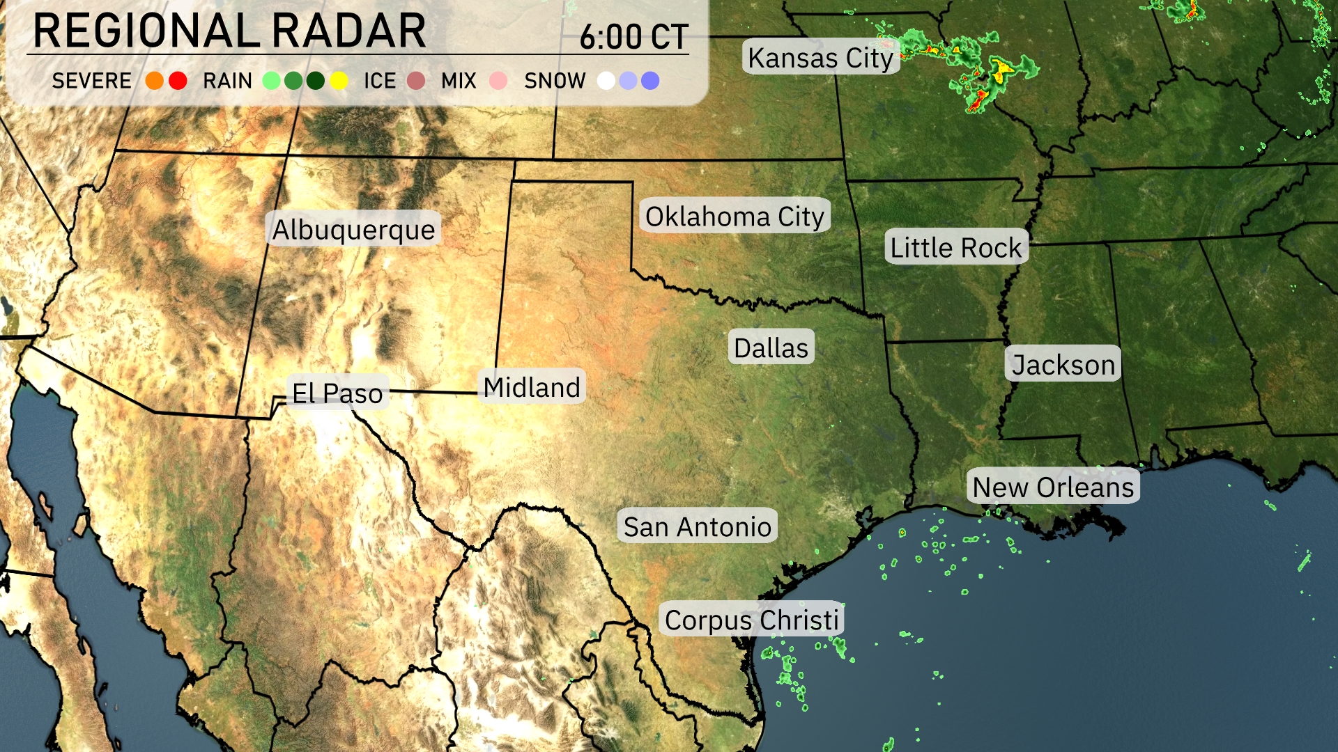
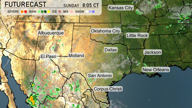
Across the Southern Plains, the radar reveals scattered severe storms near Kansas City, extending northeastward. Oklahoma City enjoys clear skies, while Dallas experiences minor cloud cover without any precipitation. In southern Texas, around San Antonio and Corpus Christi, isolated showers are present but not intense enough for major disruption. The lower Mississippi Delta, including areas around Little Rock and Jackson, is experiencing calm weather with widespread cloud-free conditions.
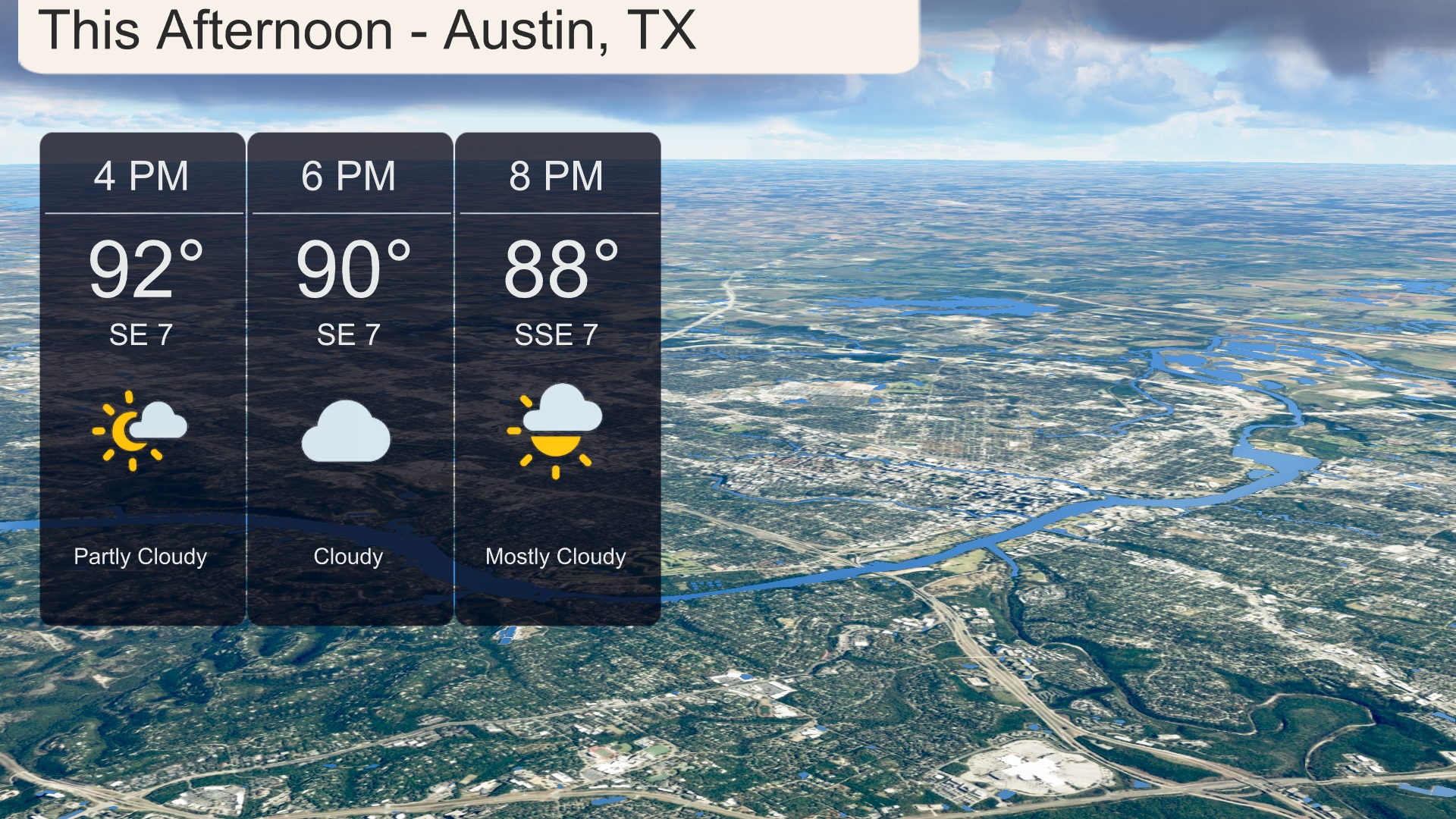
This afternoon in Austin, expect partly cloudy skies transitioning to cloudy by 6 PM. Temperatures will start at 92 degrees and gradually cool to 88 degrees by 8 PM. A steady southeast wind of 7 miles per hour will add a gentle breeze to the air.
Today in the Southern Plains, we see some steamy conditions. El Paso is sizzling with a high of 99 degrees, while Midland will reach 93. In San Antonio, expect a warm afternoon with a high of 95 degrees. Dallas is a bit cooler today, topping out at 97, whereas Corpus Christi will be more moderate at 92 degrees. The varying temperatures reflect the ongoing summer heat, with some areas experiencing lighter breezes and higher humidity levels.
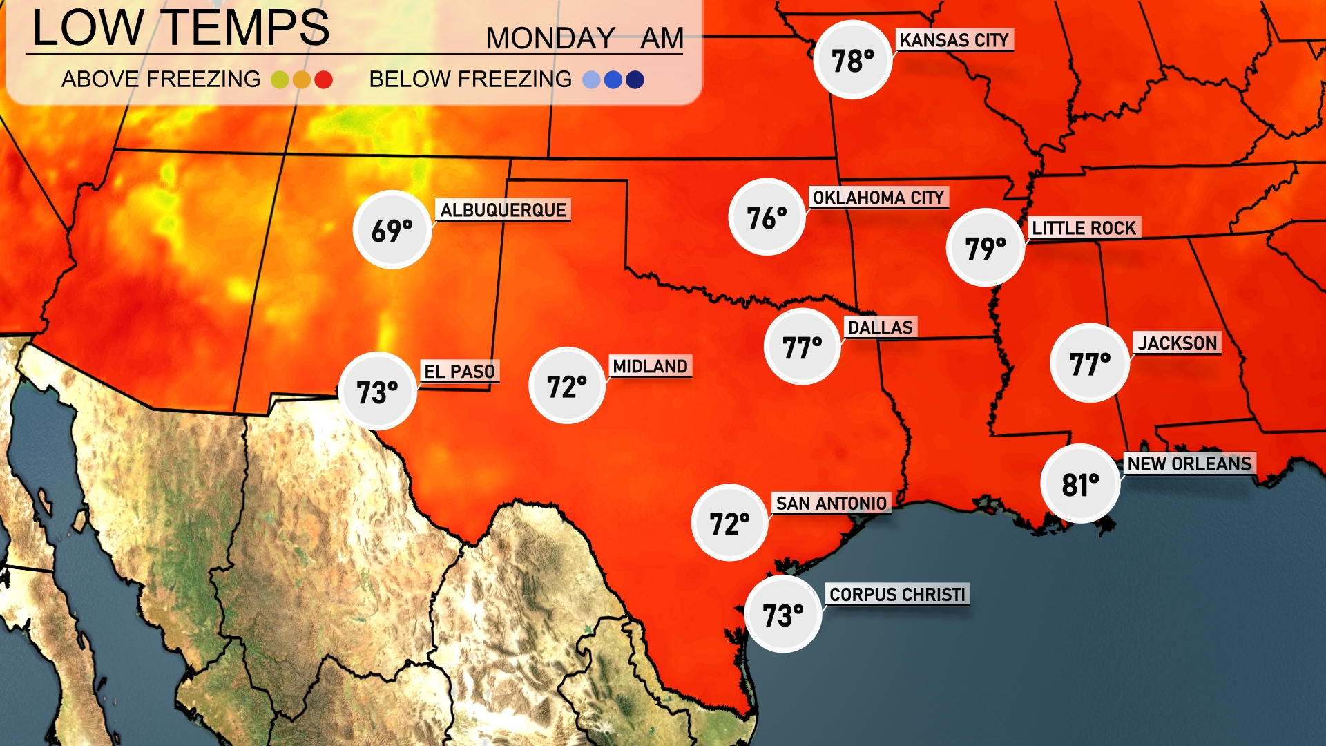
Tonight, temperatures in the Southern Plains will be quite mild with lows hovering around 72 degrees in San Antonio and Midland. El Paso will see a cooler night at 69 degrees. Dallas is expected to drop to 77 degrees while Oklahoma City will maintain a steady 76. Expect a slightly warmer low of 81 degrees in New Orleans, keeping those southern areas quite balmy for the night.
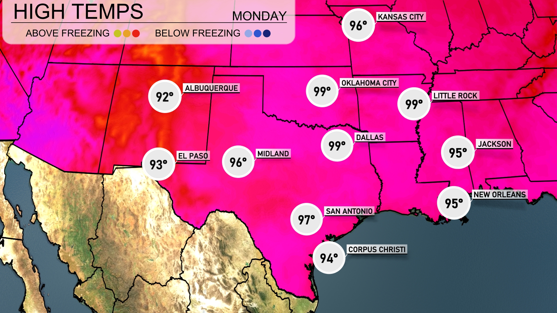
Tomorrow in the Southern Plains, prepare for scorching temperatures. Dallas is set to reach a high of 99 degrees, while Midland isn’t far behind at 96. El Paso will see a warm high of 93 degrees, and San Antonio will hit 97. Little Rock is also expected to warm up to 99 degrees, pushing into above-average territory for this time of year. These high temperatures are influenced by a strong high-pressure system dominating the region, leading to clear skies and abundant sunshine.
Thunderstorms are expected to move through the Southern Plains, impacting regions from Oklahoma City to Corpus Christi through the next 24 to 48 hours. The storms could intensify with the approaching cold front, raising the potential for severe weather, including damaging winds and heavy rainfall, particularly in eastern Texas and southeastern Oklahoma. Rainfall totals could exceed an inch in some areas, which may lead to localized flooding concerns. Temperatures will initially remain warm before cooling slightly after the frontal passage.
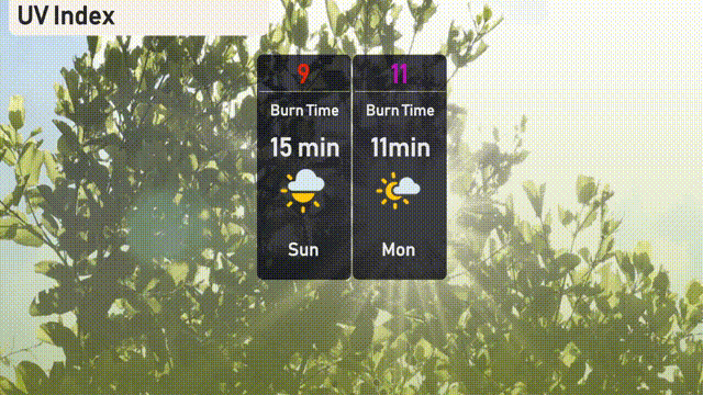
The UV index in Austin will be very high at 9 on Sunday, with a swift burn time of 15 minutes under direct sunlight. As we move into Monday, expect an extreme level of 11, reducing the burn time to just 11 minutes.