NYC Heatwave to Flash Floods: A Complete Look at This Week’s Weather
By
Amy Freeze
From sweltering highs near 100°F to cooling rains, here’s what you need to know about the dynamic weather changes affecting NYC and the Northeast this week.
This week in NYC: soaring temperatures followed by needed rains. Stay informed with our latest forecast.
As New York and its surrounding regions brace for another week of temperature extremes, here’s a detailed breakdown of the weather patterns from heatwaves peaking at 98°F to a cooling front promising widespread rains and potential urban flash floods. Understand the impacts, prepare for quick weather changes, and stay safe with our comprehensive guide.
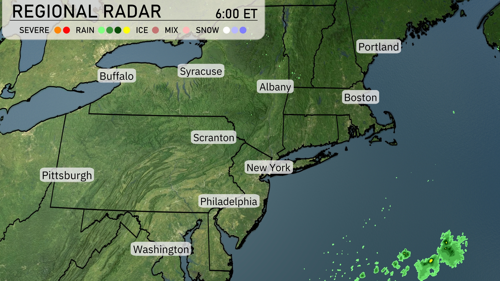
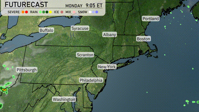
Across the Northeast, the regional radar is showing clear conditions with no precipitation currently observed. Areas like Boston, New York, and Philadelphia are experiencing dry weather with no significant cloud cover. To the east of the region, offshore over the Atlantic, there’s a small area of rain, but it’s not impacting any land at this time.
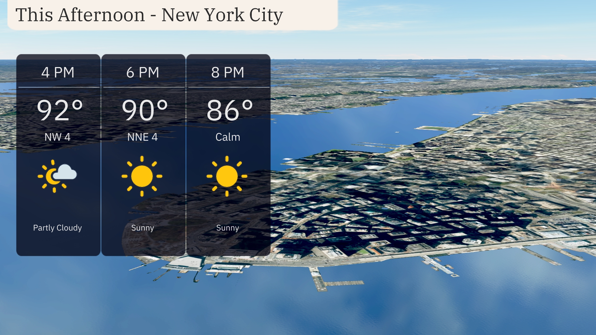
In New York City, this afternoon brings partly cloudy skies with temperatures soaring to 92 degrees by 4 PM and a northwest wind at 4 mph. As we move into the evening, expect clear sunny skies with temperatures slightly dropping to 90 degrees at 6 PM with a gentle north-northeast breeze at 4 mph. By 8 PM, conditions remain sunny and calm with temperatures at 86 degrees.
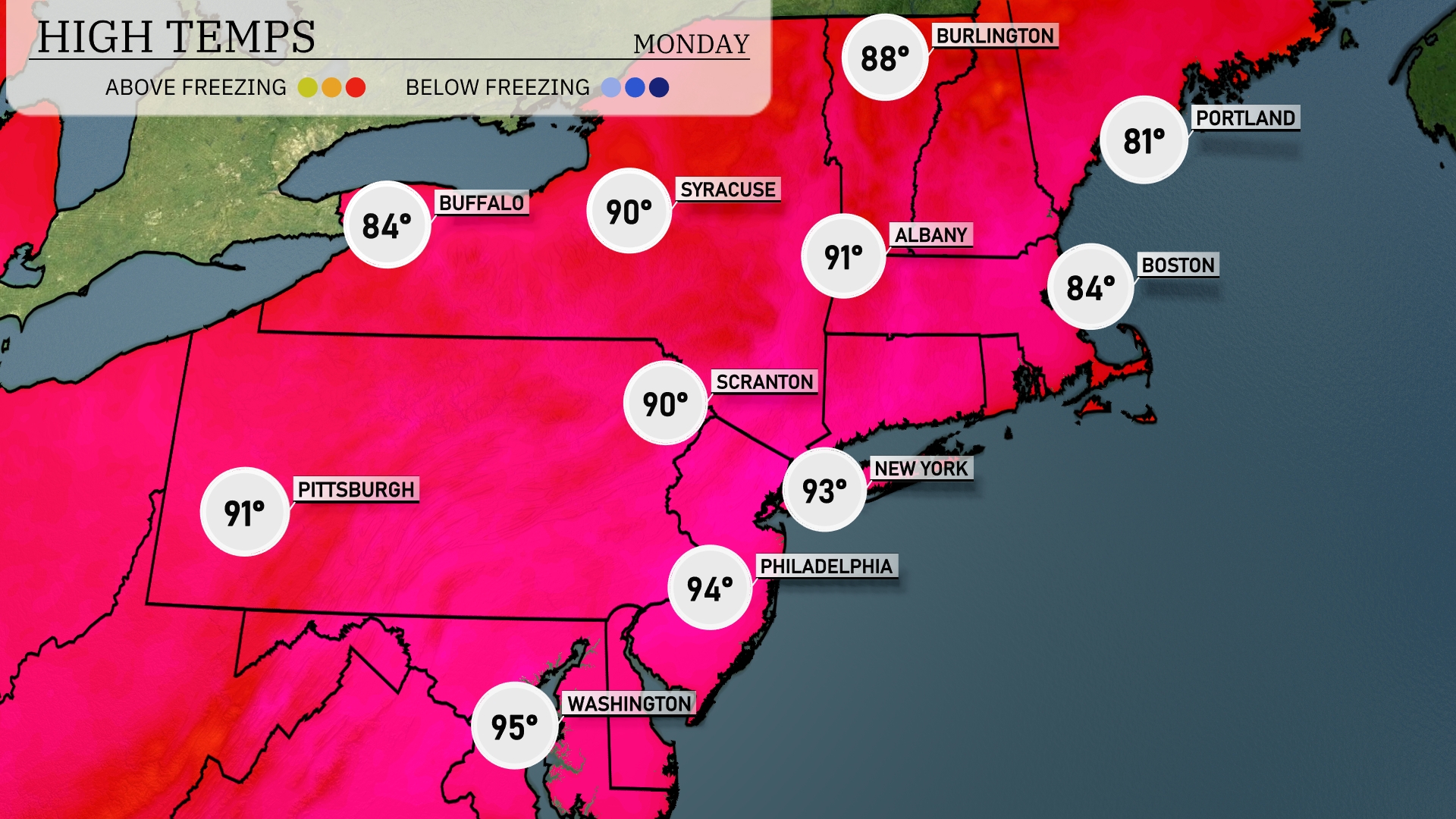
Today’s regional high temperatures in the Northeast are shaping up to be quite warm. Philadelphia is leading the pack with a high of 94 degrees, while New York follows closely with a sizzling 93. Scranton and Syracuse are both in the mix at 90 degrees. Meanwhile, Boston residents can expect a slightly cooler day at 84 degrees. Up north, Buffalo will experience a mild high of 84 degrees, providing a nice contrast to the warmer temperatures further south.
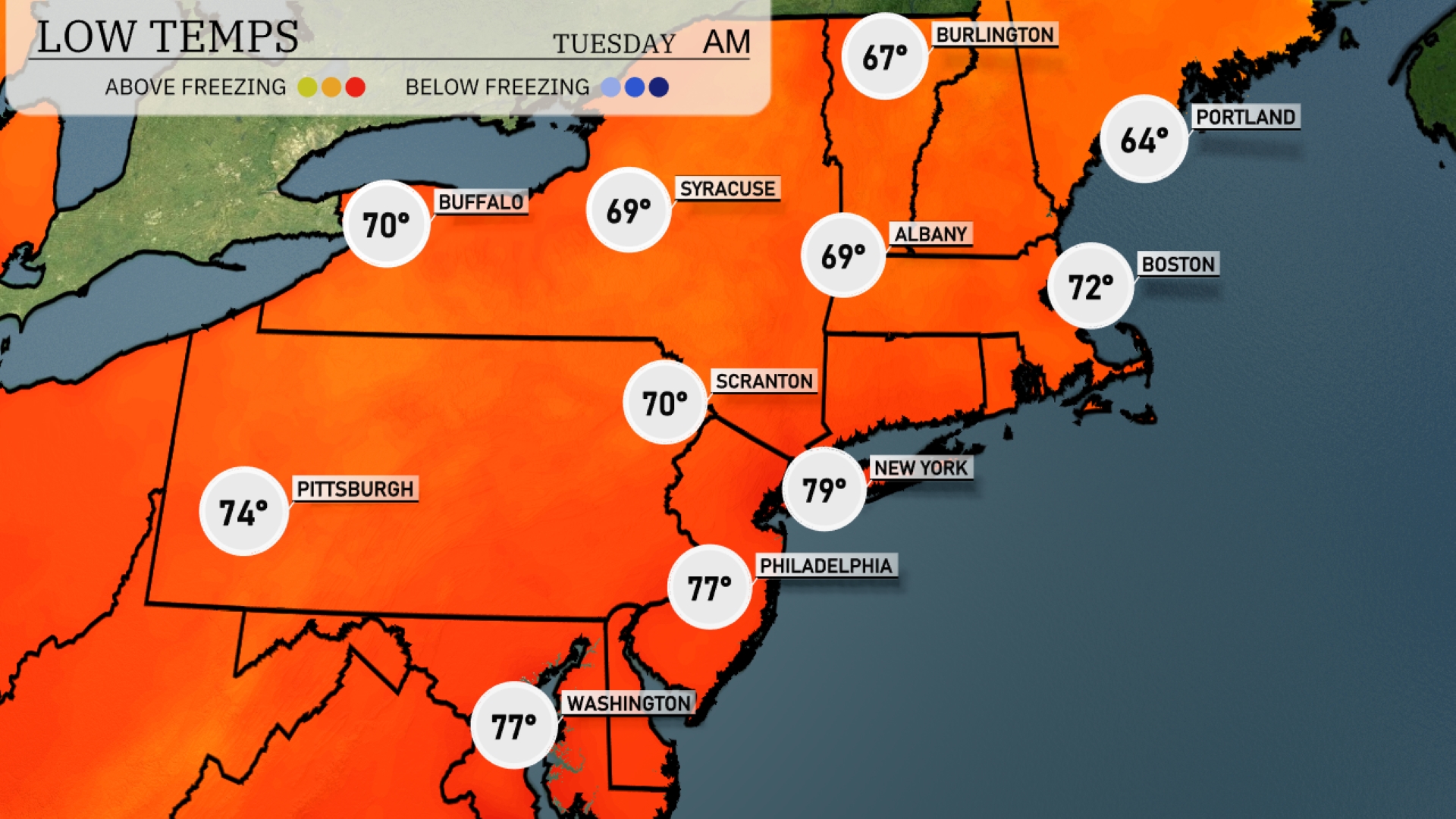
Tonight, Boston will dip to 72 degrees, while Albany is expecting a low of 69. Syracuse will also see a low of 69, with Scranton matching at 70 degrees. Pittsburgh will cool down to 74, providing a relatively mild evening compared to other areas.
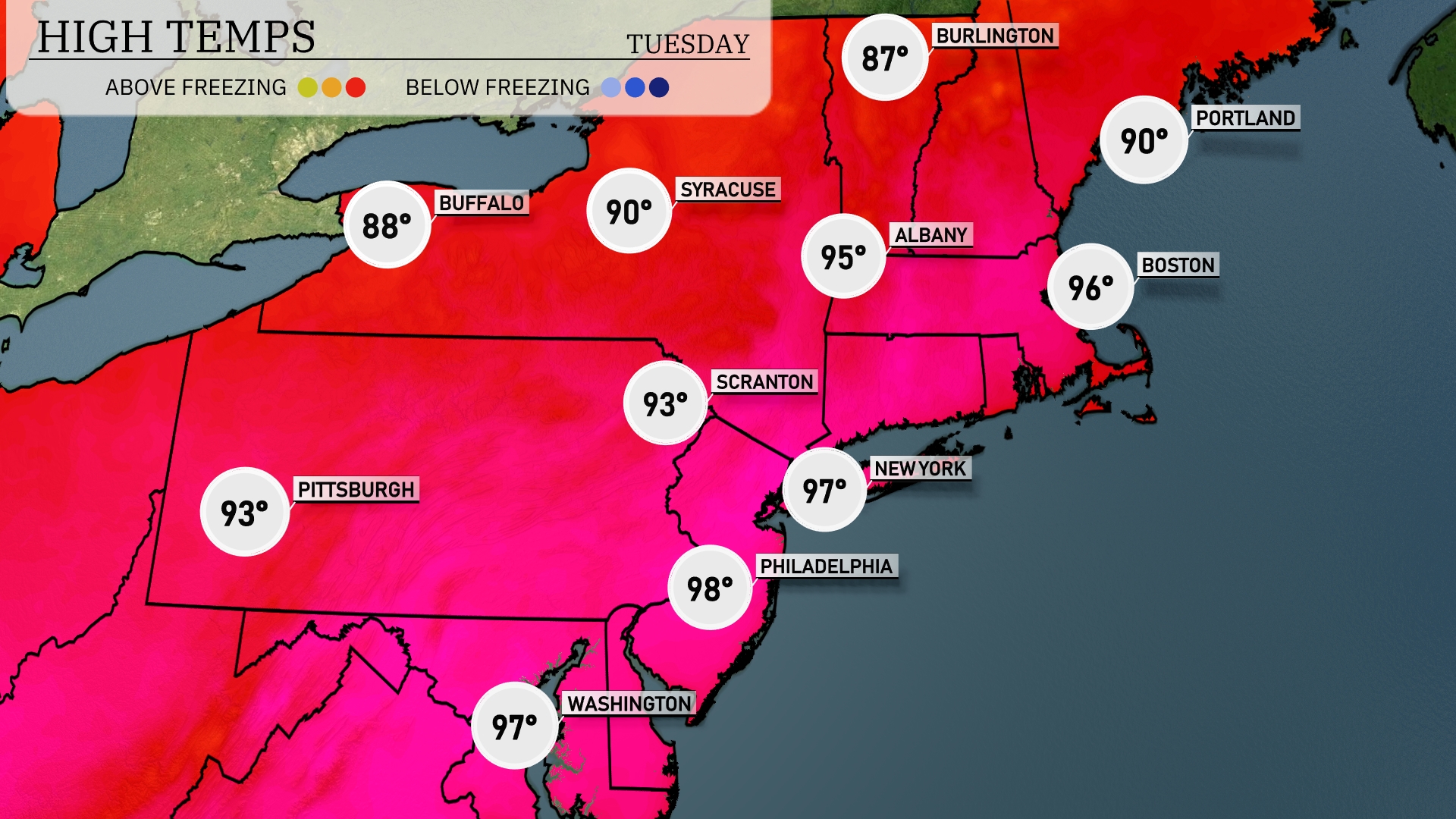
Tomorrow in the Northeast, temperatures will soar with New York reaching a high of 97 degrees. Boston isn’t far behind at 96 degrees, while Philadelphia will hit a blistering 98 degrees. Syracuse will also feel the heat with a high expected at 90 degrees. Notably, many areas are experiencing temperatures significantly above average, influenced by a strong ridge of high pressure settling over the region.
A warm front will move through the Northeast tomorrow, bringing widespread rain across the region from Pittsburgh to Boston. Expect showers to start in the morning and persist throughout the day, with heavier rainfall likely in the afternoon, leading to potential flash flooding in urban areas. Temperatures will remain cooler, in the mid-60s to low 70s, due to cloud cover and rain. As the front moves east, west of Syracuse may see clearing skies later in the day. Watch for localized thunderstorms in eastern areas, with lightning and strong winds possible as the front pushes through.
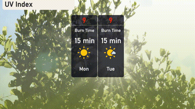
Expect the UV index in New York City to be very high at 9 for both Monday and Tuesday, meaning a quick burn time of just 15 minutes in direct sunlight.