From Sunny to Stormy: Navigating Chicago’s Dynamic Weather Patterns
By
Amy Freeze
Explore the swift weather transitions sweeping through the Midwest, from sunny skies to imminent storms, and how these changes impact daily life in Chicago.
Dive into a detailed update of Chicago’s weather, featuring forecasts and warnings as Midwest storms approach. Learn how to stay safe and prepared.
This detailed blog post delves into the weather dynamics of Chicago and the broader Midwest region. With expert analysis, we cover the transition from partial clouds to severe storms and what this means for residents. Expect insights on temperature trends, storm forecasts, and practical advice on weather preparedness. Full 7-day forecast included.
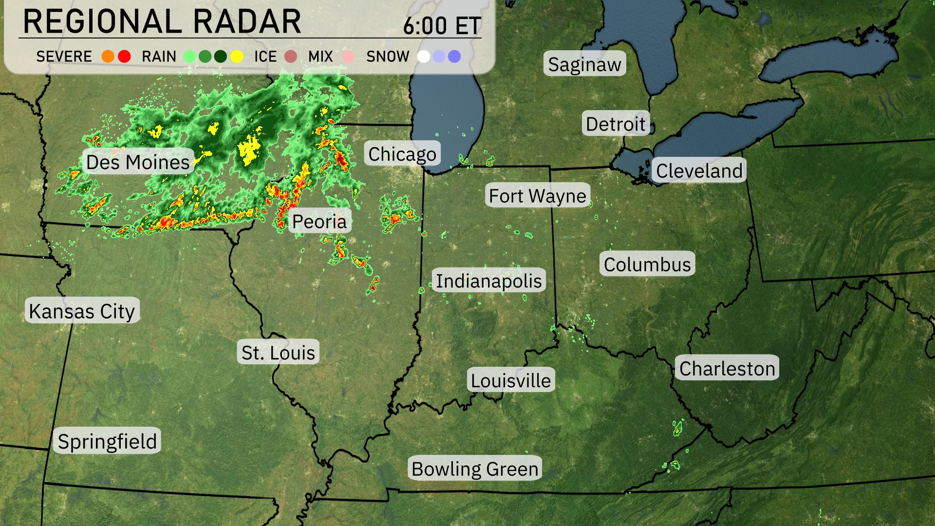
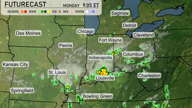
The Midwest is seeing quite a bit of activity today as strong storms are pushing through Iowa, with Des Moines currently under severe weather threats moving eastward. Heavy rain is impacting Peoria, making its way toward Chicago. As the showers travel east, Fort Wayne and Indianapolis are expected to see increasing cloud cover leading to precipitation. While Cleveland and Detroit remain relatively dry, keep an eye out because some of that system could veer northeast soon.
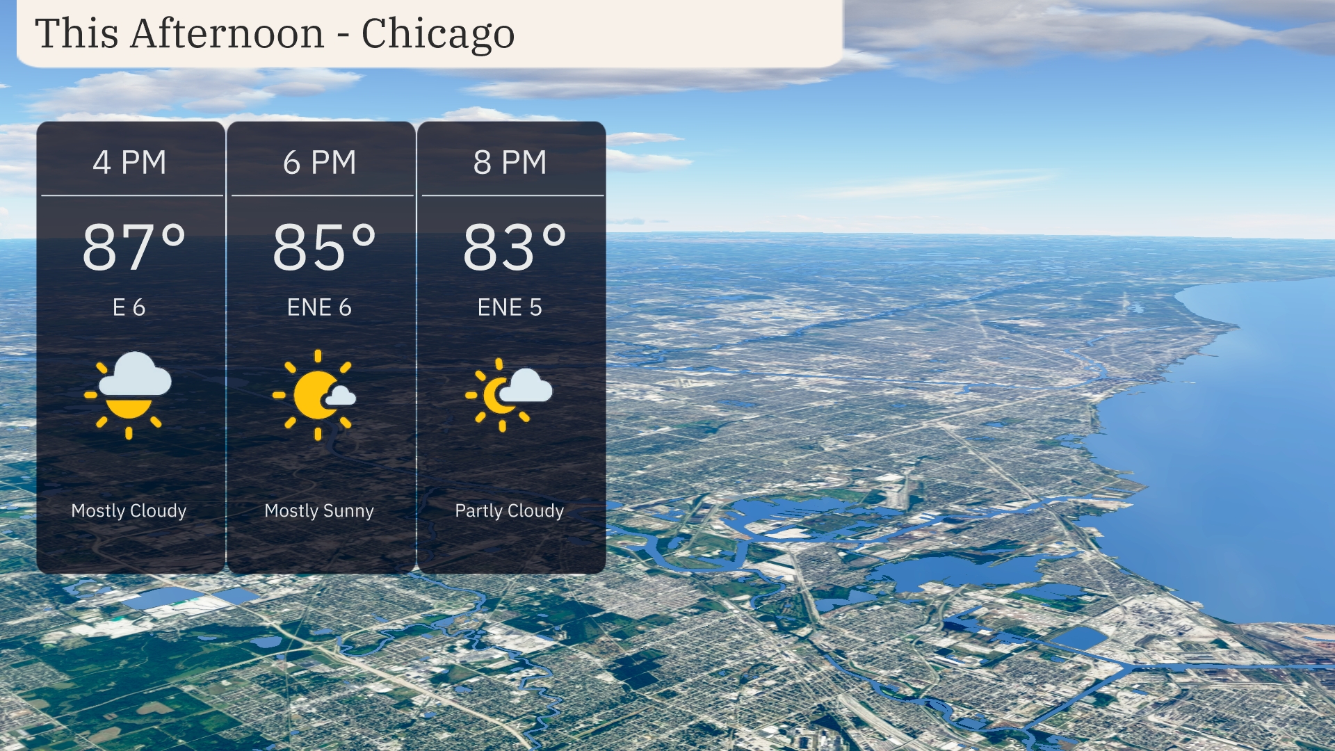
Temperatures in Chicago this afternoon will reach 87 degrees by 4 PM, with mostly cloudy skies providing some relief from the heat. Winds will be from the east at 6 miles per hour, bringing a gentle breeze through the city. By 6 PM, expect a slight dip as temperatures ease to 85 degrees under mostly sunny conditions. As the evening progresses, skies will be partly cloudy with temperatures settling to 83 degrees by 8 PM.
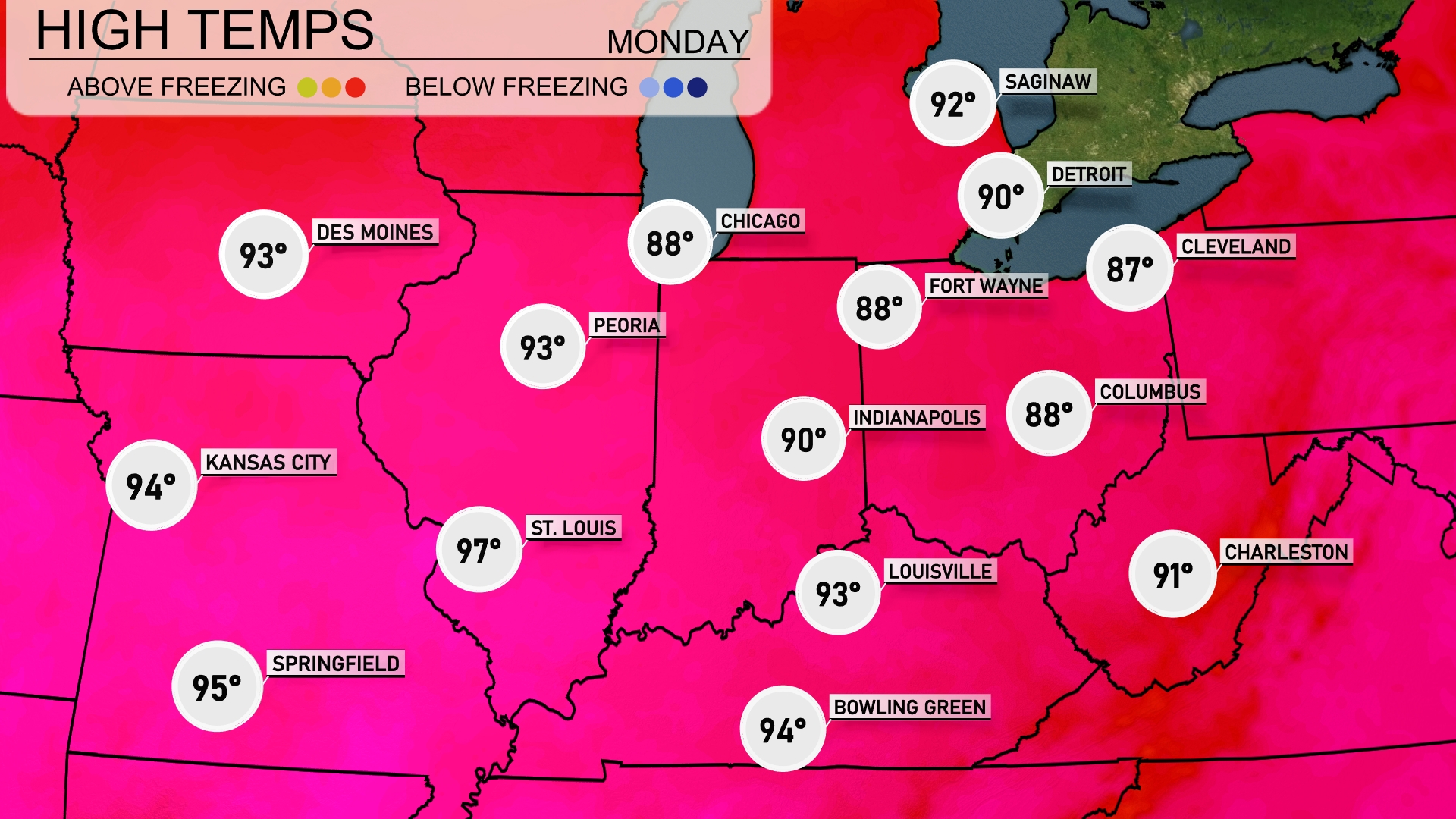
Today’s high temperatures in the Midwest feature some significant warmth. St. Louis is on the hotter side with a high of 97 degrees, while Kansas City will see a high of 94. To the north, Peoria and Indianapolis are both reaching 93 and 90, respectively. Chicago will enjoy a slightly cooler day at 88 degrees, and further east, Columbus is set for a high of 88 as well.
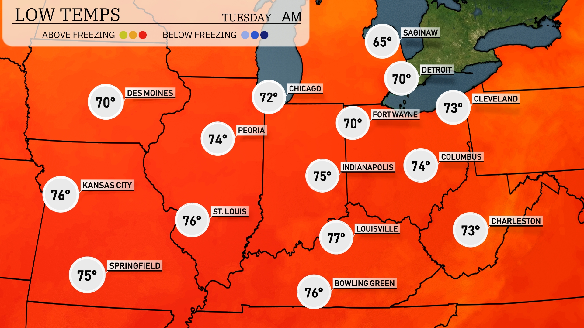
Tonight, the Midwest will experience mild temperatures, with St. Louis dipping to 75 degrees and Kansas City at 76. Expect a cooler 70 in both Chicago and Fort Wayne. Indianapolis will see a low of 75 degrees, while Louisville remains slightly warmer at 77. In Cleveland, the temperature will settle at 73 degrees, providing a mild night across the region.
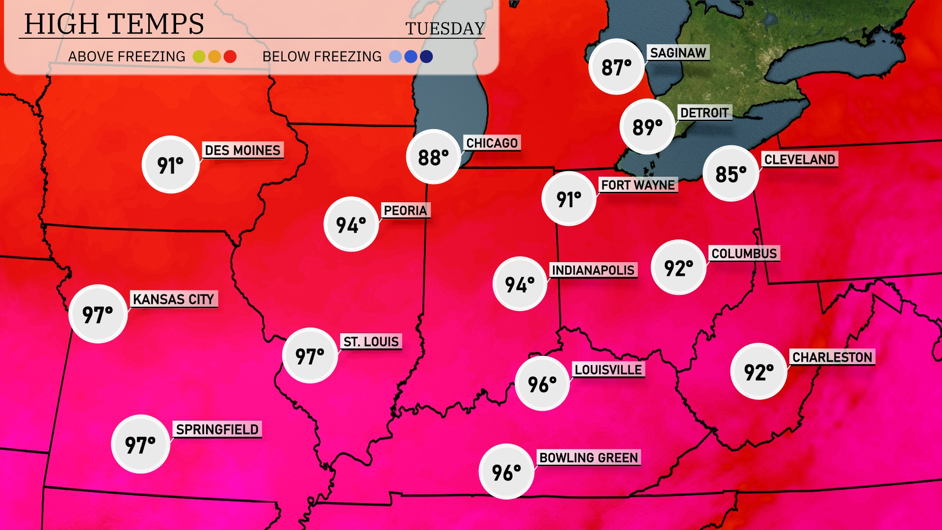
Tomorrow, Kansas City will reach a sizzling 97 degrees, while nearby St. Louis matches that mark. Peoria is forecasted for a warm 94 degrees, with Indianapolis also expecting a high of 94. Chicago will experience slightly cooler temperatures at 88 degrees, with Fort Wayne reaching 91.
A cold front is set to move through the Midwest on Tuesday, bringing thunderstorms primarily concentrated over Indiana and Kentucky, centered near Indianapolis and Louisville. These storms could produce heavy rain and potentially strong winds, so stay alert for any rapidly changing weather conditions. By Tuesday evening, expect showers stretching from Ohio through Michigan, with cooler temperatures following the frontal passage. As the cold front advances, Chicago and Peoria may see a drier air mass filtering in, leading to clearer skies and cooler temperatures on Wednesday.
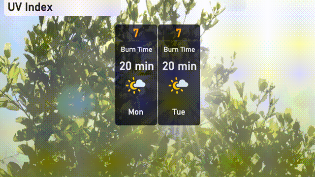
The UV index in Chicago is high at 7 for both today and tomorrow, leading to a burn time of approximately 20 minutes in direct sunlight. Keep sunblock handy and enjoy protective clothing if you’ll be outside for extended periods.