Austin on Fire: Soaring Temperatures and Storm Alerts in the Southern Plains
By
Amy Freeze
Experience today's dynamic weather across the Southern Plains, with sizzling highs and storm threats. Dive into our comprehensive guide for what to expect in Austin and neighboring regions.
Get the scoop on today’s scorching heat and potential storms in the Southern Plains. From Austin’s high of 97 degrees to storm warnings, find out what the weather has in store.
Today in the Southern Plains, expect clear skies over Austin with temperatures soaring to 97 degrees. But not all areas are as calm, with storm clusters moving across New Mexico towards Midland and potential severe weather near Oklahoma City. Tonight, temperatures drop slightly, offering a brief respite before another hot day tomorrow. Our comprehensive analysis includes safety advice for dealing with extreme UV levels and preparing for the upcoming weather shifts.
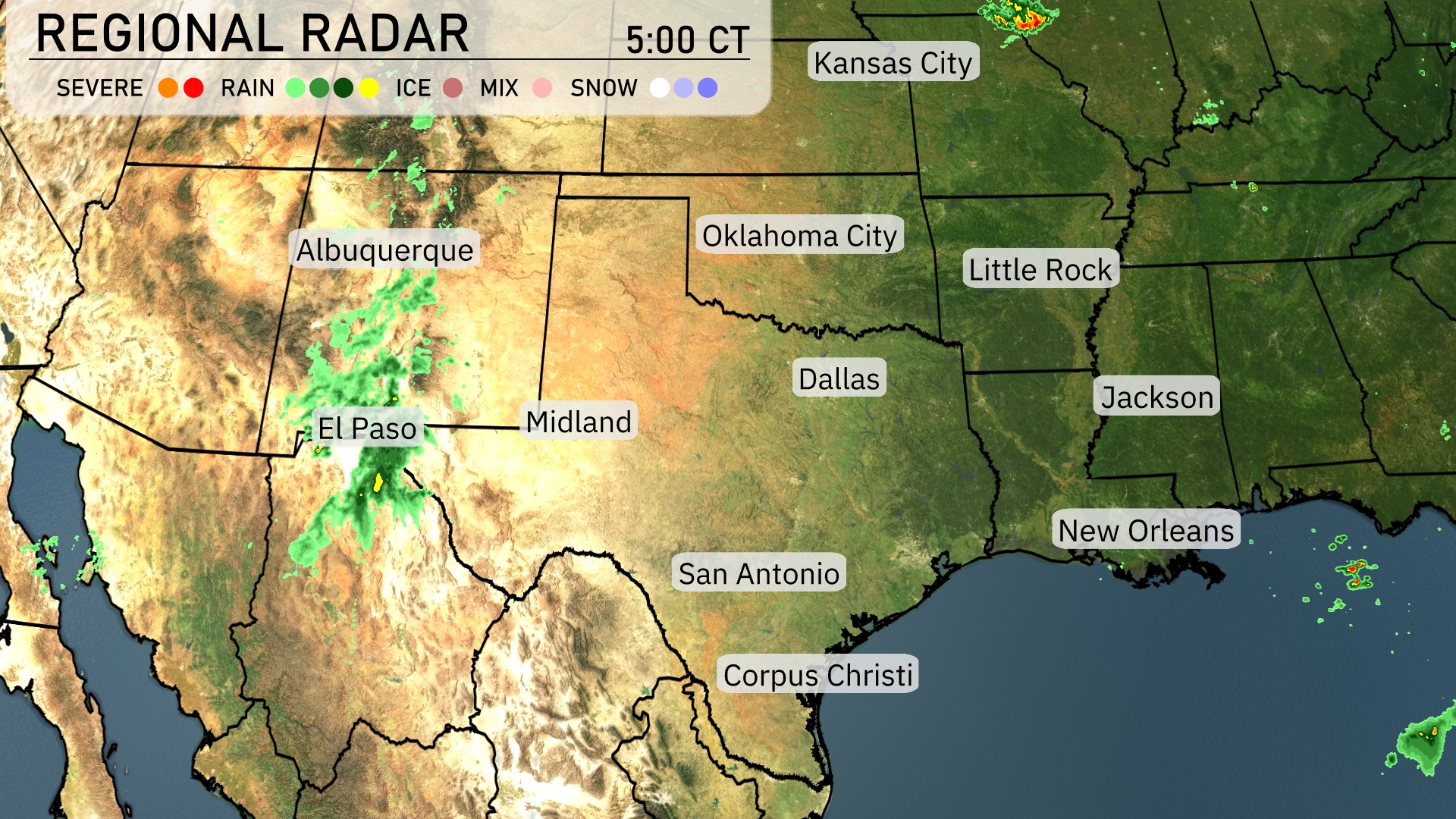
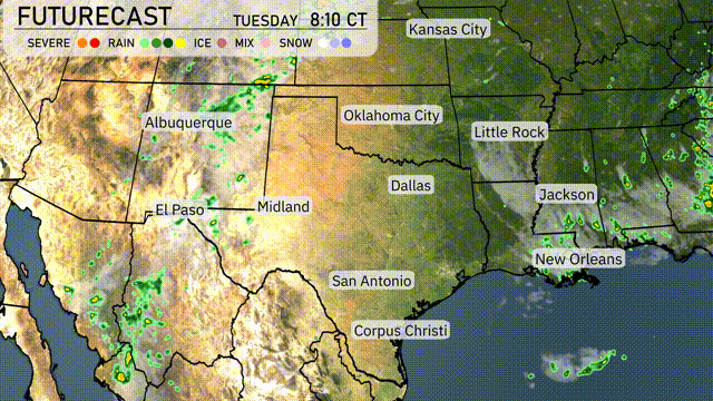
A cluster of storms is pushing through New Mexico near Albuquerque and is moving east. El Paso is currently experiencing heavy rainfall, with precipitation spreading towards Midland. Clear skies are prevailing over Dallas, Oklahoma City, and Little Rock, offering a short break from the activity. Conditions remain unsettled near the Texas-New Mexico border, with showers anticipated to gather strength as they move eastward.
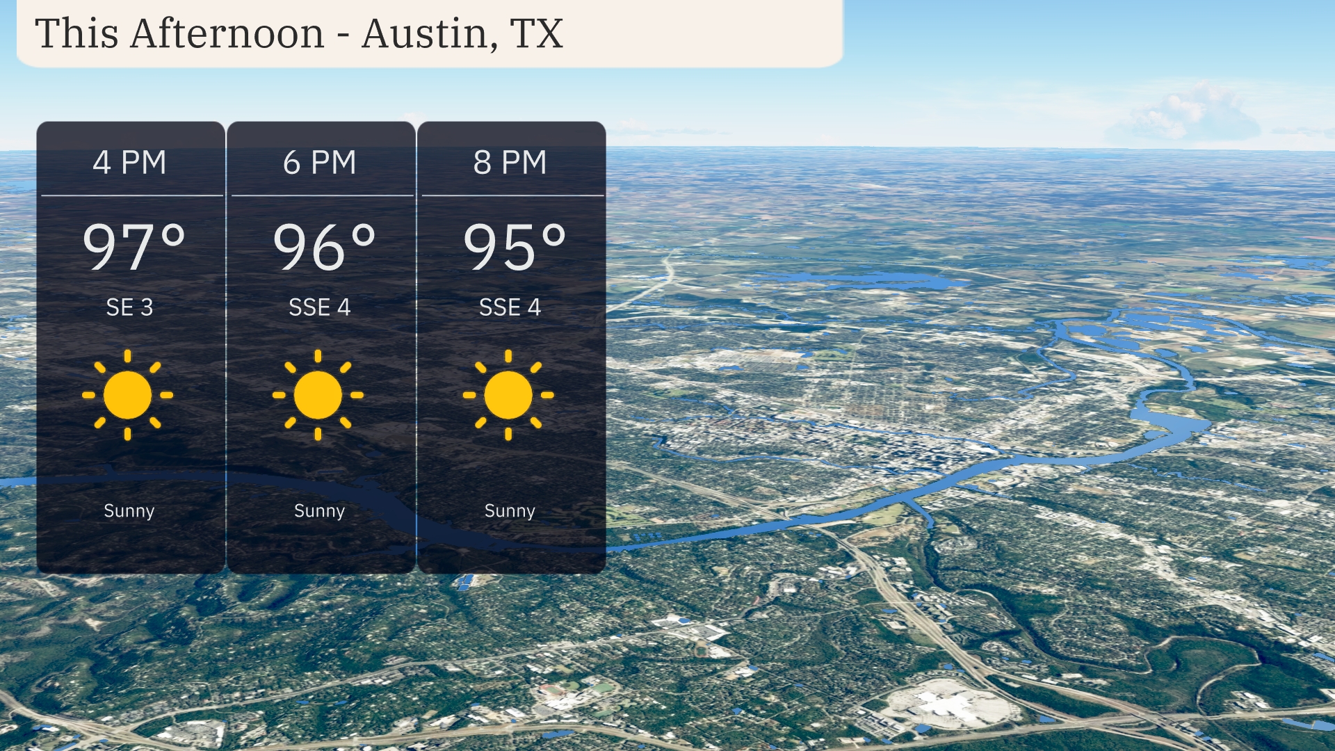
Sunny skies will continue through the afternoon in Austin, Texas, with a temperature reaching 97 degrees by 4 PM. Winds will be gentle from the southeast at 3 to 4 miles per hour. As the evening approaches, temperatures will slightly drop to 95 degrees by 8 PM while staying pleasantly clear.
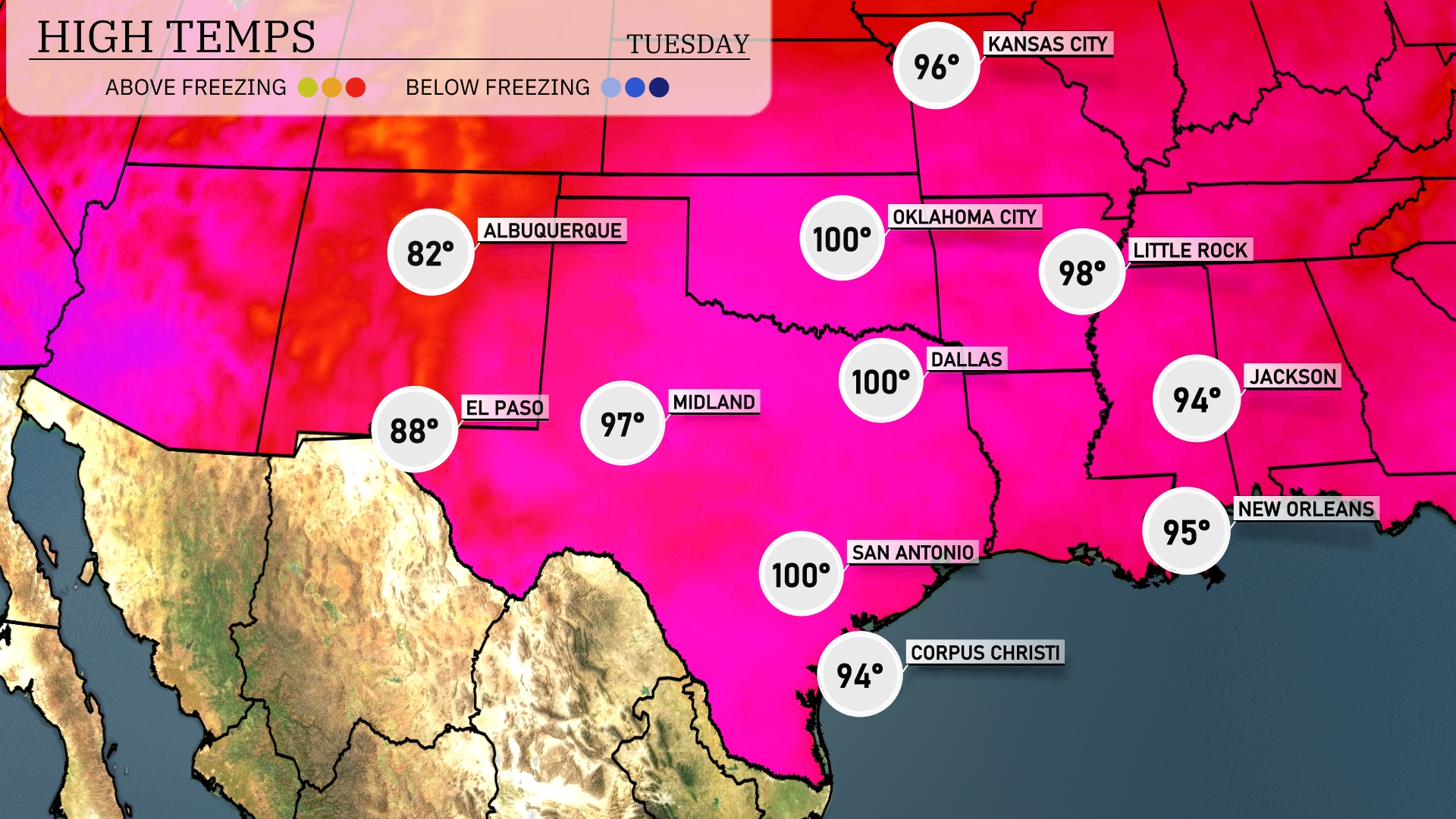
In the Southern Plains today, temperatures are soaring with several areas reaching into the upper 90s and even hitting the century mark. Dallas is forecasted for a high of 100 degrees, while nearby San Antonio matches that heat with another 100 degree day. Further to the west, Midland is slightly cooler at 97 degrees, but still toasty. In contrast, El Paso will see a high of 88 degrees as it stays on the milder side today. Over in Jackson, expect a high of 94 degrees, providing a warm but less extreme day compared to the rest of the region.
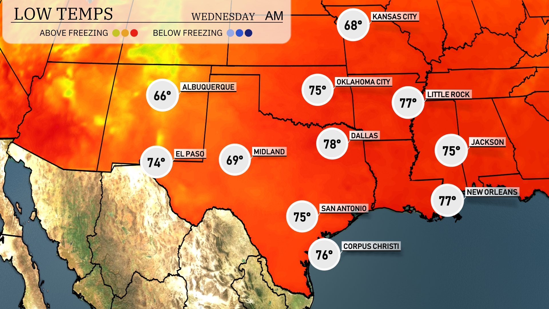
Tonight in the Southern Plains, expect low temperatures to dive into the upper 60s. El Paso will cool down to 74 degrees, while Midland dips to 69. Dallas will see a low of 78, and San Antonio is expected to hit 75. Corpus Christi will stay mild at 76 degrees.
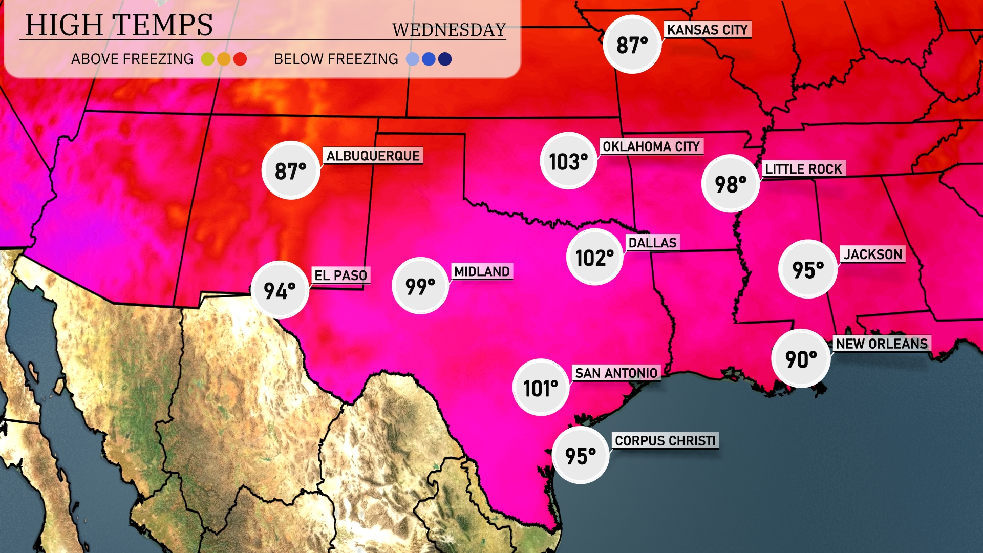
Tomorrow in Dallas, expect a scorching high of 102 degrees, significantly above average for this time of year. Midland isn’t cooling off either, with a projected high of 99 degrees. In San Antonio, temperatures will reach around 101 degrees, while El Paso will hit a high of 94 degrees. The southern Plains are experiencing a heat wave, with warm air dominating the region. New Orleans is looking at a steamy 90 degrees, making it a hot day across the board.
Expect a dynamic weather day across the Southern Plains with significant activity. A strong cold front is pushing through, sparking rain showers and storms from Dallas to Corpus Christi, offering much-needed moisture. There’s a potential for severe storms near Oklahoma City due to an unstable air mass. Be prepared for alerts, as strong winds and heavy rain could impact Little Rock to New Orleans. This system is tracking eastward, prompting weather vigilance through Wednesday night.
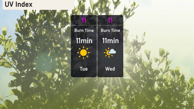
The UV index in Austin is exceptionally high at 11 for both today and Wednesday, making sun protection crucial. Expect a burn time of just 11 minutes, so it’s important to lather up with sunscreen and limit direct sun exposure.