From Heatwaves to Thunderstorms: NYC’s Wild Weather Ride
By
Amy Freeze
Partly cloudy skies, sudden thunderstorms, and a sizzling temperature rollercoaster paint today's weather picture in NYC. Get the full scoop on what to expect this week!
Today’s NYC forecast: a mix of sun, heat and sudden thunderstorms! Read more about this week’s weather rollercoaster from heatwaves to refreshing thunderstorms at our latest blog post.
This afternoon in NYC, expect partly cloudy skies with a swift-moving rain system approaching, promising a mix of sun and imminent showers. While temperatures soar to near record highs, evenings are set to cool slightly with thunderstorms. This dynamically changing weather pattern not only offers surprises but also a caution with high UV indexes. The coming days promise more variability – stay updated on our site, https://amyfreeze.ai/.
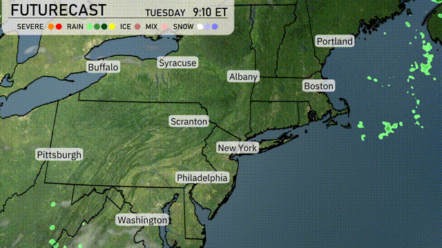
A swift-moving rain system is currently over parts of Pennsylvania and heading northeast towards New York City. Light showers are indicated near Scranton, gradually making their way towards Albany. Clouds are thickening around Syracuse, suggesting more rain to follow. The rest of the Northeast, including Boston and Washington, remains mostly clear with no precipitation detected.
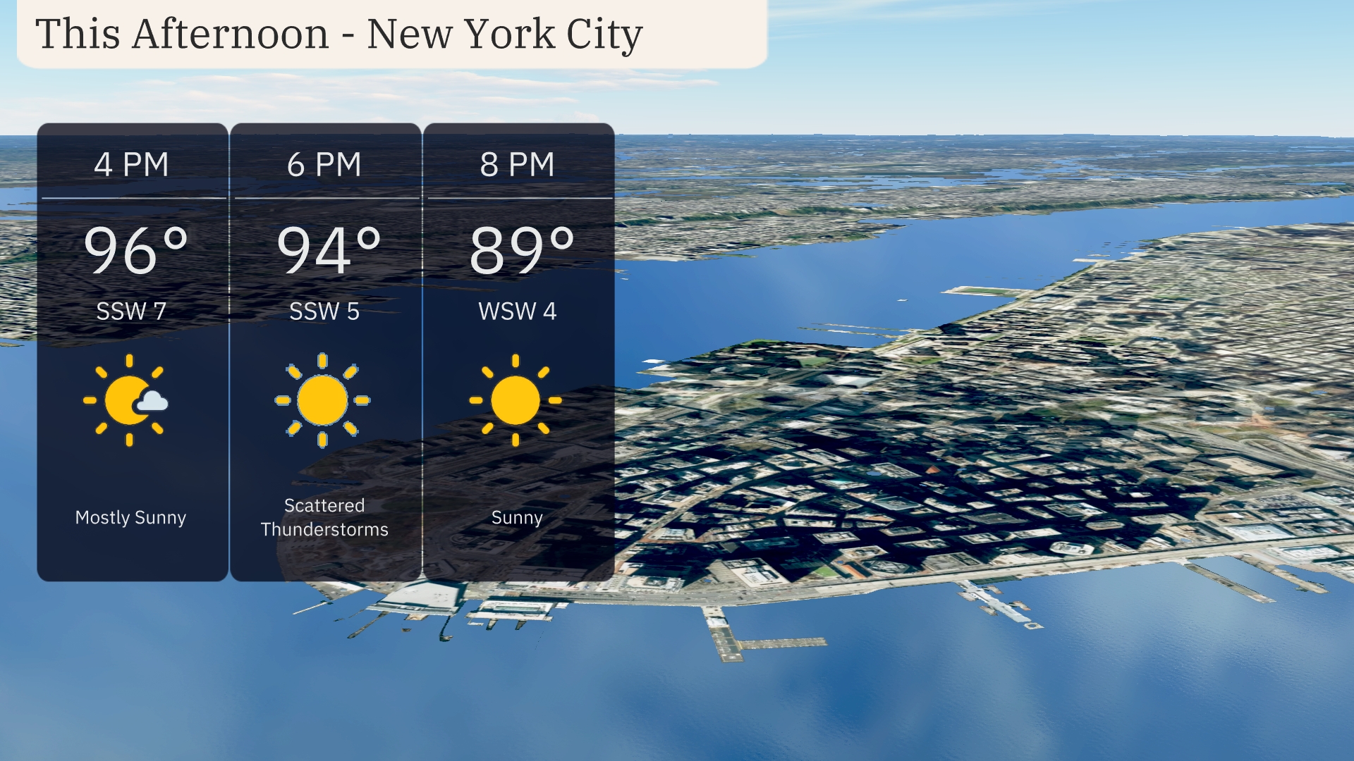
New York City’s afternoon forecast features temperatures climbing to a warm 96 degrees by 4 PM, with winds from the southwest at 7 mph. Expect mostly sunny skies as the day progresses. By 6 PM, scattered thunderstorms may develop, slightly dropping the temperature to 94 degrees with winds diminishing to 5 mph from the southwest. The evening will clear up with sunny skies and temperatures at 89 degrees by 8 PM, while winds shift to come from the west-southwest at 4 mph.
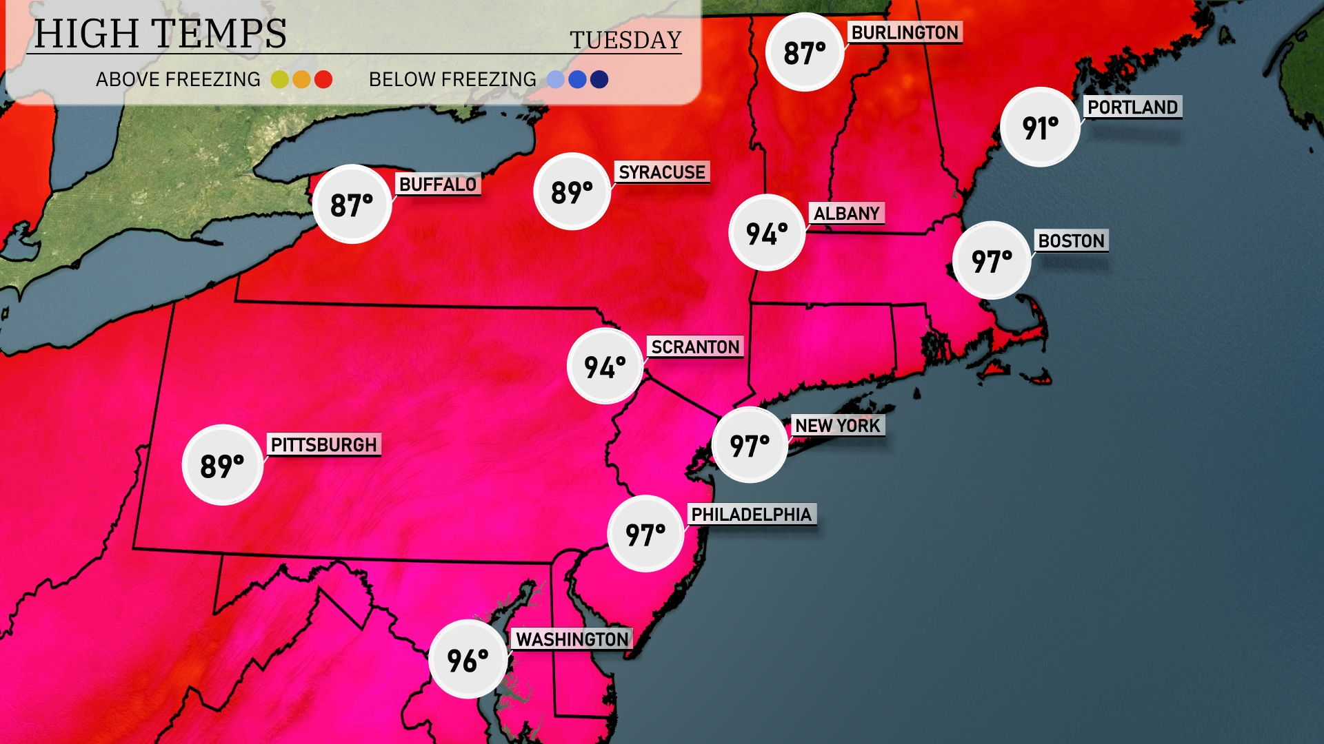
Today’s high temperatures in the Northeast are showing a significant warm-up. Boston reaches a sizzling 97 degrees, while New York City is not far behind at 94 degrees. Philadelphia also hits 97, making it one of the hottest spots today. Upstate, Syracuse records a high of 89, and Buffalo cools down slightly to 87.
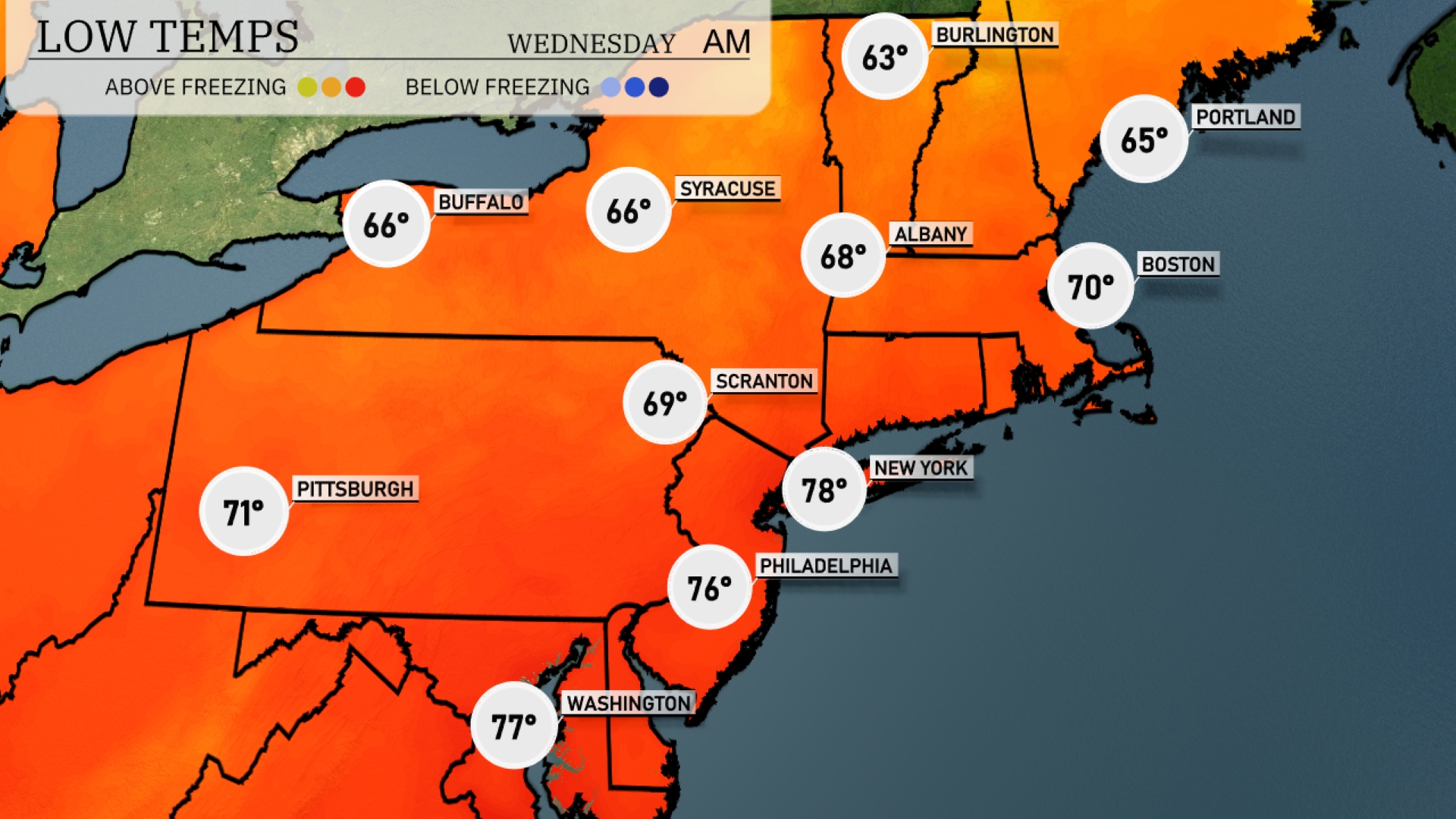
Tonight, temperatures will drop significantly across the Northeast. New York City is expected to reach a low of 78 degrees, while Philadelphia will dip to 76. Scranton should cool down to 69 degrees, and Albany will see temperatures around 68. Boston will experience a low of 70, but watch for a notable chill in Burlington, where it will hit 63 degrees.
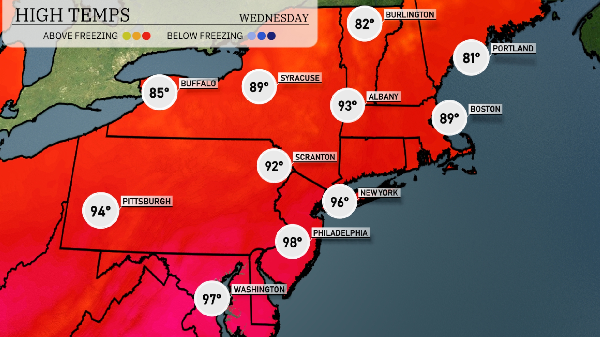
Tomorrow in the Northeast, highs will soar as the heatwave continues. Philadelphia tops the charts with a sizzling 98 degrees, while New York City is not far behind at 96 degrees. Scranton will experience a high of 92, and temperatures in Pittsburgh will reach 94 degrees. Boston is set to enjoy warmer weather at 89 degrees, whereas Albany will see a high of 93.
As a cold front sweeps through the Northeast, expect scattered showers and thunderstorms from Albany to Boston starting late Tuesday night and continuing into Wednesday. Temperatures will remain mild overnight, with daytime highs reaching the upper 70s to low 80s. The risk of severe weather is relatively low, but some areas might experience localized heavy rain and gusty winds on Wednesday. Following the front’s passage, cooler and drier conditions will settle in just in time for the end of the week, accompanied by clearer skies from Syracuse to Portland.
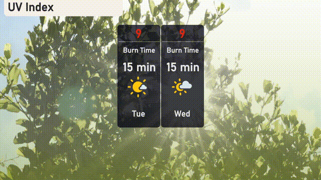
The UV index in New York City will be very high at 9 for both Tuesday and Wednesday, with a burn time of approximately 15 minutes under the sun.