Tomorrow in Miami starts with partly cloudy skies and a warm temperature of 84 degrees. Meanwhile, the Southeast faces potential storms. Get the full forecast!
Expect a blend of sun and clouds in Miami tomorrow morning with temperatures rising swiftly from 84°F. As Southeast braces for storms, stay updated with our comprehensive forecast.
https://www.youtube.com/watch?v=dY_BC_XnDTA
As Miami welcomes a warm and partly cloudy morning, the broader Southeast region prepares for a stormy day. With strong storms over the Gulf Coast and a cold front moving in, the weather patterns promise significant shifts. This detailed analysis provides you with all you need to plan your day effectively while staying safe during unpredictable weather changes.
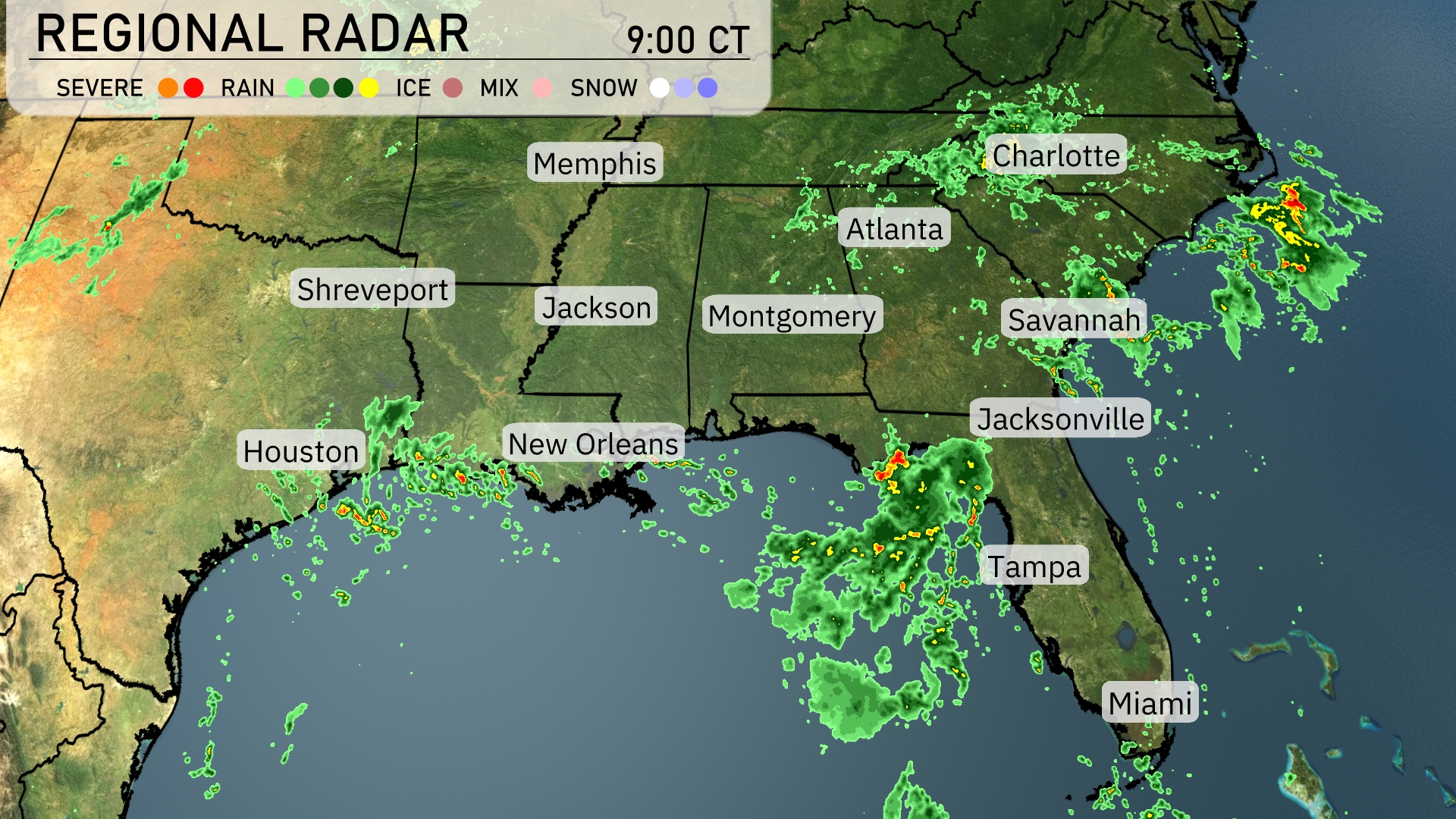
On the Regional Radar, the Southeast is showing active weather patterns. Strong storms with embedded heavy rain are advancing over the Gulf Coast, particularly affecting New Orleans and approaching the Tampa area. Light to moderate rain is visible stretching from Jackson moving eastward, touching Montgomery. Cloud cover dominates much of Georgia, with scattered showers expected across the Carolinas, while Miami enjoys clearer skies.
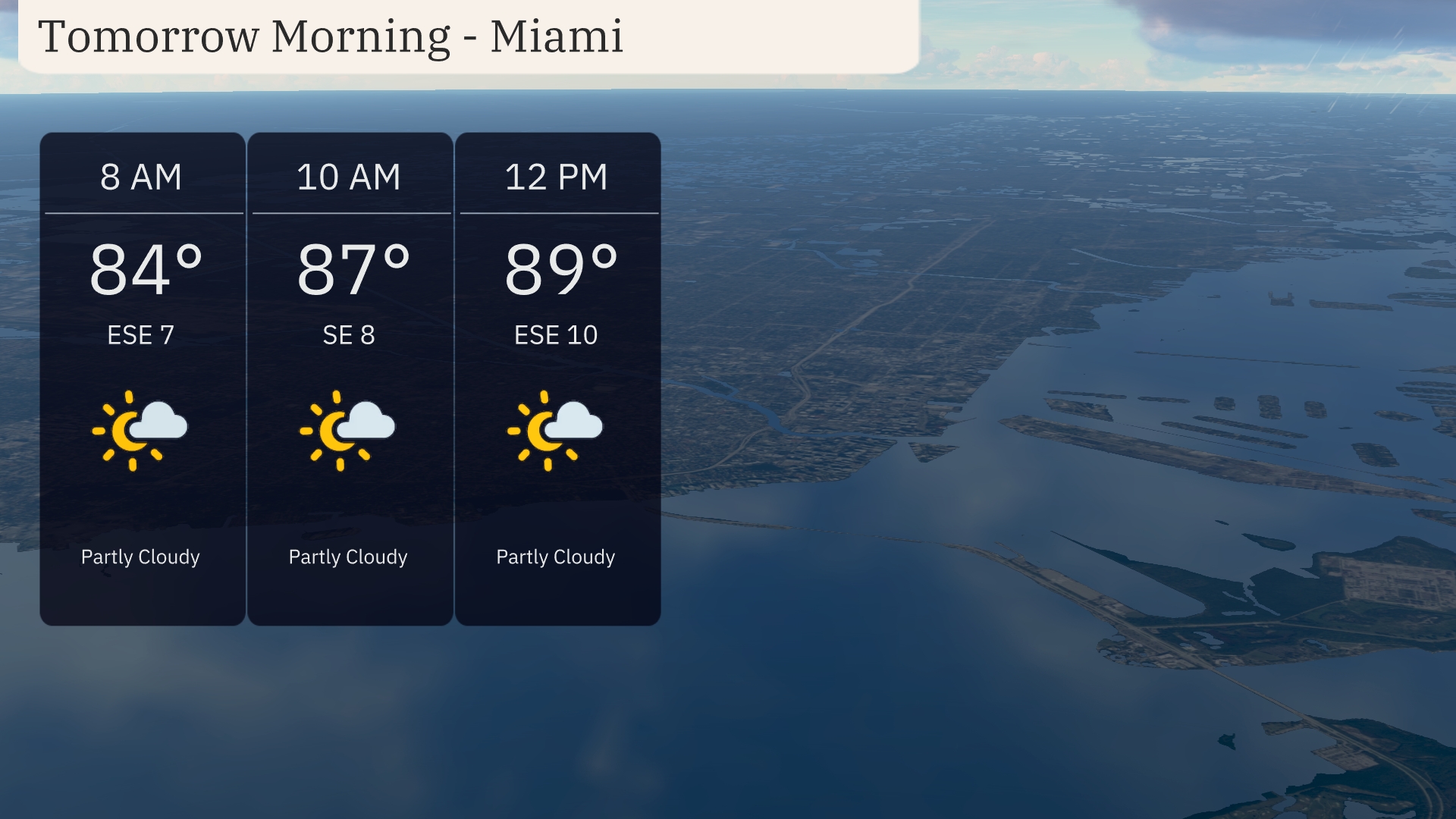
Tomorrow morning in Miami, temperatures start off at 84 degrees at 8 AM, gradually rising to 89 degrees by noon. Expect partly cloudy skies with wind coming from the east-southeast at 7 miles per hour, increasing slightly to 10 miles per hour toward midday.
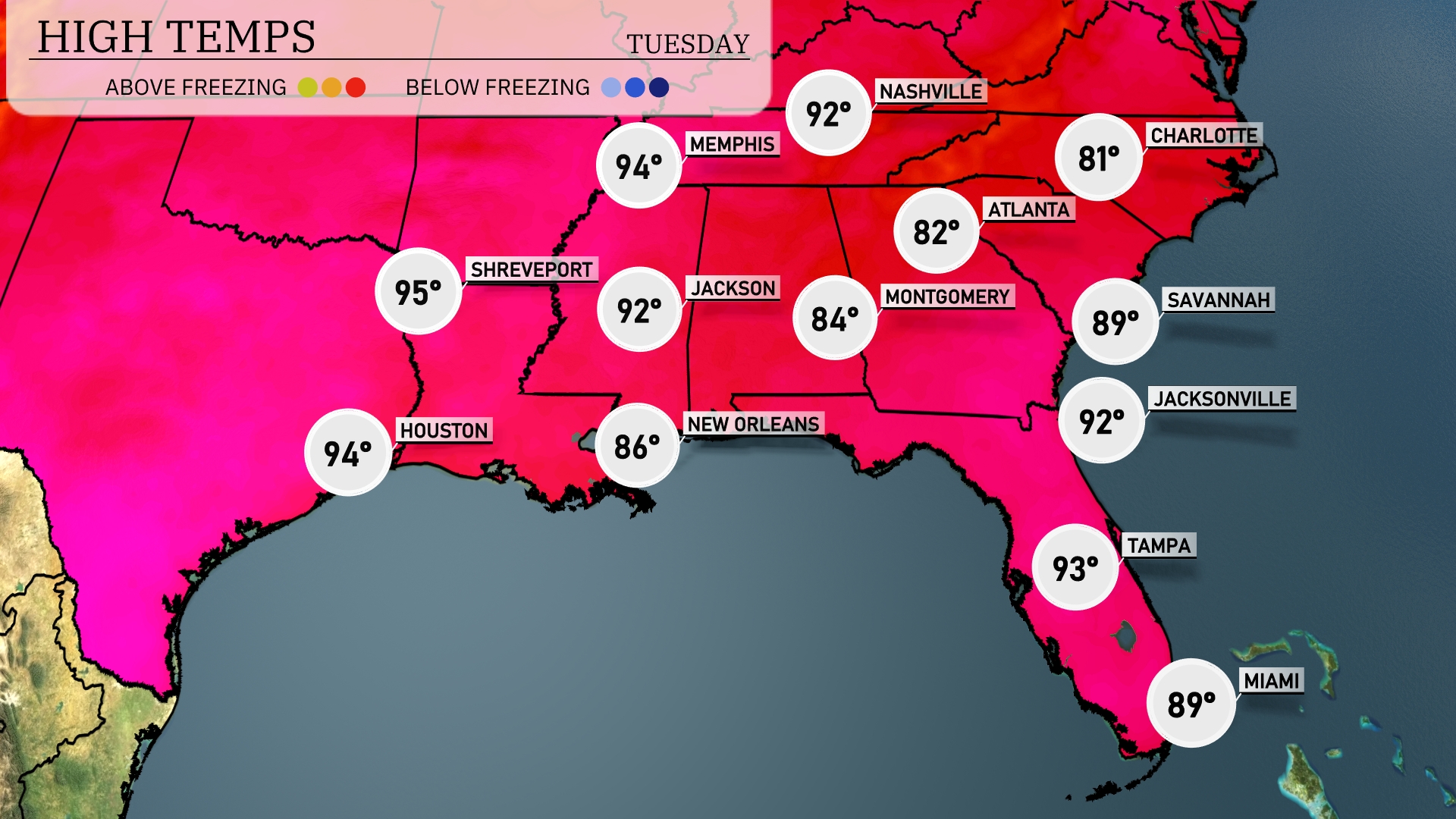
Tomorrow, temperatures in the Southeast will soar above average, with Houston hitting 94 degrees and Shreveport leading the pack at 95 degrees. In New Orleans, expect a warm 86 degrees, while Jackson will see a high of 92. Atlanta will be warm as well, reaching 82 degrees, and Tampa will be hot at 93 degrees. Coastal cities like Jacksonville and Savannah will enjoy highs around 92 and 89 degrees, respectively, as a warm front continues to influence the region.
A cold front is set to advance across the Southeast tomorrow, ushering in a wave of unsettled weather. Expect thunderstorms to flare up, particularly from New Orleans to Montgomery, with the potential for heavy rainfall and gusty winds. Atlanta’s morning commute could face disruptions as storms roll in. Jacksonville to Savannah will see storm activity by Wednesday, with more than an inch of rain forecasted, posing localized flooding risks. Post-storm, a cooling trend follows, bringing clearer skies into the weekend.
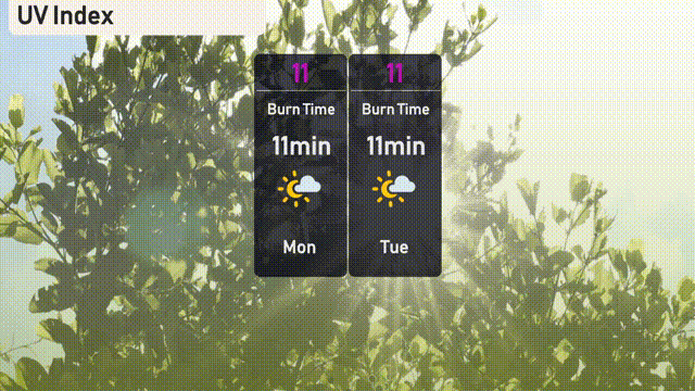
The UV index in Miami will be very high at 11 for both Monday and Tuesday, with an expected burn time of just 11 minutes under direct sunlight. It’s crucial to protect your skin with sunscreen and seek shade when possible. Stay sun-safe while enjoying the outdoors!
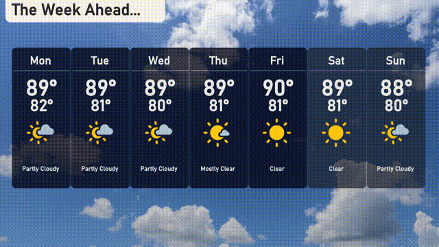
Monday: Partly cloudy with temperatures reaching a high of 89 degrees and a low of 82 degrees.
Tuesday: Another partly cloudy day with a high of 89 degrees and a low of 81 degrees.
Wednesday: Expect partly cloudy skies with a high of 89 degrees and a low of 80 degrees.
Thursday: Mostly cloudy conditions with the temperature peaking at 89 degrees and dipping to 81 degrees overnight.
Friday: Clear skies ahead with the temperature rising to a high of 90 degrees, and a low of 81 degrees.
Saturday: A clear day is expected with highs of 89 degrees and lows of 81 degrees.
Sunday: The week wraps up with partly cloudy skies, a high of 88 degrees, and a low of 80 degrees.
Hope that helps!