Austin’s Weather Outlook: Blue Skies and Scorching Days Ahead
By
Amy Freeze
Explore how Austin's weather shapes up with clear skies and rising temperatures, while surrounding regions brace for stormy conditions.
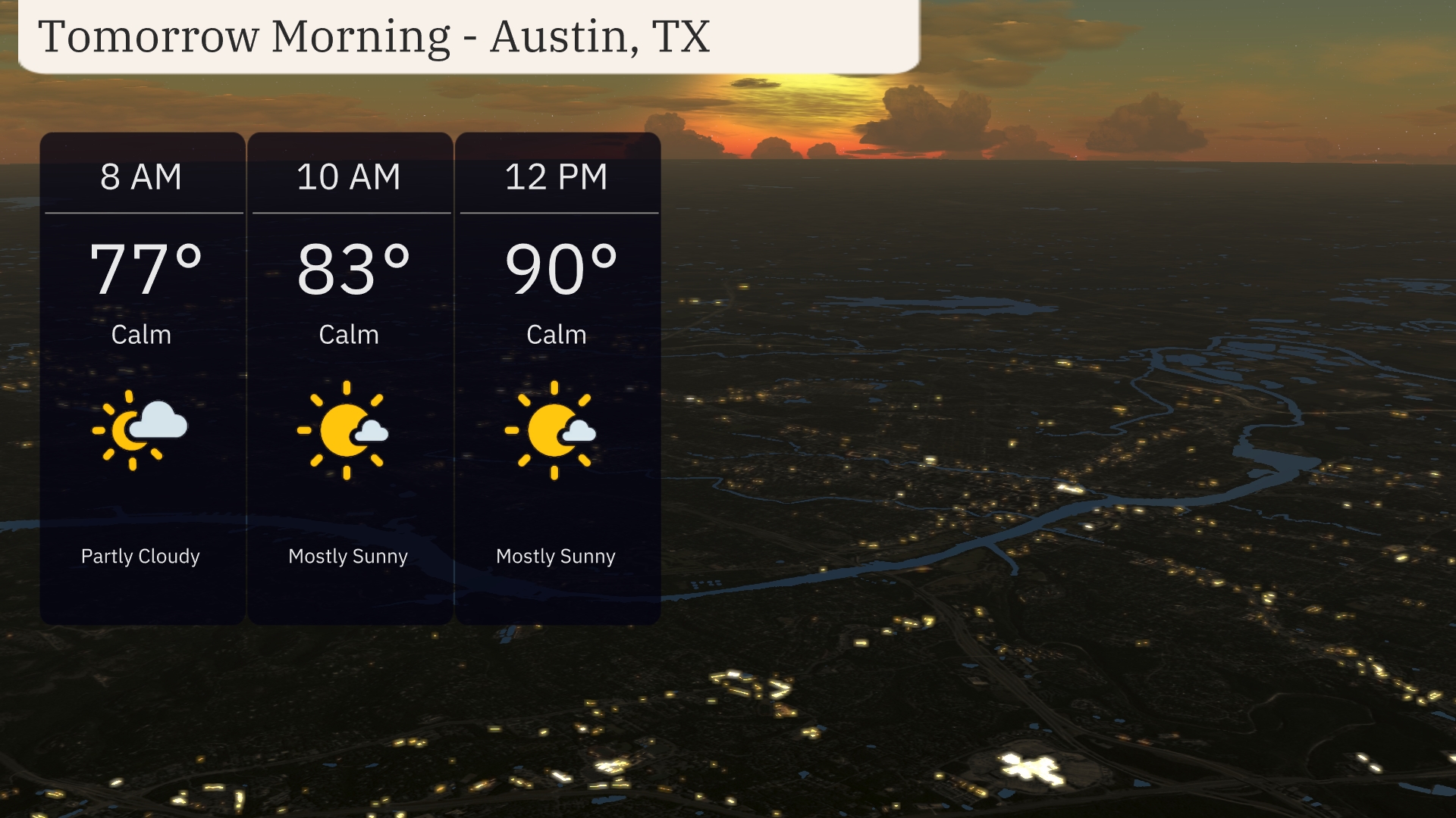
Tomorrow begins with partly cloudy skies in Austin, clearing up by mid-morning to welcome sunny skies and temperatures soaring to 90 degrees by noon. Meanwhile, severe storms and heavy rains challenge parts of Texas.
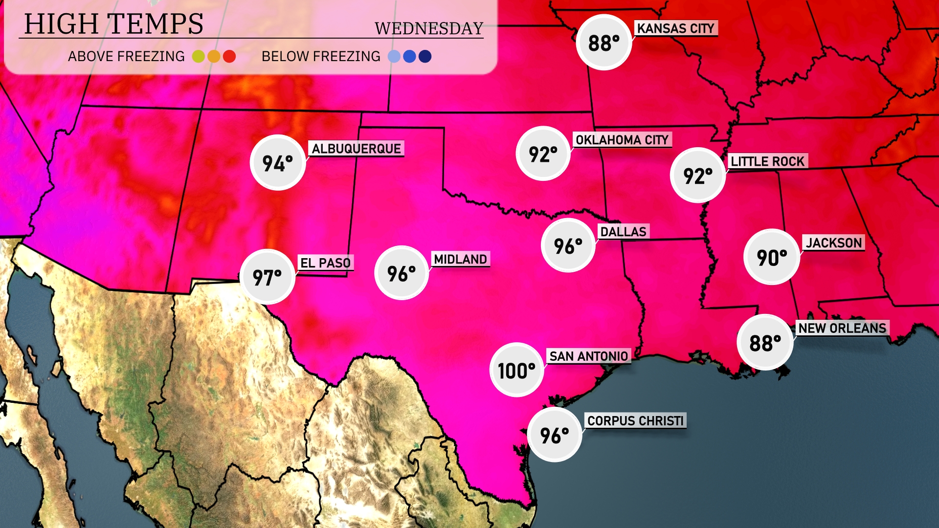
As Austin enjoys a sunny day forecasted with highs nudging 90 degrees, neighboring areas like El Paso and Dallas prepare for a wetter scenario. With severe storms on the horizon and temperatures reaching near 100 degrees in some southern areas, stay informed about your weather situation. Extended forecasts predict a mild cooling down as the week progresses.
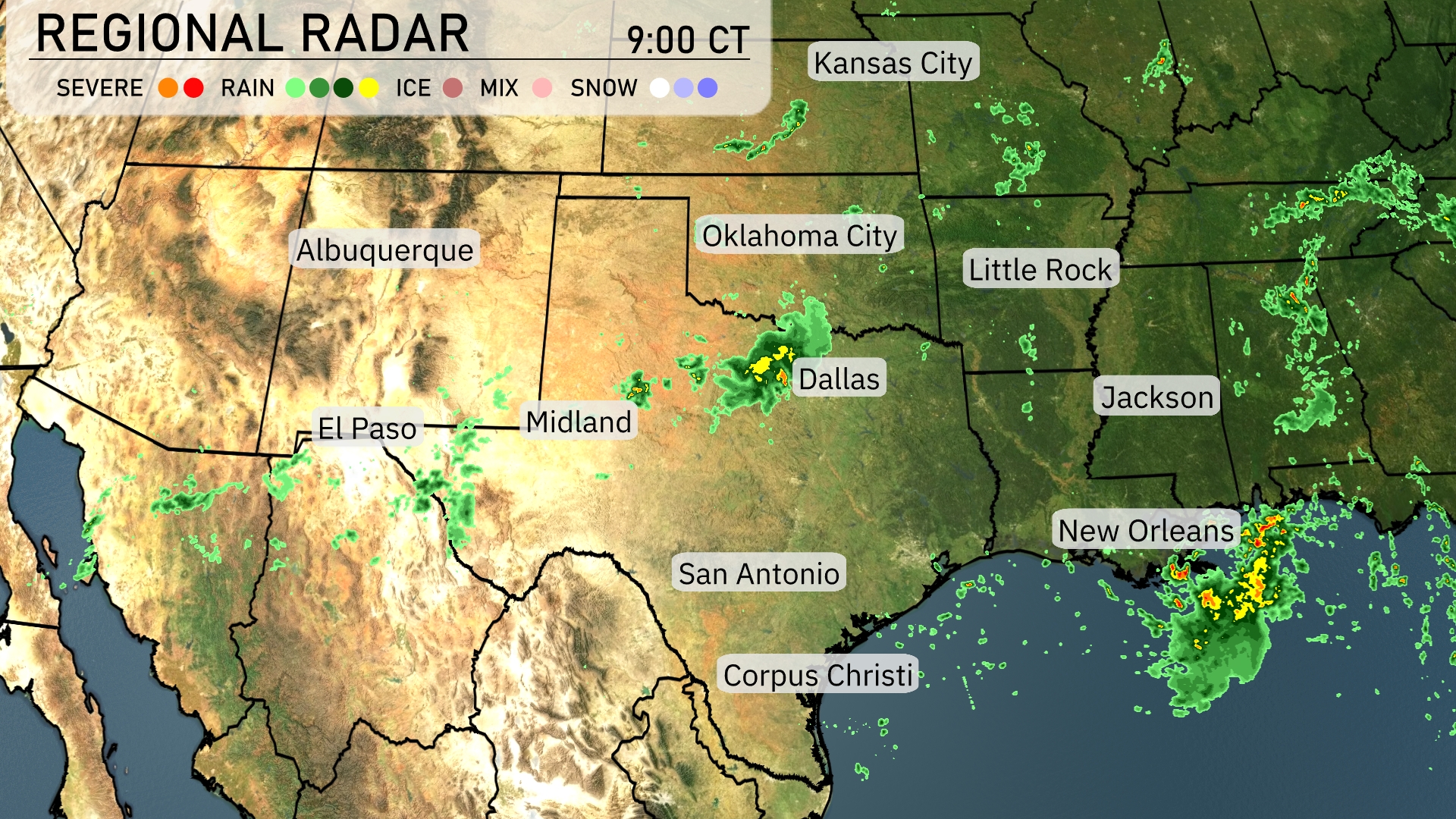
A line of severe storms is advancing from El Paso towards Midland, bringing intense weather to western Texas. In Dallas, expect moderate to heavy rain which is currently moving through the city heading eastward. Oklahoma City is also experiencing some scattered showers as rain moves across the region. Meanwhile, the Gulf Coast, especially around New Orleans, is seeing substantial rainfall sweeping in from the Gulf, while the central parts of Louisiana and Mississippi remain mostly cloudy with patchy rain.
Tomorrow morning in Austin begins partly cloudy at 8 AM with temperatures around 77 degrees. By 10 AM, the skies clear to mostly sunny, and temperatures rise to 83 degrees. The wind remains calm throughout the morning. By noon, expect mostly sunny skies and temperatures reaching 90 degrees.
Tomorrow, El Paso is expected to reach a high of 97 degrees, while Midland will also see warm temperatures at 96 degrees. San Antonio is heating up significantly, with a projected high of 100 degrees, making it notably above average for this time of year. In Dallas, the temperature is forecasted to hit 96 degrees, adding to the warm trend across the Southern Plains. Little Rock and Oklahoma City will see slightly milder temperatures, peaking at 92 degrees.
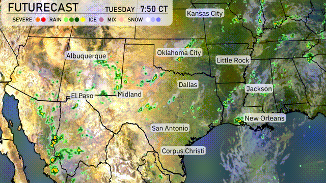
On the futurecast for the Southern Plains for tomorrow, expect a dynamic day with rain showers extending from Dallas down to Corpus Christi, offering some relief in dry areas. Oklahoma City could encounter stronger storms due to an unstable air mass coupled with an advancing cold front. Be alert to potential severe weather warnings in the southeast through the night. Thunderstorms are likely as the front sweeps across the region. Wednesday and beyond show a shift towards drier, cooler conditions.
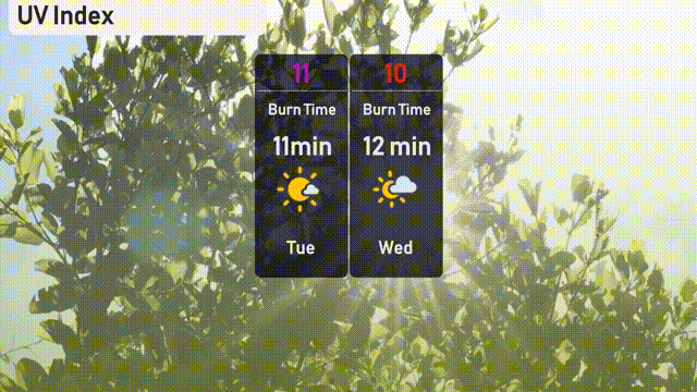
The UV index in Austin will be very high with a value of 11 on Tuesday, and 10 on Wednesday, indicating a burn time of 11 to 12 minutes. It’s important to use high-SPF sunscreen and seek shade during peak sun hours. Long-sleeved shirts and wide-brimmed hats can offer extra protection!
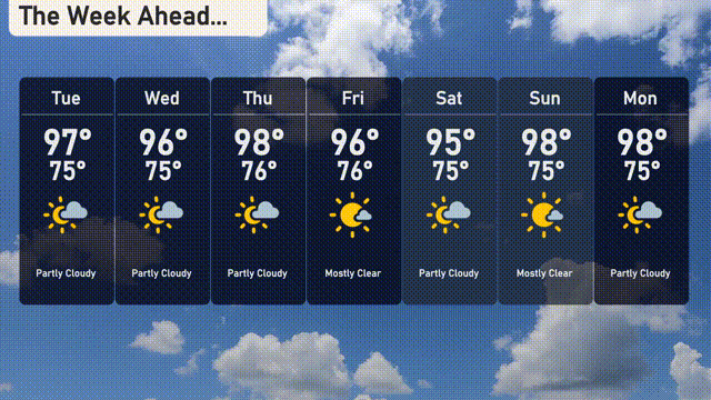
Tuesday: Partly cloudy with temperatures reaching a high of 97 degrees and a low of 76.
Wednesday: Keeping it warm with partly cloudy skies, a high of 96 degrees, and a low of 75.
Thursday: Expect similar conditions with partly cloudy skies. The high will be 98 degrees and the low 76.
Friday: Mostly clear with a high of 96 degrees and a low of 76.
Saturday: Mostly clear once again, with temperatures hitting a high of 95 degrees and a low of 75.
Sunday: The sunshine continues, mostly clear with a high of 98 degrees and a low of 75.
Monday: Finishing the week on a partly cloudy note, with a high of 98 degrees and a low of 75.