Miami Mornings and Southeast Sizzle: A Detailed Weather Forecast
By
Amy Freeze
Explore the dynamic weather patterns shaping up tomorrow in Miami and across the Southeast. From gentle breezes to potential storms, we provide all the insights you need!
Tomorrow’s forecast in Miami starts with partly cloudy skies and mild temperatures. Across the Southeast, expect a mix from sun to storms. Visit our blog for all the details.
This extensive post dives into tomorrow’s weather forecast for Miami, outlining the expected partly cloudy conditions and temperatures. Additionally, it covers the broader Southeast region, noting areas of rain and potential storms. From daily temperature rundowns to future climate trends, we provide an in-depth look to help you plan ahead. Check out the full forecast and more at https://amyfreeze.ai/
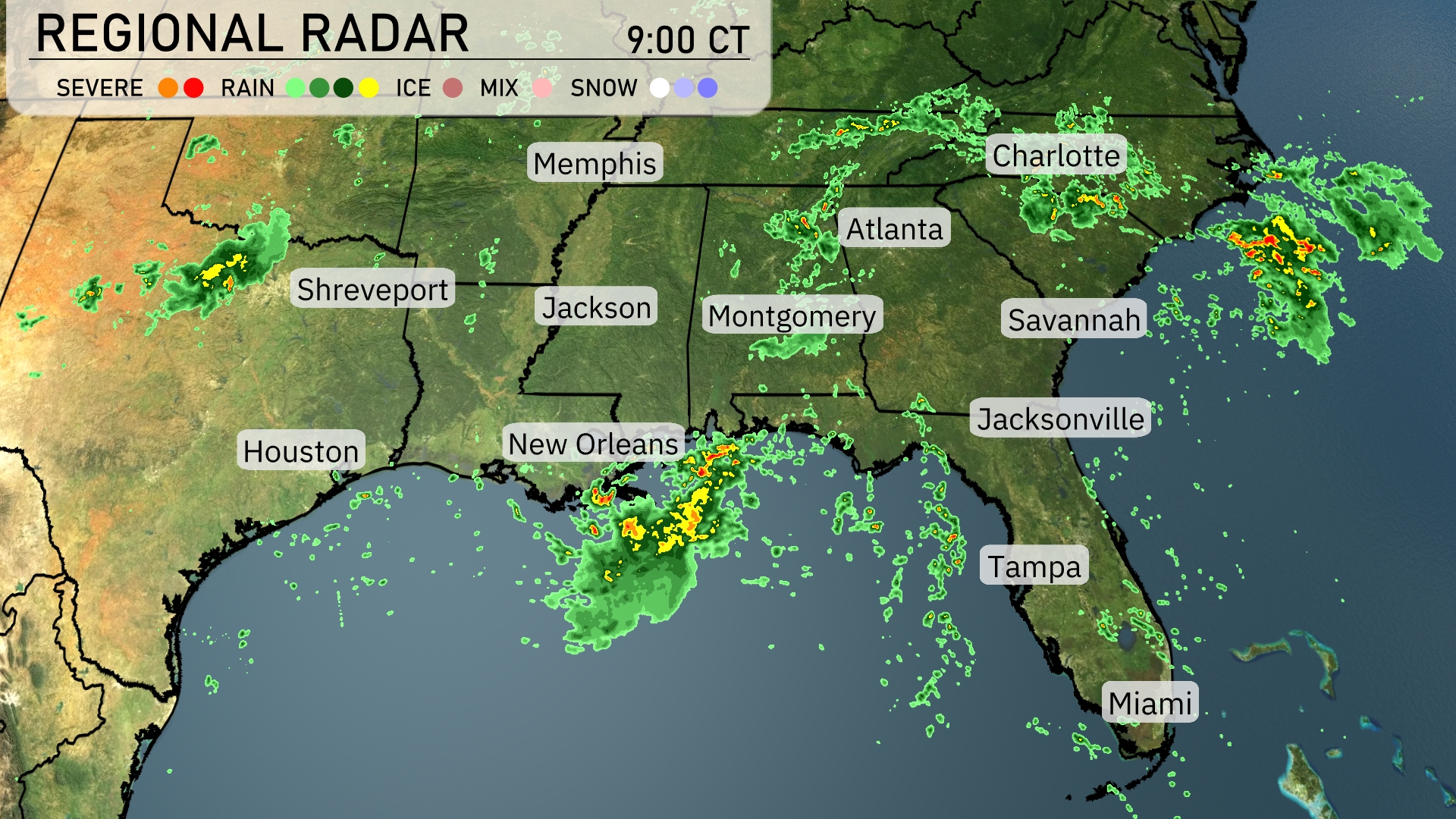
On the Regional Radar, showers and thunderstorms are prevalent along the Gulf Coast, especially impacting areas around New Orleans and moving eastward. Atlanta and Charlotte are currently experiencing scattered rain showers, with cloud cover extending across Georgia and parts of the Carolinas. Memphis remains mostly clear, while light rain is approaching from the east. Jacksonville is dry for now, but a developing line of storms may bring rain later in the day.
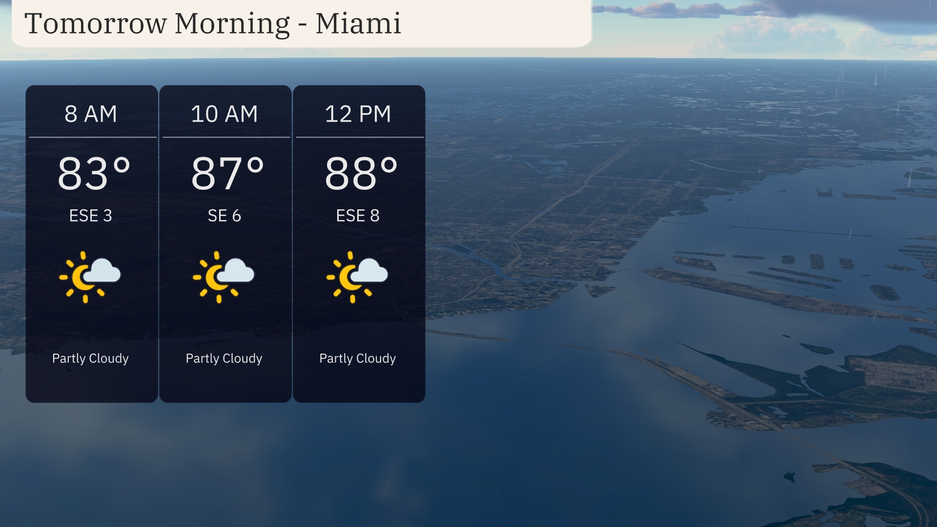
Tomorrow morning in Miami starts off partly cloudy with temperatures around 83 degrees at 8 a.m. Winds are gentle from the east-southeast. By 10 a.m., the temperature rises to 87 degrees, and winds shift to southeast at 6 miles per hour. Expect the skies to remain partly cloudy as temperatures continue to climb to 88 degrees by noon, with east-southeast winds picking up slightly.
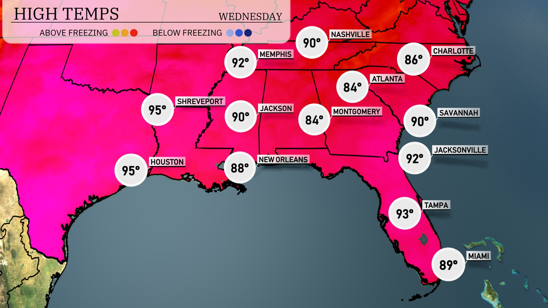
Tomorrow in the Southeast, expect soaring temperatures across the region with Memphis reaching 90 degrees. Shreveport and Houston are both forecasted to hit a high of 95 degrees, marking a trend of above-average warmth. Jackson will warm to 90 degrees, while New Orleans sees a slightly cooler high of 88. In Florida, expect Tampa to hit 93 and Miami to stay around 89 degrees. Atlanta will have a high of 84, cooler than surrounding areas but still comfortably warm.
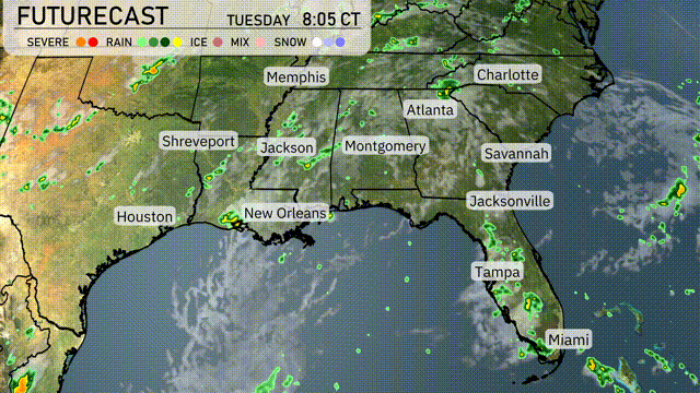
A cold front is moving into the Southeast on Wednesday, bringing a chance for thunderstorms from Houston to Jacksonville. Expect rain and potential storms impacting commute times in cities like Montgomery and Atlanta. Heavy rainfall could lead to localized flooding, particularly in areas from New Orleans to Jackson. Temperatures will likely drop behind the front, bringing cooler and drier air into the region by Thursday.
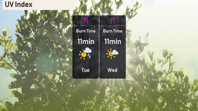
The UV index in Miami is very high at 11, so it’s important to protect your skin from sun exposure. Burn time is rapid, approximately 11 minutes in direct sunlight.
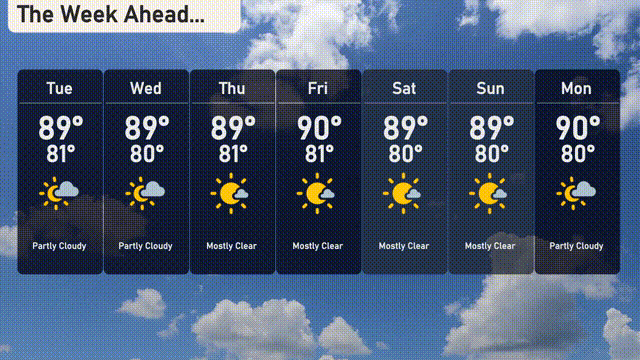
Tuesday: Partly cloudy skies with a high of 89 degrees and a low of 81 degrees.
Wednesday: Partly clear skies again with a high of 89 degrees and a low of 80 degrees.
Thursday: Mostly sunny and warm, as temperatures peak at 89 degrees with a low of 81 degrees.
Friday: Expect mostly clear conditions with a high of 90 degrees and a low of 81 degrees.
Saturday: Clear skies continue, with temperatures reaching 89 degrees by day and 80 degrees by night.
Sunday: Mostly sunny with a high of 89 degrees and a low of 80 degrees.
Monday: The week wraps up with partly cloudy skies, and a high of 90 degrees with a low of 80 degrees.