New York Morning Brew: Clouds, Sun, and the Stirrings of Hurricane Erin
By
Amy Freeze
Dive into a detailed analysis of New York's upcoming weather conditions, the looming presence of Hurricane Erin, and essential tips to stay safe and prepared.
Expect a partly cloudy and warm start in NYC with details on Hurricane Erin and essential UV safety tips.
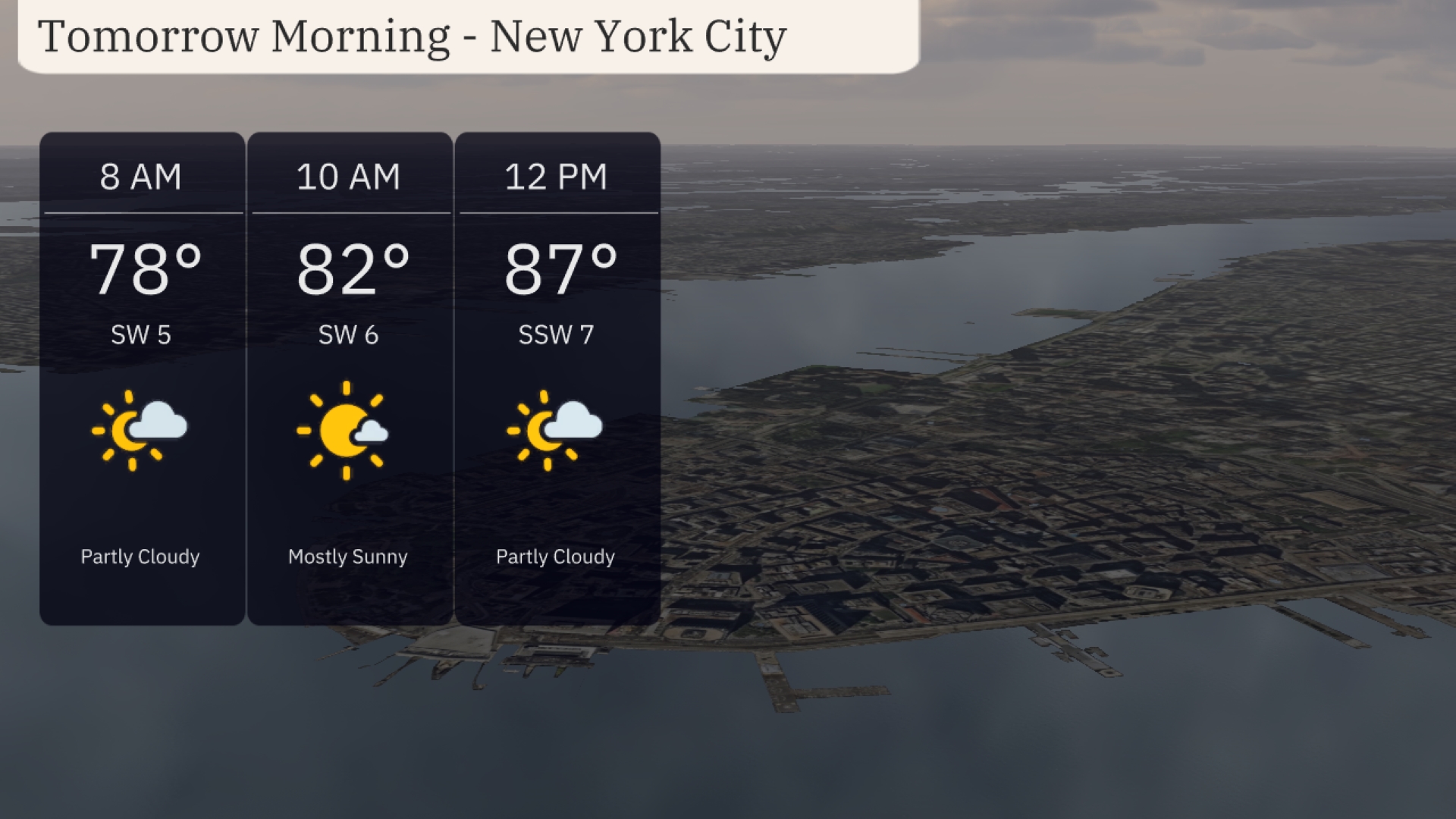
Tomorrow morning in New York City starts with partly cloudy skies and a rapid warming to 78 degrees by 8 AM. Prepare for a major weather shift with Hurricane Erin brewing in the Atlantic. This post dives deep into what to expect from today’s conditions across the Northeast, the storm near the Great Lakes, and gives essential advice on managing the very high UV index. As we transition from calm mornings to potentially stormy evenings, stay ahead with our comprehensive coverage.
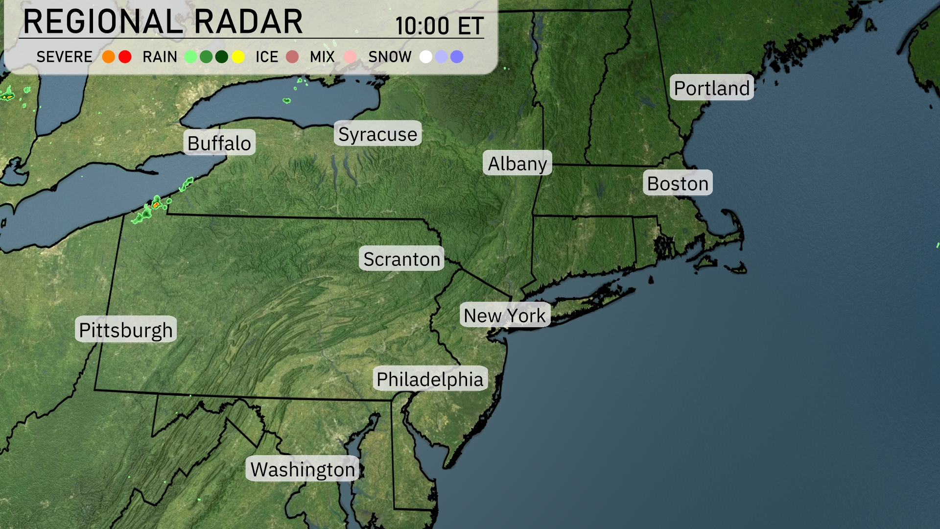
All eyes are on Erin, the storm is forecast to be the first major hurricane for the Atlantic. It’s too soon to tell if it will impact U-S land. Now radar shows a line of storms is brushing across the northeastern Great Lakes, with Buffalo seeing some light rain showers moving eastward. The remainder of the Northeast, including cities like Syracuse, Albany, and New York City, enjoy clear skies, setting up for a hot day. The Boston area and coastal regions, like Portland are rain free today.
For tomorrow morning in New York City, expect partly cloudy skies to begin with temperatures at 78 degrees by 8 AM. A light southwest wind. By 10 AM, the weather will have cleared to mostly sunny with temperatures climbing to 82 degrees. As we approach noon, temperatures will reach 87 degrees with a gentle shift in wind to south-southwest wind.
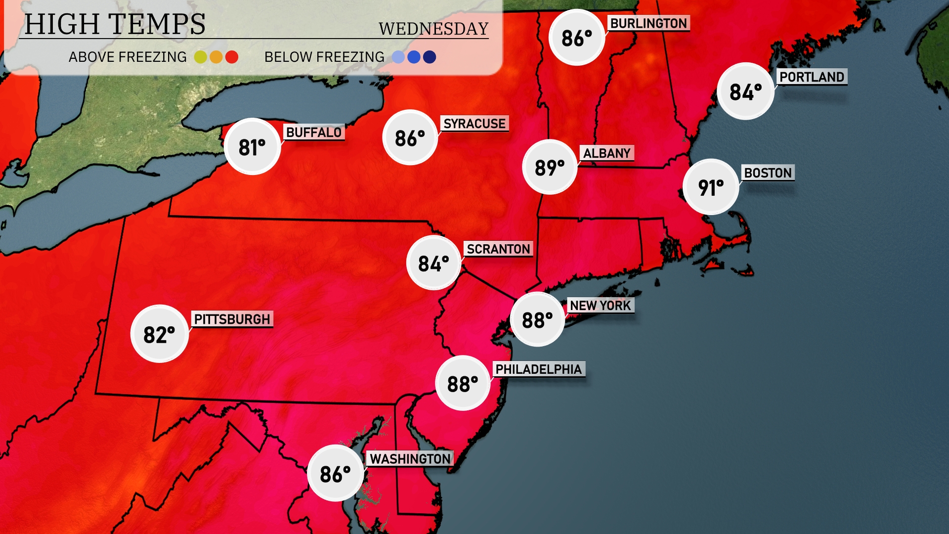
Tomorrow in Boston, expect a high temperature of 91 degrees, well above the seasonal average. New York will see a warm afternoon high of 88 degrees, while Philadelphia matches that with 88 degrees as well. Scranton will enjoy a comfortable high of 84 degrees, while Pittsburgh will reach 82 degrees. Syracuse is also in on the warmth, with temperatures climbing to 86 degrees.
A cold front will sweep across the Northeast tomorrow, bringing scattered thunderstorms from Pittsburgh to Scranton and potentially reaching the New York City area by late afternoon. Areas like Albany and Syracuse should prepare for possible heavy downpours and gusty winds in the late evening. Temperatures will start warm, but expect a significant drop as cooler air settles in post-frontal passage.
Today in NYC, the UV index is 9, indicating a very high risk with a burn time around 15 minutes under direct sunlight. Make sure to wear sunscreen, hats, and protective clothing. On Wednesday, the index slightly decreases to 8, but the sun remains strong, with a burn time of about 17 minutes.
For the 7-day forecast in New York City:
Tuesday: The day will be mostly clear with a high of 88 degrees and a low of 74 degrees.
Wednesday: Expect cloudy skies, with temperatures also reaching a high of 88 degrees and a low of 74 degrees.
Thursday: Partly cloudy conditions carry on into Thursday with a high of 86 degrees and a low of 73 degrees.
Friday: Enjoy mostly clear weather and a high reaching 86 degrees with a low of 70 degrees.
Saturday: Temperatures will peak at 86 degrees under partly cloudy skies with lows around 71 degrees.
Sunday: Expect a warmer day, mostly sunny with a high of 91 degrees and a low of 73 degrees.
Monday: Showers expected late in the day, with a daytime high of 84 degrees and a nighttime low of 70 degrees.