Chicago Morning & Midwest Storm Watch: Weather Updates for a Dynamic Day
By
Amy Freeze
Get live updates on the weather conditions in Chicago and the Midwest, including storm alerts, temperature shifts, and safety tips.
Prepare for a mix of sun and storms across the Midwest with key insights on temperature changes and storm predictions for a safer day.
Discover the detailed weather dynamics for Chicago and the surrounding Midwest areas as we predict an overcast morning followed by regional storms. Learn how these conditions will affect your day and gain essential safety tips to navigate the potential weather hazards. More extended insights into the weekly forecast ensure you’re well-prepared beyond today.
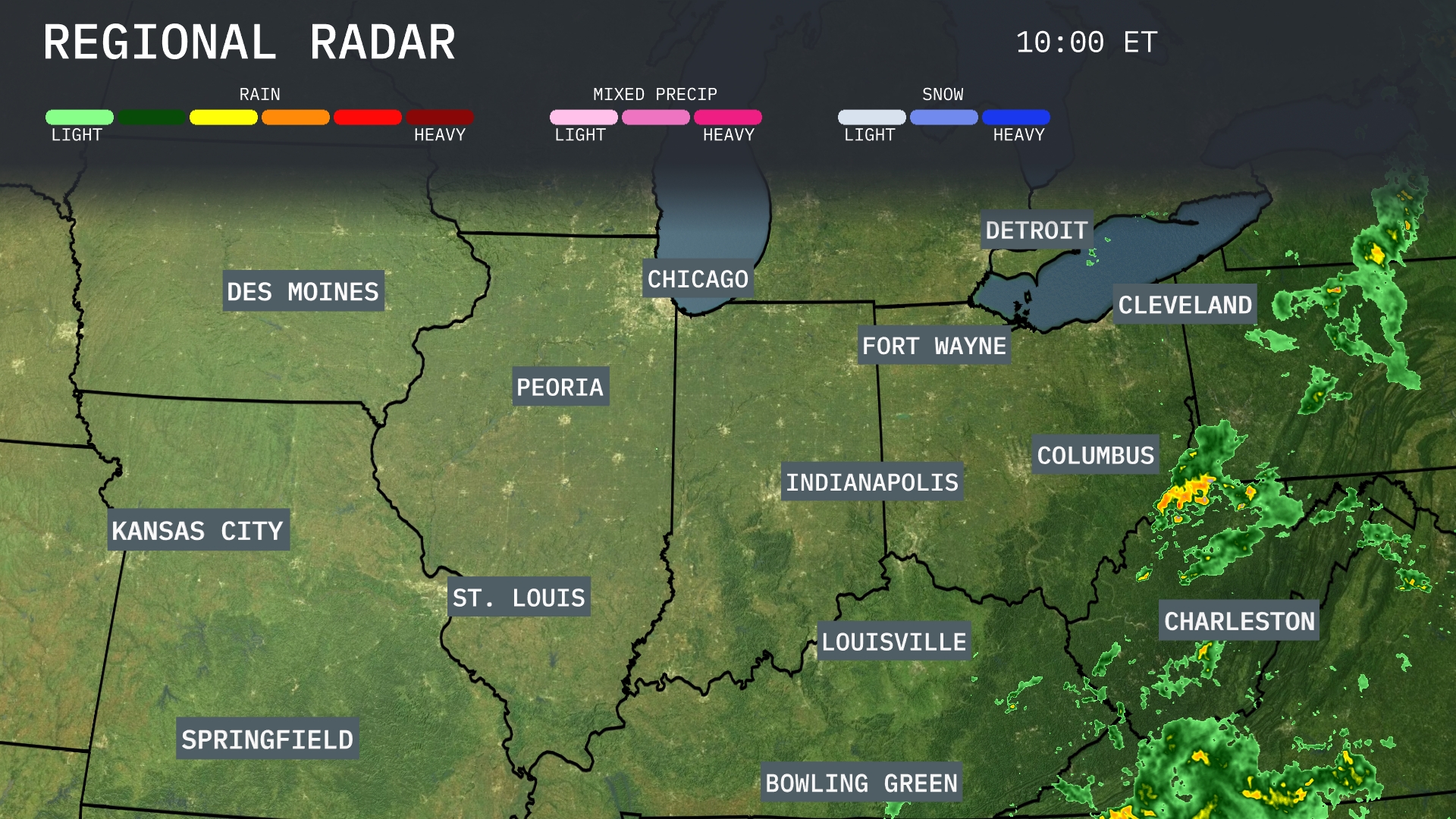
A robust line of rainstorms stretches from Columbus to Cincinnati, moving northeast toward Cleveland, with scattered showers seen approaching Fort Wayne. Charleston is experiencing heavy rainfall and thunderstorms, particularly in the southeastern quadrant. Chicago, St. Louis, and the surrounding areas of Des Moines and Kansas City enjoy clear and calm conditions. Clouds have begun to increase over Indianapolis, signaling potential weather changes soon.
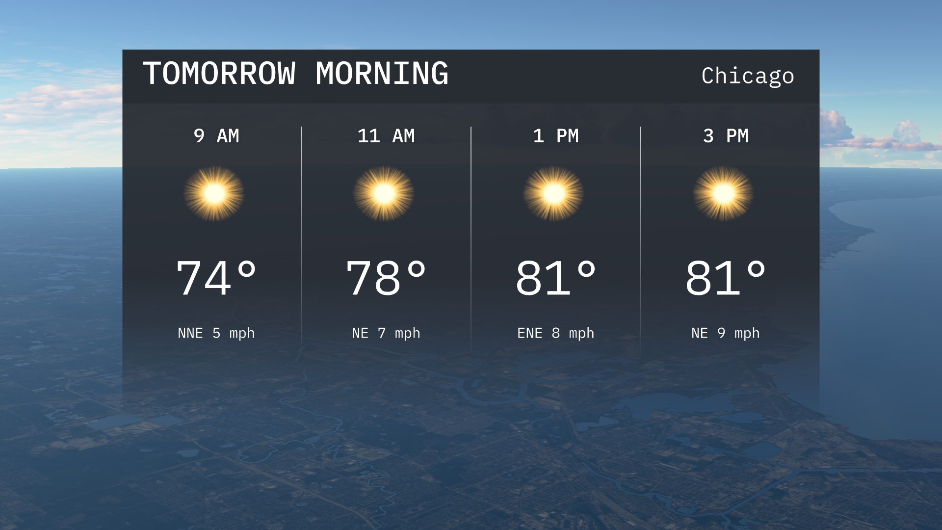
In the early hours tomorrow morning in Chicago, temperatures start at 74 degrees by 9 AM, climbing to 78 degrees by 11 AM. You’ll experience a gentle breeze from the north-northeast, shifting to a more easterly direction at 7 miles per hour. Sunshine prevails, so it’s a bright start to the day.
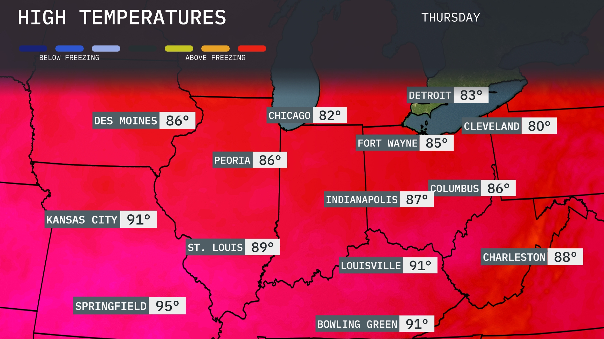
Tomorrow in the Midwest, Kansas City will reach a sizzling high of 91 degrees, while St. Louis isn’t far behind at 89 degrees. Springfield is set to hit the hottest mark of the day at 95 degrees. Across the region, Chicago will enjoy 82 degrees and Detroit will see a pleasant 83 degrees.
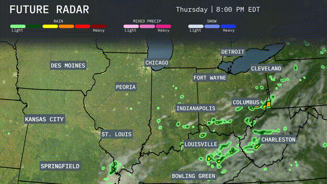
A cold front will push across the Midwest tomorrow, bringing the potential for scattered thunderstorms. Areas from Kansas City to Indianapolis should prepare for periods of heavy rain and localized flooding. Southern parts of Illinois and Indiana could experience gusty winds, with temperatures dropping by 5 to 10 degrees post-front. Showers are expected to continue into the evening around Louisville and Bowling Green. As the front moves eastward, Columbus and Charleston may see thunderstorms, so keep an eye on weather alerts.
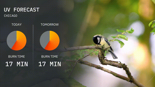
The UV index in Chicago today holds at 5, with a burn time of about 17 minutes. For tomorrow, expect the UV index to remain steady at 5, making the sun moderately strong again with the same 17-minute burn time.
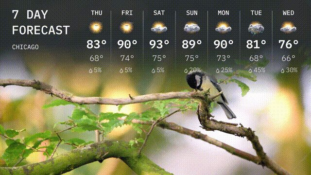
Thursday: Enjoy sunny skies with a high of 83 degrees and a low of 68 degrees.
Friday: The sun sticks around, warming up to 90 degrees, with nighttime temperatures dropping to 74 degrees.
Saturday: Even hotter, with temperatures hitting 93 degrees during the day and cooling to 75 degrees at night.
Sunday: Expect a high of 89 degrees, with increased clouds and a low of 75 degrees.
Monday: Partly cloudy conditions persist, with a high of 90 degrees and a dip to 73 degrees at night.
Tuesday: Thunderstorms likely, temperatures will peak at 81 degrees, with a cooler evening at 68 degrees.
Wednesday: Thunderstorms continue with a high of 76 degrees and a low of 66 degrees.