NYC Weather Alert: From Sunny Mornings to Tropical Threats
By
Amy Freeze
Discover how Tropical Storm Erin might shake up your week, alongside a detailed forecast for NYC and the Northeast. Stay ahead of the weather with Amy Freeze!
NYC gears up for a mixed weather palette: bright skies, rising temps, and a looming tropical storm. Get all the details on what to expect right at your doorstep!
As NYC welcomes a pleasantly warm morning, residents should keep an eye on the horizon as Tropical Storm Erin gears up, potentially upgrading to a hurricane. In addition to NYC’s heatwave, the broader Northeast braces for impactful weather including possible showers and thunderstorms, making for a dramatic and changeable weather week. Comprehensive insights on temperatures, storm timings, and safety precautions are all included in our detailed forecast.
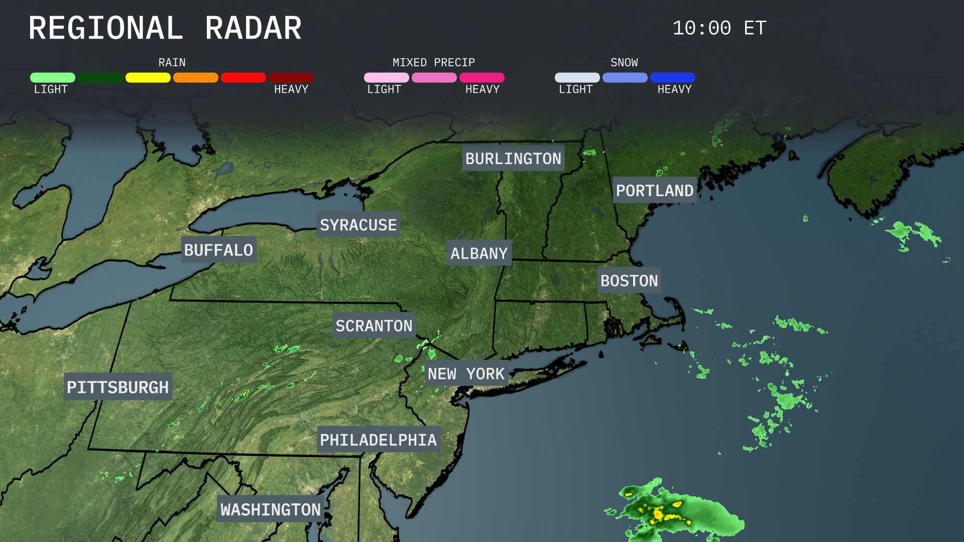
Light rain showers are sweeping over areas near Scranton and into New York City, hinting at a wet morning commute. Over in Portland and Boston, the skies remain clear now, but clouds are starting to gather, signaling possible changes later in the day. Along the southern stretches, Washington sees showers creeping northward, potentially impacting Philadelphia.
Tropical Storm Erin is on track to become the first hurricane of the busy 2025 Atlantic season—possibly reaching major hurricane strength by the weekend. Coastal regions from Puerto Rico to the Leeward Islands are being warned of deadly surf and rip currents even if Erin veers offshore
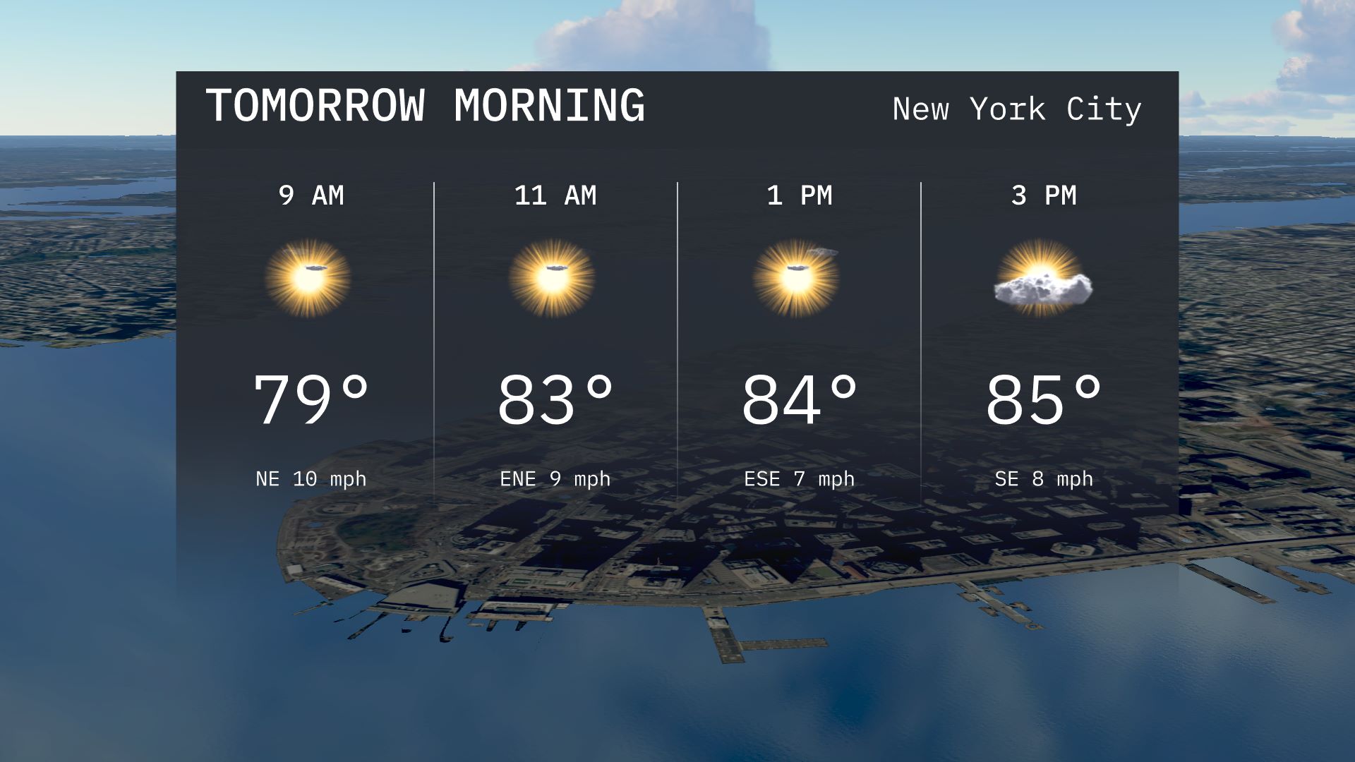
Expect a sunny start to your morning in New York City with temperatures rising from 79 degrees at 9 AM to 83 degrees by 11 AM. Winds will be gentle, coming from the northeast at around 10 miles per hour.
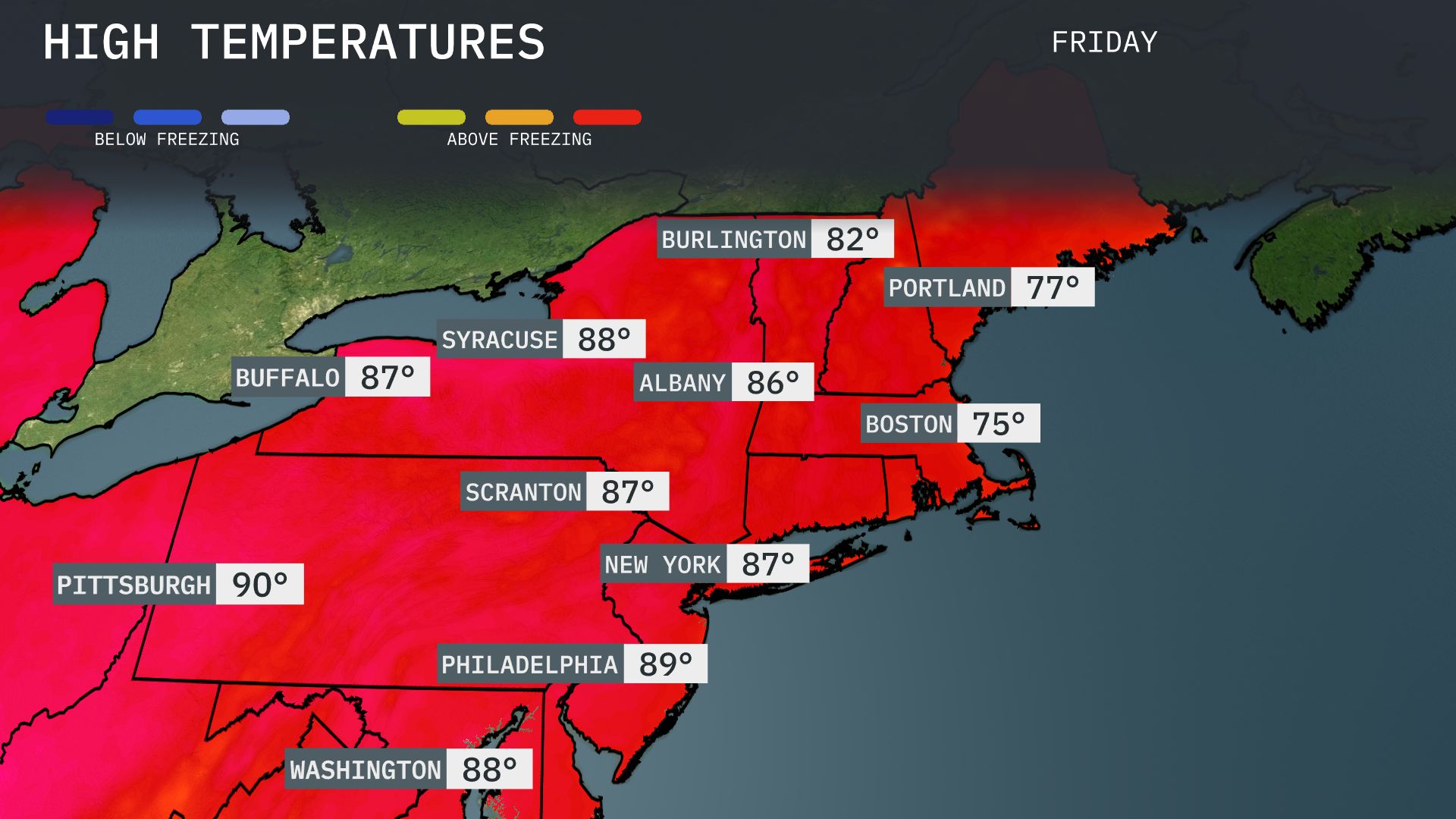
Tomorrow, Pittsburgh will reach a sizzling 90 degrees, marking a significant above-average high for the season. Philadelphia follows closely with a high of 89 degrees, also well above normal for this time of year. New York City will see temperatures hitting 87 degrees, while Albany warms up to 86 degrees. In Syracuse, expect a warm day with a high of 88 degrees, and Buffalo will cool slightly to 87 degrees. Boston will be a bit milder at 75 degrees.
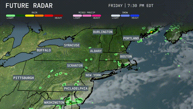
A front is moving through the Northeast tomorrow, bringing scattered showers and isolated thunderstorms from Scranton to Burlington. Expect the heaviest downpours in the evening, with gusty winds possible in isolated spots. Temperatures will remain in the mid-70s across most areas, cooling slightly after the front passes. While severe weather risks are low, be prepared for potential localized flooding in low-lying areas. Skies will gradually clear as the system exits by late Thursday.
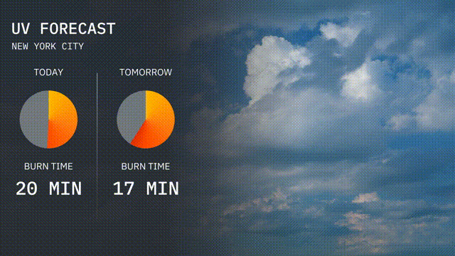
The UV index in New York City today is high with a value of 8, meaning you can expect a burn time of about 20 minutes in direct sunlight. Tomorrow, the UV index will still be high but slightly lower at 7, with a burn time of 17 minutes.
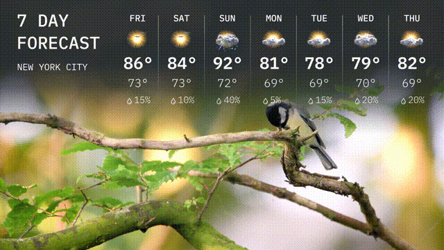
For the 7 day forecast in New York City:
Friday: Look forward to mostly sunny skies with a high reaching 86 degrees and an evening low of 73 degrees.
Saturday: Expect similar conditions with partly sunny weather, a high of 84 degrees and a low around 73 degrees.
Sunday: We’ll see our warmest day at 92 degrees, with increasing clouds later and temperatures cooling to 74 degrees overnight.
Monday: A mix of rain and sunshine returns with a high of 81 degrees, falling to a low of 69 degrees by night.
Tuesday: Partly sunny skies with a possible rain shower, reaching 78 degrees for a daytime high and 69 degrees at night.
Wednesday: A cloudy day with scattered showers expected, a peak of 79 degrees, and a low of 69 degrees.
Thursday: Wrap up the week with a high of 82 degrees, featuring sun, clouds, and some evening rain.