Austin Morning Mix: Sun Patches and Storm Paths – Weather Insights for August 15, 2025
By
Amy Freeze
Partly cloudy skies in Austin with storm warnings in effect for the region. Get all your weather updates for a safe and informed start to your day.
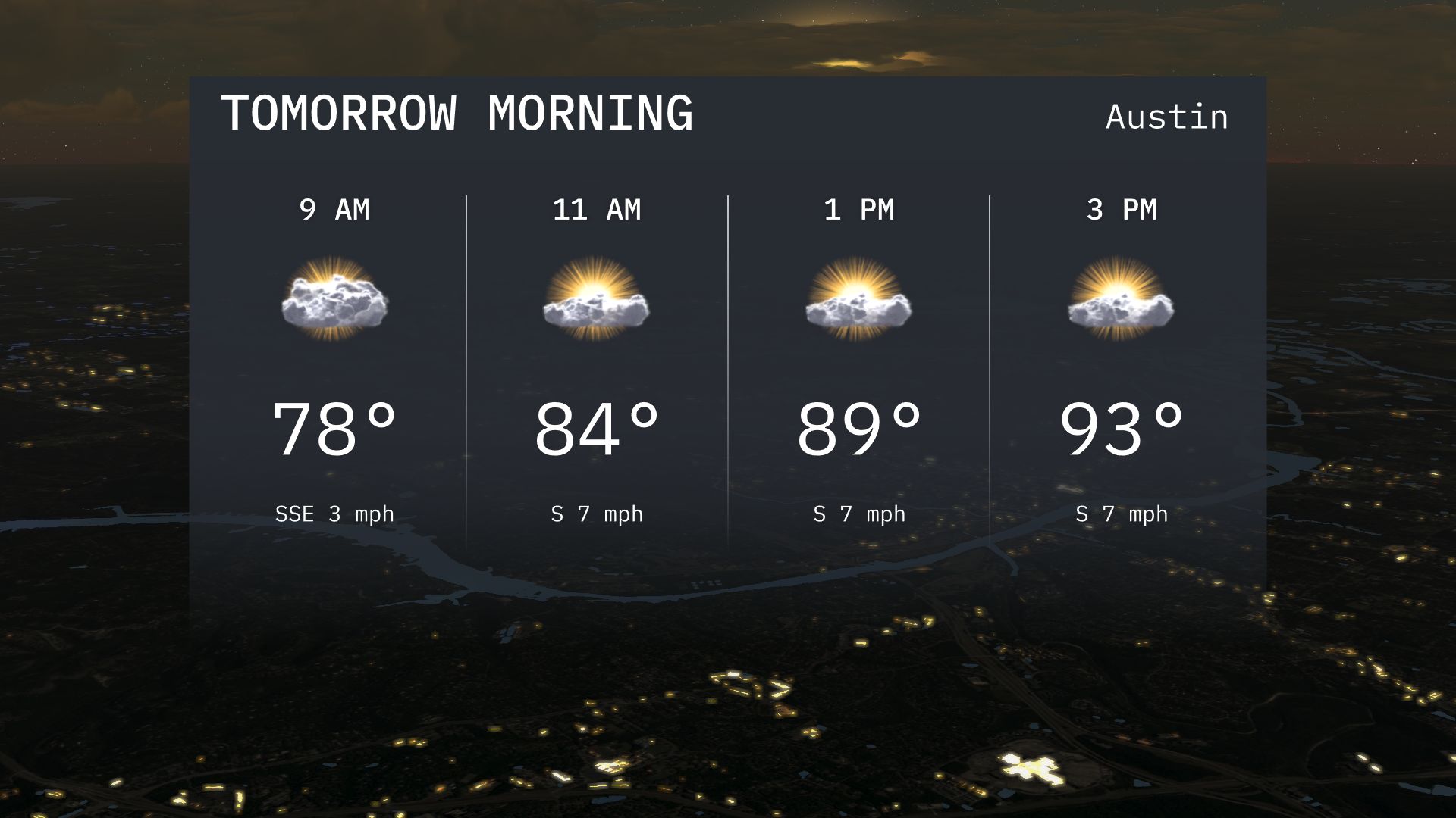
Tomorrow morning in Austin looks partly cloudy with temperatures around 78°F, warming up as the day progresses. Keep an eye on the storm tracker for updates on potential heavy rain!
Austin wakes up to partly cloudy skies on August 15, 2025, promising a pleasant morning with temperatures starting at a comfy 78 degrees. As the South sees storm advancements, we provide all details on potential heavy rains and storm paths affecting nearby regions. Austin’s UV index remains high; don’t forget your sunscreen. With fluctuating temperatures across the Southern Plains, our blog at https://amyfreeze.ai/ dives deep into the forecasts to help you plan your week effectively.
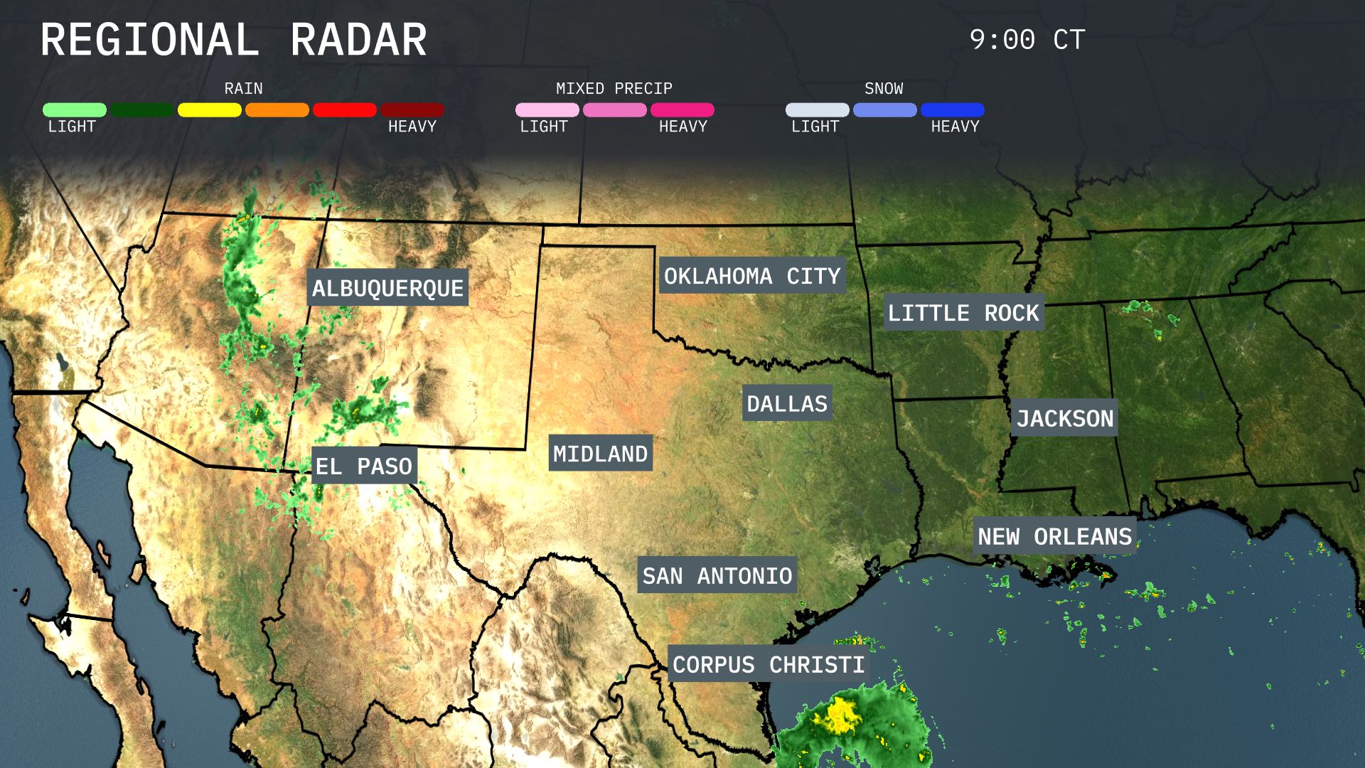
Strong thunderstorms are evident from Albuquerque stretching into the Texas Panhandle, moving eastward towards Midland. Expect scattered showers with potential for heavy rain, especially around El Paso as it tracks southeast. Coastal areas like Corpus Christi and surrounding Gulf regions are seeing intense rain, which is expanding northward, possibly impacting New Orleans later. Dallas and Oklahoma City remain mostly clear, providing a brief reprieve from wet conditions today.
Tomorrow morning in Austin, look for partly cloudy skies with temperatures starting around 78 degrees at 9 am. Winds will be from the south-southeast, offering a light and gentle breeze. By 11 am, temperatures rise to 84 degrees as the sun begins to break through. The weather remains pleasant with a calm southerly wind maintaining a steady pace.
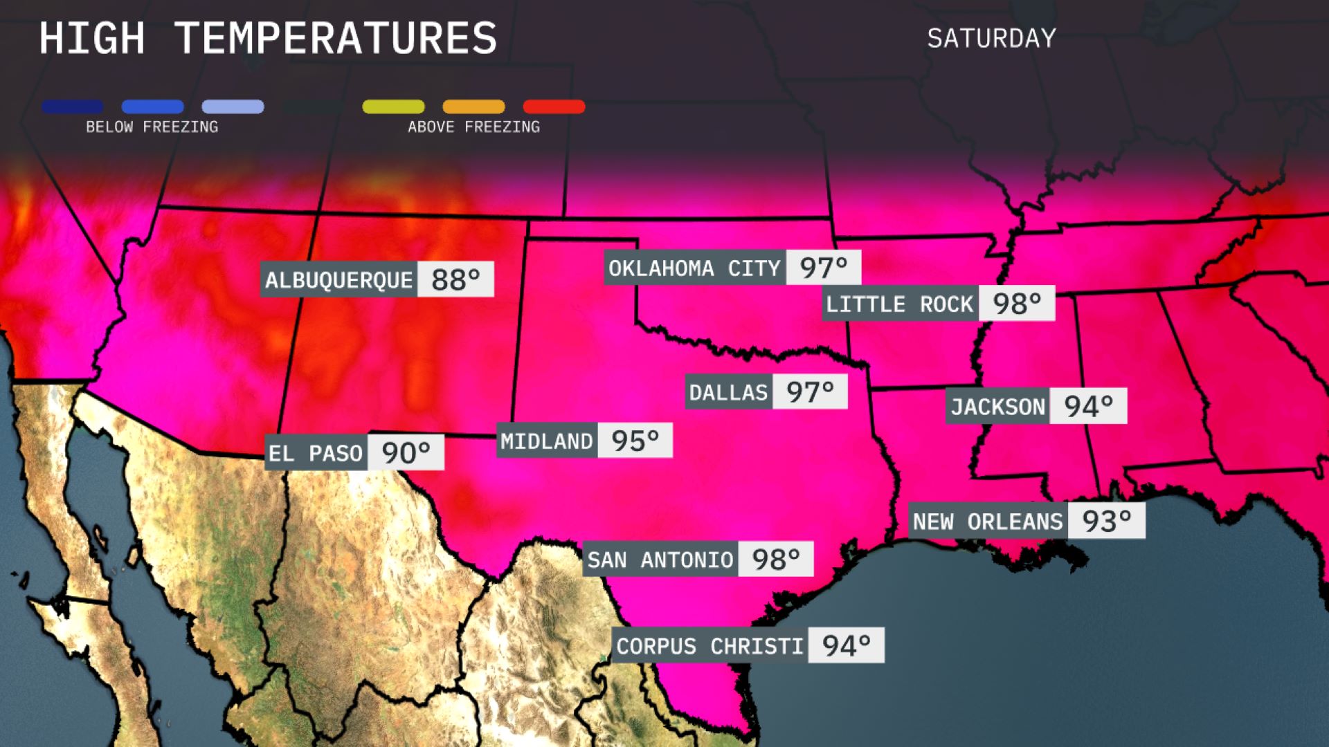
Tomorrow, Oklahoma City will be hot with a high of 97 degrees, while Dallas also reaches 97. Little Rock is forecasted to hit 98, marking above-average temperatures for this time of year. San Antonio will swelter at 98 degrees as well, contributing to a notably warm trend in the Southern Plains. El Paso rounds out the region with a high of 90, maintaining the heat across the area.
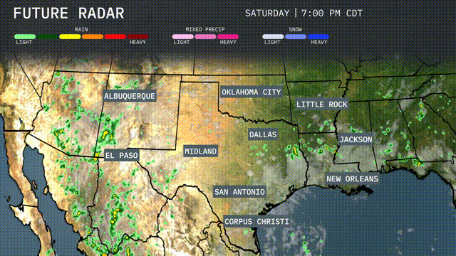
A dynamic day in the Southern Plains as a cold front continues to advance. Expect scattered storms from Dallas to Corpus Christi, with the potential for heavy rain and localized flooding. Oklahoma City may see severe storms, with strong winds as the primary threat. Lingering precipitation persists through Wednesday, providing much-needed moisture to the region.
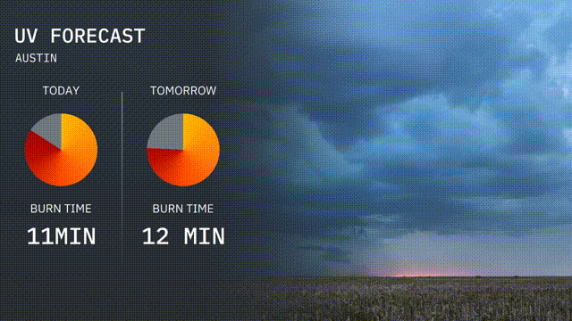
The UV index in Austin is high with values suggesting a burn time of 11 minutes today and 12 minutes tomorrow.
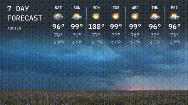
Saturday: Expect mostly cloudy skies with a high of 96 degrees and a low of 78 degrees.
Sunday: Sunny with a high reaching 99 degrees and a low of 76 degrees.
Monday: Heat continues with the temperature climbing to 100 degrees, cooling down to 77 degrees overnight.
Tuesday: Partly sunny and hot with a high of 99 degrees, dipping to 77 degrees at night.
Wednesday: Mostly sunny, maintaining a high of 99 degrees with a low of 76 degrees.
Thursday: Clouds and a chance for rain develop, as highs reach 96 degrees with lows around 75 degrees.
Friday: Mostly cloudy with a high of 96 degrees and a low of 75 degrees,