Experience mostly sunny skies in NYC today with a sneak peek at tomorrow’s mercurial weather, from sun to potential storms. Detailed insights inside!
New York City enjoys a sunny start tomorrow, but watch for a change as the day progresses, with storms expected by evening. Perfect for planning your day whether you’re commuting or planning an outing!
New York City will see a sunny start tomorrow with temperatures gradually increasing throughout the morning. However, as the day progresses, expect changing weather conditions with showers and thunderstorms rolling in by the evening that might disrupt outdoor activities and travel. Stay prepared and informed with our comprehensive guide on how to navigate NYC’s fluctuating weather conditions from sunny mornings to stormy evenings.
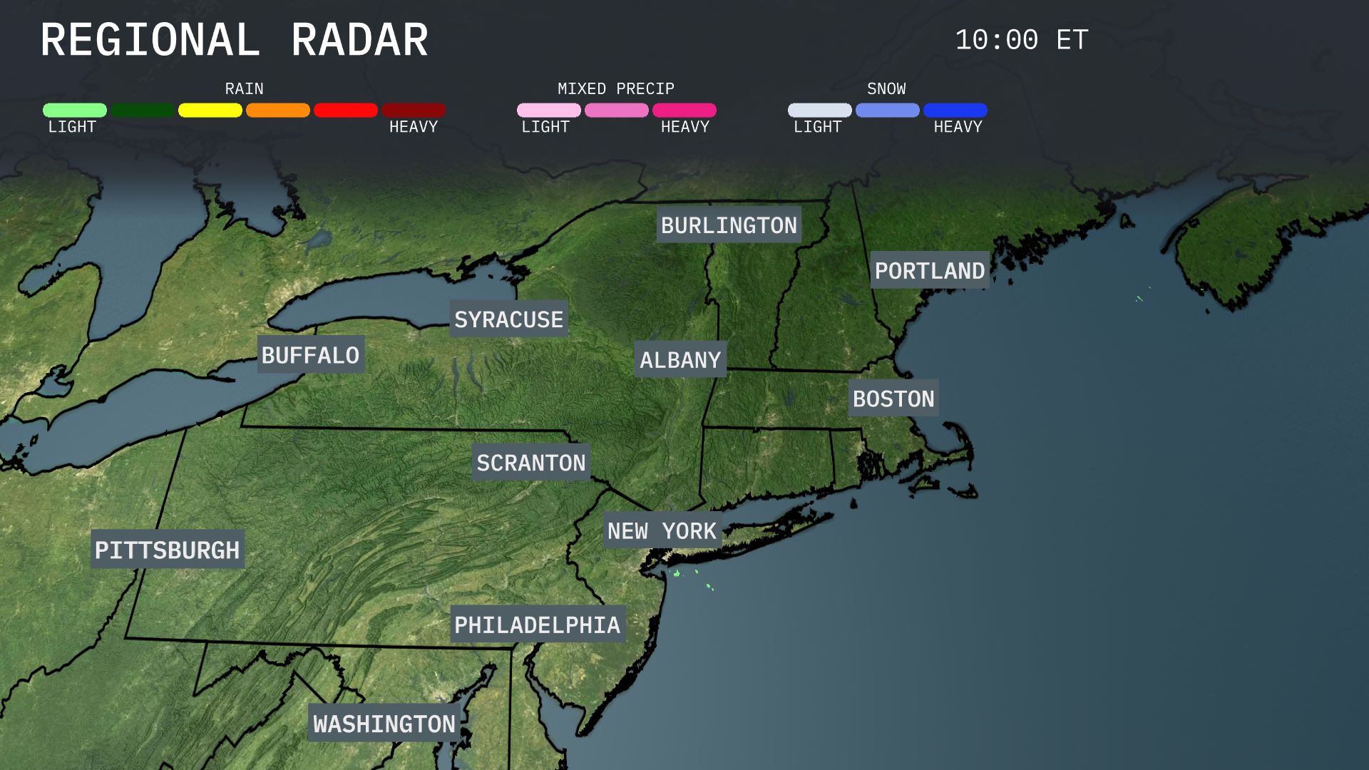
Showers are spreading across the Northeast, with notable precipitation over Scranton and Syracuse. Albany and Burlington are under thick cloud cover, albeit with little precipitation for now. Portland and Boston are witnessing light rain, which could intensify through the day. In contrast, New York City remains mostly clear, giving residents a dry start to their day.
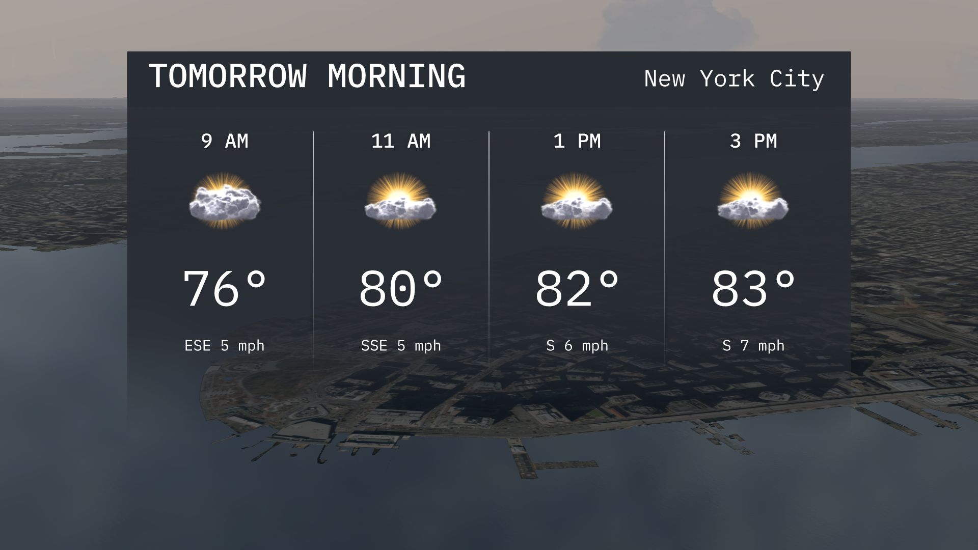
Expect partly cloudy skies in New York City tomorrow morning with temperatures rising from 76 degrees at 9 AM to 80 degrees by 11 AM. Winds will be gentle, starting from the east-southeast. Enjoy a mild morning with the sun peeking through as we move towards the late morning hours.
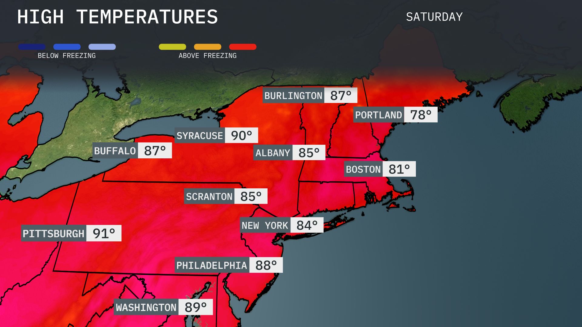
Tomorrow, Pittsburgh will be hot, reaching a high of 91 degrees. Syracuse is expected to hit 90 degrees, while Albany and Scranton will see temperatures around 85 degrees. New York City will warm up to 84 degrees, and Philadelphia is slated for a high of 88 degrees. Overall, temperatures across the Northeast are trending significantly above average due to a strong ridge of high pressure dominating the region. Portland will be slightly cooler at 78 degrees, but still warmer than seasonal norms.
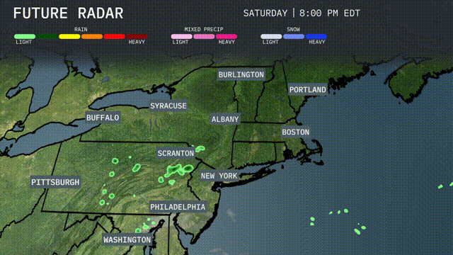
Tomorrow, the Northeast will experience scattered showers and thunderstorms passing through areas like Scranton and New York in the evening. Expect heavy rain around late afternoon, potentially impacting travel and outdoor activities. Temperatures across Boston and Albany will remain in the mid-70s, a bit cooler than average for this time of year. Watch out for gusty winds accompanying these storms, especially from Pittsburgh to Syracuse. A cold front moving through will bring drier conditions and clearer skies by late Wednesday.
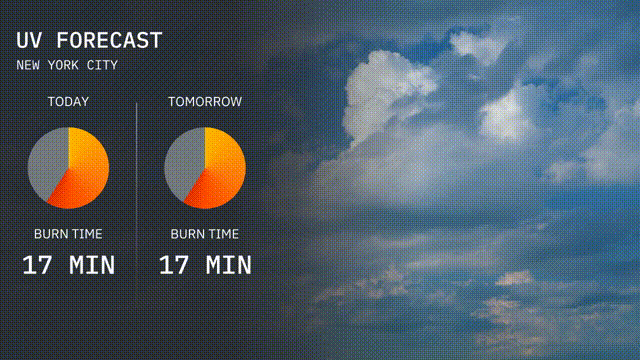
Today in New York City, the UV index will be high at 8, with a burn time of about 17 minutes.
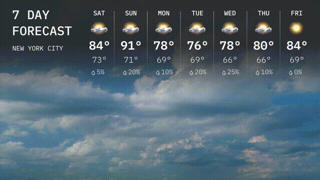
For the 7-day forecast in New York City:
Saturday: Expect partly cloudy skies with a high of 84 degrees and a low of 73 degrees.
Sunday: Warming up with a sunny day and a high of 91 degrees, dipping to 71 degrees overnight.
Monday: Cooler with a mix of sun and clouds, reaching up to 78 degrees and a low of 69 degrees.
Tuesday: Partly cloudy with the temperature peaking at 76 degrees and an overnight low of 69 degrees.
Wednesday: A chance of showers with a high of 66 degrees and a low of 66 degrees.
Thursday: A mix of clouds and sun with temperatures climbing to 80 degrees, cooling to 64 degrees at night.
Friday: Enjoy sunshine to wrap up the week with a high of 84 degrees and a low of 69 degrees.