Chicago Weather Forecast: A Warm Morning and Stormy Afternoon Ahead
By
Amy Freeze
Dive into tomorrow’s weather forecast for Chicago with a detailed look at the morning warmth and the afternoon storm potentials. Full details inside!
Expect a partly cloudy morning in Chicago with temperatures around 80 degrees. Keep an eye on potential afternoon storms as a low-pressure system moves in.
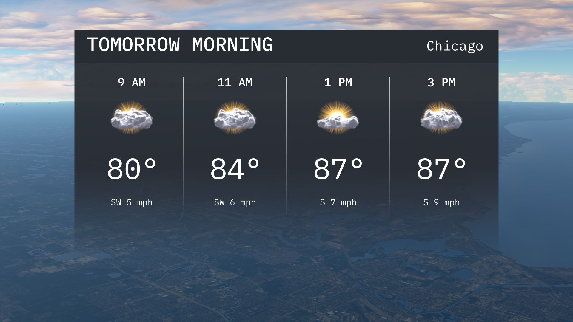
Tomorrow’s weather in Chicago starts with partly cloudy skies and a warm 80 degrees, escalating to 84 by mid-morning. By afternoon, watch out for potential thunderstorms due to a developing low-pressure system, especially in southern regions. Complete details on temperature trends and severe weather warnings are available. Visit https://amyfreeze.ai/ for continuous updates and in-depth analysis.
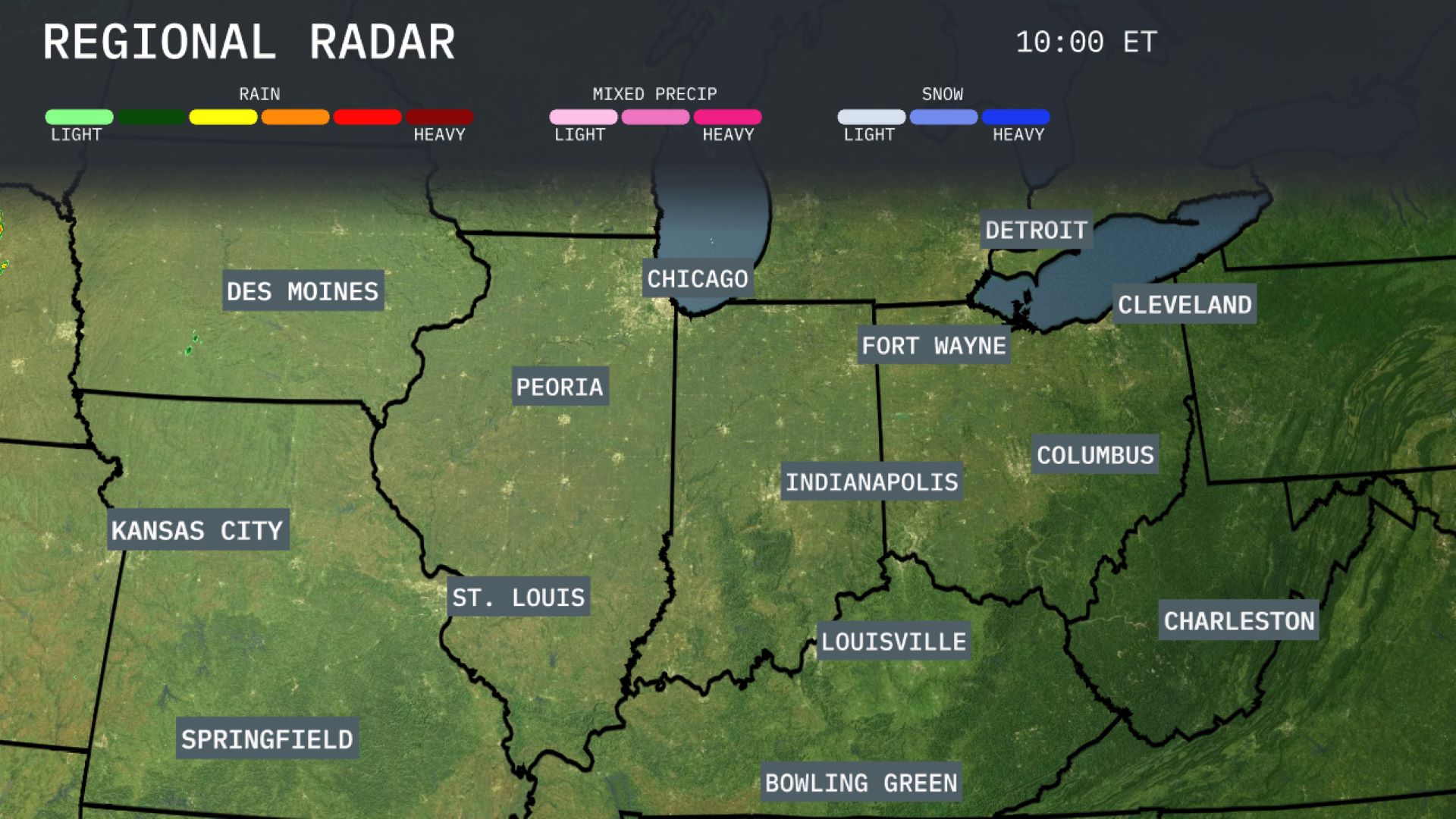
On the Regional Radar, a band of rain is stretching from Kansas City to Des Moines, with heavier showers particularly centered near Des Moines and Peoria. A mix of precipitation with light snow is impacting Fort Wayne and stretches to Columbus, indicating cooler temperatures there. In contrast, Chicago and Detroit are currently under clear skies. Cloud cover is thickening over Indianapolis as weather systems shift eastward across the Midwest.
Expect a warm start to your morning in Chicago with temperatures around 80 degrees at 9 AM. By 11 AM, temperatures will reach 84 degrees, accompanied by a light southwest breeze. Skies will be mostly cloudy, providing some comfort from the sun as the morning progresses.
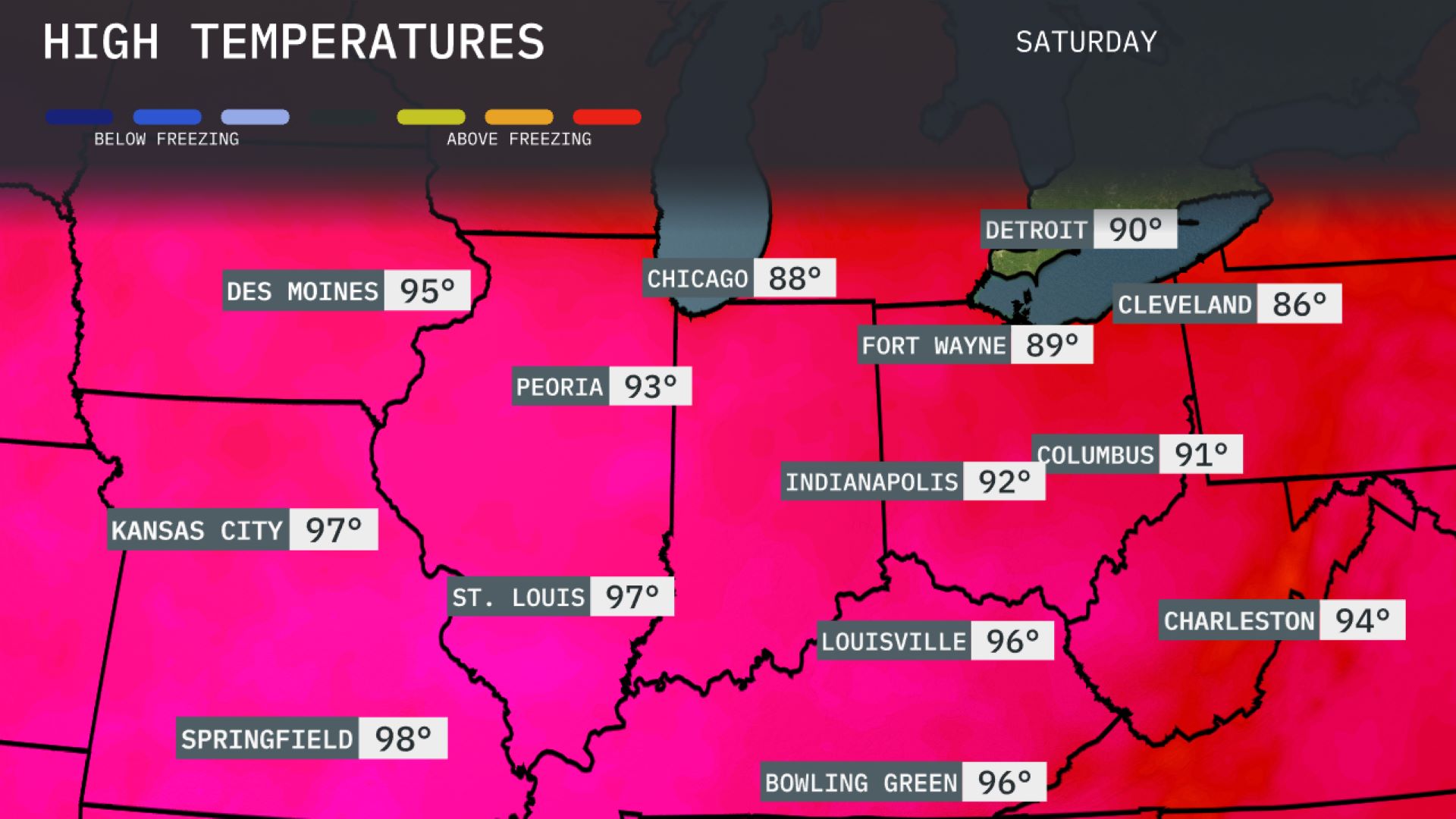
Tomorrow in the Midwest, temperatures are expected to soar with Kansas City reaching 97 degrees. Springfield will be slightly warmer at 98, while St. Louis anticipates a high of 97 as well. Chicago is seeing a milder day at 88 degrees, but Peoria will warm up to 93. In the east, Indianapolis will experience a high of 92, while Detroit matches that at 90 degrees.
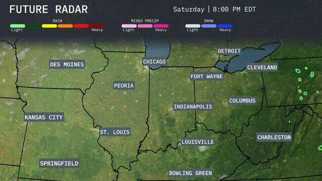
A developing low-pressure system is set to bring active weather across the Midwest for tomorrow. Expect rain and possible thunderstorms moving into Springfield, St. Louis, and Indianapolis by afternoon, with the potential for severe storms, especially in the southern portions of the region. Heavier downpours and gusty winds may impact travel, so stay alert for any severe weather warnings. Cooler air follows the front, with temperatures dropping and clearing skies by late Wednesday.
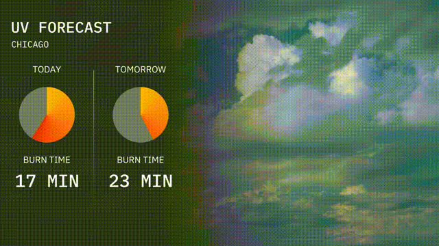
The UV index in Chicago today is high with a rating of 8, leading to a burn time of about 17 minutes in direct sunlight. Tomorrow, the index is projected to moderate at 5, with a longer burn time of 23 minutes.
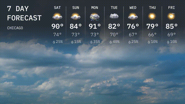
Saturday: Get ready for a hot day with a high of 90 degrees and a low of 74 degrees. Expect a 25 percent chance of rain.
Sunday: Temperatures dip slightly as the high reaches 84 degrees and the low is 73 degrees.
Monday: The heat returns with temperatures soaring to a high of 91 degrees and a low of 73 degrees. There’s a 35 percent chance of rain.
Tuesday: Cooling down to a high of 82 degrees with a low of 70 degrees, and a 40 percent chance of rain showers.
Wednesday: Expect a cooler day as the high will be 76 degrees and a low of 67 degrees, with a 25 percent chance of rain.
Thursday: Mostly sunny with a high warming up to 79 degrees and a low of 66 degrees.
Friday: Ending the week with sunshine, reaching a high of 85 degrees and a low of 69 degrees.