Morning Mists to Sunshine: NYC’s Weather Outlook for the Week
By
Amy Freeze
From scattered showers to sunny days, read about what the weather holds for New Yorkers this week. A comprehensive guide on temperatures, storm forecasts, and a sneak peek into the highs and lows across the Northeast region.
This week in NYC weather: a mix of clouds, sunshine, and chances of showers! Dive deep into the forecast with daily highs and lows and special alerts for potential storms.
The upcoming week in New York City presents a mix of partly cloudy skies and possibilities of scattered showers. With morning temperatures starting at 69°F, learn about the gradual climb and the expected temperatures region-wide. Our comprehensive guide will also cover the approaching low-pressure system which will bring thunderstorms and potential heavy rains. Wrap up your planning with safety tips and stay ahead of the weather curve!
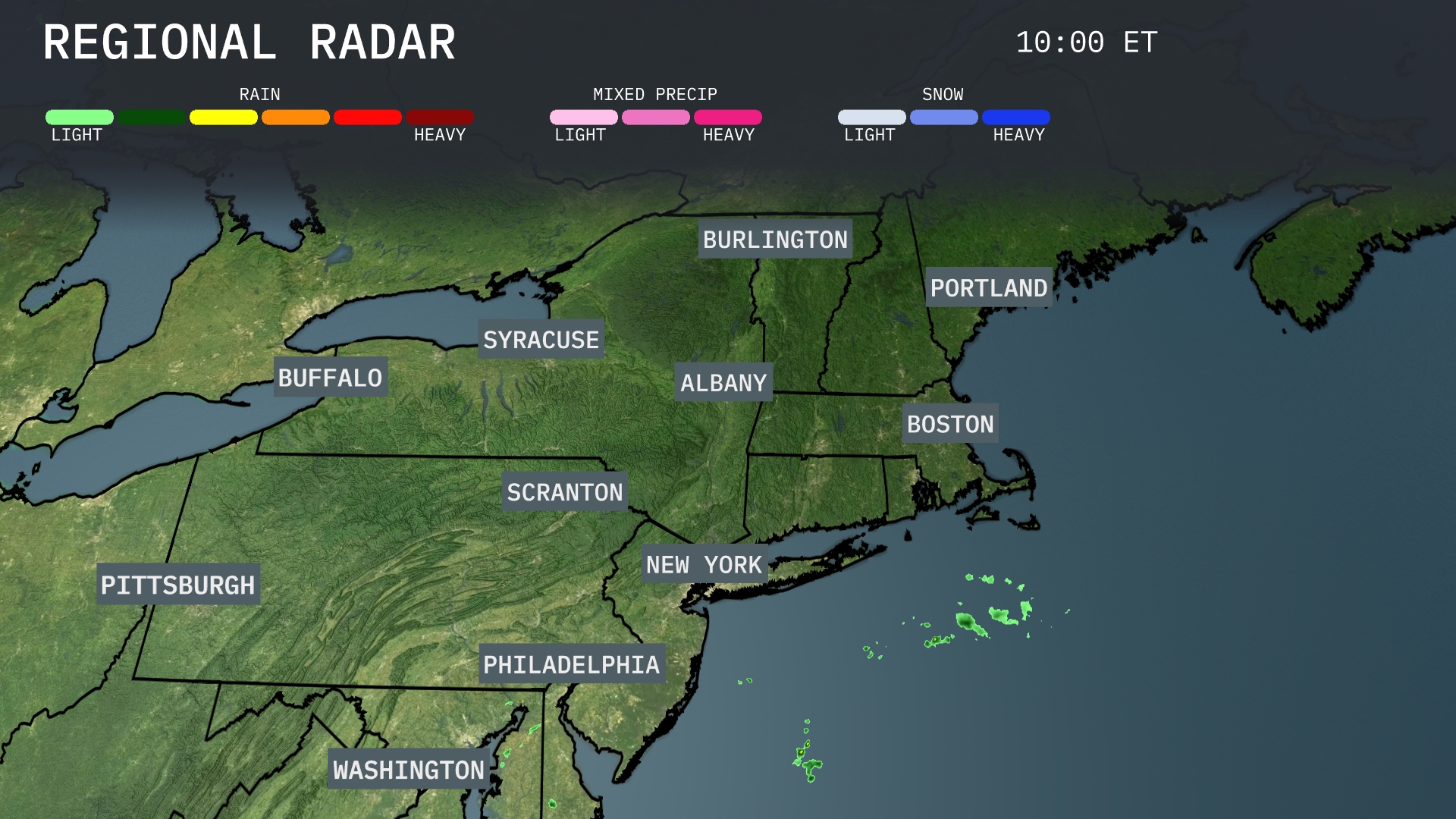
Scattered showers can be seen off the coast of Long Island, gradually approaching the New York City area, but the Northeast remains largely clear at this time. Buffalo to Burlington enjoys dry conditions, with no precipitation detected on the radar over northeastern cities. The skies over Boston and Portland are clear, suggesting a calm weather pattern across most of the Northeast region.
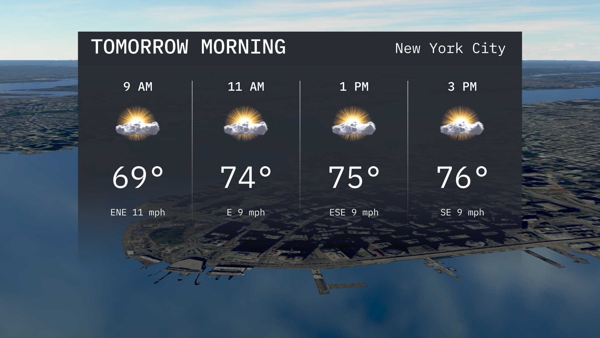
For tomorrow morning in New York City, expect temperatures to begin at 69 degrees at 9 AM, with a light east-northeast. By 11 AM, temperatures rise to 74 degrees, accompanied by an east wind.
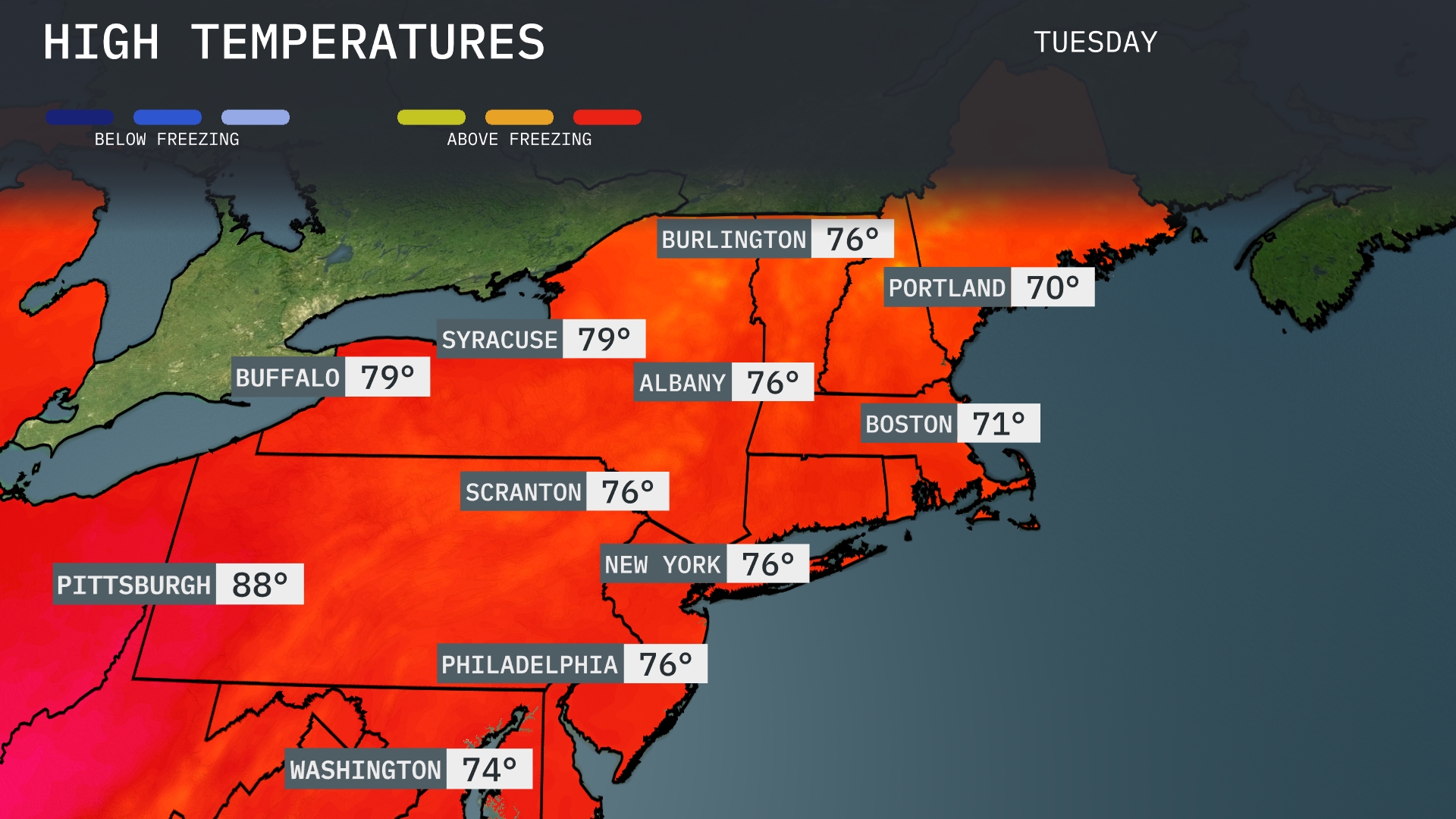
Tomorrow, Pittsburgh will soar to a warm 88 degrees, setting the stage for above-average temperatures in the region. Buffalo is expected to reach 79 degrees, while Syracuse warms up to 79 as well. In New York City and Philadelphia, anticipate highs around 76 degrees, with Boston a touch cooler at 71 degrees.
A low-pressure system will move through the Northeast, bringing scattered showers and thunderstorms from Washington to Portland late Tuesday evening into Wednesday. Be prepared for heavy rain in Philadelphia and New York City, which could lead to localized flooding, particularly in urban areas. Temperatures will hover in the mid-70s, before cooling slightly as a cold front passes through Wednesday evening. Keep an eye out for potential severe storms, especially in the Burlington and Syracuse regions.
The UV index in New York City is high today with a value that results in a burn time of 27 minutes in direct sunlight. Tomorrow, the UV index remains elevated, bringing the burn time down to 17 minutes.
For the 7 Day Outlook in New York City:
Tuesday: Partly cloudy with a high of 77 degrees, dipping to a low of 68 degrees.
Wednesday: Expect a chance of showers, with highs reaching 75 degrees and a low of 67 degrees.
Thursday: Enjoy mostly sunny conditions with a high of 78 degrees, cooling to 65 degrees at night.
Friday: The sunshine continues with temperatures climbing to a high of 84 degrees, and a low of 67 degrees.
Saturday: Another sunny day with a high of 84 degrees and a low of 71 degrees.
Sunday: Showers develop with highs around 82 degrees, dropping to 69 degrees overnight.
Monday: The week wraps up with a mix of sun and clouds, reaching a high of 83 degrees and a low of 65 degrees.