Bracing for the Breeze: Chicago’s Weather Forecast Unveiled
By
Amy Freeze
Prepare for a mixed bag of weather in Chicago with insights on temperature variations and storm predictions.
Chicago is gearing up for a weather-filled week with temperatures peaking and thunderstorms looming. Get the latest forecast and how it affects your plans.
Chicago’s dynamic weather is set for another unpredictable week. Expect partly cloudy skies with potential heavy showers as storms move from Peoria towards Chicago. The Midwest heats with varying temperatures peaking at mid-90s in some parts while Chicago remains relatively cooler. A band of thunderstorms will create potential flooding risks. Our guide details what you can expect and how to prepare. Visit our blog for all the updates: https://amyfreeze.ai/
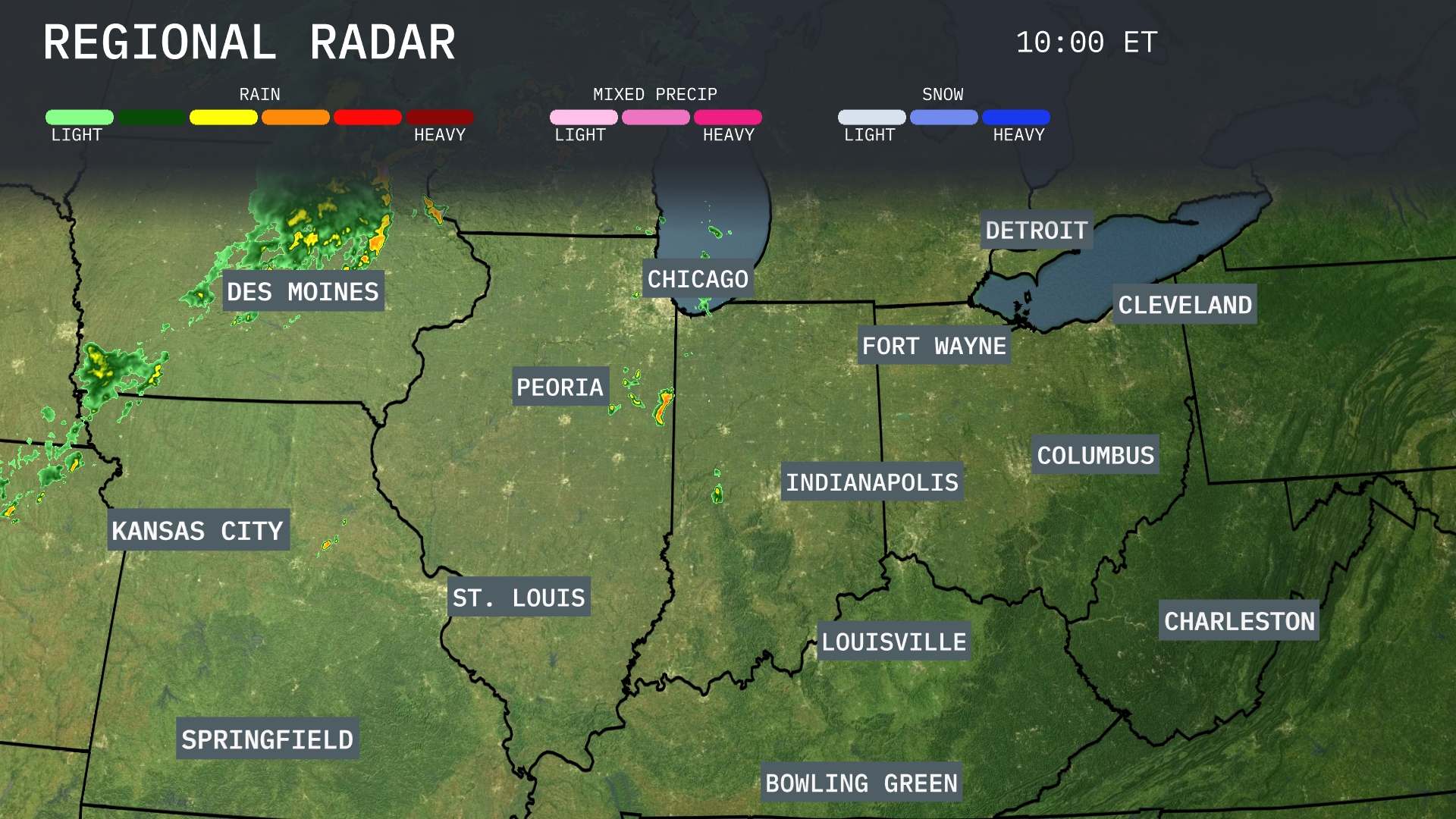
An expanse of showers is spreading from Kansas City towards Des Moines, indicating possible heavy rain for these areas. There’s ongoing storm activity around Peoria moving northeastward toward Chicago, which might experience some strong showers. Indianapolis is under cloudy skies with spotty rain showers, while Fort Wayne is seeing mild precipitation, drifting toward Cleveland. St. Louis enjoys clearer skies, providing a break from the wet conditions central to the region.
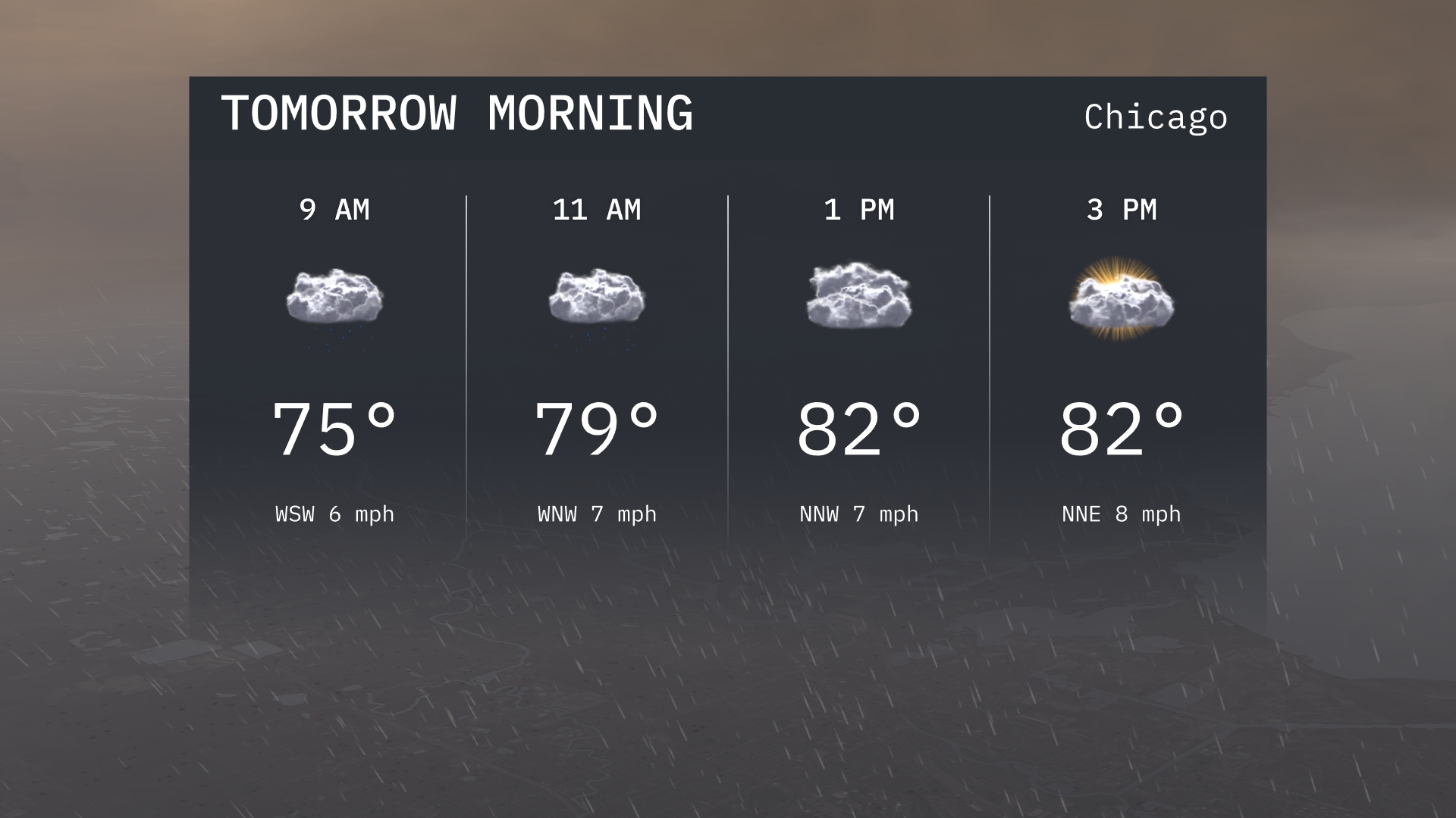
For Chicago tomorrow morning, expect a warm start with temperatures beginning at 75 degrees at 9 a.m. A mix of clouds covers the sky, and the wind will be from the west-southwest. By 11 a.m., temperatures will rise to 79 degrees with winds shifting to the west-northwest.
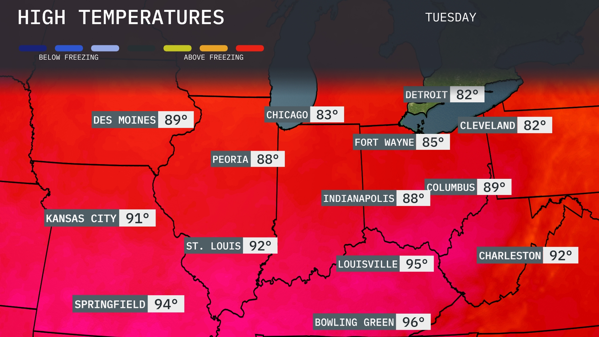
Tomorrow, the Midwest is heating up with temperatures well above average. St. Louis and Louisville lead the pack, reaching sizzling highs of 92 and 95 degrees, respectively. Kansas City isn’t far behind at 91 degrees, while Peoria and Indianapolis will both hit 88 degrees. In contrast, Chicago and Detroit will see slightly cooler conditions, with highs around 83 and 82 degrees.
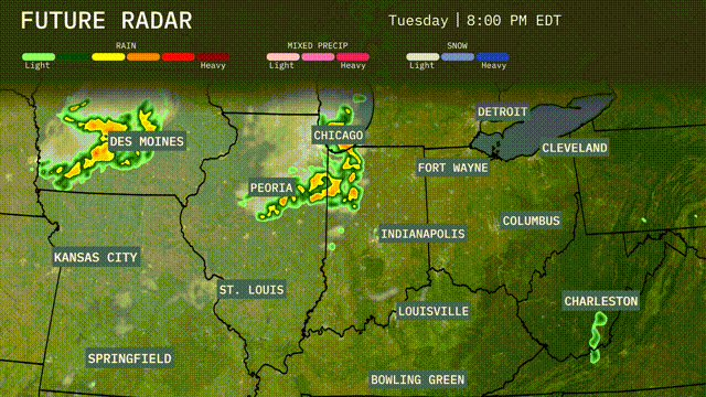
A band of thunderstorms is expected to sweep across the Midwest, starting tonight in Des Moines and moving toward Chicago and Peoria by morning. Expect heavy rain potentially leading to localized flooding, with strong winds as an embedded threat. The cold front associated with these storms will bring cooler temperatures across the region starting Wednesday, dropping by about 10 degrees. By tomorrow evening, the storms will push eastward into Fort Wayne, with clearing skies anticipated for St. Louis and Kansas City.
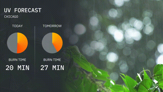
The UV index in Chicago is moderate today with a value of 5, suggesting a burn time of around 20 minutes in direct sunlight. Tomorrow, the UV index rises to 6, with a quicker burn time of about 27 minutes.
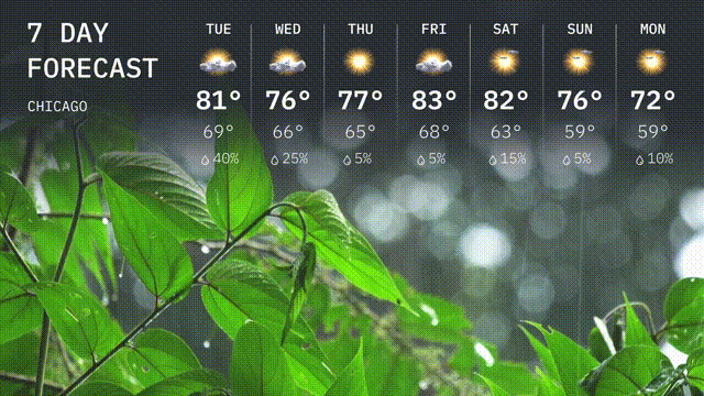
Tuesday: Expect a high of 81 degrees with scattered thunderstorms, and a low of 69 degrees.
Wednesday: Partly cloudy skies with a high of 76 degrees and a low of 66 degrees.
Thursday: Mostly sunny and warmer with temperatures reaching 77 degrees at the high and 66 degrees overnight.
Friday: Mostly sunny skies with a high of 83 degrees and a low of 68 degrees.
Saturday: The trend continues with mostly sunny conditions and a high of 82 degrees, cooling to 63 degrees at night.
Sunday: Expect clear skies with a high of 76 degrees and a comfortable low of 61 degrees.
Monday: Cooling slightly with partly cloudy skies and a high of 72 degrees, the temperature will dip to 59 degrees overnight.