Weather Wonders: NYC’s Partly Cloudy Days and Approaching Storms
By
Amy Freeze
Explore the dynamic weather patterns of New York City, from tranquil mornings to stormy evenings. Discover what this means for your week ahead!
This week in NYC: From sunshine to storms! Read on for a detailed day-by-day weather forecast and what it means for your urban adventures.
New York City offers a diverse range of weather conditions this week, starting with partly cloudy skies and mild temperatures. As the week progresses, expect a gradual build-up of clouds that will culminate in a series of thunderstorms affecting the city and its surrounding areas. This could lead to sudden temperature drops and localized flooding. Learn how to prepare and what to expect each day with our in-depth analysis on the upcoming weather shifts. Visit our full blog post at https://amyfreeze.ai/ for more extensive details.
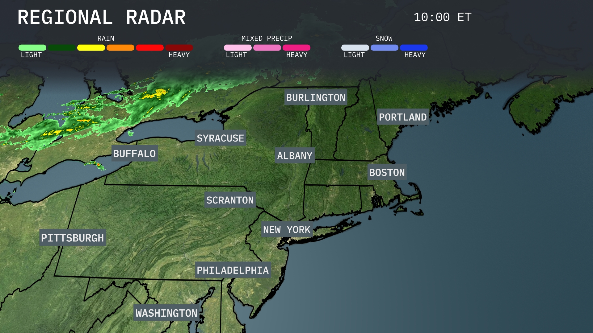
A band of rain is stretching across the Great Lakes, with steady precipitation moving through Buffalo and beginning to approach Syracuse. The northern tier remains mostly dry but clouds are increasing from Burlington to Portland, setting the stage for potential rain later. Albany is experiencing light cloud cover, while areas from New York City to Boston enjoy clear skies for now. This tranquil weather extends down the coast to Philadelphia and Washington, D.C., with no immediate precipitation expected.
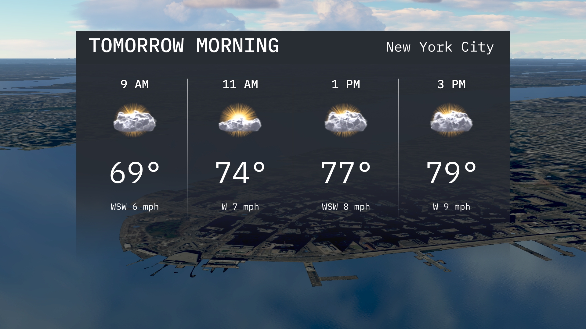
Temperatures in New York City for tomorrow morning will start at 69 degrees at 9 a.m., warming up to 74 degrees by 11 a.m. with a light west-southwest wind around 6 to 7 miles per hour. Expect a partly cloudy sky, offering brief moments of sunshine.
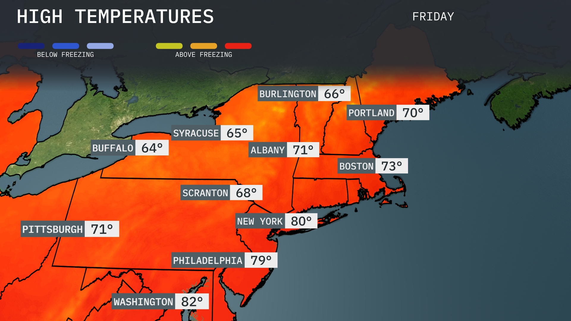
Tomorrow in the Northeast, New York City tops the charts at an impressive 80 degrees. Philadelphia isn’t far behind with a high of 79 degrees, while Boston reaches a warm 73 degrees. Albany will see temperatures climb to 71 degrees, and Scranton will hit a comfortable 68 degrees. Across the Lake, Buffalo will be on the cooler side with a high of 64 degrees.
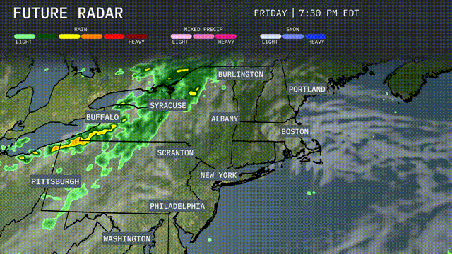
A line of thunderstorms will sweep across the Northeast beginning late Thursday night. Buffalo and Syracuse are in the path of heavy rainfall with embedded thunderstorms, which could lead to localized flooding. The moisture continues eastward through Friday, bringing rain to Albany and New York City by afternoon. A significant cool-down follows as the front moves east, lowering temperatures by about 10 degrees into Friday evening.Scattered showers drift into New England, affecting Boston and Portland by Friday night.
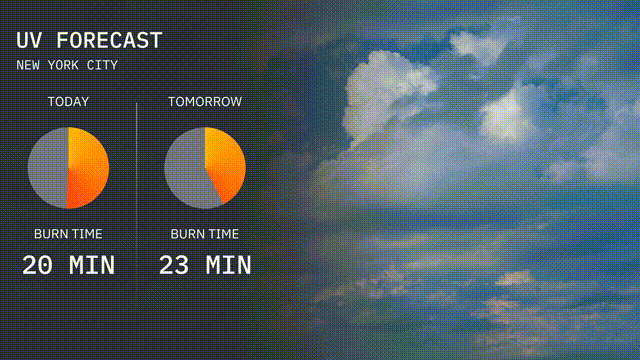
The UV index in New York City today is high, with a value indicating a burn time of about 20 minutes in direct sunlight. Tomorrow, the UV index slightly decreases to 6, with a burn time of 23 minutes.
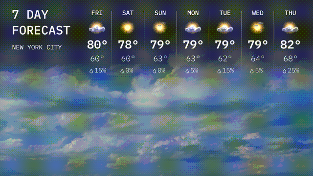
Friday: Partly cloudy with temperatures reaching a pleasant high of 80 degrees, cooling down to 60 degrees at night.
Saturday: The sun shines brightly with a daytime high of 78 degrees and an overnight low near 60 degrees.
Sunday: Enjoy more sunshine with temperatures peaking at 79 degrees during the day and dropping to 63 degrees after sunset.
Monday: Continuing the sunny trend, expect a high of 79 degrees with a crisp low of 63 degrees overnight.
Tuesday: Look for partly sunny skies with a high around 79 degrees, dipping to 62 degrees by nightfall.
Wednesday: Another lightly cloudy day with temperatures rising to 79 degrees, and a nighttime low of 64 degrees.
Thursday: Warming up to a high of 82 degrees under partly sunny skies, with nighttime lows around 68 degrees.