Morning Rays to Evening Rains: Chicago’s Dynamic Weather Forecast
By
Amy Freeze
Experience a swift weather transition in Chicago from a sunny morning to possible stormy conditions by night. Learn what to expect and how to prepare.
Tomorrow in Chicago starts sunny with a gentle breeze, but a cold front moving through could stir up storms by evening!
https://www.youtube.com/watch?v=
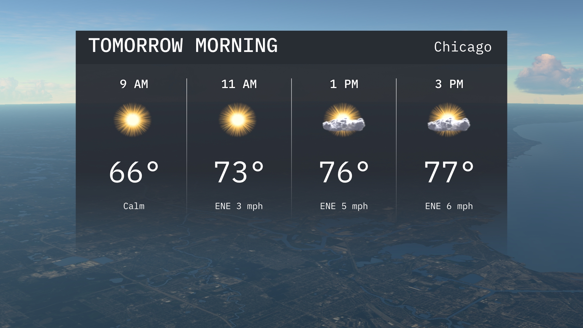
Chicago greets us with sunshine and rising temperatures tomorrow morning, hitting 66 degrees by 9 AM. As the day unfolds, a cold front aims to shake things up, bringing thunderstorms by nighttime. Find out how this affects other Midwest areas, from Kansas City to Detroit, and what these changes mean for your daily plans. Stay tuned for tips on handling fluctuating temperatures and stormy weather effectively.
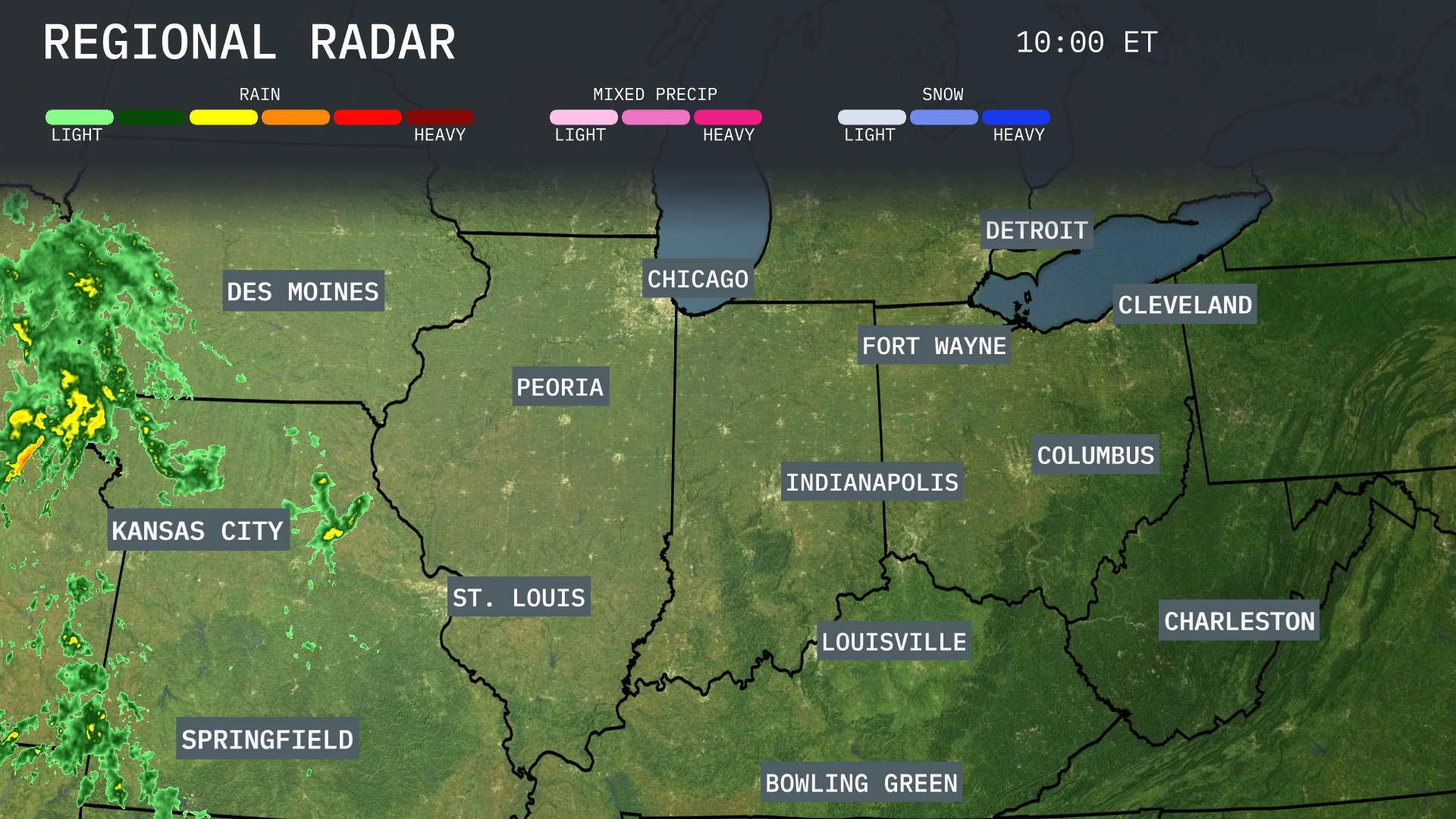
A substantial band of showers is making its way toward Kansas City, moving east from Des Moines, and is likely to bring some wet conditions to Springfield soon. Peoria might begin to see cloudy skies as the rain band approaches from the west. The rest of the Midwest, including Chicago, Fort Wayne, and areas north like Detroit, remains under clearer skies for now. However, cloud cover might start to increase as the rain progresses eastward.
Tomorrow morning in Chicago, expect a sunny start with temperatures rising to 66 degrees by 9 AM. The breeze will be calm initially, then shifting slightly to the east-northeast.Temperatures will gradually increase to 73 degrees by late morning.
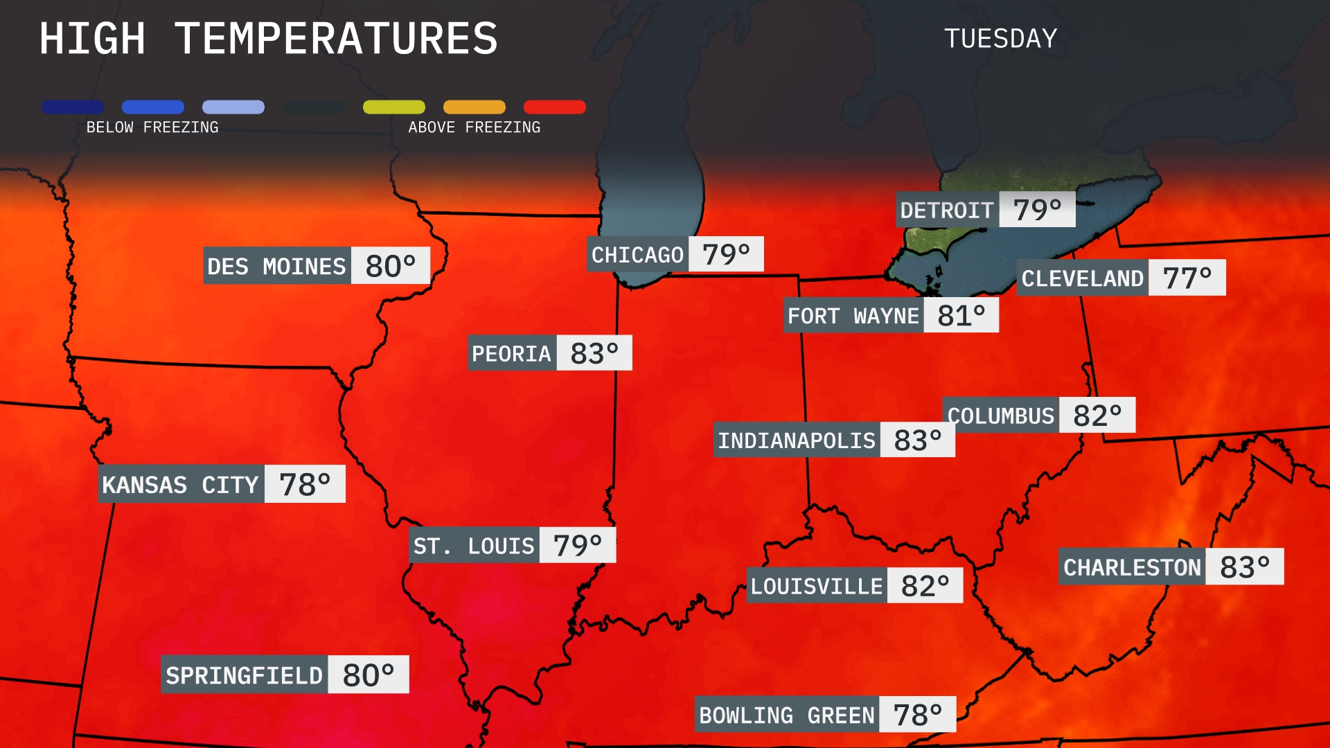
Tomorrow, Chicago is expecting a high of 79 degrees, while St. Louis will see similar temperatures at 79 as well. Indianapolis is warming up slightly more with a high of 83 degrees, and Peoria will even reach 83. In the Ohio Valley, Columbus is forecasted to hit 82 degrees, with Louisville also reaching 82. Overall, temperatures across the Midwest are slightly above average for this time of year, influenced by a warm air mass moving through the region.
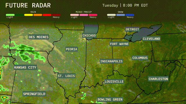
A cold front is moving through the Midwest, expected to bring showers and thunderstorms by tomorrow evening, particularly impacting areas from Kansas City to St. Louis. Heavy rainfall and gusty winds are likely, with potential for localized flooding. As the front progresses, temperatures will drop noticeably, ushering in cooler air by Wednesday morning from Chicago to Indianapolis. Although severe storms are possible, most of the region will experience moderate rainfall with cooler and drier conditions settling in by the weekend. Stay alert for any severe weather warnings, especially in areas where the front passes during peak heating hours.
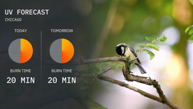
Today’s UV index in Chicago reaches a high value of 7, suggesting a burn time of just 20 minutes in direct sunlight, so sunscreen and protective wear are essential. As we move into tomorrow, the UV index remains elevated, with another day where burn time hovers around 20 minutes. Keep those sun protection measures handy!
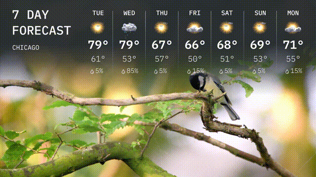
Tuesday: Sunny skies with a high of 79 degrees and a low of 61 degrees.
Wednesday: Expect thunderstorms with a high of 79 degrees and a low of 53 degrees.
Thursday: Cooler and rainy, reaching up to 67 degrees for the high and 50 degrees for the low.
Friday: Partly sunny with a high of 66 degrees and a low of 50 degrees.
Saturday: Mostly sunny, temperatures climb to 68 degrees during the day and drop to 51 degrees at night.
Sunday: Another sunny day with a high of 69 degrees and a nighttime low of 53 degrees.
Monday: Partly cloudy with a high of 71 degrees and a low of 55 degrees.