From Chilly Mornings to Sunny Weekends: Your Comprehensive Guide to Atlanta’s Weather
By
Amy Freeze
Explore the detailed weather trends from morning chill to delightful warm weekends in Atlanta. Learn more about what to expect from the weather this week.
Get ready for a week of diverse weather in Atlanta! From partly cloudy skies and mild temperatures to sunny days with high UV risk. Don’t miss our detailed daily weather breakdown.
https://www.youtube.com/watch?v=
This week in Atlanta, expect a mix of weather conditions starting with partly cloudy skies and a cool morning breeze, transitioning to warmer temperatures towards the weekend. Each day brings something new, from rising UV indexes to potential scattered thunderstorms. Detailed insights into daily weather trends and tips to plan your week effectively are available. Keep an eye on the evening forecasts as temperatures take a slight dip overnight.
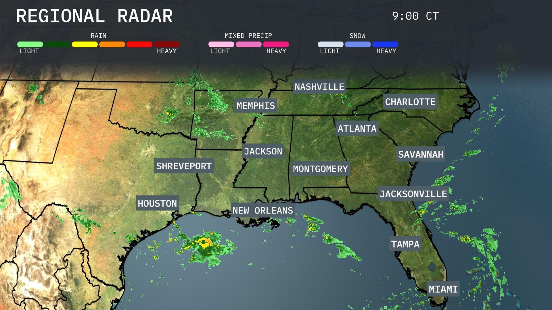
Heavy rain is currently moving into New Orleans from the Gulf of Mexico, while clear skies are prevalent across much of the interior Southeast. Scattered showers are visible in the region near Houston. Further north, the radar remains dry across major cities like Atlanta, Charlotte, and Nashville. The cloud cover is modest, allowing for fair weather conditions in those areas.
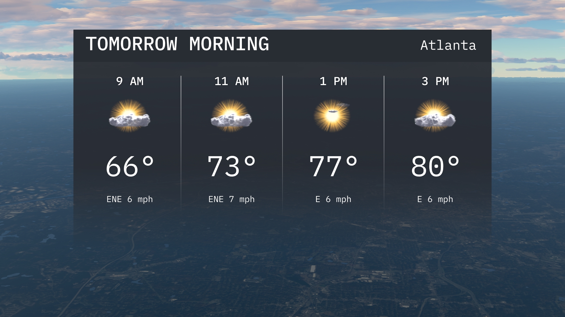
In Atlanta for tomorrow morning, expect temperatures rising from 66 degrees at 9 AM to 73 degrees by 11 AM. Winds will be coming from the east-northeast, providing a gentle breeze. Cloud cover will be light, allowing for a mix of sun and clouds.
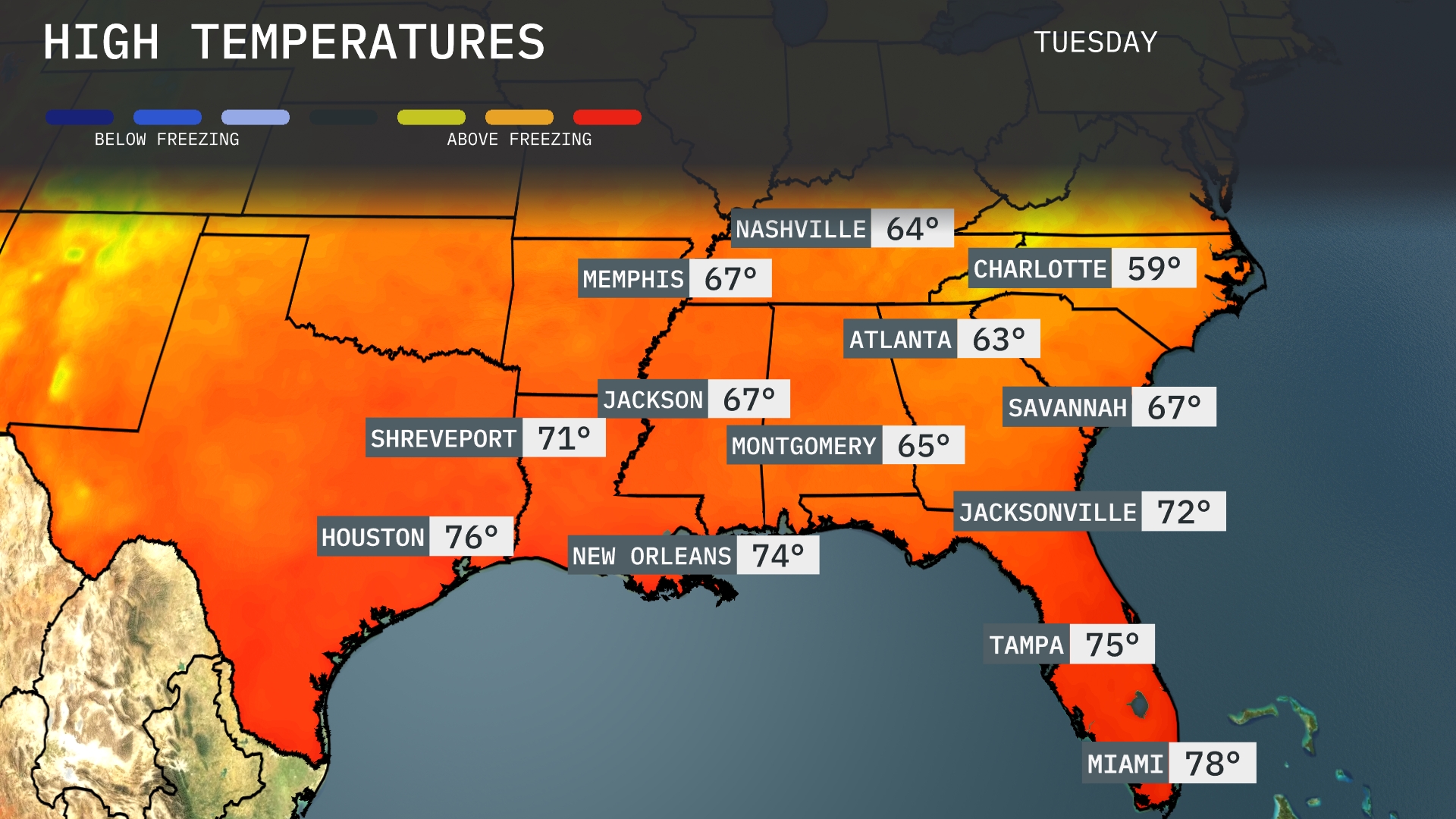
Tomorrow in Atlanta, expect a high of 63 degrees, which is slightly below average for this time of year. Meanwhile, Nashville will see a high of 64 degrees, also on the cooler side. In contrast, temperatures in Jacksonville will reach 72 degrees, providing a mild and pleasant day. New Orleans is forecasted to enjoy a warmer 74 degrees, while Miami tops out at 78 degrees. Overall, the Southeast is experiencing temperature trends that are generally below average for September, influenced by a cooling front moving through the region.
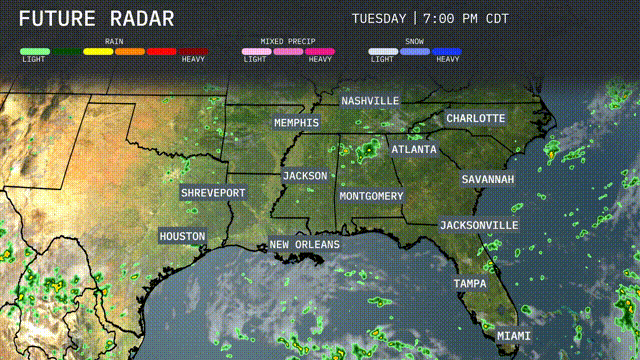
A cold front sweeps through the Southeast, bringing scattered thunderstorms from Houston to Jacksonville tomorrow. Expect heavier rainfall and potential flash flooding near New Orleans and Baton Rouge by afternoon. Storms taper off by late evening with cooler and drier air settling in. Temperatures will trend about 5 degrees cooler behind the front across the region.
Today’s UV index in Atlanta is high, with a burn time of about 12 minutes under direct sunlight. Tomorrow sees a slight increase in UV intensity, reducing the burn time to 15 minutes.
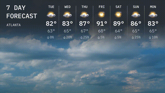
For the 7 Day Outlook in Atlanta:
Tuesday: Warm and sunny with a high of 82 degrees and a low of 63 degrees.
Wednesday: Mostly sunny skies continue with a high of 83 degrees and a low of 65 degrees.
Thursday: Warmer with a mix of sun and clouds, reaching up to 87 degrees, dropping to 66 degrees overnight.
Friday: A hot day with plenty of sunshine, the high climbing to 91 degrees and a low around 68 degrees.
Saturday: A warm start to the weekend, mostly sunny with a high of 89 degrees and a low of 64 degrees.
Sunday: Sunny again, expect temperatures around 86 degrees for the high and a low of 65 degrees.
Monday: Warming slightly with a sunny outlook, hitting 83 degrees for the day high.