Atlanta’s Week of Weather Extremes: From Sunshine to Chilly Nights
By
Amy Freeze
Explore how Atlanta's weather will shift from balmy mornings to cooler nights, with a detailed 7-day weather outlook.
Get ready for a week of weather swings in Atlanta! From sunny skies to unexpected chilly evenings, find out what the weather holds each day. Stay updated with Amy Freeze.
This week in Atlanta, the weather takes us on a rollercoaster from bright sunny mornings to potentially stormy afternoons and chilly nights. Starting off with a mild 64°F in the mornings, temperatures climb before potentially plummeting due to an incoming cold front. Expect scattered thunderstorms midweek, contributing to a cool-down that brings temperatures below average for this time of year. Keep an eye out for localized heavy rains and strong winds that could lead to flash flooding in some areas. With a high UV index, don’t forget your sunscreen during daylight hours. Follow our daily and 7-day forecast to stay ahead of Atlanta’s unpredictable weather!
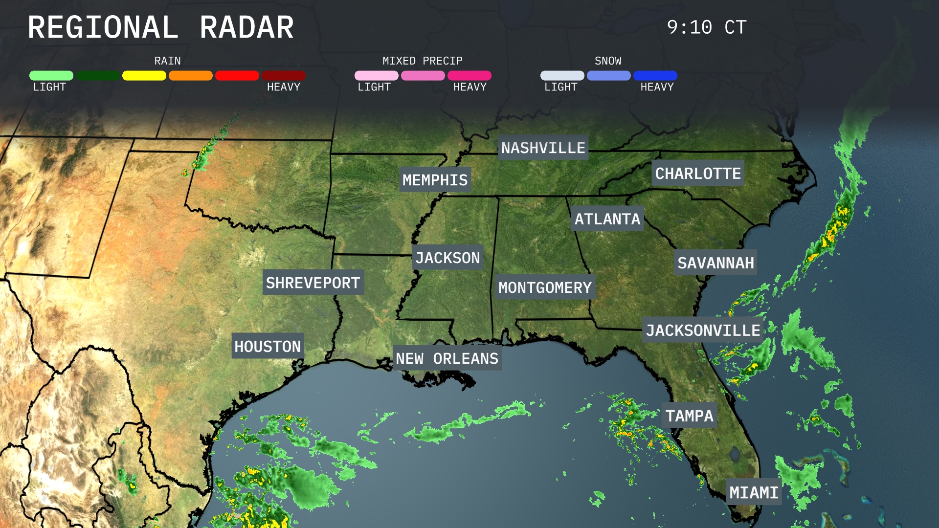
Showers are advancing across the Gulf of Mexico, moving closer to New Orleans and mobile cloud cover over the Florida Panhandle. Atlanta and Charlotte are dry but should see increasing clouds as rain approaches from the Gulf. Miami is seeing some scattered thunderstorms with more likely to develop. Houston and Shreveport are currently clear, but keep an eye on developing rain patterns to the south.
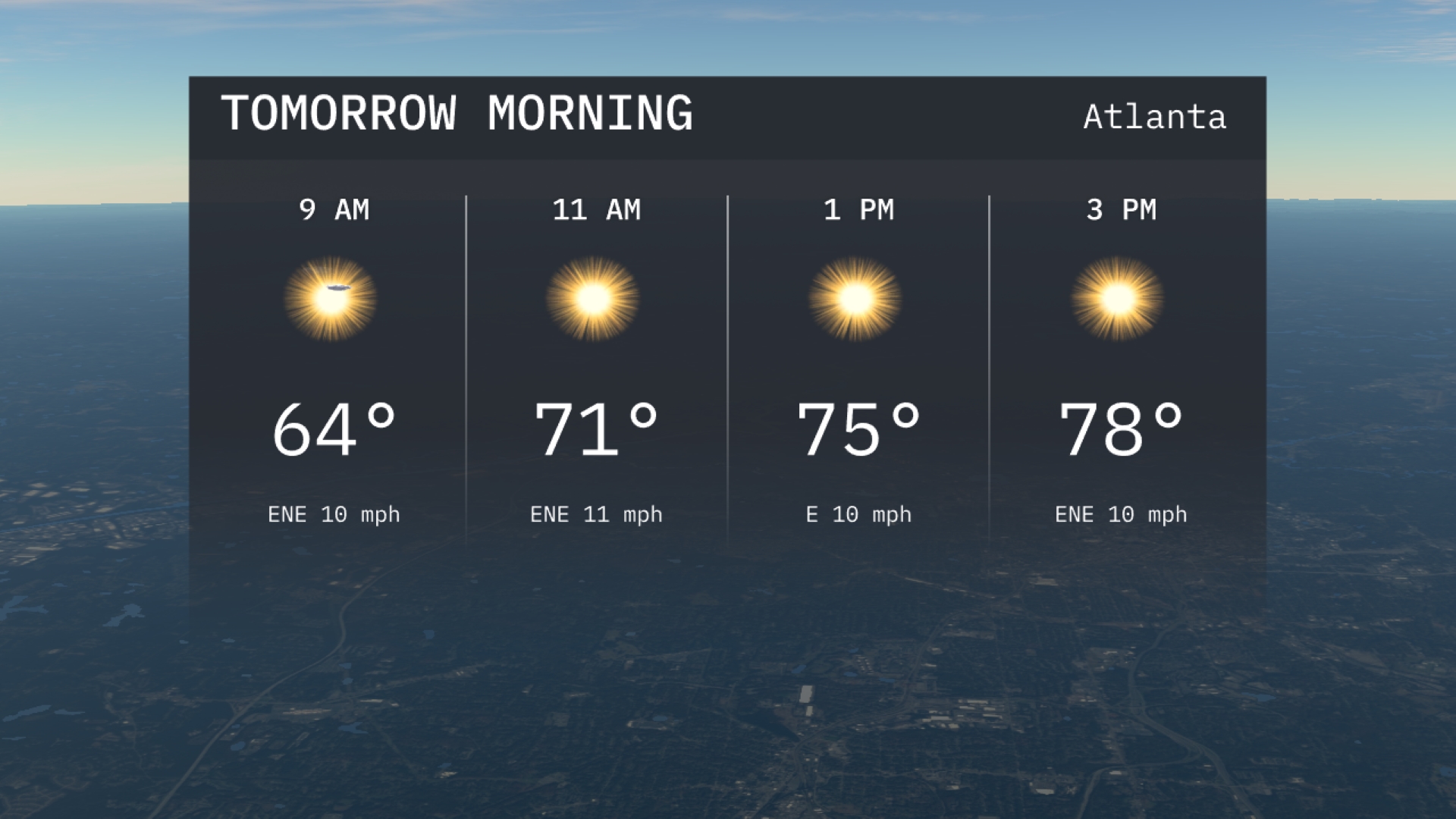
For tomorrow morning in Atlanta, enjoy clear skies as temperatures begin at 64 degrees at 9 AM. A gentle wind from the east-northeast at 10 miles per hour accompanies the sunshine. Temperatures will rise to 71 degrees by 11 AM, making it a bright and pleasant start to the day.
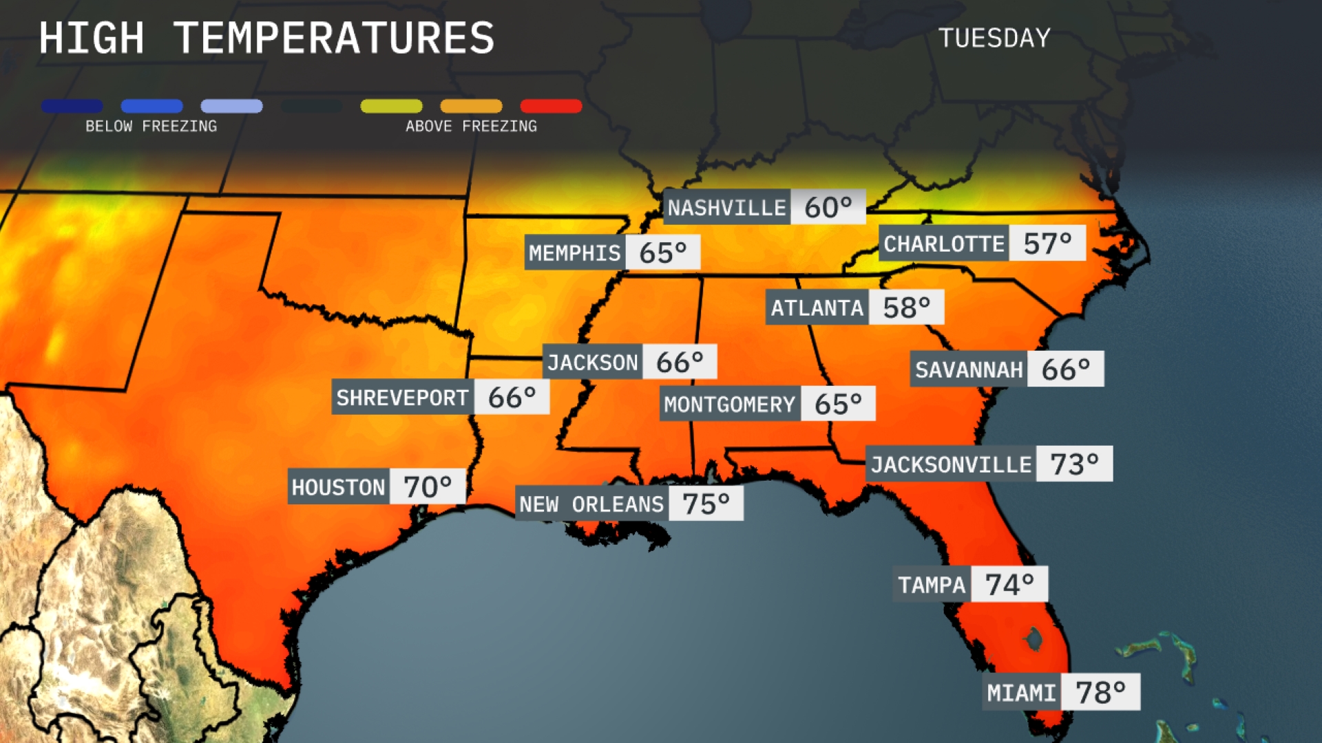
Tomorrow in Atlanta, expect a high of 58 degrees, which is notably below average for this time of year. Jacksonville will see a warmer day, reaching 73 degrees, while Tampa is expected to hit 74. New Orleans will enjoy a pleasant 75 degrees, aligning closely with seasonal averages. Charlotte remains on the cooler side, only getting up to 57 degrees. Memphis and Montgomery will both see highs around 65 and 66 degrees, respectively, as a chilly front influences the area.
A cold front is advancing through the Southeast, bringing scattered thunderstorms and heavy rainfall across the region on Wednesday. Expect localized heavy downpours from Atlanta to Montgomery, with the potential for flash flooding in low-lying areas. Strong thunderstorms are likely from Shreveport to Jackson by midday, with gusty winds being the primary concern. Coastal areas from Jacksonville to Miami may experience isolated thunderstorms and brief heavy rain showers. Temperatures will dip slightly behind the front, providing a temporary respite from recent humidity levels.
The UV index in Atlanta will be high today, with a quick burn time of just 20 minutes in direct sunlight. As we look to tomorrow, the burn time decreases slightly to 15 minutes, indicating the sun’s intensity remains strong.
For the 7 Day Outlook in Atlanta:
Tuesday: Sunny with a high of 80 degrees and a low of 58 degrees.
Wednesday: More sunshine and increasing warmth. Highs reach 83 degrees, cooling to 59 degrees overnight.
Thursday: Expect mostly sunny skies with temperatures climbing to 87 degrees and a low of 62 degrees.
Friday: Partly sunny and warm, reaching 86 degrees with an evening low of 63 degrees.
Saturday: Continued warmth at 85 degrees under mostly sunny skies, dipping to 63 degrees.
Sunday: Another warm day with a high of 86 degrees, staying mild overnight at 63 degrees.
Monday: Heating up to start the week with a warm 90 degrees high, dropping to 65 degrees at night.