Get the latest insights on Miami's weather: Partly cloudy mornings and stormy afternoons are setting the stage for an unpredictable week ahead.
Miami greets the day with partly cloudy skies and a peek-a-boo sun. As temperatures climb, so does the chance of rain. Read on for a detailed weekly forecast and be prepared for every weather whim!
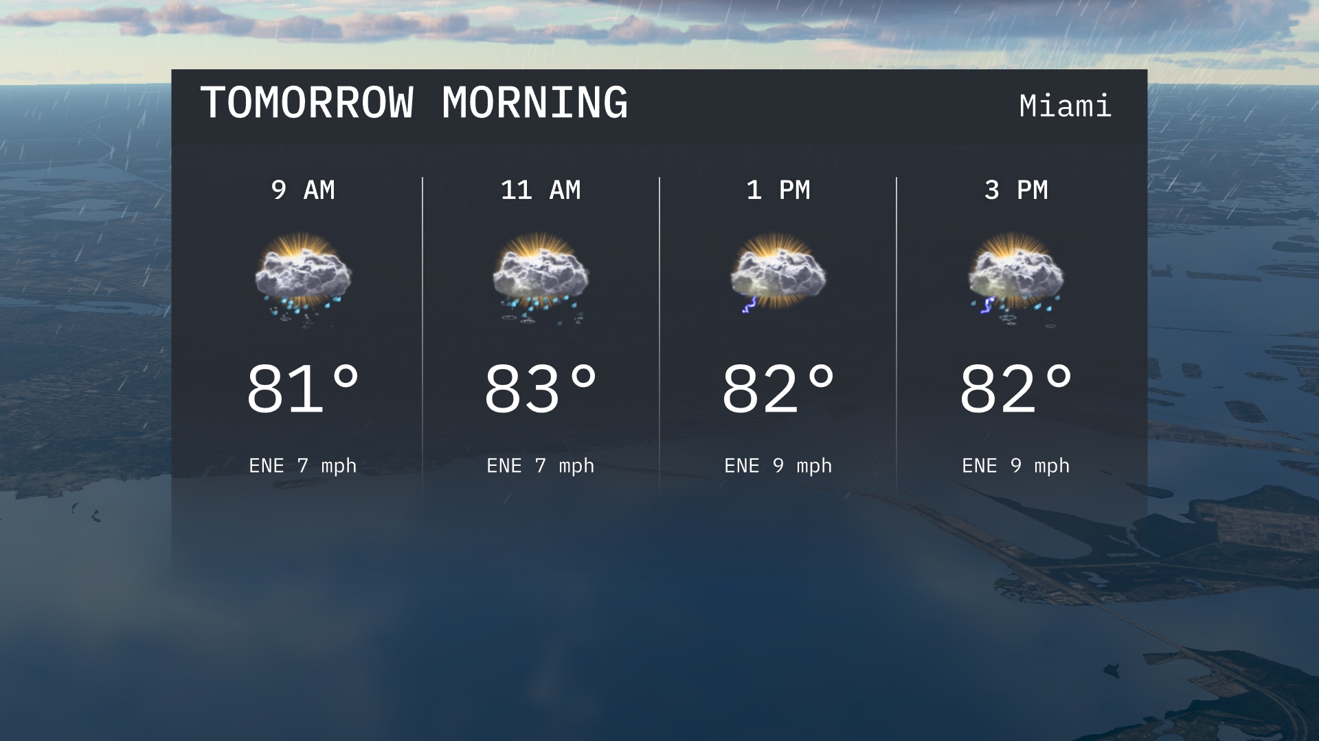
Tomorrow morning in Miami kicks off with 81 degrees, climbing to 83 by midday under partly cloudy skies. Keep an umbrella nearby as brief rain showers are possible, alongside a high UV index warning. As the day progresses, expect temperature highs across the Southeast, with an atmospheric setup that may bring potent thunderstorms midweek. Dive deep into Miami’s weather predictions plus safety tips to tackle these changes, only on our blog!
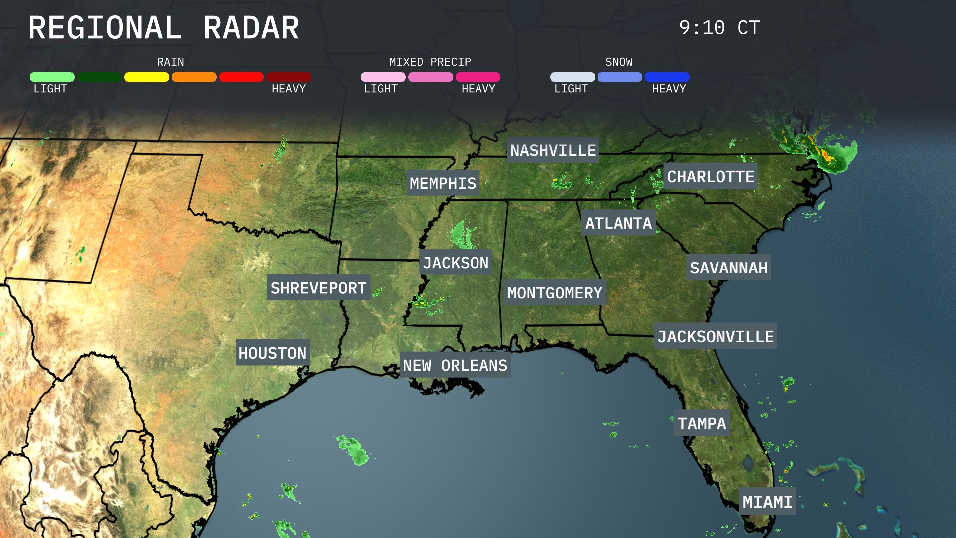
The Southeast region is bracing for an active weather day as a band of rain progresses across the eastern Carolinas, with heavy rainfall evident near Charlotte. Meanwhile, light showers are making their way across the Gulf Coast, including New Orleans and the surrounding areas, providing a damp start to the morning. Cloud cover is prominent from Atlanta extending towards Nashville, hinting at the likelihood of further precipitation moving in later. Elsewhere, Houston and Miami continue to experience predominantly clear skies, offering a break from any impending weather activity.
For tomorrow morning in Miami, temperatures will start at 81 degrees at 9 AM, gradually rising to 83 degrees by 11 AM. Expect partly cloudy skies throughout the morning with brief rain showers possible. Winds will be from the east-northeast. Keep an umbrella handy, as the chance of rain increases slightly as the morning progresses.
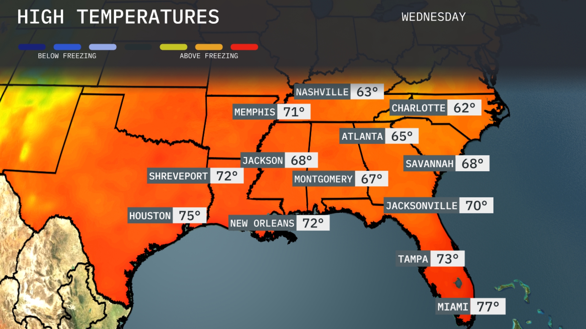
Tomorrow, Memphis will see a high of 71 degrees, while Nashville reaches 63. Jackson is expected to warm to 68 degrees, and Montgomery will hit 67. Heading into Florida, Tampa is on track for a high of 73 degrees, with Miami warming up to 77. Notably, these temperatures are generally above average for this time of year, reflecting a warm air mass settling across the region.
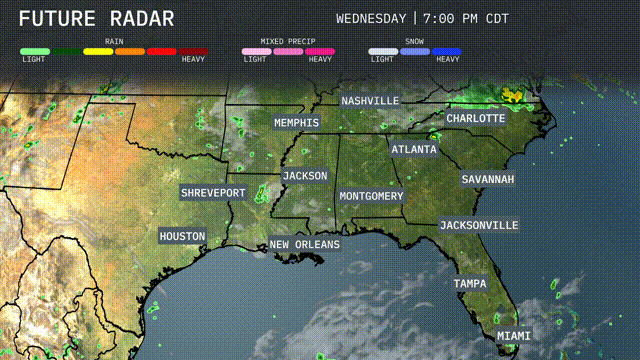
A robust cold front is set to impact the Southeast starting early Wednesday. Expect thunderstorms stretching from New Orleans over to Montgomery and reaching up to Nashville by midday. This system could bring heavy rain and gusty winds, with the potential for localized flooding in areas like Atlanta and Jackson, especially due to saturated grounds from previous rainfalls. Jacksonville to Charlotte should prepare for scattered showers and thunderstorms by Wednesday afternoon. Temperatures will drop post front, ushering in cooler, drier air through Thursday.
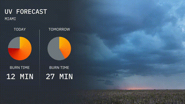
Miami’s UV index will reach a high level today with a value of 9, leading to a quick burn time of about 12 minutes in direct sunlight. Tomorrow, while the UV index remains high at 8, the burn time extends to 27 minutes.
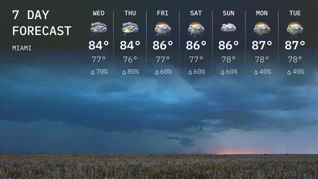
Wednesday: Partly sunny skies with a high of 84 degrees and a low of 77 degrees.
Thursday: Expect showers, with temperatures reaching a high of 84 degrees and a low of 76 degrees.
Friday: Thunderstorms likely, warming up to a high of 86 degrees with lows around 77 degrees.
Saturday: Scattered thunderstorms continue, with a high of 86 degrees and a low of 78 degrees.
Sunday: Partly sunny and warm, hitting a high of 86 degrees and cooling to 78 degrees at night.
Monday: The chance of showers decreases, with partly cloudy skies and a high of 87 degrees and a low of 78 degrees.
Tuesday: Mostly sunny with a high reaching 87 degrees and a pleasant low of 78 degrees.