Navigating Through Miami’s Partly Cloudy Mornings and Approaching Storms
By
Amy Freeze
Get the latest updates on Miami's morning weather, from balmy temperatures to incoming storms, and how to prepare for the day ahead.
Step into your day in Miami informed with a morning forecast featuring partly cloudy skies and warming temperatures, alongside important alerts on approaching thunderstorms.
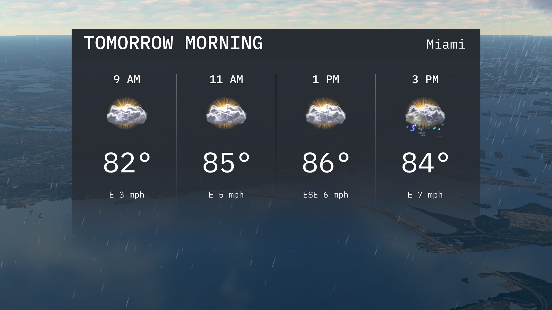
Welcome to your Miami morning weather update! Tomorrow starts with partly cloudy skies and temperatures of 82°F, rising to 85°F by mid-morning. However, the weather takes a turn as we track thunderstorms pushing towards our area. This post explores the implications of these weather patterns, offering guidance on how to navigate potential disruptions and safety measures.
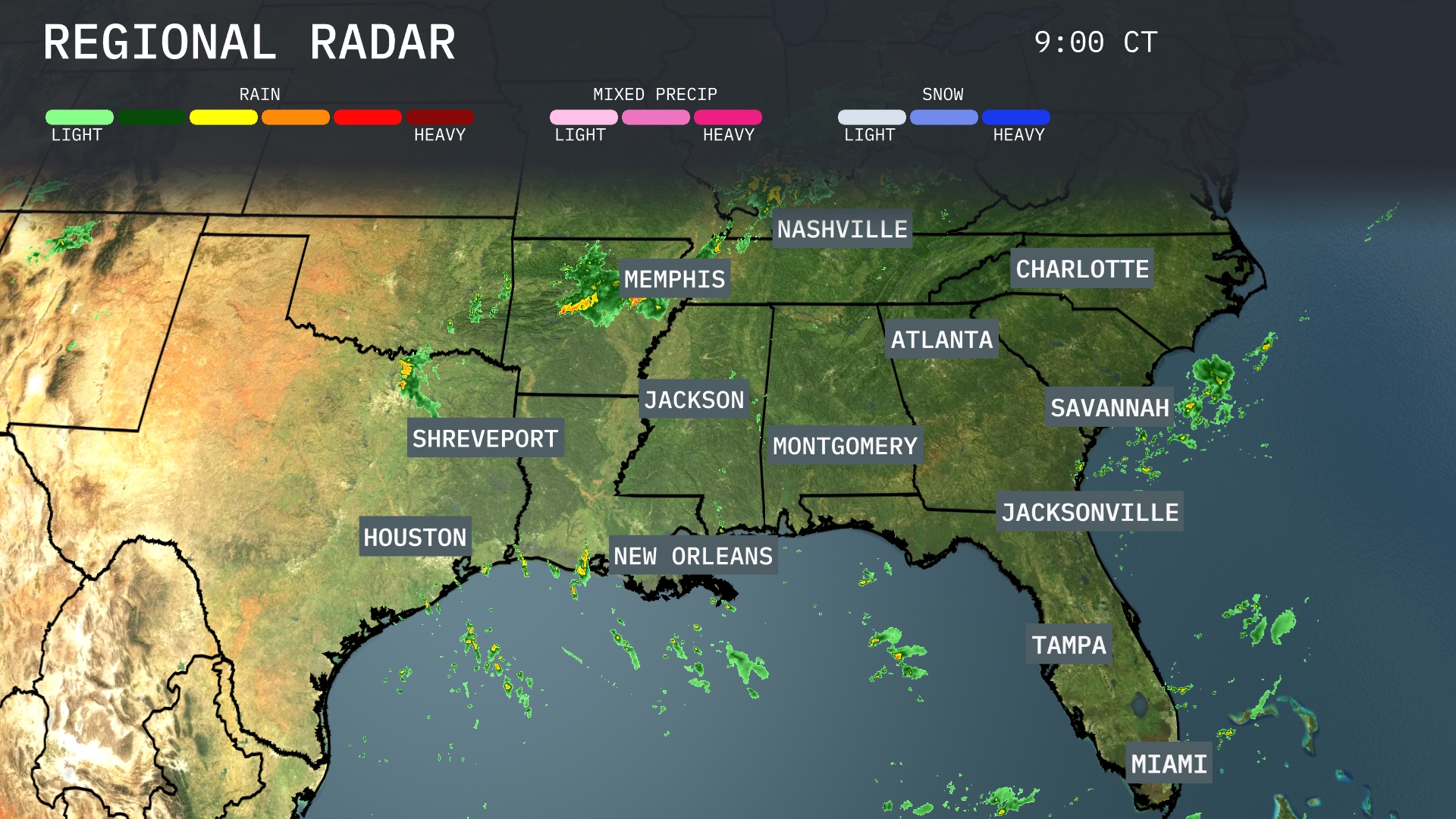
A line of strong storms is pushing through eastern Texas and Louisiana, making its way toward Shreveport and New Orleans. In contrast, Memphis is experiencing light rain showers, while Nashville remains dry under clear skies. Coastal areas of Florida, including Miami and Tampa, are seeing isolated rain showers as well. The Southeast, particularly around Atlanta and Charlotte, can expect increasing cloud cover as these weather patterns shift eastward.
For Miami tomorrow morning, expect temperatures starting at 82 degrees at 9 AM, gradually rising to 85 degrees by 11 AM. Light winds from the east will continue.. Cloud cover will be present throughout the morning, so plan for partly cloudy skies as you step out.
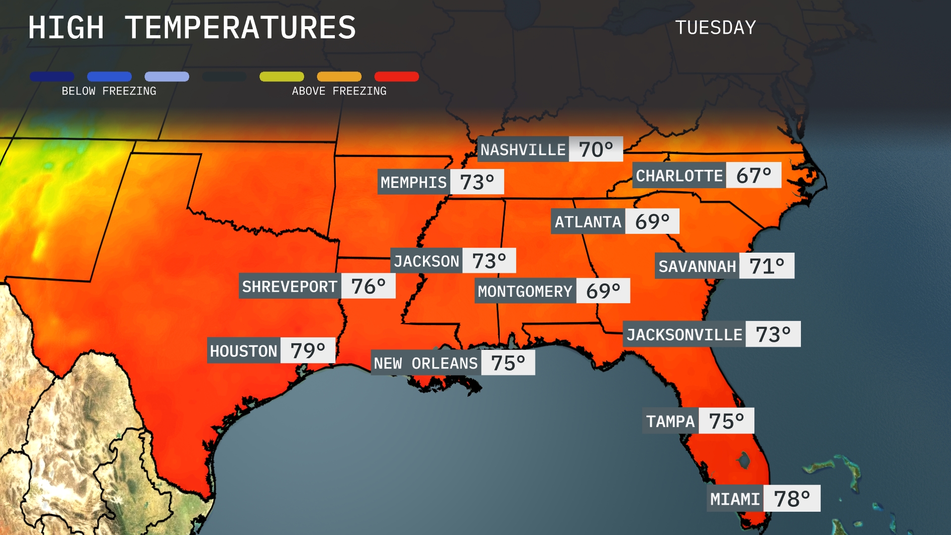
Tomorrow in Atlanta, expect a high of 69 degrees, a slight dip below average for this time of year. Nashville will see a high of 70 degrees, aligning with typical September temperatures. In the Gulf region, Houston reaches a warm 79 degrees, while New Orleans will be slightly cooler at 75 degrees. Jacksonville will warm up to a pleasant 73 degrees as well, contributing to a balmy day across Florida, where Miami could hit 78.
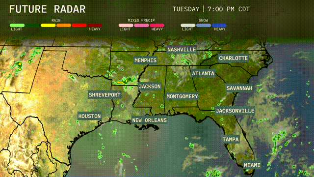
A frontal boundary approaching from the west will bring showers and thunderstorms across the Southeast, especially impacting areas from Shreveport to Montgomery starting late Tuesday evening. Locations from Memphis to New Orleans should be prepared for thunderstorm activity, with a slight risk of severe storms and gusty winds. Rainfall could be intense at times, raising concerns for localized flooding in vulnerable areas. As the front progresses, expect cooler, drier conditions to fill in behind, with temperatures dipping by about 5-10 degrees by Thursday.
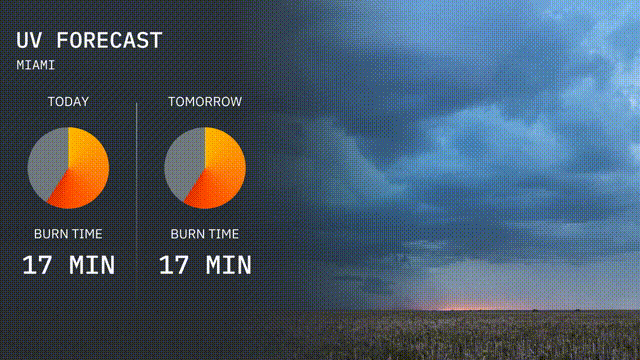
The UV index in Miami is 8 today, indicating high levels of sun exposure with a burn time of about 17 minutes. Tomorrow, similar conditions are expected with a high UV index of 8 and a 17-minute burn time.
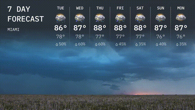
For the 7-day forecast in Miami:
Tuesday: Expect thunderstorms with a high of 86 degrees and a low of 78 degrees.
Wednesday: A bit warmer, with storms lingering. The high will be 87 degrees and the low 78 degrees.
Thursday: Continuing the pattern with thunderstorms, temperatures peak at 88 degrees and will dip to 77 degrees.
Friday: Thunderstorms continue with a high of 88 degrees and a low of 77 degrees.
Saturday: Partly cloudy skies with some thunderstorms expected. The high remains at 88 degrees with a low of 77 degrees.
Sunday: Storms are slightly clearing, bringing the temperature to a high of 87 degrees and a low of 76 degrees.
Monday: Partly cloudy skies with a few thunderstorms possible. Highs reach 87 degrees, and lows are at 76 degrees.